Paludicultures in Cumbria Jack Clough Research Assistant and

Paludicultures, in Cumbria? Jack Clough, Research Assistant and Paludiculture Ph. D student

Introduction Where are the best locations for paludicultures in Cumbria – with reference to designated sites? Which crops could be grown? What are the potential markets?

681, 685 ha in Cumbria

217, 000 ha of peaty soils

53 lowland peatland SSSI’s
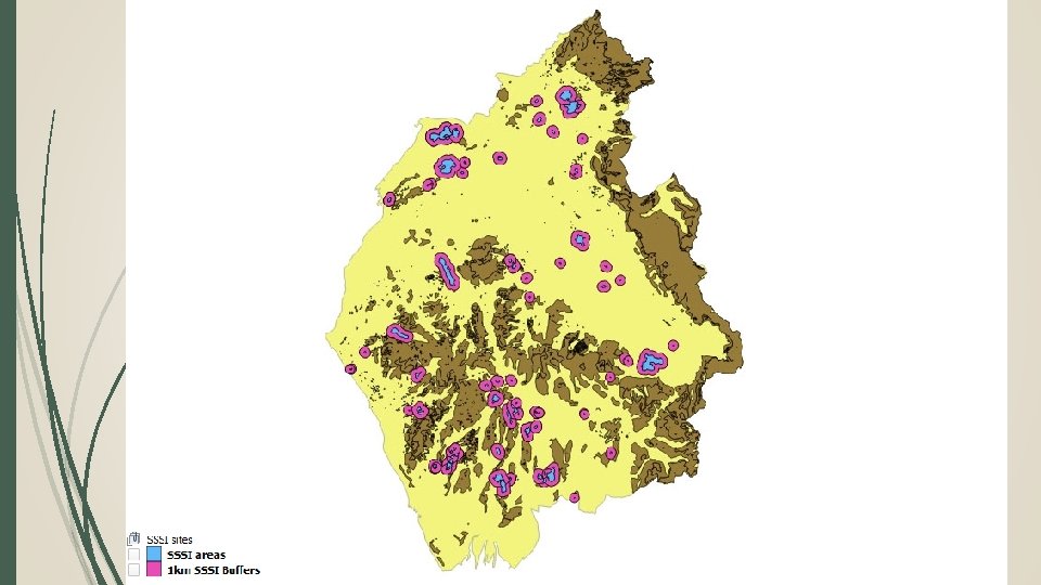
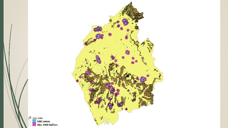

Cumbria wide map – approximately 5000 ha of peaty soils are on slopes of 2 degrees or less within the 1 km SSSI buffer zones. Which could be protected with paludicultures. Approximately 108, 000 ha of peaty soil exists on slopes of 2 degrees or less outside of protected areas and the suggested buffers. – These are mostly on existing farmland, which could be converted into paludicultures

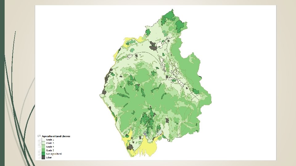
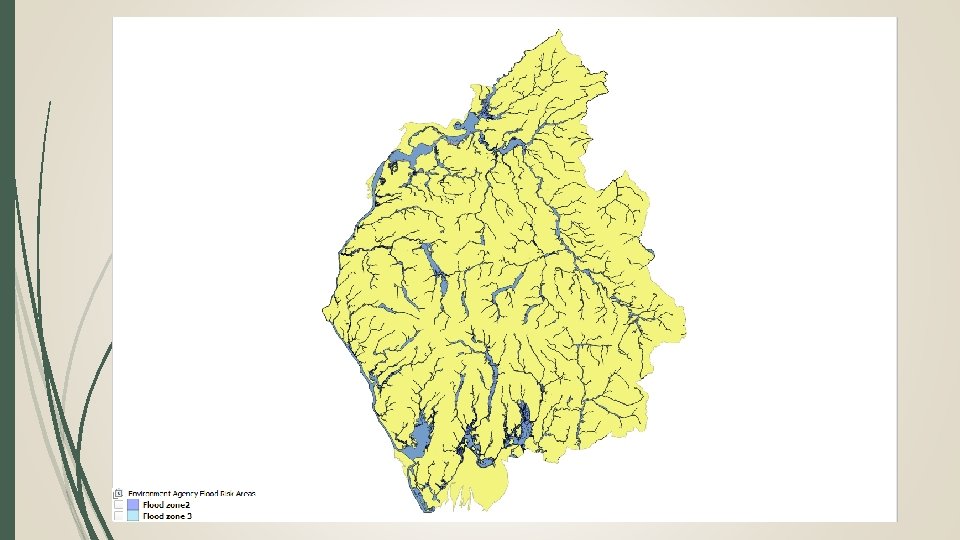
Scoring and Evaluating Case study areas SSSI buffer - Paludiculture Potential Questions Score Is there unprotected peat within the SSSI buffer? 1 Is the peat within the buffer well connected? 1 Does at least some of the unprotected peat connect with the SSSI 1 Does the buffer area contain over 10% peaty soils, with a slope angle of 2 degrees or less? 2 Does the buffer area intersect with an EA flood risk zone? 2 Is the majority of the buffer area on land with an ALC of 4 and 5? 2 Is the majority of the buffer area on land with an ALC of 2 and 3? 1 total score (Max 9)

Sunbiggin Tarn & Moors and Little Asby Scar Outley Mosses
![Paludiculture Potential for Lowland SSSI sites [CATEGORY NAME], [VALUE] sites](http://slidetodoc.com/presentation_image/8634ff1d73d8b26ed700d718e996ab58/image-14.jpg "Paludiculture Potential for Lowland SSSI sites [CATEGORY NAME], [VALUE] sites")
Paludiculture Potential for Lowland SSSI sites [CATEGORY NAME], [VALUE] sites

Case study: Nichols Moss, Meathop and Foulshaw moss

Case study: Nichols Moss, Meathop and Foulshaw moss

Case study: Nichols Moss, Meathop and Foulshaw moss

Case study: Nichols Moss, Meathop and Foulshaw moss

Case study: Nichols Moss, Meathop and Foulshaw moss

What are the products and markets? DPPP: over 3000 sp 333 have very good potential 75 suitable species

What are the products and markets? Food Ornamental/ raw materials Fodder Biomass/ energy Medicines & supplements Agricultural conditioners

What are the next steps? • Develop the UK DPPP further; • Provide opportunities and resources to local farmers; • Trial different systems for different crops; • Develop and adapt existing farming equipment to cope with harvesting on wet soil; • Develop and build additional markets; • Investigate the potential for ‘carbon’ farming credits to further increase profitability.

Images produced using Arc. GIS and QGIS: Summary of GIS layers used: • Peaty Soils Locations (source: NE, BGS, NSRI and OS) • SSSI Locations (source: data. gov. uk under open government licence). • Cumbria County Administrative boundary (source: data. gov. uk under open government licence). • Agricultural Land Classifications (source: data. gov. uk under open government licence). • Environment Agency Flood Risk Zones 2 and 3 (source: data. gov. uk under open government licence). Additional images: • Taken from Pixabay. com under the creative commons licence, no attribution needed.
- Slides: 23