Pachon Sky Camera Christopher Stubbs Chuck Claver Jan

Pachon Sky Camera Christopher Stubbs Chuck Claver Jan 25, 2014.

Motivation • Op. Sim and Im. Sim can both benefit from actual sky brightness and attenuation data. • Although some instruments exist in Chile, we consider it advantageous to measure what we care about: optical sky brightness and optical transmission through clouds. • Goal is to provide a map of m 5, the 5 sigma point source magnitude, across the sky vs. time • This should evolve into an agile scheduling system for LSST operations, that accounts for clouds in real time.

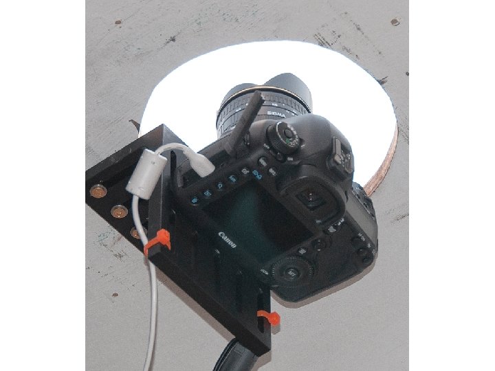
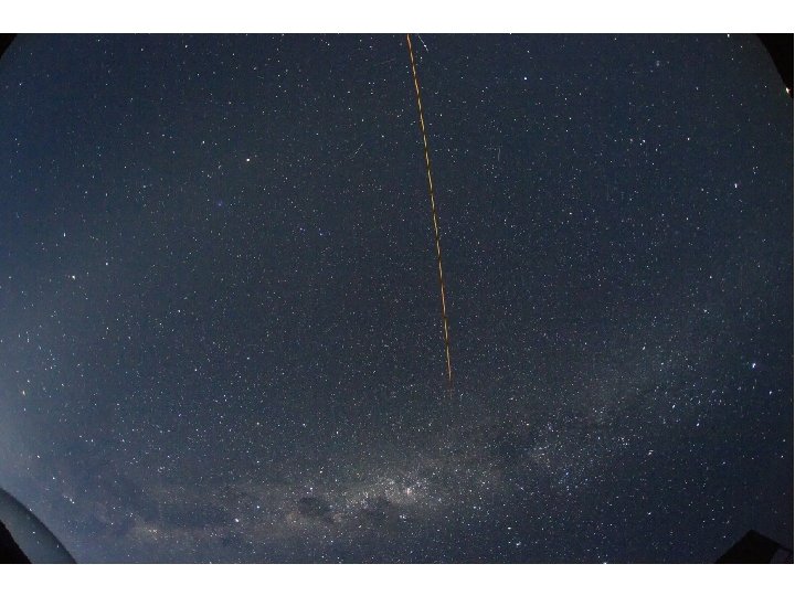
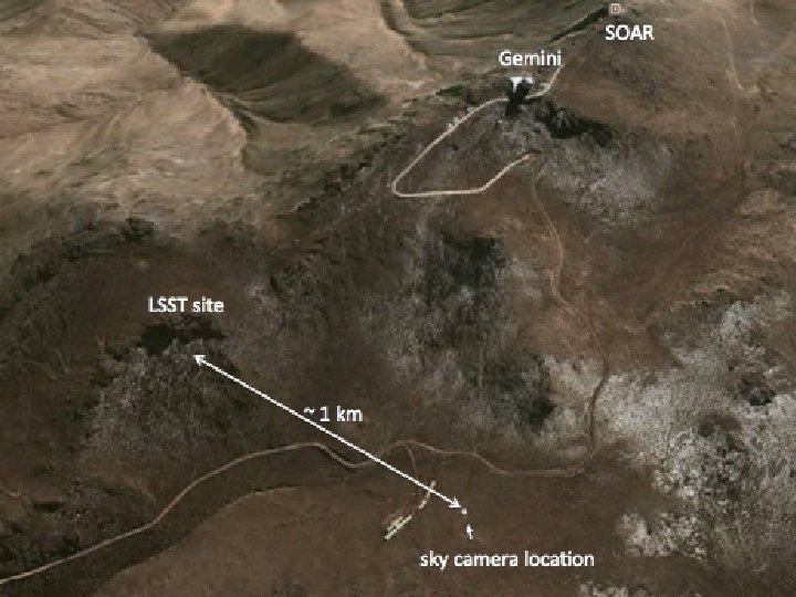
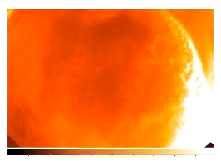
Instrumentation • We installed at Pachon, on Jan 13 2014, a Canon digital SLR camera with a 15 mm fisheye lens. • Instrument resides in an atmospheric sciences building, looking out through a hemispherical plexiglass dome. • We acquire 1 sec and 10 second images each minute. • Data is 3 band 14 bit dynamic range, lossless raw data, at 2888 x 1928 resolution. • ~3 arcmin/pixel • 180 degrees of sky coverage from corner to corner
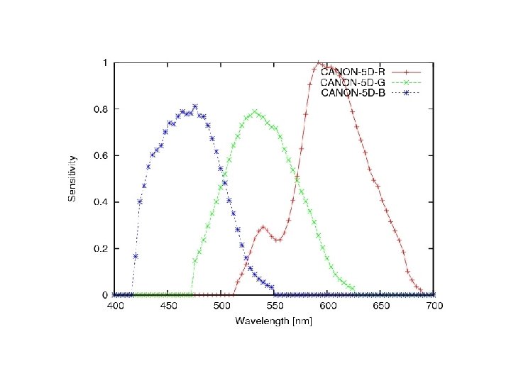

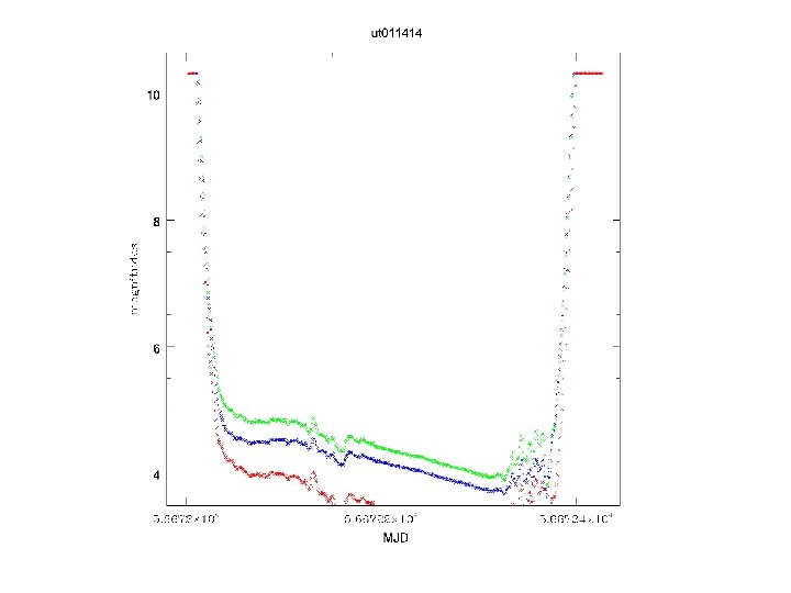
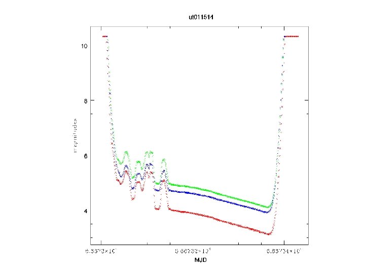
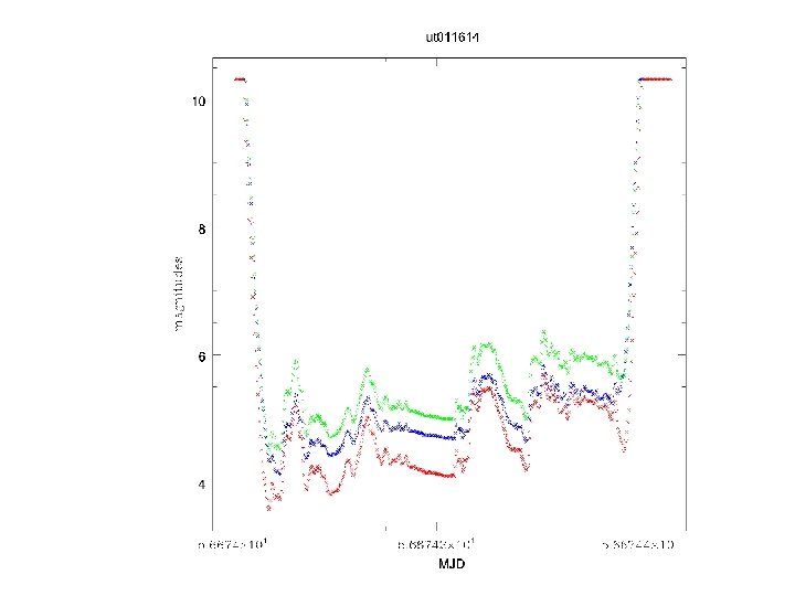
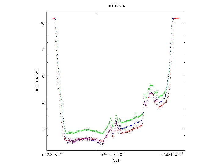
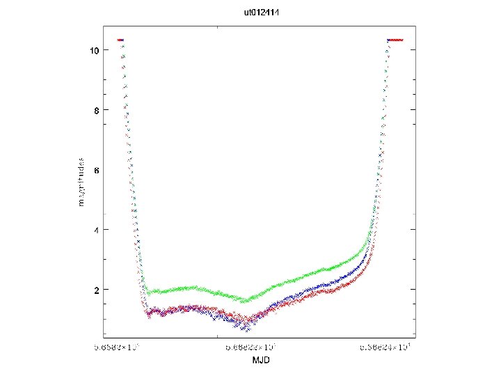
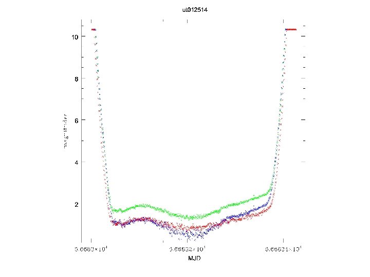
Analysis Pipeline • Convert. CR 2 raw Canon files into FITS files: – monochrome (add all flux) – B, G, R • Perform photometry on all of these files • Extract sky brightness estimate at zenith, from 200 x 200 pixel box at zenith. • We can get a 3 arcmin resolution of sky brightness by taking median filtered (point source-suppressed) image.

 with 7 th order")
Towards All-sky Astrometry RMS fitting error ~60 arcsec (~1/3 pixel) with 7 th order polynomial

More work to do on the photometry d. M = M_SAO - M_tphot + ZP

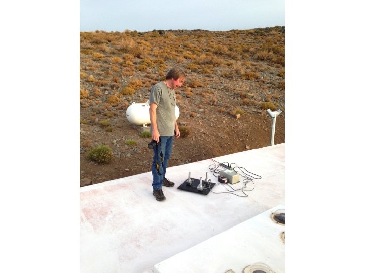
Photo-diode measurements 3. 5 deg FOV NIST calibrated diodes Extends zenith measurements to the red with LSST ‘z’ and ‘y’ band filters.

Goals Finalize astrometric aspects, x, y to Ra, Dec Refine photometry over full sky Deploy photodiodes permanently Map out attenuation in magnitudes Determine 2 -d profile of 5 sigma point source magnitudes • Obtain this information for all nights • Continue to obtain nightly m 5 maps • Transmit this information to Op. Sim and Im. Sim • • •
- Slides: 25