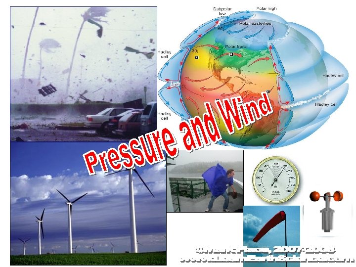
ORIGIN from Greek anemos wind ORIGIN from Greek
![[ORIGIN from Greek anemos ‘wind’] [ORIGIN from Greek baros ‘weight’]](https://slidetodoc.com/presentation_image_h2/c7ae38e25ce95836d7517edb54c64d7f/image-2.jpg "[ORIGIN from Greek anemos ‘wind’] [ORIGIN from Greek baros ‘weight’]")
 because the air is (less,")
 because the air is (less,")


 any wind")


- Slides: 29
[ORIGIN from Greek anemos ‘wind’] [ORIGIN from Greek baros ‘weight’]
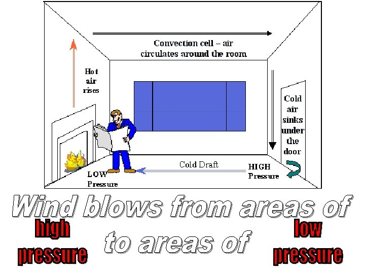
In a high pressure area, air will (rise, sink) because the air is (less, more) dense. This is because the air is (cold, warm) and (rises, sinks). Therefore, clouds CANNOT form.
In a low pressure area, air will (rise, sink) because the air is (less, more) dense. This is because the air is (cold, warm) and (rises, sinks). Therefore, clouds are LIKELY to form.
Correctly draw the direction of wind flow around both a high and a low pressure area in the NORTHERN HEMISPHERE.
low pressure high pressure warm or cold air rising or sinking clouds or no clouds clockwise or counterclockwise wind direction winds toward or away from the center
On the diagrams below, label which one represents a land breeze and which represents a sea breeze. Correctly label on each diagram where the high and low pressure areas would be found.
On the diagrams below, label which one represents a land breeze and which represents a sea breeze. Correctly label on each diagram where the high and low pressure areas would be found.
On the diagrams below, label which one represents a land breeze and which represents a sea breeze. Correctly label on each diagram where the high and low pressure areas would be found.
This is the story of storms! L What type of pressure system is this? ?
The Weather Man
The Coriolis Effect Because of the earth's rotation (from west to east) any wind or water will appear to: • Turn to the right of its direction of motion in the Northern Hemisphere and • Turn to the left of its direction of motion in the Southern Hemisphere. • This is called the Coriolis Effect!! Makes it big in a movie
Coriolis Force
The Coriolis Effect
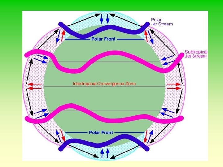
The Jet Stream • The jet stream is literally a river of wind high in the atmosphere. • The jet streams can steer major air masses, pressure systems, and fronts in certain directions. • There are two main jet streams in each hemisphere. 1) Subtropical Jet Stream 2) Polar Jet Stream
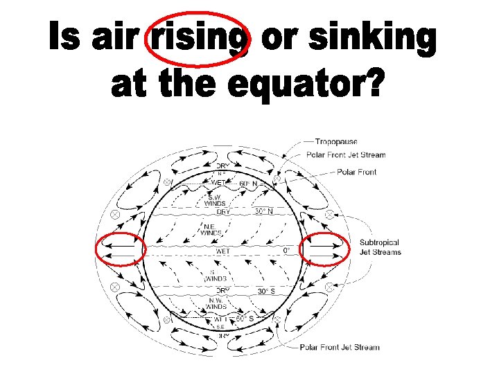
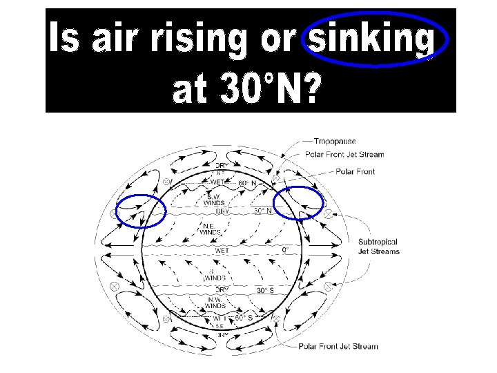
Global Atmospheric Circulation Model
bottom of page 14 has a planetary wind belt diagram!
Using the chart on page 14, state the prevailing wind direction for each latitude below: 45°N
Using the chart on page 14, state the prevailing wind direction for each latitude below: 45°N 45°S 75°N 20°N
1. The diagram below represents the general circulation of the Earth's atmosphere and the Earth's planetary wind and pressure belts. Points A through F represent locations on the Earth's surface. Which location is experiencing a southwest planetary wind? A) F B) D C) C D) B
2. The diagram below represents the general circulation of the Earth's atmosphere and the Earth's planetary wind and pressure belts. Points A through F represent locations on the Earth's surface. Which location is near the center of a low-pressure belt where daily rains are common? A) E B) B C) F D) D
4. 5. What is the Coriolis Effect?