Organization of Course INTRODUCTION 1 Course overview 2

- Slides: 38

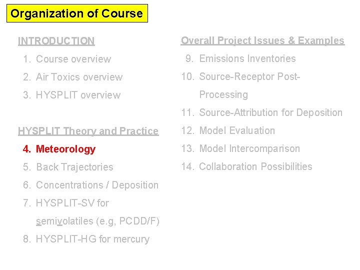
Organization of Course INTRODUCTION 1. Course overview 2. Air Toxics overview 3. HYSPLIT overview Overall Project Issues & Examples 9. Emissions Inventories 10. Source-Receptor Post. Processing 11. Source-Attribution for Deposition HYSPLIT Theory and Practice 12. Model Evaluation 4. Meteorology 13. Model Intercomparison 5. Back Trajectories 14. Collaboration Possibilities 6. Concentrations / Deposition 7. HYSPLIT-SV for semivolatiles (e. g, PCDD/F) 8. HYSPLIT-HG for mercury

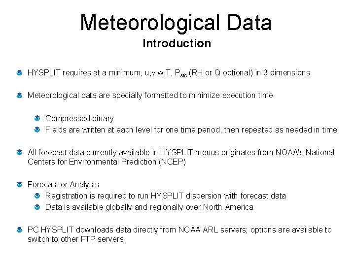
Meteorological Data Introduction HYSPLIT requires at a minimum, u, v, w, T, Psfc (RH or Q optional) in 3 dimensions Meteorological data are specially formatted to minimize execution time Compressed binary Fields are written at each level for one time period, then repeated as needed in time All forecast data currently available in HYSPLIT menus originates from NOAA’s National Centers for Environmental Prediction (NCEP) Forecast or Analysis Registration is required to run HYSPLIT dispersion with forecast data Data is available globally and regionally over North America PC HYSPLIT downloads data directly from NOAA ARL servers; options are available to switch to other FTP servers

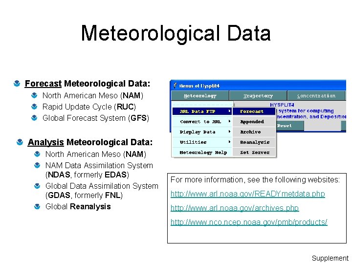
Meteorological Data Forecast Meteorological Data: North American Meso (NAM) Rapid Update Cycle (RUC) Global Forecast System (GFS) Analysis Meteorological Data: North American Meso (NAM) NAM Data Assimilation System (NDAS, formerly EDAS) Global Data Assimilation System (GDAS, formerly FNL) Global Reanalysis For more information, see the following websites: http: //www. arl. noaa. gov/READYmetdata. php http: //www. arl. noaa. gov/archives. php http: //www. nco. ncep. noaa. gov/pmb/products/ Supplement

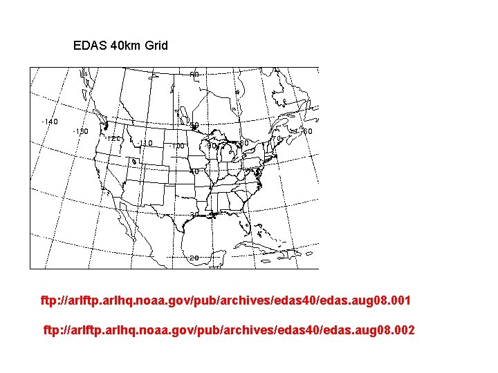
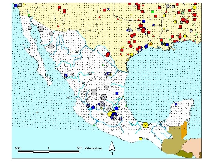
Regional Met Data Sets Example: EDAS 40 km data set

EDAS 40 km Grid ftp: //arlftp. arlhq. noaa. gov/pub/archives/edas 40/edas. aug 08. 001 ftp: //arlftp. arlhq. noaa. gov/pub/archives/edas 40/edas. aug 08. 002


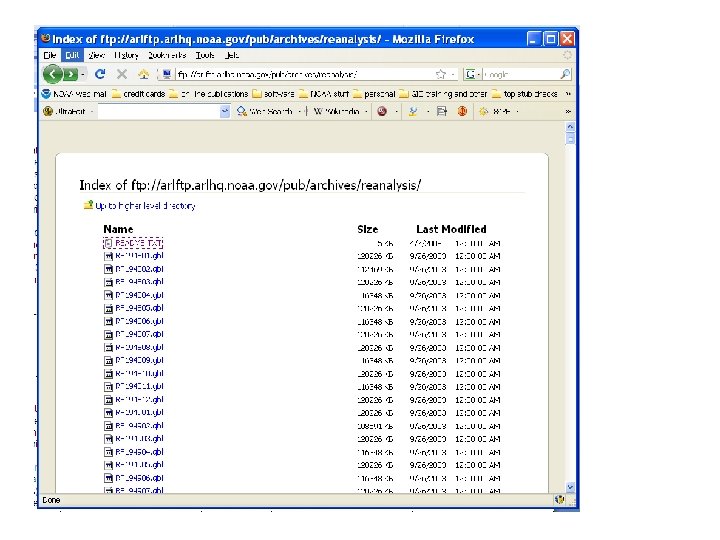
Global Met Data Sets Example: NCEP/NCAR Reanalysis Data Archive

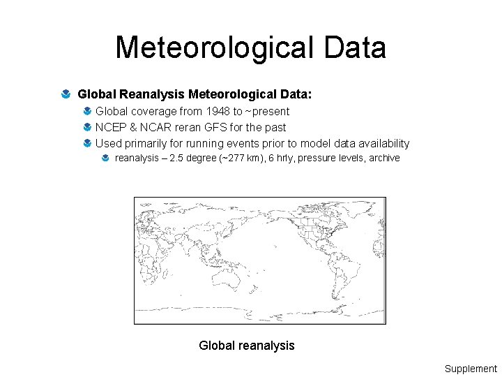
Meteorological Data Global Reanalysis Meteorological Data: Global coverage from 1948 to ~present NCEP & NCAR reran GFS for the past Used primarily for running events prior to model data availability reanalysis – 2. 5 degree (~277 km), 6 hrly, pressure levels, archive Global reanalysis Supplement


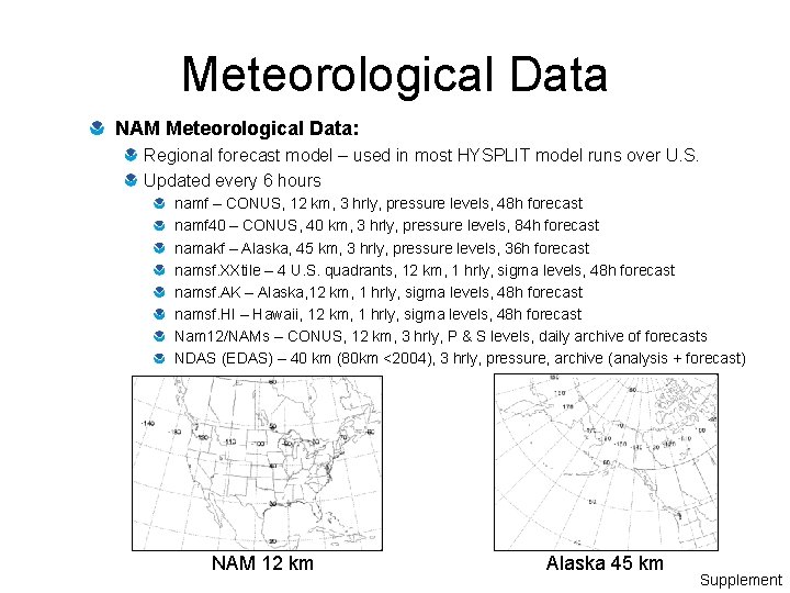
Meteorological Data NAM Meteorological Data: Regional forecast model – used in most HYSPLIT model runs over U. S. Updated every 6 hours namf – CONUS, 12 km, 3 hrly, pressure levels, 48 h forecast namf 40 – CONUS, 40 km, 3 hrly, pressure levels, 84 h forecast namakf – Alaska, 45 km, 3 hrly, pressure levels, 36 h forecast namsf. XXtile – 4 U. S. quadrants, 12 km, 1 hrly, sigma levels, 48 h forecast namsf. AK – Alaska, 12 km, 1 hrly, sigma levels, 48 h forecast namsf. HI – Hawaii, 12 km, 1 hrly, sigma levels, 48 h forecast Nam 12/NAMs – CONUS, 12 km, 3 hrly, P & S levels, daily archive of forecasts NDAS (EDAS) – 40 km (80 km <2004), 3 hrly, pressure, archive (analysis + forecast) NAM 12 km Alaska 45 km Supplement

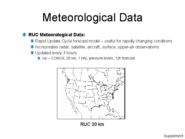
Meteorological Data RUC Meteorological Data: Rapid Update Cycle forecast model – useful for rapidly changing conditions Incorporates radar, satellite, aircraft, surface, upper-air observations Updated every 3 hours ruc – CONUS, 20 km, 1 hrly, pressure levels, 12 h forecast RUC 20 km Supplement

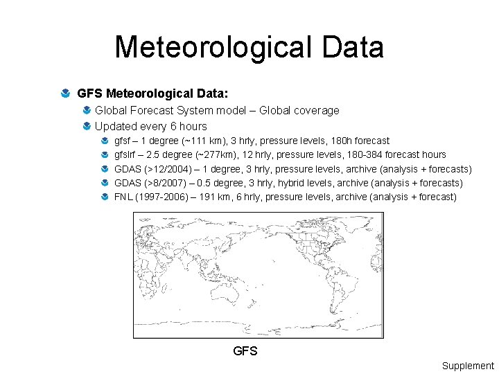
Meteorological Data GFS Meteorological Data: Global Forecast System model – Global coverage Updated every 6 hours gfsf – 1 degree (~111 km), 3 hrly, pressure levels, 180 h forecast gfslrf – 2. 5 degree (~277 km), 12 hrly, pressure levels, 180 -384 forecast hours GDAS (>12/2004) – 1 degree, 3 hrly, pressure levels, archive (analysis + forecasts) GDAS (>8/2007) – 0. 5 degree, 3 hrly, hybrid levels, archive (analysis + forecasts) FNL (1997 -2006) – 191 km, 6 hrly, pressure levels, archive (analysis + forecast) GFS Supplement

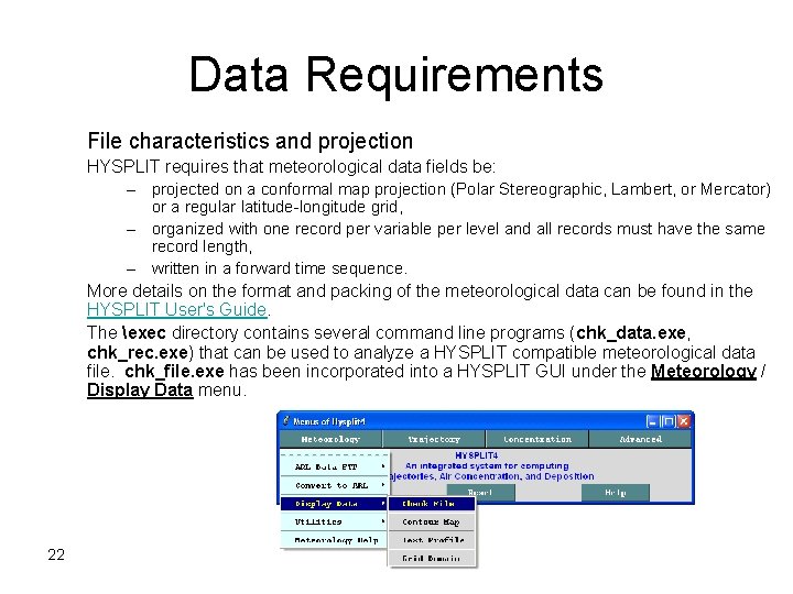
Data Requirements File characteristics and projection HYSPLIT requires that meteorological data fields be: – projected on a conformal map projection (Polar Stereographic, Lambert, or Mercator) or a regular latitude-longitude grid, – organized with one record per variable per level and all records must have the same record length, – written in a forward time sequence. More details on the format and packing of the meteorological data can be found in the HYSPLIT User's Guide. The exec directory contains several command line programs (chk_data. exe, chk_rec. exe) that can be used to analyze a HYSPLIT compatible meteorological data file. chk_file. exe has been incorporated into a HYSPLIT GUI under the Meteorology / Display Data menu. 22 PC-HYSPLIT WORKSHOP

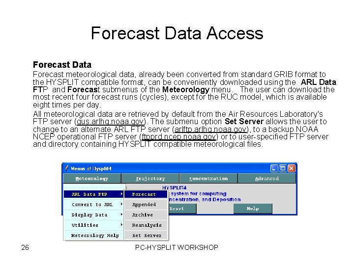
Forecast Data Access Forecast Data Forecast meteorological data, already been converted from standard GRIB format to the HYSPLIT compatible format, can be conveniently downloaded using the ARL Data FTP and Forecast submenus of the Meteorology menu. The user can download the most recent four forecast runs (cycles), except for the RUC model, which is available eight times per day. All meteorological data are retrieved by default from the Air Resources Laboratory's FTP server (gus. arlhq. noaa. gov). The submenu option Set Server allows the user to change to an alternate ARL FTP server (arlftp. arlhq. noaa. gov), to a backup NOAA NCEP operational FTP server (ftpprd. ncep. noaa. gov) or to user-specified FTP server and directory containing HYSPLIT compatible meteorological files. 26 PC-HYSPLIT WORKSHOP

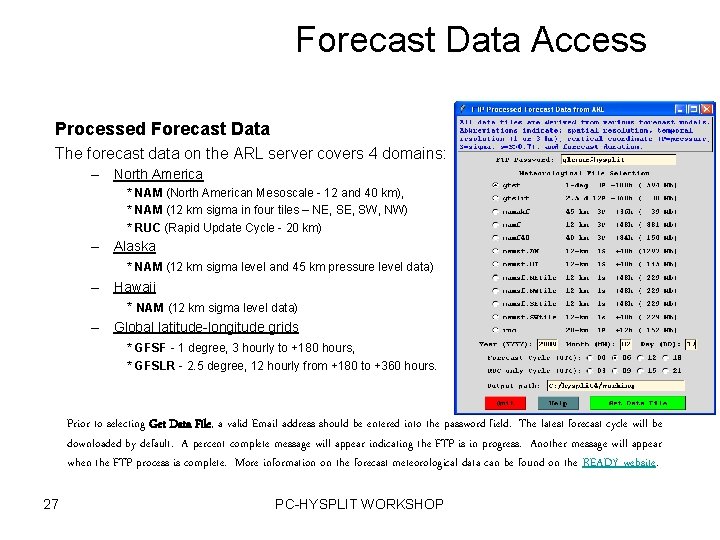
Forecast Data Access Processed Forecast Data The forecast data on the ARL server covers 4 domains: – North America * NAM (North American Mesoscale - 12 and 40 km), * NAM (12 km sigma in four tiles – NE, SW, NW) * RUC (Rapid Update Cycle - 20 km) – Alaska * NAM (12 km sigma level and 45 km pressure level data) – Hawaii * NAM (12 km sigma level data) – Global latitude-longitude grids * GFSF - 1 degree, 3 hourly to +180 hours, * GFSLR - 2. 5 degree, 12 hourly from +180 to +360 hours. Prior to selecting Get Data File, a valid Email address should be entered into the password field. The latest forecast cycle will be downloaded by default. A percent complete message will appear indicating the FTP is in progress. Another message will appear when the FTP process is complete. More information on the forecast meteorological data can be found on the READY website. 27 PC-HYSPLIT WORKSHOP

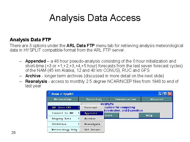
Analysis Data Access Analysis Data FTP There are 3 options under the ARL Data FTP menu tab for retrieving analysis meteorological data in HYSPLIT compatible format from the ARL FTP server. – Appended – a 48 hour pseudo-analysis consisting of the 0 hour initialization and short-time (+3 or +1, +2, +3, +4, +5 hour) forecasts from the last seven forecast cycles) of the NAM (45 km Alaska, 12 and 40 km CONUS), RUC and GFS – Archive - longer term archives (discussed in more detail on the next slide) – Reanalysis - access to monthly 2. 5 degree NCAR/NCEP files from 1948 to end of last year 28 PC-HYSPLIT WORKSHOP

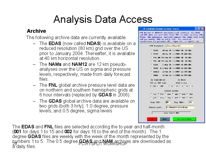
Analysis Data Access Archive The following archive data are currently available: – The EDAS (now called NDAS) is available on a reduced resolution (80 km) grid over the US prior to January 2004. Thereafter, it is available at 40 km horizontal resolution. – The NAMs and NAM 12 are 12 km pseudoanalyses over the US on sigma and pressure levels, respectively, made from daily forecast files. – The FNL global archive pressure level data are on northern and southern hemispheric grids at 6 hour intervals (replaced by GDAS in 2006). – The GDAS global archive data are available on two grids (both 3 hrly); 1. 0 degree, pressure levels, and 0. 5 degree, sigma levels The EDAS and FNL files are selected according the to year and half-month (001 for days 1 to 15 and 002 for days 16 to the end of the month). The 1 degree GDAS files are weekly with the week of the month represented by the numbers 1 to 5. The 0. 5 degree PC-HYSPLIT GDAS and NAM archives are downloaded as 29 WORKSHOP a daily files.

There a lot of powerful tools available in the HYSPLIT modeling system to display meteorological data We aren’t going to go into much detail here, but here a few examples…

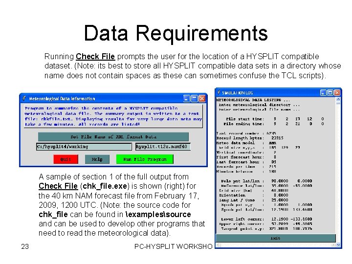
Data Requirements Running Check File prompts the user for the location of a HYSPLIT compatible dataset. (Note: its best to store all HYSPLIT compatible data sets in a directory whose name does not contain spaces as these can sometimes confuse the TCL scripts). A sample of section 1 of the full output from Check File (chk_file. exe) is shown (right) for the 40 km NAM forecast file from February 17, 2009, 1200 UTC. (Note: the source code for chk_file can be found in examplessource and can be used to develop other programs that need to read the meteorological data). 23 PC-HYSPLIT WORKSHOP

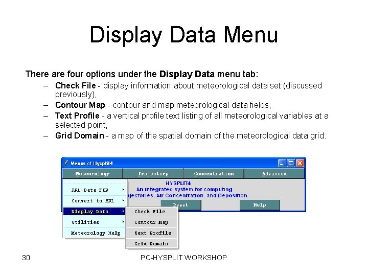
Display Data Menu There are four options under the Display Data menu tab: – Check File - display information about meteorological data set (discussed previously), – Contour Map - contour and map meteorological data fields, – Text Profile - a vertical profile text listing of all meteorological variables at a selected point, – Grid Domain - a map of the spatial domain of the meteorological data grid. 30 PC-HYSPLIT WORKSHOP

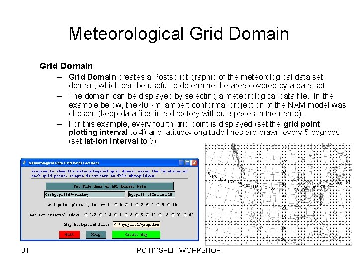
Meteorological Grid Domain – Grid Domain creates a Postscript graphic of the meteorological data set domain, which can be useful to determine the area covered by a data set. – The domain can be displayed by selecting a meteorological data file. In the example below, the 40 km lambert-conformal projection of the NAM model was chosen. (keep data files in a directory without spaces in the name). – For this example, every fourth grid point is displayed (set the grid point plotting interval to 4) and latitude-longitude lines are drawn every 5 degrees (set lat-lon interval to 5). 31 PC-HYSPLIT WORKSHOP

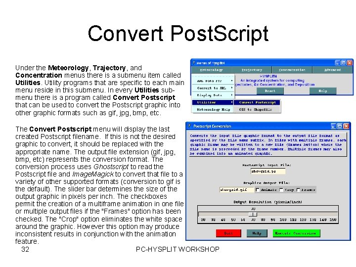
Convert Post. Script Under the Meteorology, Trajectory, and Concentration menus there is a submenu item called Utilities. Utility programs that are specific to each main menu reside in this submenu. In every Utilities submenu there is a program called Convert Postscript that can be used to convert the Postscript graphic into other graphic formats such as gif, jpg, bmp, etc. The Convert Postscript menu will display the last created Postscript filename. If this is not the desired graphic to convert, it should be replaced with the appropriate name. The output file extension (gif, jpg, bmp, etc) represents the conversion format. The conversion process uses Ghostscript to read the Postscript file and Image. Magick to convert that file to a variety of other supported formats (conversion to gif is the default). The slider bar determines the size of the output graphic in pixels per inch. The checkboxes permit the creation of a multiframe animation in one file or multiple output files if the "Frames" option has been checked. The "Crop" option eliminates the white space around the graphic. However this option may produce inconsistent results in conjunction with the animation feature. 32 PC-HYSPLIT WORKSHOP

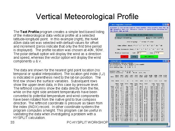
Vertical Meteorological Profile The Text Profile program creates a simple text based listing of the meteorological data vertical profile at a selected latitude-longitude point. In this example (right), the NAM 40 km data set was selected with default values for offset and increment (zeros indicate that only the first time period is displayed). The profile location was chosen at 40 N, 90 W. The polar default option will display the wind as a direction and speed, whereas the vector option will display the wind components u & v. The data are shown for the nearest grid point location (no temporal or spatial interpolation). The location grid index (I, J) is indicated in parenthesis next to the lat-lon position. The first row shows the surface variables. Subsequent rows show the upper-level data, in this case by pressure level. The leftmost columns show the data directly from the file, while on the right side ambient temperatures have been converted to potential temperature and wind components have been rotated from the native grid to true compass direction. The leftmost coordinate is pressure as taken from the index (INDX) record. In other coordinate systems the program computes a height. This program can be useful in validating the data when investigating a problem with a HYSPLIT calculation. 33 PC-HYSPLIT WORKSHOP

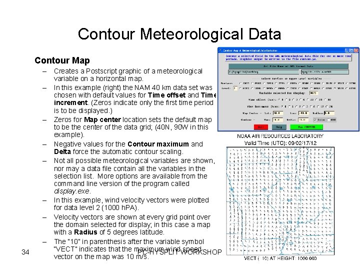
Contour Meteorological Data Contour Map 34 – Creates a Postscript graphic of a meteorological variable on a horizontal map. – In this example (right) the NAM 40 km data set was chosen with default values for Time offset and Time increment. (Zeros indicate only the first time period is to be displayed. ) – Zeros for Map center location sets the default map to be the center of the data grid; (40 N, 90 W in this example). – Negative values for the Contour maximum and Delta force the automatic contour scaling. – Not all possible meteorological variables are shown, nor may a data file contain all the variables in the selection list. More options are available from the command line version of the program called display. exe. – In this example, wind velocity vectors were plotted for data level 2 (1000 h. PA). – Velocity vectors are shown at every grid point over the domain selected for display; in this case a map with a Radius of 5 degrees latitude. – The “ 10” in parenthesis after the variable symbol “VECT” indicates that the maximum wind. WORKSHOP speed PC-HYSPLIT vector on the map was 10 m/s.

Additional Information about Meteorological Data and HYSPLIT

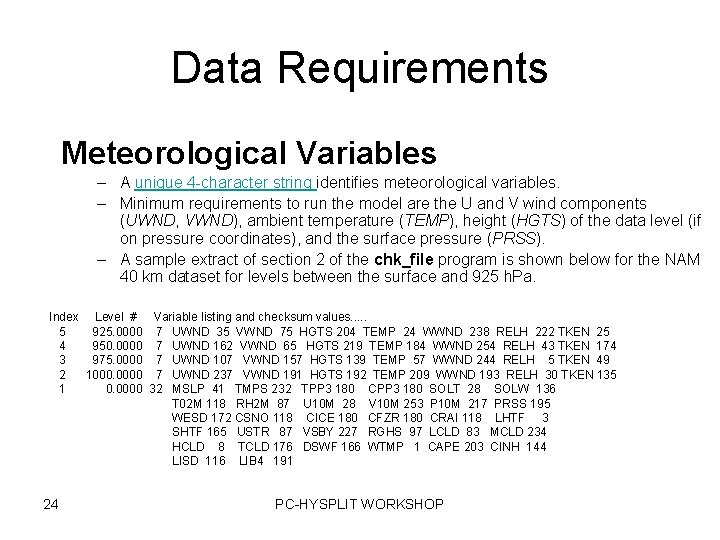
Data Requirements Meteorological Variables – A unique 4 -character string identifies meteorological variables. – Minimum requirements to run the model are the U and V wind components (UWND, VWND), ambient temperature (TEMP), height (HGTS) of the data level (if on pressure coordinates), and the surface pressure (PRSS). – A sample extract of section 2 of the chk_file program is shown below for the NAM 40 km dataset for levels between the surface and 925 h. Pa. Index Level # Variable listing and checksum values. . . 5 925. 0000 7 UWND 35 VWND 75 HGTS 204 TEMP 24 WWND 238 RELH 222 TKEN 25 4 950. 0000 7 UWND 162 VWND 65 HGTS 219 TEMP 184 WWND 254 RELH 43 TKEN 174 3 975. 0000 7 UWND 107 VWND 157 HGTS 139 TEMP 57 WWND 244 RELH 5 TKEN 49 2 1000. 0000 7 UWND 237 VWND 191 HGTS 192 TEMP 209 WWND 193 RELH 30 TKEN 135 1 0. 0000 32 MSLP 41 TMPS 232 TPP 3 180 CPP 3 180 SOLT 28 SOLW 136 T 02 M 118 RH 2 M 87 U 10 M 28 V 10 M 253 P 10 M 217 PRSS 195 WESD 172 CSNO 118 CICE 180 CFZR 180 CRAI 118 LHTF 3 SHTF 165 USTR 87 VSBY 227 RGHS 97 LCLD 83 MCLD 234 HCLD 8 TCLD 176 DSWF 166 WTMP 1 CAPE 203 CINH 144 LISD 116 LIB 4 191 24 PC-HYSPLIT WORKSHOP

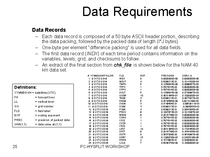
Data Requirements Data Records – Each data record is composed of a 50 byte ASCII header portion, describing the data packing, followed by the packed data of length (I*J bytes). – One-byte per element “difference packing” is used for all data fields. – The first data record (INDX) of each time period contains information on the variables, levels, grid, and checksums to follow. – An extract of the final section from chk_file is shown below for the NAM 40 km data set. Definitions: YYMMDDHH = date/time (UTC) FH = forecast hour LL = vertical level GG = grid number FLD = field label EXP = scaling exponent PREC = precision of packed data VAR(1, 1) = data value at (1, 1) 25 # YYMMDDHHFHLLGG 1 9 21712 0 018 2 9 21712 0 018 3 9 21712 0 018 4 9 21712 0 018 5 9 21712 0 018 6 9 21712 0 018 7 9 21712 0 018 8 9 21712 0 018 9 9 21712 0 018 10 9 21712 0 018 11 9 21712 0 018 12 9 21712 0 018 13 9 21712 0 018 14 9 21712 0 018 15 9 21712 0 018 16 9 21712 0 018 17 9 21712 0 018 18 9 21712 0 018 19 9 21712 0 018 20 9 21712 0 018 21 9 21712 0 018 22 9 21712 0 018 23 9 21712 0 018 24 9 21712 0 018. . . . FLD INDX MSLP TMPS TPP 3 CPP 3 SOLT SOLW T 02 M RH 2 M U 10 M V 10 M PRSS WESD CSNO CICE CFZR CRAI LHTF SHTF USTR VSBY RGHS LCLD PC-HYSPLIT WORKSHOP EXP 0 4 5 1 1 5 10 4 6 3 4 4 8 9 1 1 10 9 0 15 2 7 PRECISION 0. 0000000 E+00 0. 6299213 E-01 0. 1259843 E+00 0. 7874016 E-02 0. 1259843 E+00 0. 4031496 E+01 0. 6299213 E-01 0. 2519685 E+00 0. 3149606 E-01 0. 6299213 E-01 0. 1007874 E+01 0. 2015748 E+01 0. 7874016 E-02 0. 4031496 E+01 0. 2015748 E+01 0. 3937008 E-02 0. 1290079 E+03 0. 1574803 E-01 0. 5039370 E+00 VAR(1, 1) 0. 0000000 E+00 0. 1014420 E+04 0. 2988067 E+03 0. 0000000 E+00 0. 2730887 E+03 0. 1000000 E+04 0. 2977927 E+03 0. 8214149 E+02 -0. 9052811 E+01 -0. 2805954 E+01 0. 2964305 E+03 0. 1014287 E+04 0. 0000000 E+00 0. 1704460 E+03 0. 1664436 E+02 0. 3633987 E+00 0. 2403518 E+05 0. 2000000 E-02 0. 1000000 E+02

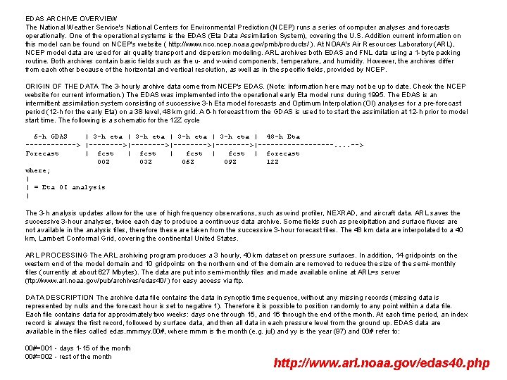
EDAS ARCHIVE OVERVIEW The National Weather Service's National Centers for Environmental Prediction (NCEP) runs a series of computer analyses and forecasts operationally. One of the operational systems is the EDAS (Eta Data Assimilation System), covering the U. S. Addition current information on this model can be found on NCEP's website ( http: //www. nco. ncep. noaa. gov/pmb/products/ ). At NOAA's Air Resources Laboratory (ARL), NCEP model data are used for air quality transport and dispersion modeling. ARL archives both EDAS and FNL data using a 1 -byte packing routine. Both archives contain basic fields such as the u- and v-wind components, temperature, and humidity. However, the archives differ from each other because of the horizontal and vertical resolution, as well as in the specific fields, provided by NCEP. ORIGIN OF THE DATA The 3 -hourly archive data come from NCEP's EDAS. (Note: information here may not be up to date. Check the NCEP website for current information. ) The EDAS was implemented into the operational early Eta model runs during 1995. The EDAS is an intermittent assimilation system consisting of successive 3 -h Eta model forecasts and Optimum Interpolation (OI) analyses for a pre-forecast period (12 -h for the early Eta) on a 38 level, 48 km grid. A 6 -h forecast from the GDAS is used to to start the assimilation at 12 -h prior to model start time. The following is a schematic for the 12 Z cycle 6 -h GDAS | 3 -h eta | 48 -h Eta ------> |-------->|-------->|---------. . --> Forecast | fcst | forecast 00 Z 03 Z 06 Z 09 Z 12 Z where; | | = Eta OI analysis | The 3 -h analysis updates allow for the use of high frequency observations, such as wind profiler, NEXRAD, and aircraft data. ARL saves the successive 3 -hour analyses, twice each day to produce a continuous data archive. Some fields such as precipitation and surface fluxes are not available in the analysis files, therefore these are taken from the successive 3 -hour forecast files. The 48 km data are interpolated to a 40 km, Lambert Conformal Grid, covering the continental United States. ARL PROCESSING The ARL archiving program produces a 3 hourly, 40 km dataset on pressure surfaces. In addition, 14 gridpoints on the western end of the model domain and 10 gridpoints on the northern end of the domain are removed to reduce the size of the semi-monthly files (currently at about 627 Mbytes). The data are put into semi-monthly files and made available online at ARL=s server (ftp: //www. arl. noaa. gov/pub/archives/edas 40/ ) for easy access via ftp. DATA DESCRIPTION The archive data file contains the data in synoptic time sequence, without any missing records (missing data is represented by nulls and the forecast hour is set to negative 1). Therefore it is possible to position randomly to any point within a data file. Each file contains data for approximately two weeks: days one through 15, and 16 through the end of the month. At each time period, an index record is always the first record, followed by surface data, and then all data in each pressure level from the ground up. EDAS data are available in the files called edas. mmmyy. 00#, where mmm is the month (e. g. jul) and yy is the year (97) and 00# refer to: 00#=001 - days 1 -15 of the month 00#=002 - rest of the month http: //www. arl. noaa. gov/edas 40. php

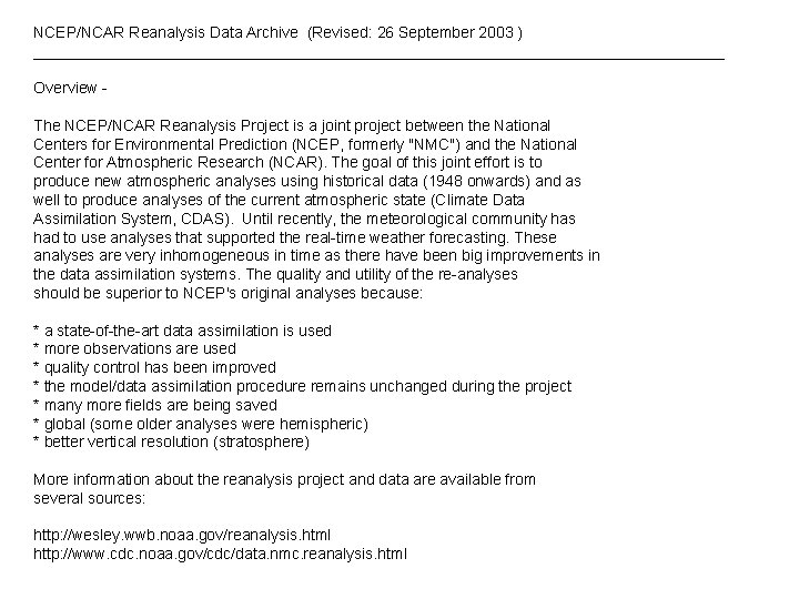
NCEP/NCAR Reanalysis Data Archive (Revised: 26 September 2003 ) ________________________________________ Overview The NCEP/NCAR Reanalysis Project is a joint project between the National Centers for Environmental Prediction (NCEP, formerly "NMC") and the National Center for Atmospheric Research (NCAR). The goal of this joint effort is to produce new atmospheric analyses using historical data (1948 onwards) and as well to produce analyses of the current atmospheric state (Climate Data Assimilation System, CDAS). Until recently, the meteorological community has had to use analyses that supported the real-time weather forecasting. These analyses are very inhomogeneous in time as there have been big improvements in the data assimilation systems. The quality and utility of the re-analyses should be superior to NCEP's original analyses because: * a state-of-the-art data assimilation is used * more observations are used * quality control has been improved * the model/data assimilation procedure remains unchanged during the project * many more fields are being saved * global (some older analyses were hemispheric) * better vertical resolution (stratosphere) More information about the reanalysis project and data are available from several sources: http: //wesley. wwb. noaa. gov/reanalysis. html http: //www. cdc. noaa. gov/cdc/data. nmc. reanalysis. html

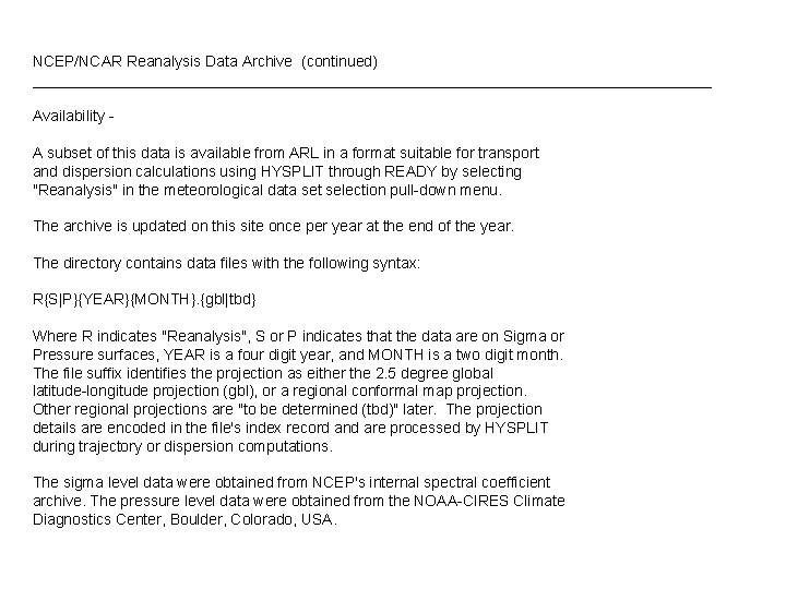
NCEP/NCAR Reanalysis Data Archive (continued) ________________________________________ Availability A subset of this data is available from ARL in a format suitable for transport and dispersion calculations using HYSPLIT through READY by selecting "Reanalysis" in the meteorological data set selection pull-down menu. The archive is updated on this site once per year at the end of the year. The directory contains data files with the following syntax: R{S|P}{YEAR}{MONTH}. {gbl|tbd} Where R indicates "Reanalysis", S or P indicates that the data are on Sigma or Pressure surfaces, YEAR is a four digit year, and MONTH is a two digit month. The file suffix identifies the projection as either the 2. 5 degree global latitude-longitude projection (gbl), or a regional conformal map projection. Other regional projections are "to be determined (tbd)" later. The projection details are encoded in the file's index record and are processed by HYSPLIT during trajectory or dispersion computations. The sigma level data were obtained from NCEP's internal spectral coefficient archive. The pressure level data were obtained from the NOAA-CIRES Climate Diagnostics Center, Boulder, Colorado, USA.

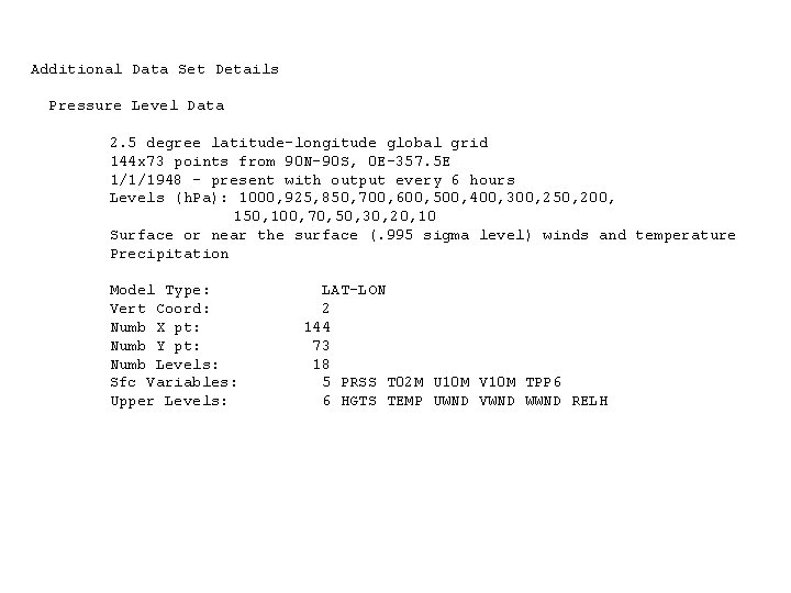
Additional Data Set Details Pressure Level Data 2. 5 degree latitude-longitude global grid 144 x 73 points from 90 N-90 S, 0 E-357. 5 E 1/1/1948 - present with output every 6 hours Levels (h. Pa): 1000, 925, 850, 700, 600, 500, 400, 300, 250, 200, 150, 100, 70, 50, 30, 20, 10 Surface or near the surface (. 995 sigma level) winds and temperature Precipitation Model Type: Vert Coord: Numb X pt: Numb Y pt: Numb Levels: Sfc Variables: Upper Levels: LAT-LON 2 144 73 18 5 PRSS T 02 M U 10 M V 10 M TPP 6 6 HGTS TEMP UWND VWND WWND RELH

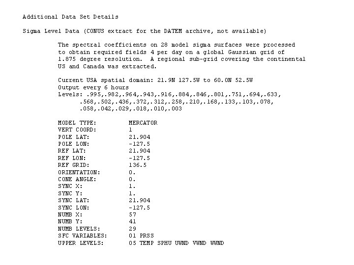
Additional Data Set Details Sigma Level Data (CONUS extract for the DATEM archive, not available) The spectral coefficients on 28 model sigma surfaces were processed to obtain required fields 4 per day on a global Gaussian grid of 1. 875 degree resolution. A regional sub-grid covering the continental US and Canada was extracted. Current USA spatial domain: 21. 9 N 127. 5 W to 60. 0 N 52. 5 W Output every 6 hours Levels: . 995, . 982, . 964, . 943, . 916, . 884, . 846, . 801, . 751, . 694, . 633, . 568, . 502, . 436, . 372, . 312, . 258, . 210, . 168, . 133, . 103, . 078, . 058, . 042, . 029, . 018, . 010, . 003 MODEL TYPE: VERT COORD: POLE LAT: POLE LON: REF LAT: REF LON: REF GRID: ORIENTATION: CONE ANGLE: SYNC X: SYNC Y: SYNC LAT: SYNC LON: NUMB X: NUMB Y: NUMB LEVELS: SFC VARIABLES: UPPER LEVELS: MERCATOR 1 21. 904 -127. 5 136. 5 0. 0. 1. 1. 21. 904 -127. 5 57 41 29 01 PRSS 05 TEMP SPHU UWND VWND WWND

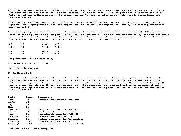
All of these datasets contain basic fields such as the u- and v-wind components, temperature, and humidity. However, the archives differ from each other because of the horizontal and vertical resolution, as well as in the specific fields provided by NCEP. All fields were selected by ARL according to what is most relevant for transport and dispersion studies and disk space limitations. Data Packing Format NCEP typically saves their model output in GRIB format. However, at ARL the data are reprocessed and stored in a 1 -byte packing algorithm. This 1 - byte packing is a bit more compact than GRIB and can be directly used on a variety of computing platforms with direct access I/O. The data array is packed and stored into one byte characters. To preserve as much data precision as possible the difference between the values at grid points is saved and packed rather than the actual values. The grid is then reconstructed by adding the differences between grid values starting with the first value, which is stored in unpacked ASCII form in the header record. To illustrate the process, assume that a grid of real data, R, of dimensions i, j is given by the example below. 1, j-1. . 1, 2 1, 1 2, j-1. . 2, 2 2, 1 . . i-1, j i, j. . i-1, j-1 i, j-1. . . . i-1, 2 i, 2. . i-1, 1 i, 1 The packed value, P, is then given by Pi, j = (Ri, j - Ri-1, j)* (2**(7 -N)), where the scaling exponent N = ln d. Rmax / ln 2. The value of d. Rmax is the maximum difference between any two adjacent grid points for the entire array. It is computed from the differences along each i index holding j constant. The difference at index (1, j) is computed from index (1, j-1), and at 1, 1 the difference is always zero. The packed values are one byte unsigned integers, where values from 0 to 126 represent -127 to -1, 127 represents zero, and values of 128 to 254 represent 1 to 127. Each record length is then equal in bytes to the number of array elements plus 50 bytes for the header label information. The 50 byte label field precedes each packed data field and contains the following ASCII data: Field Year Month Day Hour Forecast* Level Grid Variable Exponent Precision Value 1, 1 Format I 2 I 2 A 4 I 4 E 14. 7 Description Greenwich date for which data valid " " " Hours forecast, zero for analysis Level from the surface up (see Table 3) Grid identification (see Table 1) Variable label (see Table 2) Scaling exponent needed for unpacking Precision of unpacked data Unpacked data value at grid point 1, 1 *Forecast hour is -1 for missing data.