
Operational ocean forecasting in the Arctic met no


- Slides: 18
Operational ocean forecasting in the Arctic (met. no) Øyvind Saetra Norwegian Meteorological Institute Presented at the Arctic. GOOS meeting, 12 -13 September 2006 Bergen, Norway Meteorologisk Institutt met. no
Ocean and sea-ice forecasts • Large scale coupled ice-ocean model with 20 km horizontal resolution • Nudging of OSISAF satellite observations of SST and ice concentration • 168 hour forecasts with atmospheric forcing from ECMWF Meteorologisk Institutt met. no
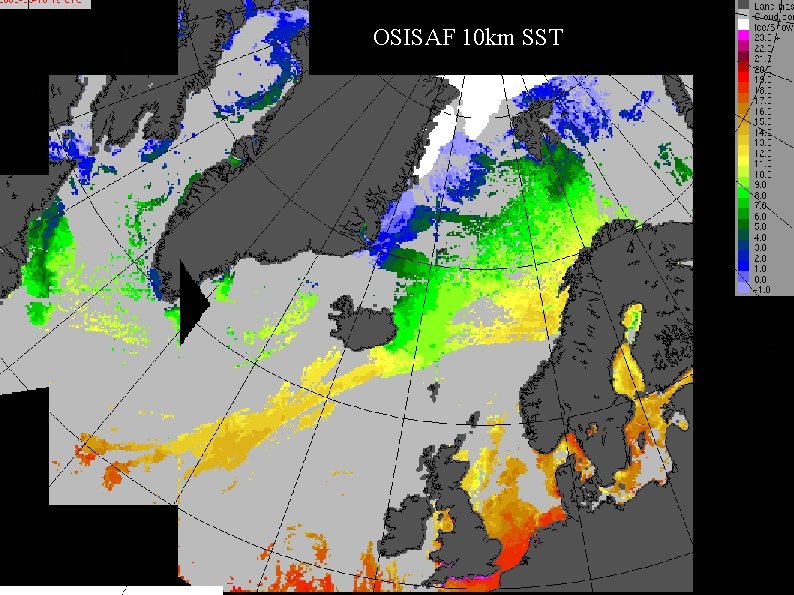
OSISAF 10 km SST Meteorologisk Institutt met. no
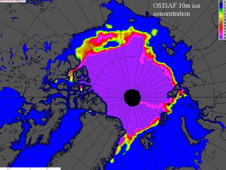
OSISAF 10 m ice concentration Meteorologisk Institutt met. no
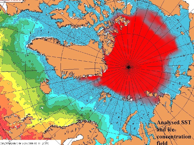
Analysed SST and iceconcentration Meteorologisk Institutt met. no
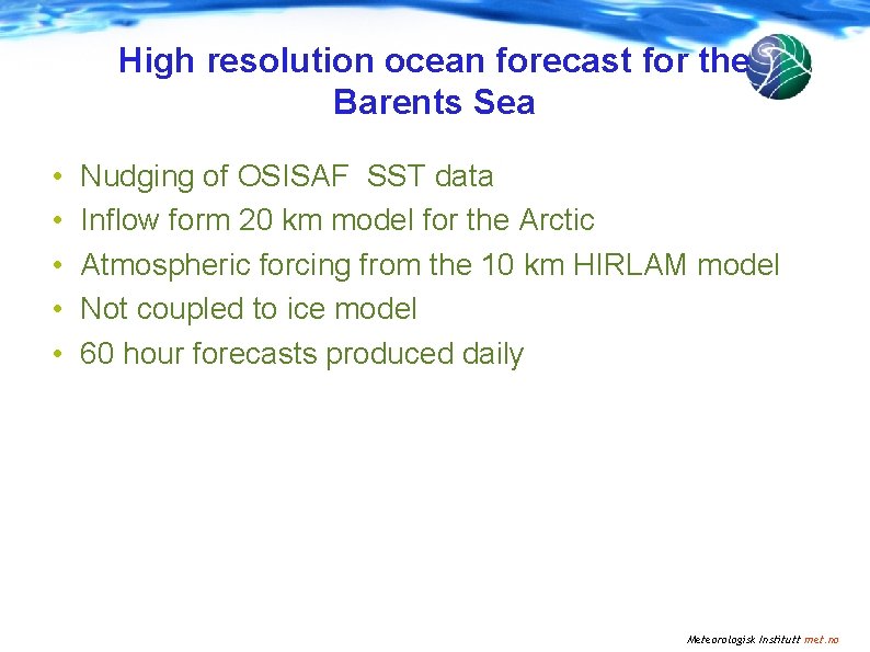
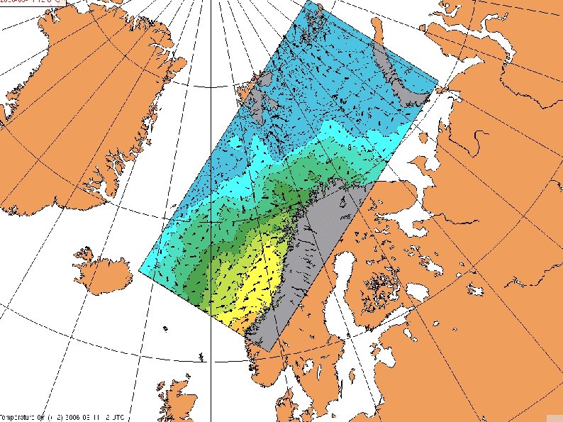
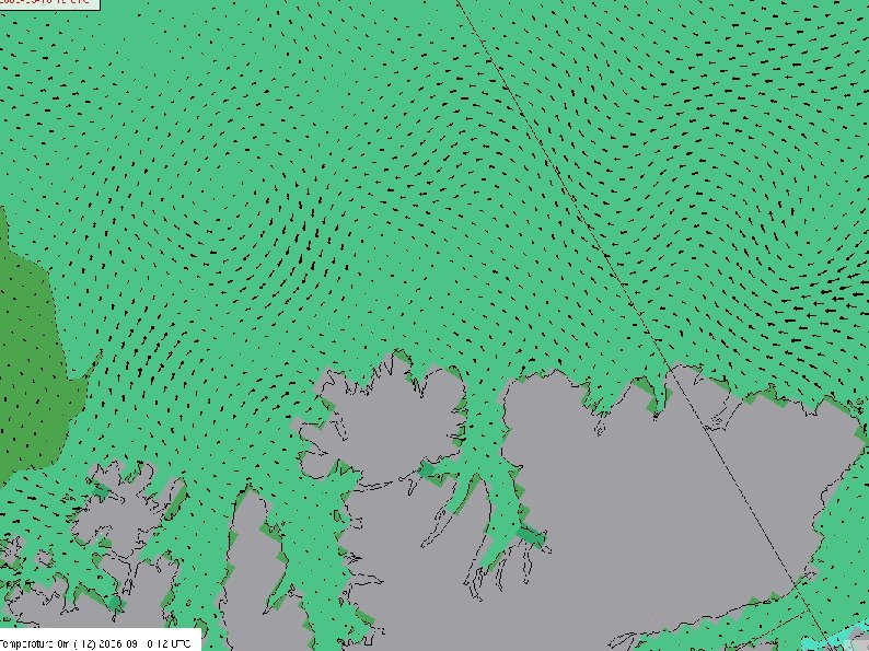
High resolution ocean forecast for the Barents Sea • • • Nudging of OSISAF SST data Inflow form 20 km model for the Arctic Atmospheric forcing from the 10 km HIRLAM model Not coupled to ice model 60 hour forecasts produced daily Meteorologisk Institutt met. no
Meteorologisk Institutt met. no
Meteorologisk Institutt met. no
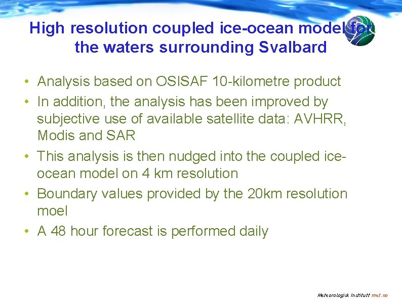
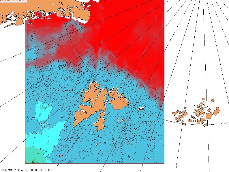
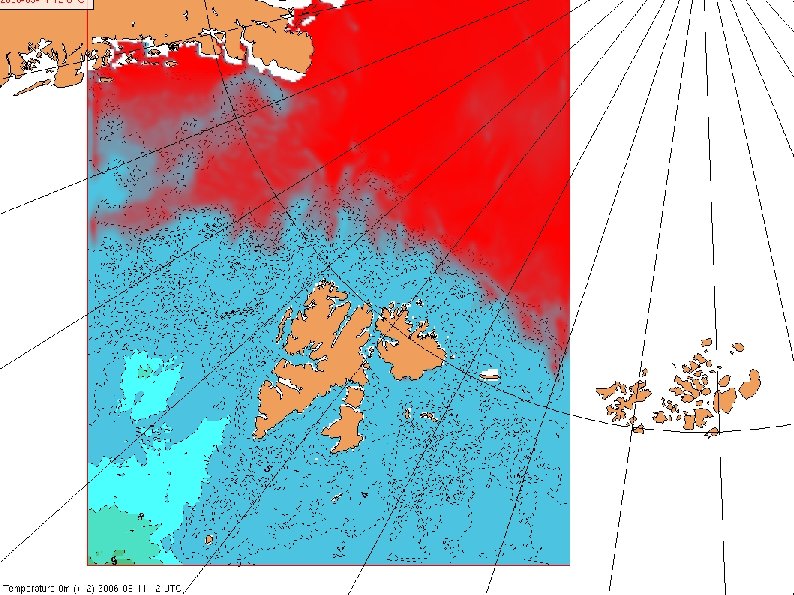
High resolution coupled ice-ocean model for the waters surrounding Svalbard • Analysis based on OSISAF 10 -kilometre product • In addition, the analysis has been improved by subjective use of available satellite data: AVHRR, Modis and SAR • This analysis is then nudged into the coupled iceocean model on 4 km resolution • Boundary values provided by the 20 km resolution moel • A 48 hour forecast is performed daily Meteorologisk Institutt met. no
Meteorologisk Institutt met. no
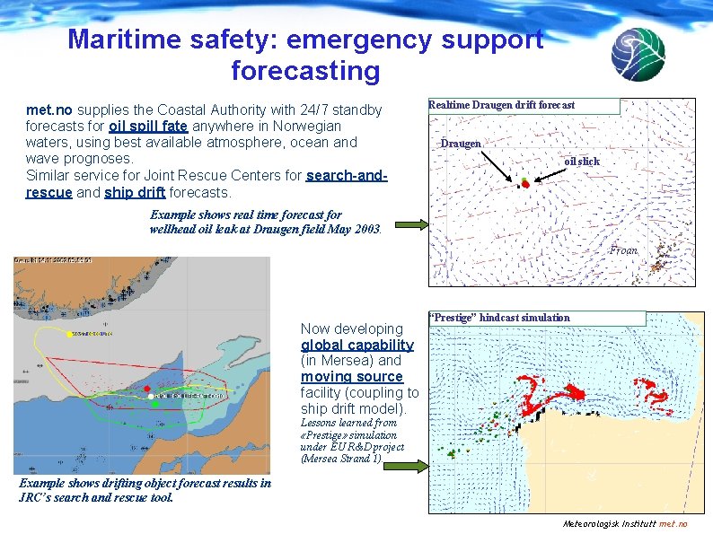
Maritime safety: emergency support forecasting met. no supplies the Coastal Authority with 24/7 standby forecasts for oil spill fate anywhere in Norwegian waters, using best available atmosphere, ocean and wave prognoses. Similar service for Joint Rescue Centers for search-andrescue and ship drift forecasts. Realtime Draugen drift forecast Draugen oil slick Example shows real time forecast for wellhead oil leak at Draugen field May 2003. Froan Now developing global capability (in Mersea) and moving source facility (coupling to ship drift model). Lessons learned from «Prestige» simulation under EU R&D project (Mersea Strand 1). Example shows drifting object forecast results in JRC’s search and rescue tool. “Prestige” hindcast simulation surface oil subsurface oil × stranded oil Meteorologisk Institutt met. no
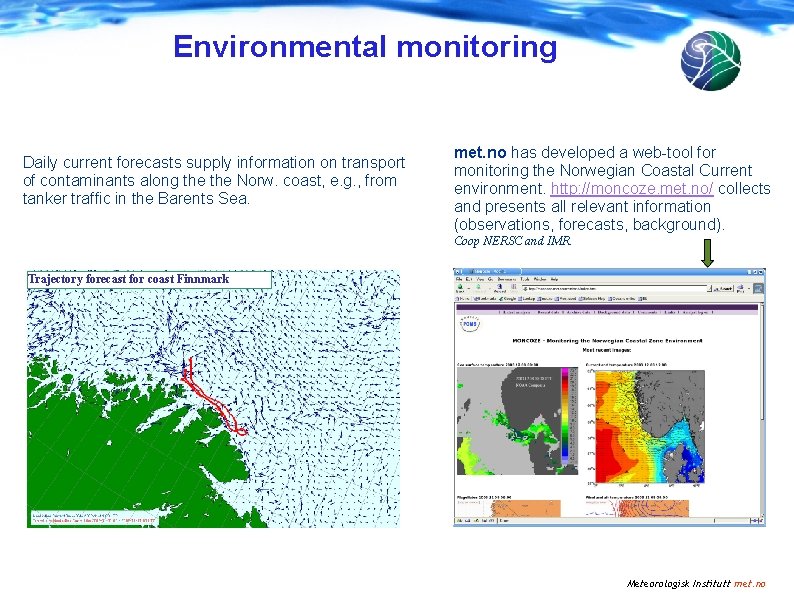
Environmental monitoring Daily current forecasts supply information on transport of contaminants along the Norw. coast, e. g. , from tanker traffic in the Barents Sea. met. no has developed a web-tool for monitoring the Norwegian Coastal Current environment. http: //moncoze. met. no/ collects and presents all relevant information (observations, forecasts, background). Coop NERSC and IMR. Trajectory forecast for coast Finnmark Meteorologisk Institutt met. no
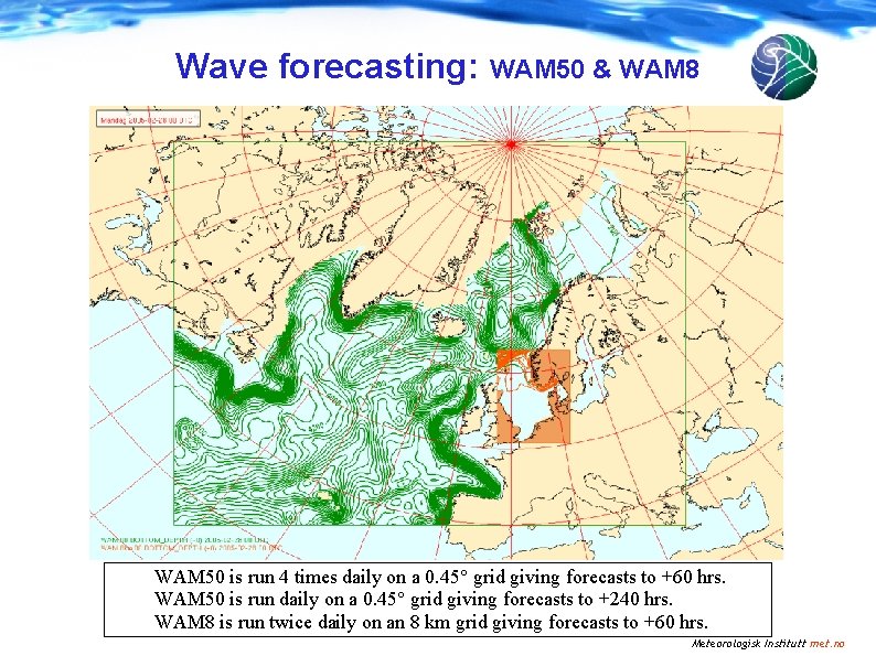
Wave forecasting: WAM 50 & WAM 8 WAM 50 is run 4 times daily on a 0. 45° grid giving forecasts to +60 hrs. WAM 50 is run daily on a 0. 45° grid giving forecasts to +240 hrs. WAM 8 is run twice daily on an 8 km grid giving forecasts to +60 hrs. Meteorologisk Institutt met. no
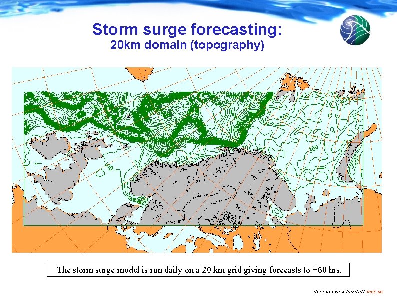
Storm surge forecasting: 20 km domain (topography) The storm surge model is run daily on a 20 km grid giving forecasts to +60 hrs. Meteorologisk Institutt met. no
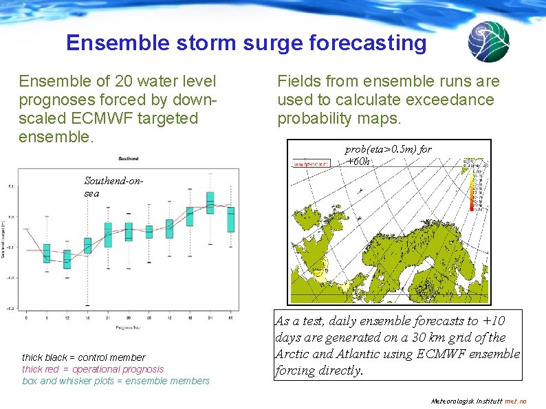
Ensemble storm surge forecasting Ensemble of 20 water level prognoses forced by downscaled ECMWF targeted ensemble. Fields from ensemble runs are used to calculate exceedance probability maps. prob(eta>0. 5 m) for +60 h Southend-on’ sea thick black = control member thick red = operational prognosis box and whisker plots = ensemble members As a test, daily ensemble forecasts to +10 days are generated on a 30 km grid of the Arctic and Atlantic using ECMWF ensemble forcing directly. Meteorologisk Institutt met. no
Future plans - challenges • Despite the analysis, the skill of the ice forecasts is still relatively poor • Model dynamics needs to be improved • Inconsistencies between the SST analysis and the ice analysis • Ice forecasts on very high resolution ( down to 500 m) for area like Hinlopenstredet • Present formulations for the dynamics are not valid at this scale (e. g. rheology) Meteorologisk Institutt met. no
Meteorologisk Institutt met. no
End Meteorologisk Institutt met. no