
Operational Application of Ensembles at the SPC Fire
Operational Application of Ensembles at the SPC: Fire Weather Forecasting David Bright NOAA/NWS/Storm Prediction Center Norman, OK Advanced Fire Weather Forecasters Course Fire Weather Virtual Conference April 25, 2008 Where Americas Climate and Weather Services Begin
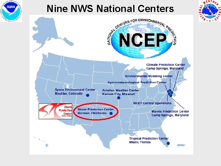
Nine NWS National Centers
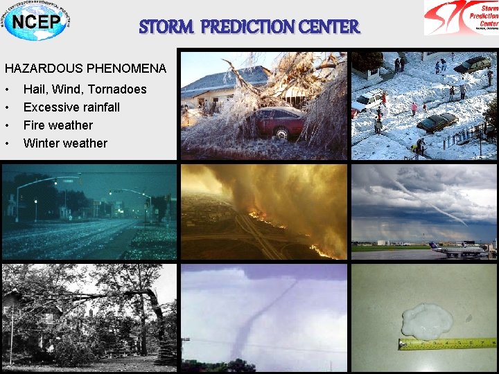
STORM PREDICTION CENTER HAZARDOUS PHENOMENA • • Hail, Wind, Tornadoes Excessive rainfall Fire weather Winter weather

SPC Fire Weather Outlooks • To provide national fire weather guidance for use by the National Weather Service, as well as other federal, state, and local government agencies • The products are intended to delineate areas of the contiguous U. S. where the forecast weather conditions, combined with pre-existing fuel conditions, result in a significant threat for wildfires • Issued once per day during the overnight hours (through 8 days) • Critical, Extremely Critical, and Critical Dry Thunderstorm forecasts – Low RH – Moderate / strong winds – Antecedent conditions / drought (NFDRS) – Critical area for dry thunderstorms implies widespread lightning with minimal rainfall
Outline • Motivation for Ensemble Forecasting • SPC Ensemble Applications in Fire Weather – Medium to Short-range Case Study (Southern California Fires Oct. 2007) • Ensemble Calibration and Decision Support • Summary and Future Directions
Outline • Motivation for Ensemble Forecasting • SPC Ensemble Applications in Fire Weather – Medium to Short-range Case Study (Southern California Fires Oct. 2007) • Ensemble Calibration and Decision Support • Summary and Future Directions
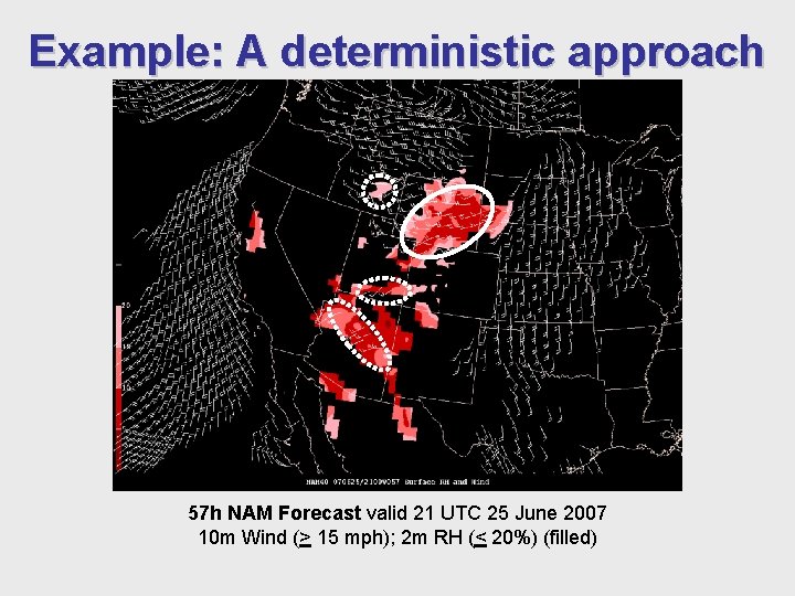
Example: A deterministic approach 57 h NAM Forecast valid 21 UTC 25 June 2007 10 m Wind (> 15 mph); 2 m RH (< 20%) (filled)
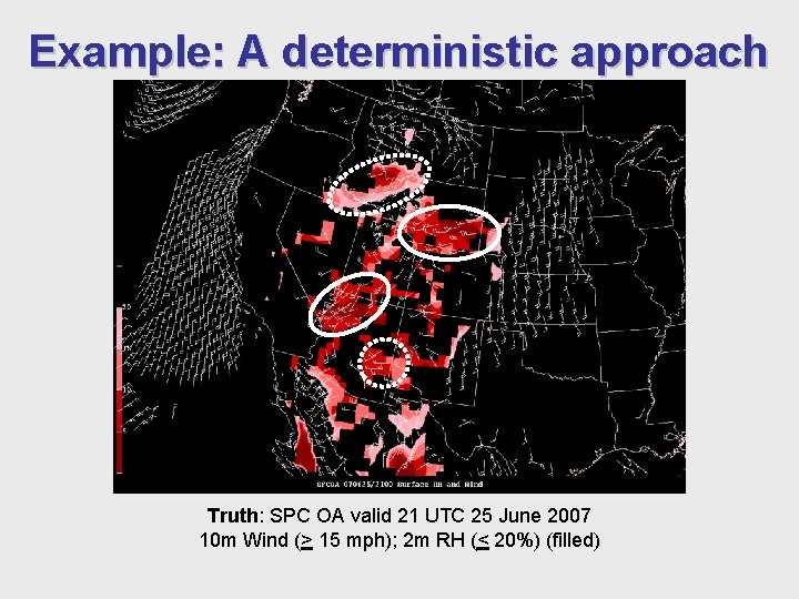
Example: A deterministic approach Truth: SPC OA valid 21 UTC 25 June 2007 10 m Wind (> 15 mph); 2 m RH (< 20%) (filled)
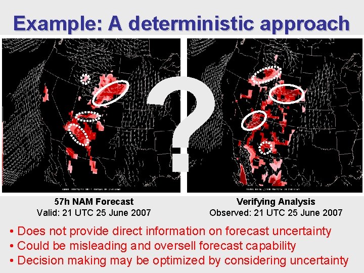
Example: A deterministic approach ? 57 h NAM Forecast Valid: 21 UTC 25 June 2007 Verifying Analysis Observed: 21 UTC 25 June 2007 • Does not provide direct information on forecast uncertainty • Could be misleading and oversell forecast capability • Decision making may be optimized by considering uncertainty
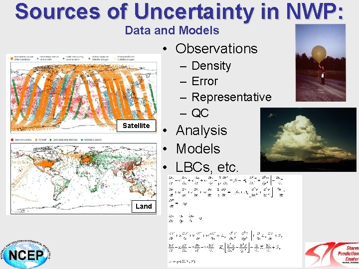
Sources of Uncertainty in NWP: Data and Models • Observations – – Satellite Land Density Error Representative QC • Analysis • Models • LBCs, etc.
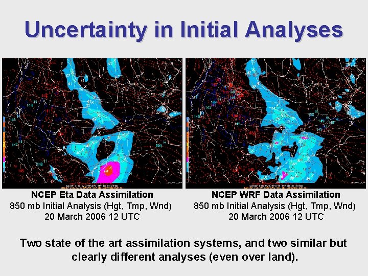
Uncertainty in Initial Analyses NCEP Eta Data Assimilation 850 mb Initial Analysis (Hgt, Tmp, Wnd) 20 March 2006 12 UTC NCEP WRF Data Assimilation 850 mb Initial Analysis (Hgt, Tmp, Wnd) 20 March 2006 12 UTC Two state of the art assimilation systems, and two similar but clearly different analyses (even over land).
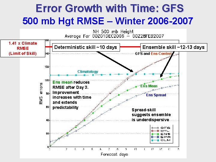
Error Growth with Time: GFS 500 mb Hgt RMSE – Winter 2006 -2007 1. 41 x Climate RMSE (Limit of Skill) Deterministic skill ~10 days Ensemble skill ~12 -13 days GFS and Ens Control Deterministic models Climatology lose Slope of skill Ens faster Mean than ensemble (solid) is less mean steep Same results in Ens mean reduces summer. Day 3. RMSE Skillafter is retained longer Improvement increases with time and extends predictability Ens Mean Ens Spread-skill suggests ensemble is underdispersive
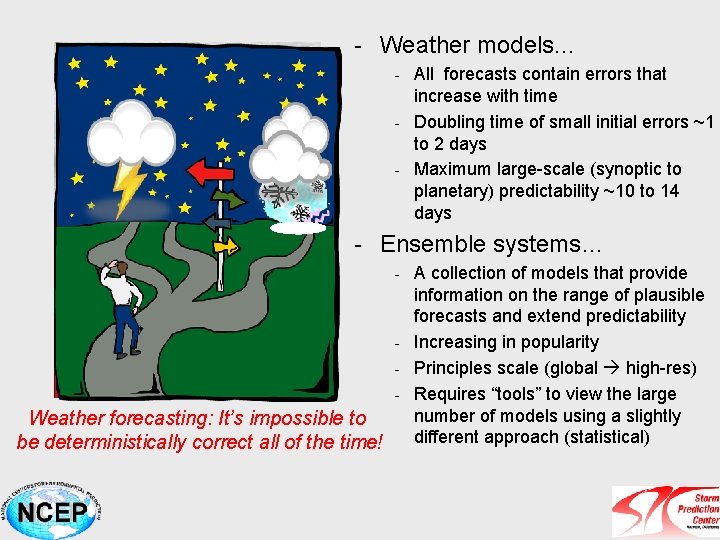
- Weather models. . . - All forecasts contain errors that increase with time - Doubling time of small initial errors ~1 to 2 days - Maximum large-scale (synoptic to planetary) predictability ~10 to 14 days - Ensemble systems… - A collection of models that provide information on the range of plausible forecasts and extend predictability - Increasing in popularity - Principles scale (global high-res) - Requires “tools” to view the large number of models using a slightly Weather forecasting: It’s impossible to different approach (statistical) be deterministically correct all of the time!
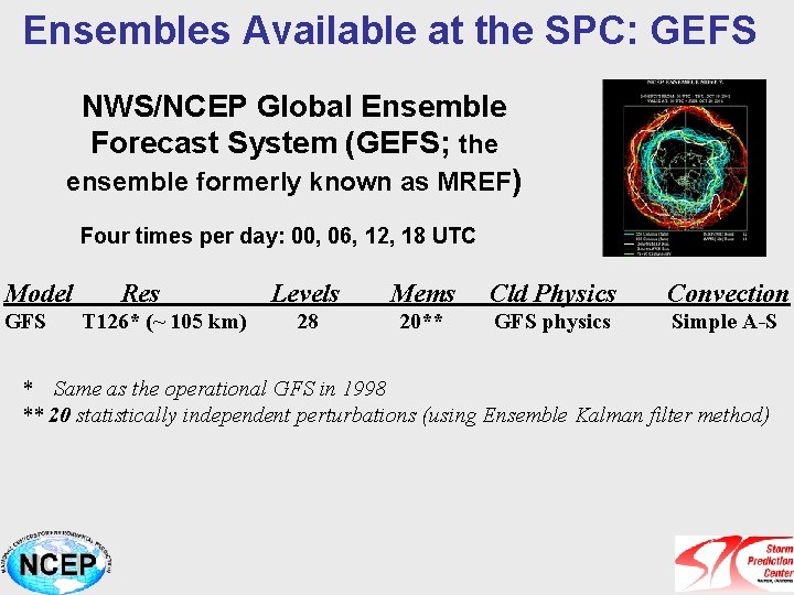
Ensembles Available at the SPC: GEFS NWS/NCEP Global Ensemble Forecast System (GEFS; the ensemble formerly known as MREF) Four times per day: 00, 06, 12, 18 UTC Model GFS Res T 126* (~ 105 km) Levels Mems Cld Physics Convection 28 20** GFS physics Simple A-S * Same as the operational GFS in 1998 ** 20 statistically independent perturbations (using Ensemble Kalman filter method)
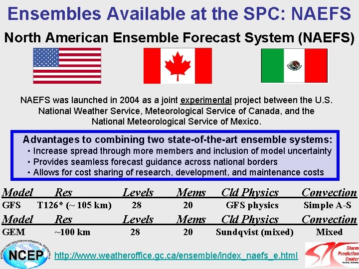
Ensembles Available at the SPC: NAEFS North American Ensemble Forecast System (NAEFS) NAEFS was launched in 2004 as a joint experimental project between the U. S. National Weather Service, Meteorological Service of Canada, and the National Meteorological Service of Mexico. Advantages to combining two state-of-the-art ensemble systems: • Increase spread through more members and inclusion of model uncertainty • Provides seamless forecast guidance across national borders • Allows for cost sharing of research, development, and maintenance costs Model GFS Res T 126* (~ 105 km) Model Res GEM ~100 km Levels 28 Mems 20 Cld Physics Convection GFS physics Simple A-S Cld Physics Convection Sundqvist (mixed) http: //www. weatheroffice. gc. ca/ensemble/index_naefs_e. html Mixed
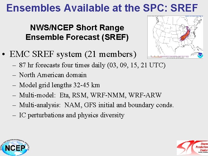
Ensembles Available at the SPC: SREF NWS/NCEP Short Range Ensemble Forecast (SREF) • EMC SREF system (21 members) – – – 87 hr forecasts four times daily (03, 09, 15, 21 UTC) North American domain Model grid lengths 32 -45 km Multi-model: Eta, RSM, WRF-NMM, WRF-ARW Multi-analysis: NAM, GFS initial and boundary conds. IC perturbations and physics diversity
Ensemble Guidance at the SPC • Develop specialized guidance for the specific application (severe weather, fire weather, winter weather) • Design guidance that… – Helps blend deterministic and ensemble approaches – Facilitates transition toward probabilistic forecasts – Considerable diagnostic parameter evaluation in probability space – Aids in decision support of high impact weather • Gauge confidence • Alert for potentially significant events
Outline • Motivation for Ensemble Forecasting • SPC Ensemble Applications in Fire Weather – Medium to Short-range Case Study (Southern California Fires Oct. 2007) Focus on Sunday afternoon: 00 Z 22 Oct 2007 • Ensemble Calibration and Decision Support • Summary and Future Directions
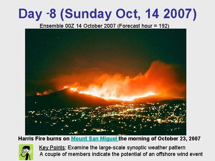
Day -8 (Sunday Oct, 14 2007) Ensemble 00 Z 14 October 2007 (Forecast hour = 192) Harris Fire burns on Mount San Miguel the morning of October 23, 2007 Key Points: Examine the large-scale synoptic weather pattern A couple of members indicate the potential of an offshore wind event
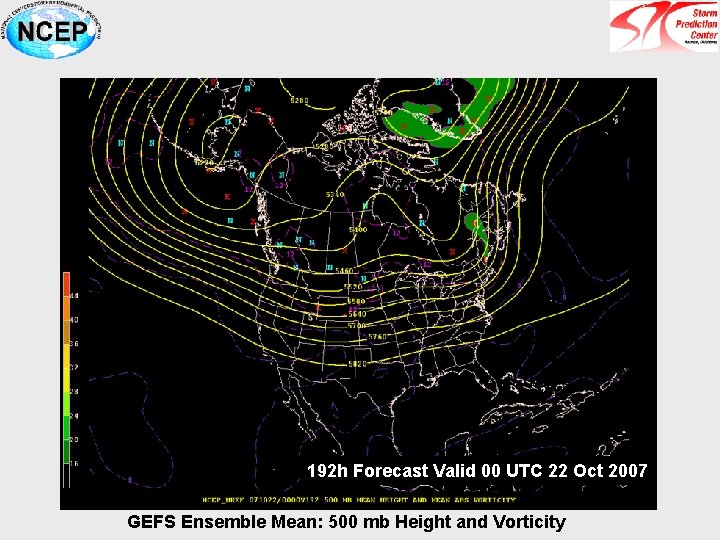
192 h Forecast Valid 00 UTC 22 Oct 2007 GEFS Ensemble Mean: 500 mb Height and Vorticity
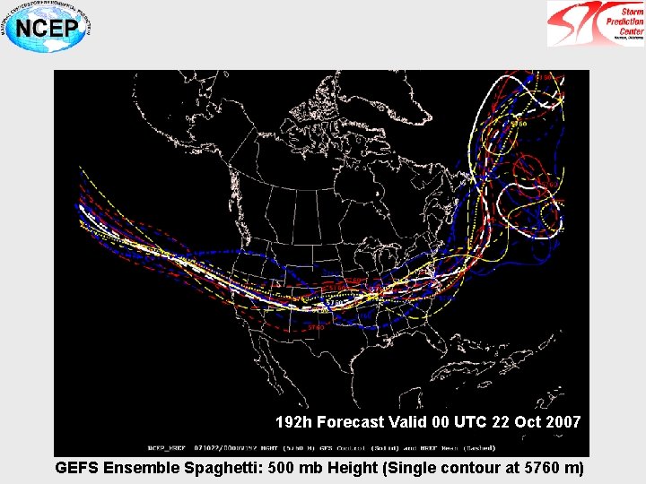
192 h Forecast Valid 00 UTC 22 Oct 2007 GEFS Ensemble Spaghetti: 500 mb Height (Single contour at 5760 m)
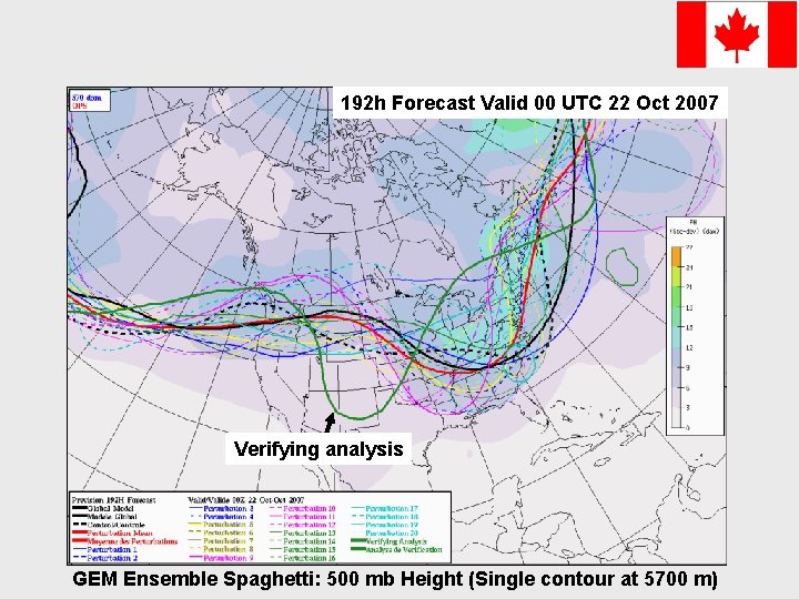
192 h Forecast Valid 00 UTC 22 Oct 2007 Verifying analysis GEM Ensemble Spaghetti: 500 mb Height (Single contour at 5700 m)
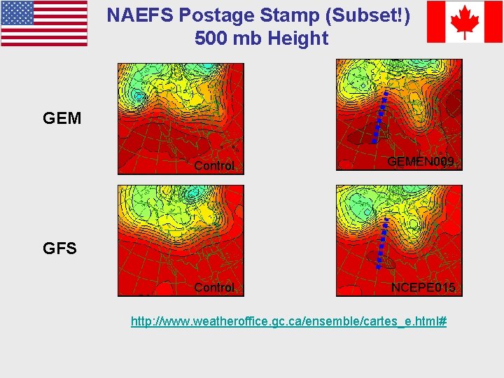
NAEFS Postage Stamp (Subset!) 500 mb Height GEM Control GEMEN 009 Control NCEPE 015 GFS http: //www. weatheroffice. gc. ca/ensemble/cartes_e. html#
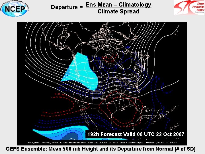
Departure = Ens Mean – Climatology Climate Spread 192 h Forecast Valid 00 UTC 22 Oct 2007 GEFS Ensemble: Mean 500 mb Height and its Departure from Normal (# of SD)
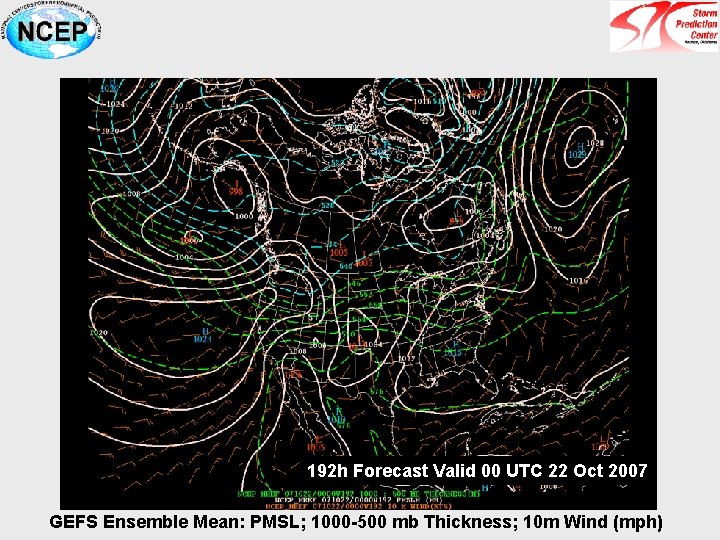
192 h Forecast Valid 00 UTC 22 Oct 2007 GEFS Ensemble Mean: PMSL; 1000 -500 mb Thickness; 10 m Wind (mph)
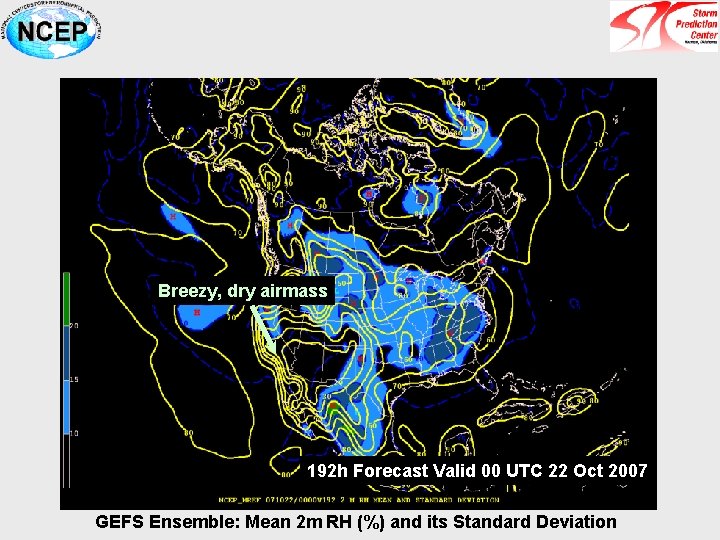
Breezy, dry airmass 192 h Forecast Valid 00 UTC 22 Oct 2007 GEFS Ensemble: Mean 2 m RH (%) and its Standard Deviation
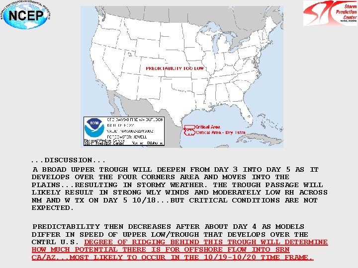
. . . DISCUSSION. . . A BROAD UPPER TROUGH WILL DEEPEN FROM DAY 3 INTO DAY 5 AS IT DEVELOPS OVER THE FOUR CORNERS AREA AND MOVES INTO THE PLAINS. . . RESULTING IN STORMY WEATHER. THE TROUGH PASSAGE WILL LIKELY RESULT IN STRONG WLY WINDS AND MODERATELY LOW RH ACROSS NM AND W TX ON DAY 5 10/18. . . BUT CRITICAL CONDITIONS ARE NOT EXPECTED. PREDICTABILITY THEN DECREASES AFTER ABOUT DAY 4 AS MODELS DIFFER IN SPEED OF UPPER LOW/TROUGH THAT DEVELOPS OVER THE CNTRL U. S. DEGREE OF RIDGING BEHIND THIS TROUGH WILL DETERMINE HOW MUCH POTENTIAL THERE IS FOR OFFSHORE FLOW INTO SRN CA/AZ. . . MOST LIKELY TO OCCUR IN THE 10/19 -10/20 TIME FRAME.
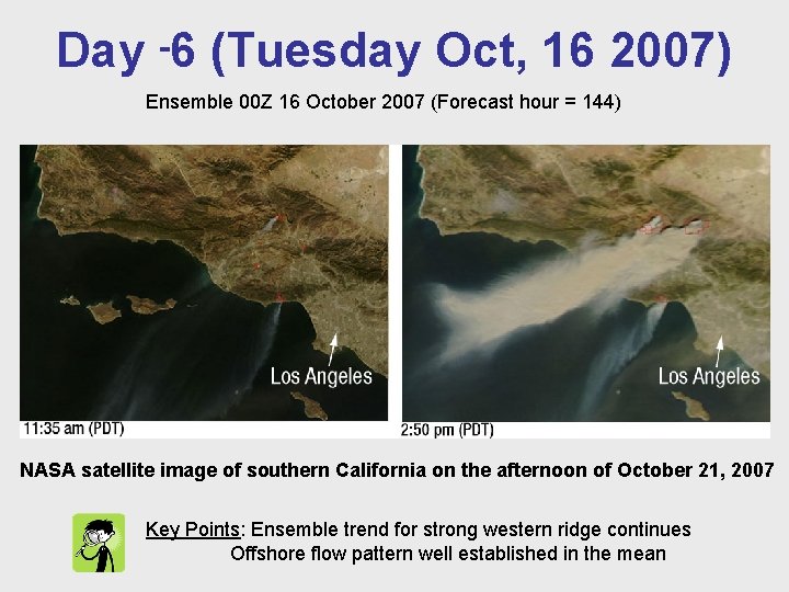
Day -6 (Tuesday Oct, 16 2007) Ensemble 00 Z 16 October 2007 (Forecast hour = 144) NASA satellite image of southern California on the afternoon of October 21, 2007 Key Points: Ensemble trend for strong western ridge continues Offshore flow pattern well established in the mean
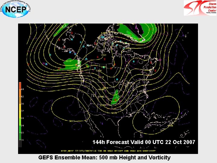
144 h Forecast Valid 00 UTC 22 Oct 2007 GEFS Ensemble Mean: 500 mb Height and Vorticity
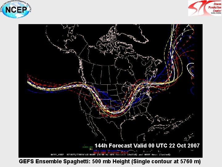
144 h Forecast Valid 00 UTC 22 Oct 2007 GEFS Ensemble Spaghetti: 500 mb Height (Single contour at 5760 m)
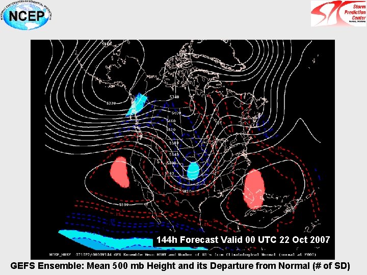
144 h Forecast Valid 00 UTC 22 Oct 2007 GEFS Ensemble: Mean 500 mb Height and its Departure from Normal (# of SD)
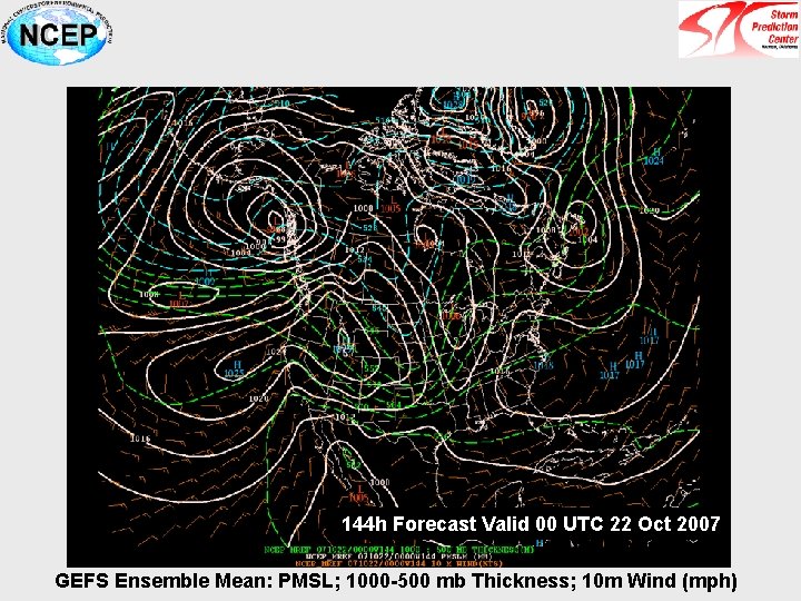
144 h Forecast Valid 00 UTC 22 Oct 2007 GEFS Ensemble Mean: PMSL; 1000 -500 mb Thickness; 10 m Wind (mph)
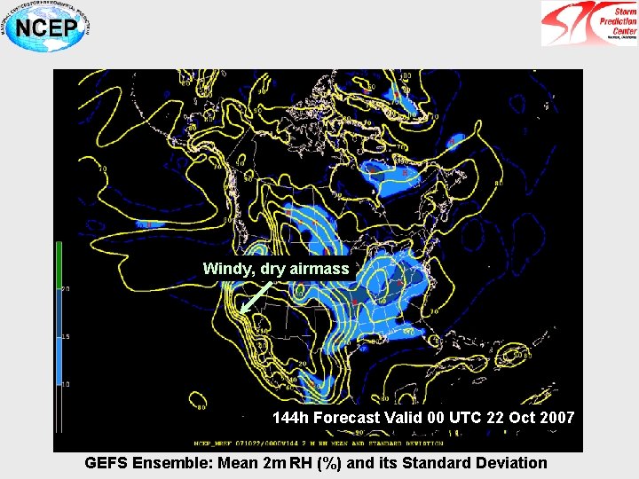
Windy, dry airmass 144 h Forecast Valid 00 UTC 22 Oct 2007 GEFS Ensemble: Mean 2 m RH (%) and its Standard Deviation
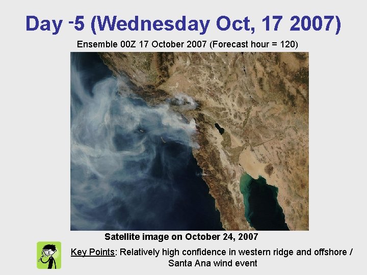
Day -5 (Wednesday Oct, 17 2007) Ensemble 00 Z 17 October 2007 (Forecast hour = 120) Satellite image on October 24, 2007 Key Points: Relatively high confidence in western ridge and offshore / Santa Ana wind event
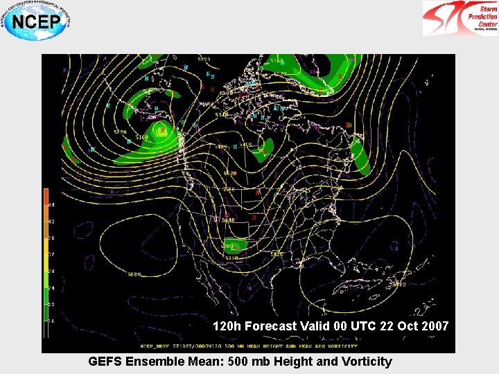
120 h Forecast Valid 00 UTC 22 Oct 2007 GEFS Ensemble Mean: 500 mb Height and Vorticity
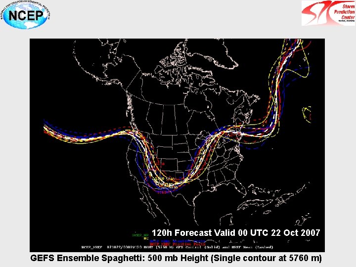
120 h Forecast Valid 00 UTC 22 Oct 2007 GEFS Ensemble Spaghetti: 500 mb Height (Single contour at 5760 m)
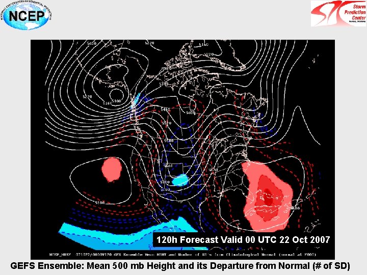
120 h Forecast Valid 00 UTC 22 Oct 2007 GEFS Ensemble: Mean 500 mb Height and its Departure from Normal (# of SD)
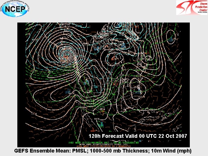
120 h Forecast Valid 00 UTC 22 Oct 2007 GEFS Ensemble Mean: PMSL; 1000 -500 mb Thickness; 10 m Wind (mph)
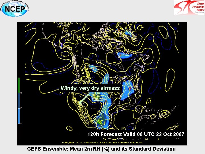
Windy, very dry airmass 120 h Forecast Valid 00 UTC 22 Oct 2007 GEFS Ensemble: Mean 2 m RH (%) and its Standard Deviation
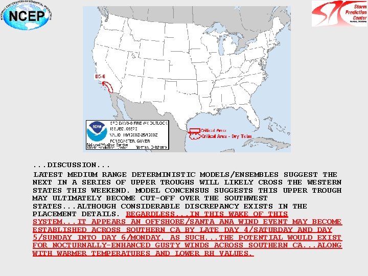
. . . DISCUSSION. . . LATEST MEDIUM RANGE DETERMINISTIC MODELS/ENSEMBLES SUGGEST THE NEXT IN A SERIES OF UPPER TROUGHS WILL LIKELY CROSS THE WESTERN STATES THIS WEEKEND. MODEL CONCENSUS SUGGESTS THIS UPPER TROUGH MAY ULTIMATELY BECOME CUT-OFF OVER THE SOUTHWEST STATES. . . ALTHOUGH CONSIDERABLE DISCREPANCY EXISTS IN THE PLACEMENT DETAILS. REGARDLESS. . . IN THIS WAKE OF THIS SYSTEM. . . IT APPEARS AN OFFSHORE/SANTA ANA WIND EVENT MAY BECOME ESTABLISHED ACROSS SOUTHERN CA BY LATE DAY 4/SATURDAY AND DAY 5/SUNDAY INTO DAY 6/MONDAY. AS SUCH. . . THE POTENTIAL WOULD EXIST FOR NOCTURNALLY-ENHANCED GUSTY WINDS ACROSS SOUTHERN CA. . . ALONG WITH WARMER TEMPERATURES AND LOWER RH VALUES.
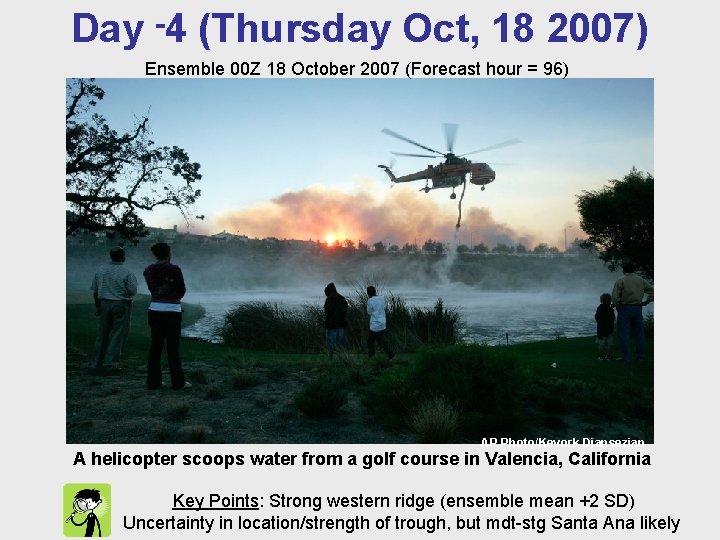
Day -4 (Thursday Oct, 18 2007) Ensemble 00 Z 18 October 2007 (Forecast hour = 96) AP Photo/Kevork Djansezian A helicopter scoops water from a golf course in Valencia, California Key Points: Strong western ridge (ensemble mean +2 SD) Uncertainty in location/strength of trough, but mdt-stg Santa Ana likely
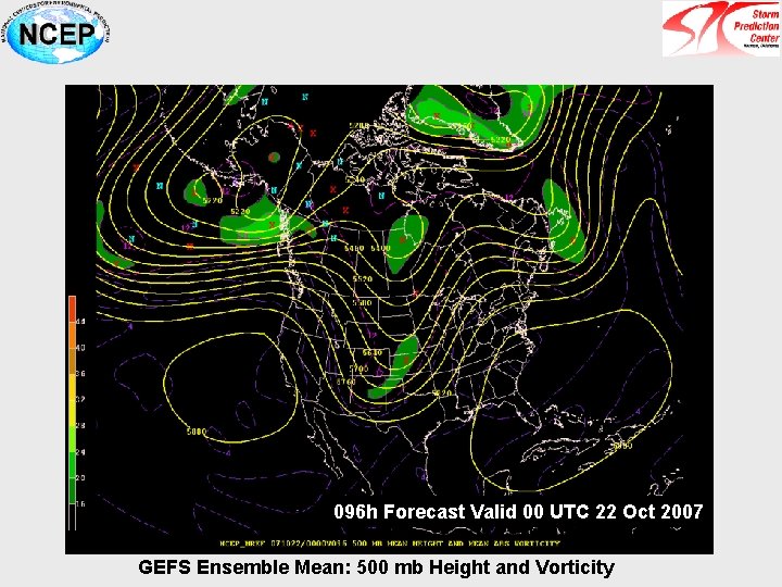
096 h Forecast Valid 00 UTC 22 Oct 2007 GEFS Ensemble Mean: 500 mb Height and Vorticity
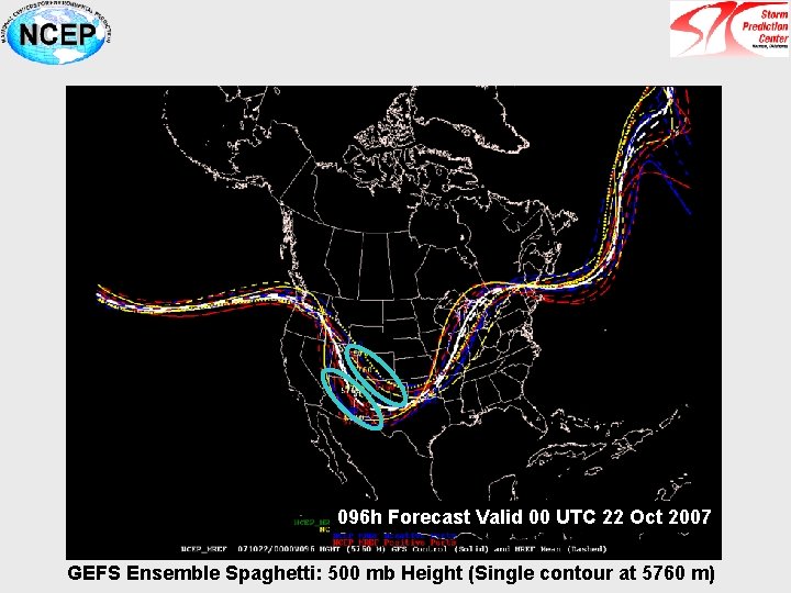
096 h Forecast Valid 00 UTC 22 Oct 2007 GEFS Ensemble Spaghetti: 500 mb Height (Single contour at 5760 m)
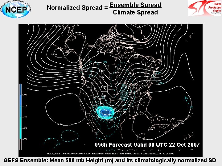
Normalized Spread = Ensemble Spread Climate Spread 096 h Forecast Valid 00 UTC 22 Oct 2007 GEFS Ensemble: Mean 500 mb Height (m) and its climatologically normalized SD
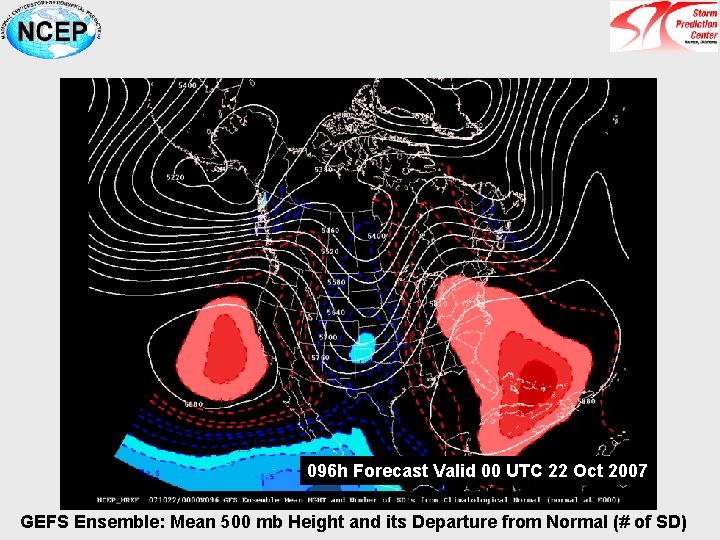
096 h Forecast Valid 00 UTC 22 Oct 2007 GEFS Ensemble: Mean 500 mb Height and its Departure from Normal (# of SD)
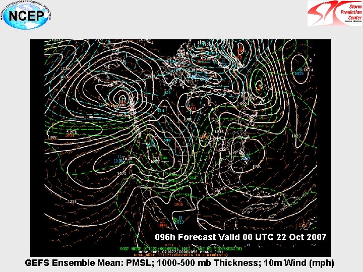
096 h Forecast Valid 00 UTC 22 Oct 2007 GEFS Ensemble Mean: PMSL; 1000 -500 mb Thickness; 10 m Wind (mph)
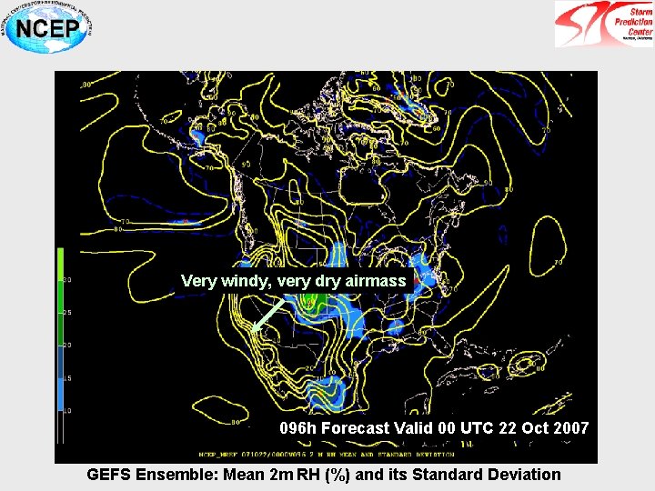
Very windy, very dry airmass 096 h Forecast Valid 00 UTC 22 Oct 2007 GEFS Ensemble: Mean 2 m RH (%) and its Standard Deviation
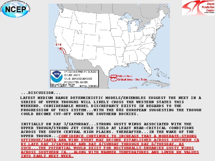
. . . DISCUSSION. . . LATEST MEDIUM RANGE DETERMINISTIC MODELS/ENSEMBLES SUGGEST THE NEXT IN A SERIES OF UPPER TROUGHS WILL LIKELY CROSS THE WESTERN STATES THIS WEEKEND. CONSIDERABLE MODEL DISCREPANCY EXISTS IN REGARDS TO THE PROGRESSION OF THIS SYSTEM. . . WITH THE 00 Z EUROPEAN SUGGESTING THE TROUGH COULD BECOME CUT-OFF OVER THE SOUTHERN ROCKIES. INITIALLY ON DAY 3/SATURDAY. . . STRONG GUSTY WINDS ASSOCIATED WITH THE UPPER TROUGH/STRONG JET COULD YIELD AT LEAST NEAR-CRITICAL CONDITIONS ACROSS THE SOUTH CENTRAL HIGH PLAINS. THEREAFTER. . . IN THE WAKE OF THE UPPER TROUGH. . . CONFIDENCE CONTINUES TO INCREASE THAT A MODERATE-STRONG OFFSHORE/SANTA ANA WIND EVENT MAY BECOME ESTABLISHED ACROSS SOUTHERN CA BY LATE DAY 3/SATURDAY AND DAY 4/SUNDAY THROUGH DAY 6/TUESDAY. AS SUCH. . . THE POTENTIAL WOULD EXIST FOR NOCTURNALLY-ENHANCED GUSTY WINDS ACROSS SOUTHERN CA. . . ALONG WITH WARMER TEMPERATURES AND LOWER RH VALUES INTO EARLY NEXT WEEK.
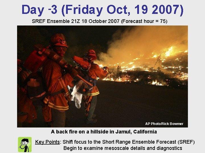
Day -3 (Friday Oct, 19 2007) SREF Ensemble 21 Z 18 October 2007 (Forecast hour = 75) AP Photo/Rick Bowmer AP Photo/Kevork Djansezian A back fire on a hillside in Jamul, California Key Points: Shift focus to the Short Range Ensemble Forecast (SREF) Begin to examine mesoscale details and diagnostics
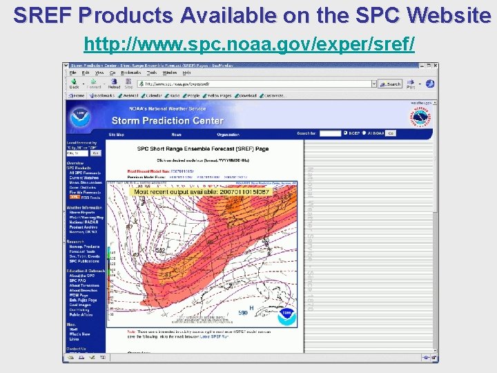
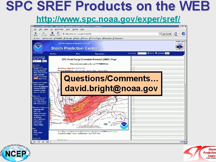
SREF Products Available on the SPC Website http: //www. spc. noaa. gov/exper/sref/
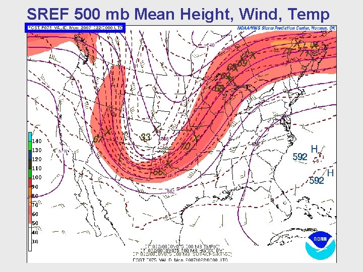
SREF 500 mb Mean Height, Wind, Temp
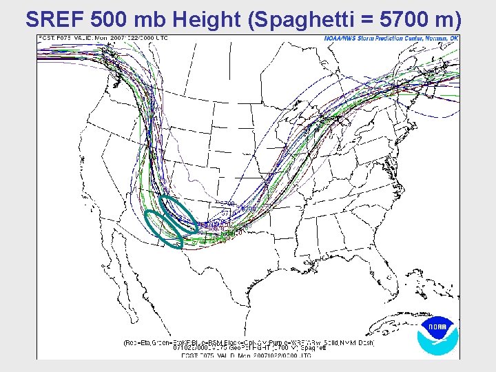
SREF 500 mb Height (Spaghetti = 5700 m)
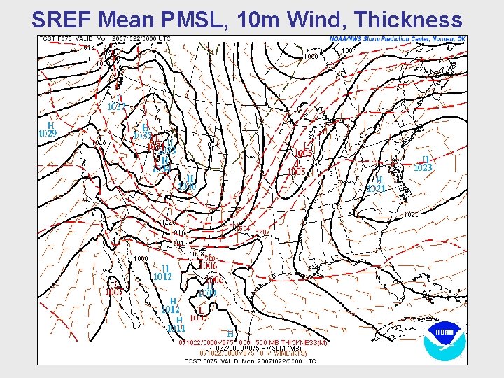
SREF Mean PMSL, 10 m Wind, Thickness
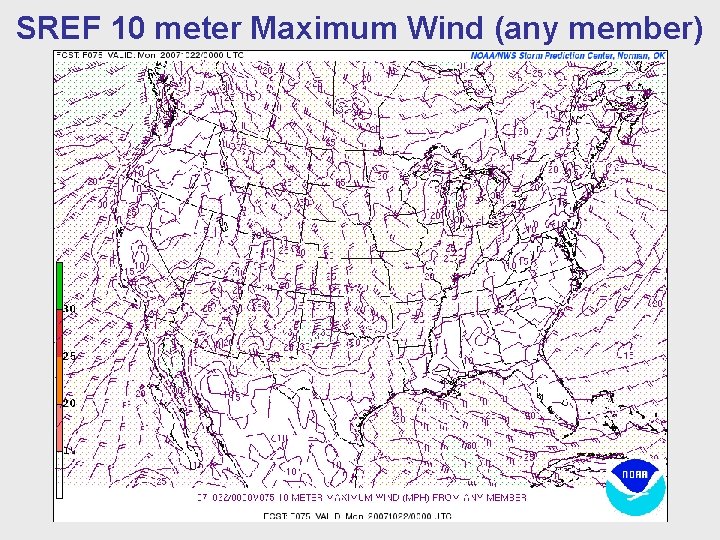
SREF 10 meter Maximum Wind (any member)
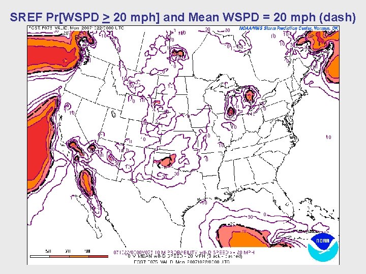
SREF Pr[WSPD > 20 mph] and Mean WSPD = 20 mph (dash)
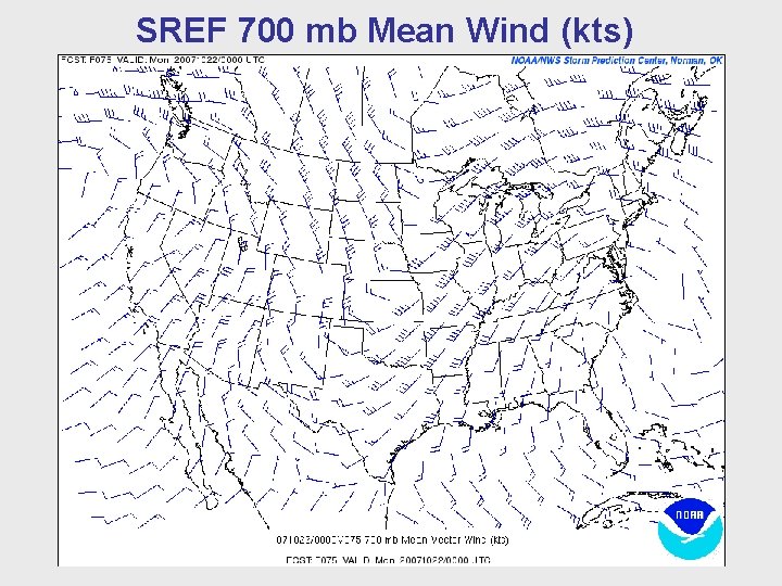
SREF 700 mb Mean Wind (kts)
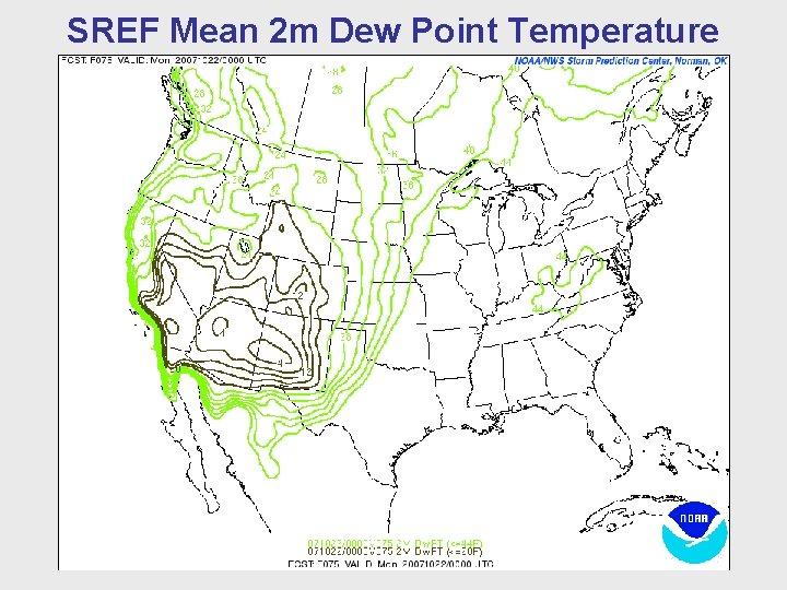
SREF Mean 2 m Dew Point Temperature
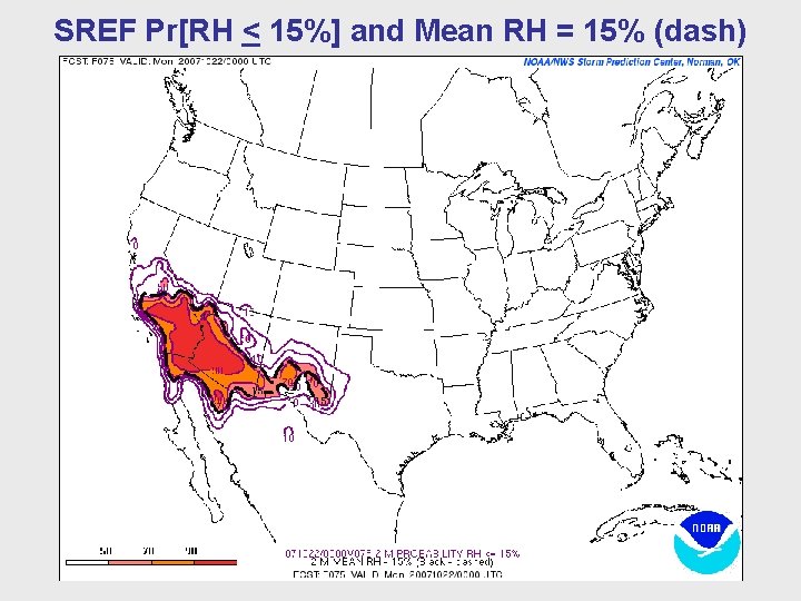
SREF Pr[RH < 15%] and Mean RH = 15% (dash)
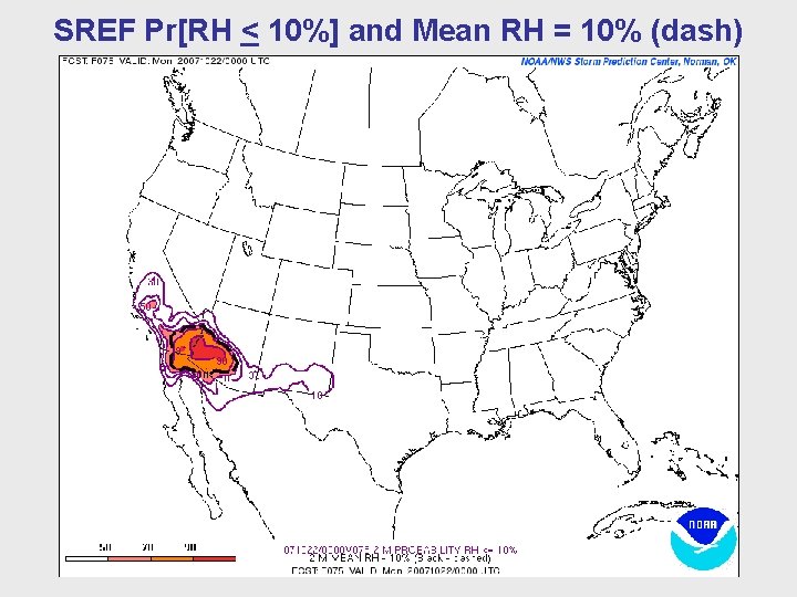
SREF Pr[RH < 10%] and Mean RH = 10% (dash)
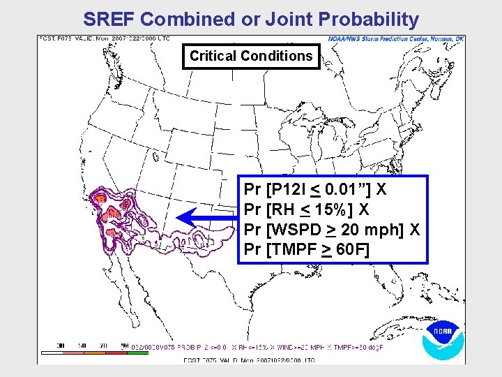
SREF Combined or Joint Probability Critical Conditions Pr [P 12 I < 0. 01”] X Pr [RH < 15%] X Pr [WSPD > 20 mph] X Pr [TMPF > 60 F]
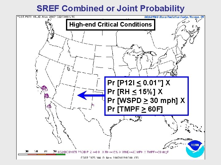
SREF Combined or Joint Probability High-end Critical Conditions Pr [P 12 I < 0. 01”] X Pr [RH < 15%] X Pr [WSPD > 30 mph] X Pr [TMPF > 60 F]
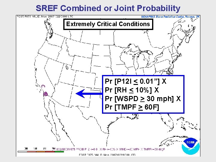
SREF Combined or Joint Probability Extremely Critical Conditions Pr [P 12 I < 0. 01”] X Pr [RH < 10%] X Pr [WSPD > 30 mph] X Pr [TMPF > 60 F]
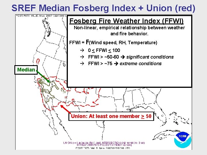
SREF Median Fosberg Index + Union (red) Fosberg Fire Weather Index (FFWI) Non-linear, empirical relationship between weather and fire behavior. FFWI = F(Wind speed, RH, Temperature) 0 < FFWI < 100 FFWI > ~50 -60 significant conditions FFWI > ~75 extreme conditions Median Union: At least one member > 50
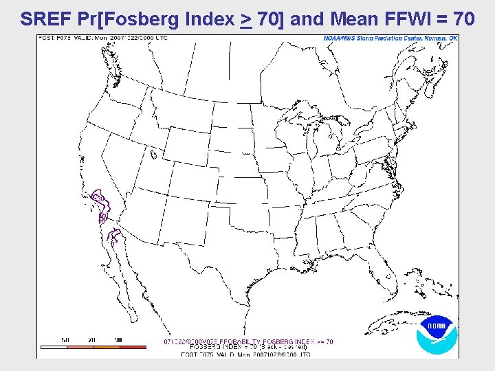
SREF Pr[Fosberg Index > 70] and Mean FFWI = 70
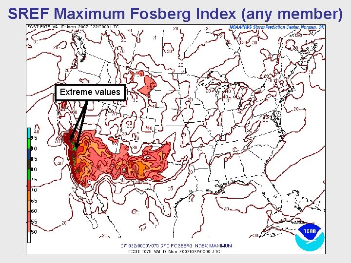
SREF Maximum Fosberg Index (any member) Extreme values
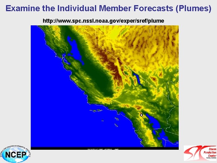
Examine the Individual Member Forecasts (Plumes) http: //www. spc. nssl. noaa. gov/exper/sref/plume
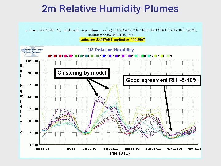
2 m Relative Humidity Plumes Clustering by model Good agreement RH ~5 -10%
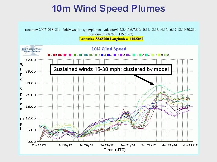
10 m Wind Speed Plumes Sustained winds 15 -30 mph; clustered by model
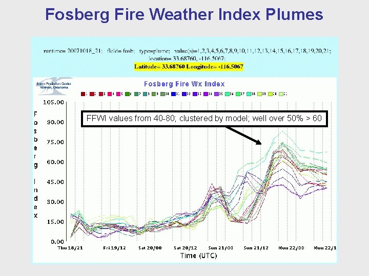
Fosberg Fire Weather Index Plumes FFWI values from 40 -80; clustered by model; well over 50% > 60
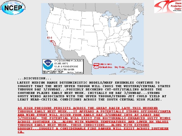
. . . DISCUSSION. . . LATEST MEDIUM RANGE DETERMINISTIC MODELS/MREF ENSEMBLES CONTINUE TO SUGGEST THAT THE NEXT UPPER TROUGH WILL CROSS THE WESTERN/CENTRAL STATES THROUGH DAY 3/SUNDAY. . . POSSIBLY BECOMING CUT-OFF/STALLING ACROSS THE SOUTHERN PLAINS EARLY NEXT WEEK. INITIALLY ON DAY 3/SUNDAY. . . STRONG GUSTY WINDS ASSOCIATED WITH THE UPPER TROUGH/STRONG JET COULD YIELD AT LEAST NEAR-CRITICAL CONDITIONS ACROSS THE SOUTH CENTRAL HIGH PLAINS. AS HIGH PRESSURE PERSISTS ACROSS THE GREAT BASIN LATE THIS WEEKEND THROUGH EARLY NEXT WEEK. . . IT APPEARS A POTENTIALLY STRONG OFFSHORE/SANTA ANA WIND EVENT WILL OCCUR FROM EARLY DAY 3/SUNDAY INTO AT LEAST DAY 5/TUESDAY. THE POTENTIAL WILL EXIST FOR NOCTURNALLY-ENHANCED GUSTY WINDS ACROSS SOUTHERN CA. . . ALONG WITH WARMER TEMPERATURES AND LOWER RH VALUES THROUGH EARLY NEXT WEEK. THESE CONDITIONS. . . ALONG WITH EXTREME DROUGHT. . . SUGGEST A CONSIDERABLE FIRE DANGER WILL EXIST ACROSS SOUTHERN CA.
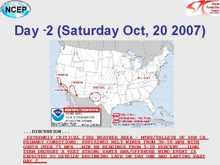
Day -2 (Saturday Oct, 20 2007) . . . DISCUSSION. . . …EXTREMELY CRITICAL FIRE WEATHER AREA - MTNS/VALLEYS OF SRN CA… PRIMARY CONDITIONS: SUSTAINED NELY WINDS FROM 30 -50 MPH WITH GUSTS OVER 75 MPH. . . MIN RH READINGS FROM 5 -10 PERCENT. . . LONG TERM DROUGHT A VERY STRONG SANTA ANA/OFFSHORE WIND EVENT IS EXPECTED TO DEVELOP BEGINNING LATE ON DAY ONE AND LASTING PAST DAY 2. . .
Outline • Motivation for Ensemble Forecasting • SPC Ensemble Applications in Fire Weather – Medium to Short-range Case Study (Southern California Fires Oct. 2007) • Ensemble Calibration and Decision Support • Summary and Future Directions
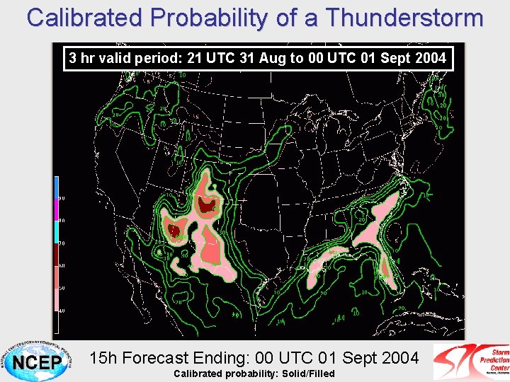
Calibrated Probability of a Thunderstorm 3 hr valid period: 21 UTC 31 Aug to 00 UTC 01 Sept 2004 15 h Forecast Ending: 00 UTC 01 Sept 2004 Calibrated probability: Solid/Filled
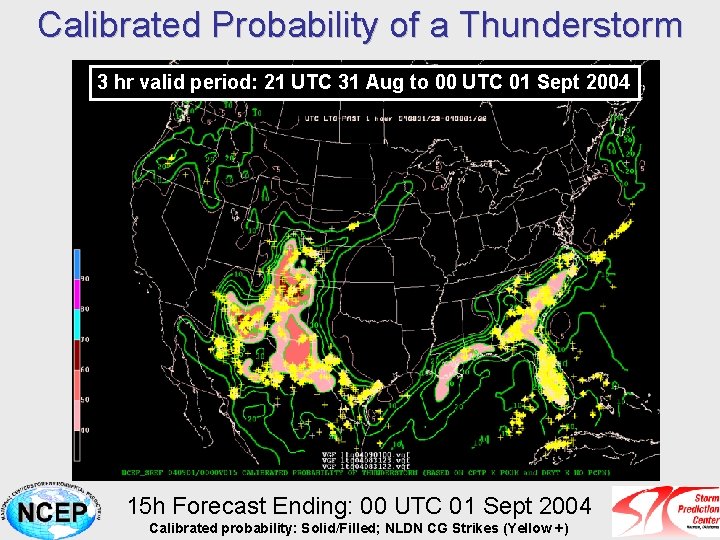
Calibrated Probability of a Thunderstorm 3 hr valid period: 21 UTC 31 Aug to 00 UTC 01 Sept 2004 15 h Forecast Ending: 00 UTC 01 Sept 2004 Calibrated probability: Solid/Filled; NLDN CG Strikes (Yellow +)
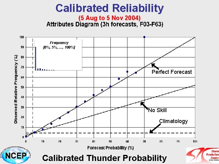
Calibrated Reliability (5 Aug to 5 Nov 2004) Frequency [0%, 5%, …, 100%] Perfect Forecast No Skill Climatology No Skill Calibrated Thunder Probability
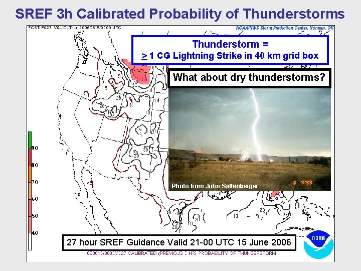
SREF 3 h Calibrated Probability of Thunderstorms Thunderstorm = > 1 CG Lightning Strike in 40 km grid box What about dry thunderstorms? Photo from John Saltenberger 27 hour SREF Guidance Valid 21 -00 UTC 15 June 2006

SREF 3 h Calibrated Probability of “Dry” Thunderstorms Dry thunderstorms = CG Lightning with < 0. 10” precipitation Red indicates grid cells with “dry lightning” 27 hour SREF Guidance Valid 21 -00 UTC 15 June 2006
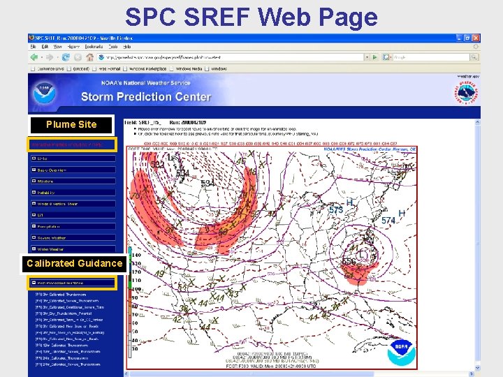
SPC SREF Web Page Plume Site Calibrated Guidance
Outline • Motivation for Ensemble Forecasting • SPC Ensemble Applications in Fire Weather – Medium to Short-range Case Study (Southern California Fires Oct. 2007) • Ensemble Calibration and Decision Support • Summary and Future Directions
General Comments about Ensemble Approach at the SPC • Ensembles have become a routine part of the forecast process at the SPC • Ensemble approach to forecasting similar to the deterministic approach – Ingredients based inputs – Diagnostic and parameter evaluation – Tend to view diagnostics in probability space – particularly in short-range • Ensembles contribute appropriate levels of confidence to the forecast process and can aid decision making (formally or informally) • Calibration of ensemble output can remove systematic biases and improve the spread, and can be used to probabilistically downscale larger-scale environment • Continue to enhance the short- and medium-range ensemble applications for the SPC fire weather program – Expanded products in GEFS – Calibrated guidance – Incorporation of NAEFS – Collaboration with partners
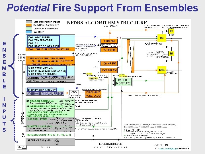
Potential Fire Support From Ensembles E N S E M B L E I N P U T S
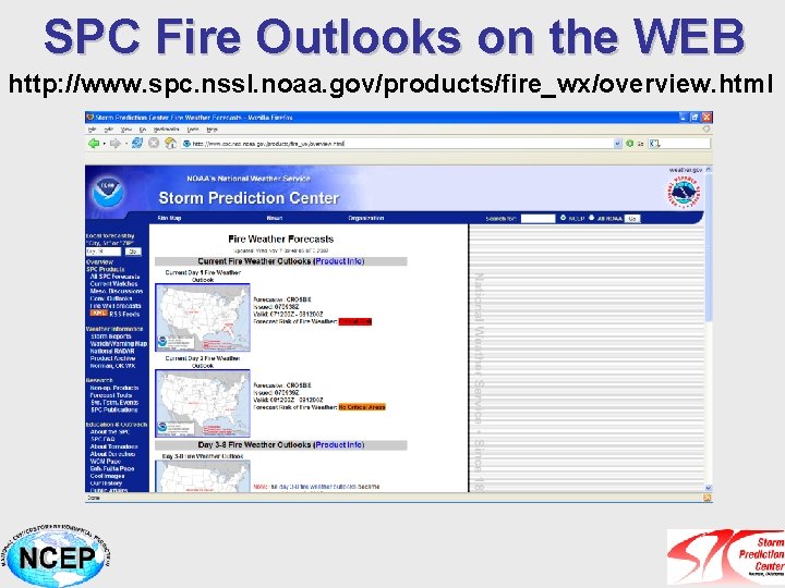
SPC Fire Outlooks on the WEB http: //www. spc. nssl. noaa. gov/products/fire_wx/overview. html
SPC SREF Products on the WEB http: //www. spc. noaa. gov/exper/sref/ Questions/Comments… david. bright@noaa. gov
- Slides: 83