
Oceans Part I Introduction Composition of Seawater Features






- Slides: 62
Oceans – Part I Introduction Composition of Seawater Features of the Sea Floor Sediments
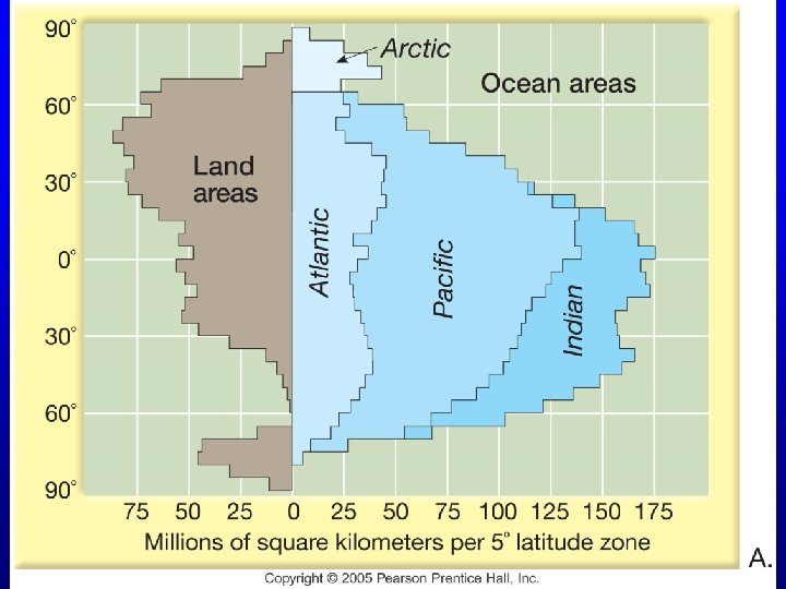
Introduction • The “Blue Planet” – Seventy-one percent of Earth’s surface is represented by oceans and marginal seas – Continents and islands comprise the remaining 29
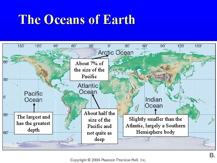
The Oceans of Earth About 7% of the size of the Pacific The largest and has the greatest depth About half the size of the Pacific and not quite as deep Slightly smaller than the Atlantic, largely a Southern Hemisphere body
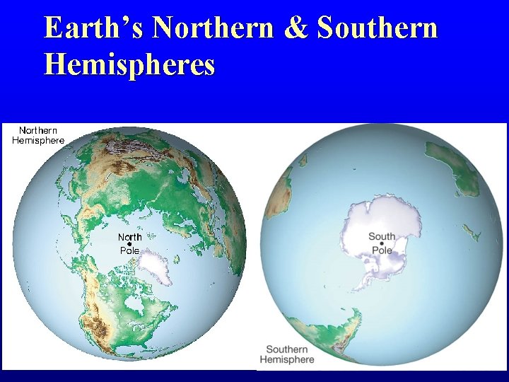
Earth’s Northern & Southern Hemispheres
The Composition of Seawater
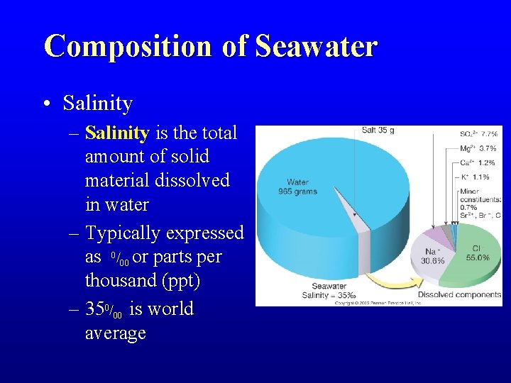
Composition of Seawater • Salinity – Salinity is the total amount of solid material dissolved in water – Typically expressed as 0/00 or parts per thousand (ppt) – 350/00 is world average
Composition of Seawater • Salinity – Anion + cation = a salt • Salt = Na. Cl = Na+ + Cl • Na+ has a positive charge (cation) • Cl- has a negative charge (anion)
Composition of Seawater • Salinity – What goes in must equal what goes out • Addition of sea salts – Chemical weathering of rocks on continents (cations) – Volcanic eruptions / outgassing (anions)
Composition of Seawater • Salinity – What goes in must equal what goes out • Addition of sea salts • Removal of sea salts – – Sea spray Evaporites Biologic processes Magma at M. O. R.
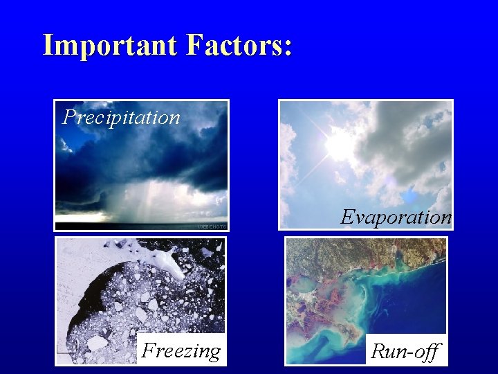
Important Factors: Precipitation Evaporation Freezing Run-off
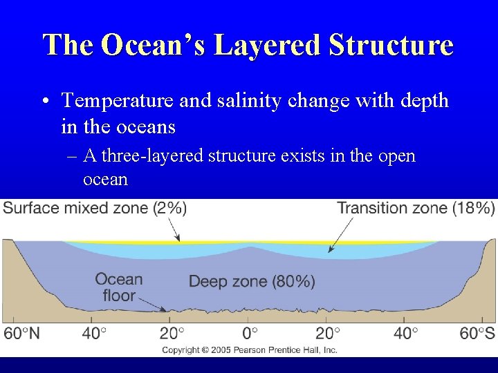
The Ocean’s Layered Structure • Temperature and salinity change with depth in the oceans – A three-layered structure exists in the open ocean
The Ocean’s Layered Structure • Temperature and salinity change with depth in the oceans – Salinity variations with depth correspond to the general three-layered structure described for temperature – Thermocline = zone of rapid temperature change – Halocline = zone of rapid salinity change
Features of the Ocean Floor
Mapping the Ocean Floor • Bathymetry – Measurement of ocean depths and the charting of the shape or topography of the ocean floor
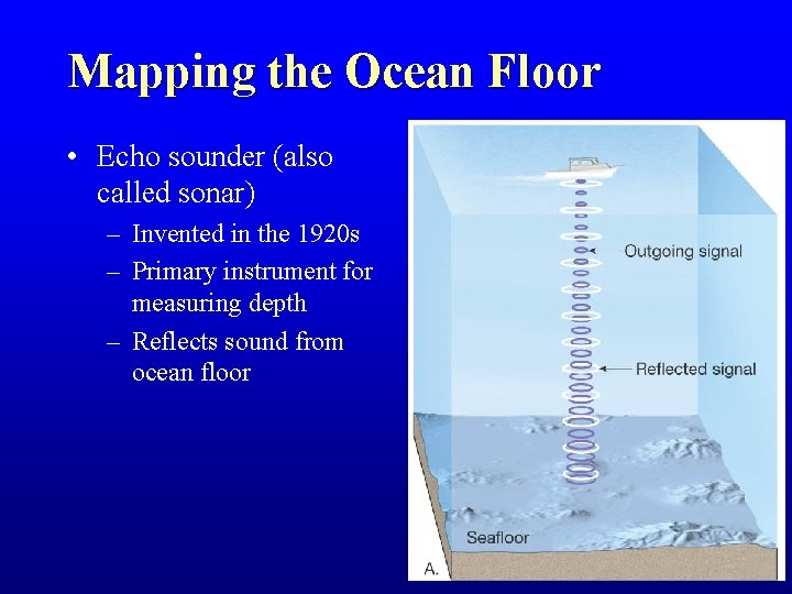
Mapping the Ocean Floor • Echo sounder (also called sonar) – Invented in the 1920 s – Primary instrument for measuring depth – Reflects sound from ocean floor
Mapping the Ocean Floor • Multibeam sonar – Employs and array of sound sources and listening devices – Obtains a profile of a narrow strip of seafloor
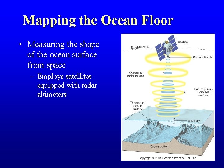
Mapping the Ocean Floor • Measuring the shape of the ocean surface from space – Employs satellites equipped with radar altimeters
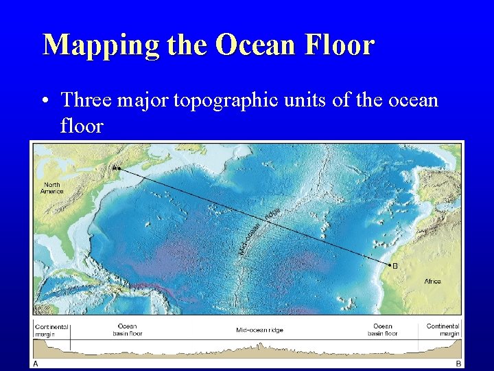
Mapping the Ocean Floor • Three major topographic units of the ocean floor
Continental Margins • Classifications of ocean floor – Continental Margins – the submerged outer edge of a continent – Ocean Basin – the deep seafloor beyond the continental margin
Continental Margins • There are two types of continental margins: – Passive margins • Also called Atlantic-type margins • Face the edges of diverging tectonic plates. • Very little volcanic or earthquake activity
Continental Margins • There are two types of continental margins: – Active margins • AKA as Pacific-type margins • Located near the edges of converging plates. • Active margins are the site of volcanic and earthquake activity.
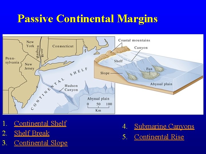
Passive Continental Margins 1. Continental Shelf 2. Shelf Break 3. Continental Slope 4. Submarine Canyons 5. Continental Rise
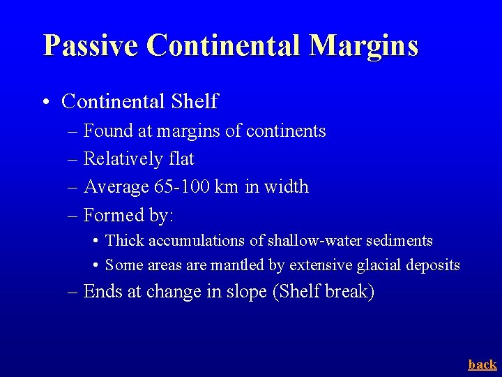
Passive Continental Margins • Continental Shelf – Found at margins of continents – Relatively flat – Average 65 -100 km in width – Formed by: • Thick accumulations of shallow-water sediments • Some areas are mantled by extensive glacial deposits – Ends at change in slope (Shelf break) back
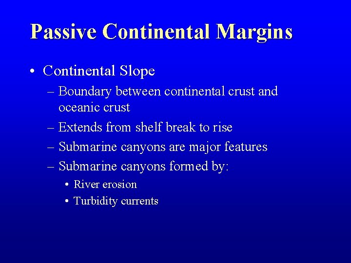
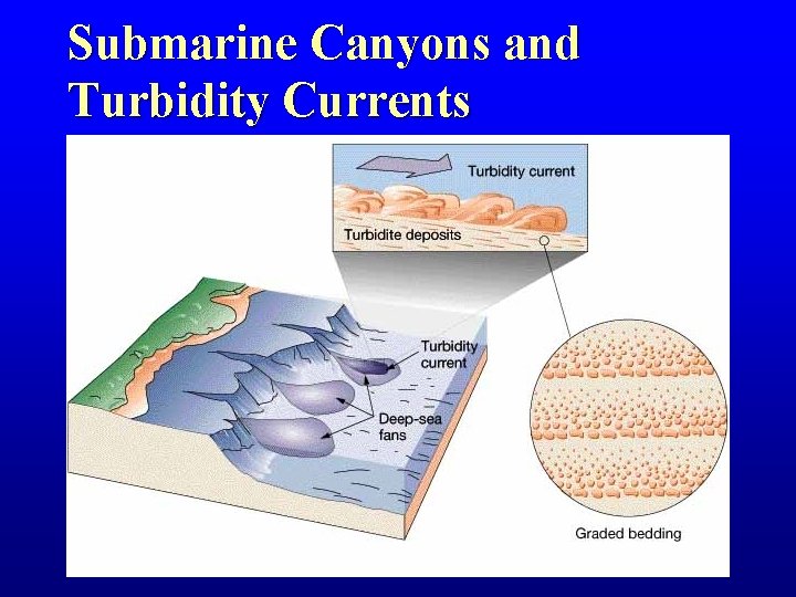
Passive Continental Margins • Continental Slope – Boundary between continental crust and oceanic crust – Extends from shelf break to rise – Submarine canyons are major features – Submarine canyons formed by: • River erosion • Turbidity currents
Submarine Canyons and Turbidity Currents
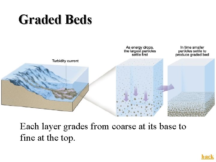
Graded Beds Each layer grades from coarse at its base to fine at the top. back
Passive Continental Margins • Continental rise – Found in regions where trenches are absent – Located where the continental slope grades into a more gradual incline as it meets the deep ocean floor – Deep-sea fans form here back
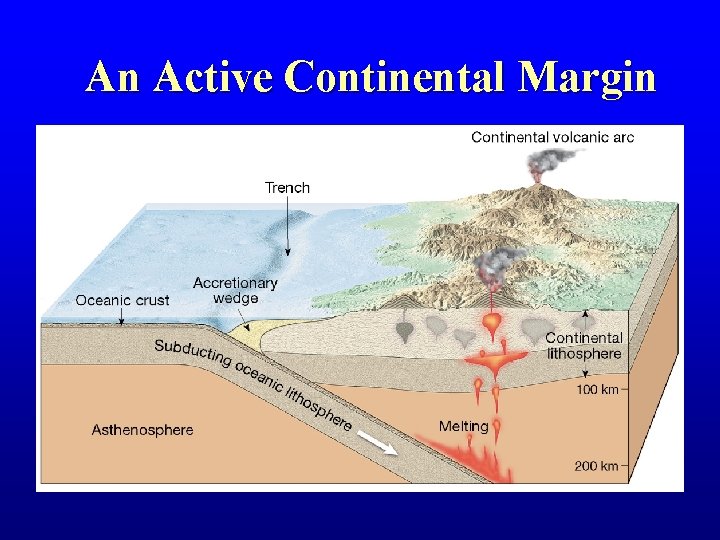
Active Continental Margins • Located primarily around the Pacific Ocean • Continental slope descends abruptly into a deep-ocean trench • Accumulations of deformed sediment and scraps of ocean crust form accretionary wedges • Some subduction zones have little or no accumulation of sediments
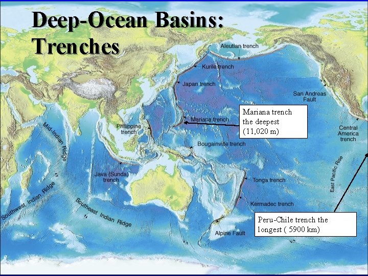
Active Continental Margins • Deep-ocean trenches – Long, relatively narrow features – Deepest parts of ocean – Most are located in the Pacific Ocean – Sites where moving lithospheric plates plunge into the mantle – Associated with volcanic activity • Volcanic islands arcs • Continental volcanic arcs
An Active Continental Margin
Deep-Ocean Basins • Features of the deep-ocean floor – Oceanic Ridges – Hydrothermal Vents – Abyssal Plains and Abyssal Hills – Seamounts and Guyots – Trenches and Island Arcs
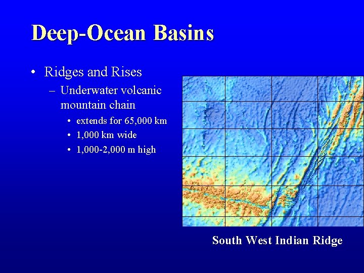
Deep-Ocean Basins • Ridges and Rises – Underwater volcanic mountain chain • extends for 65, 000 km • 1, 000 km wide • 1, 000 -2, 000 m high South West Indian Ridge
Deep-Ocean Basins
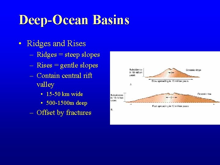
Deep-Ocean Basins • Ridges and Rises – Ridges = steep slopes – Rises = gentle slopes – Contain central rift valley • 15 -50 km wide • 500 -1500 m deep – Offset by fractures
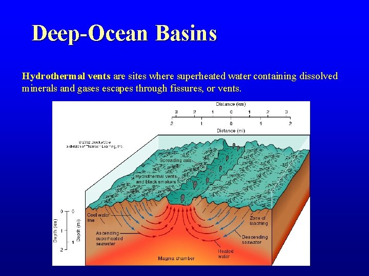
Deep-Ocean Basins Hydrothermal vents are sites where superheated water containing dissolved minerals and gases escapes through fissures, or vents.
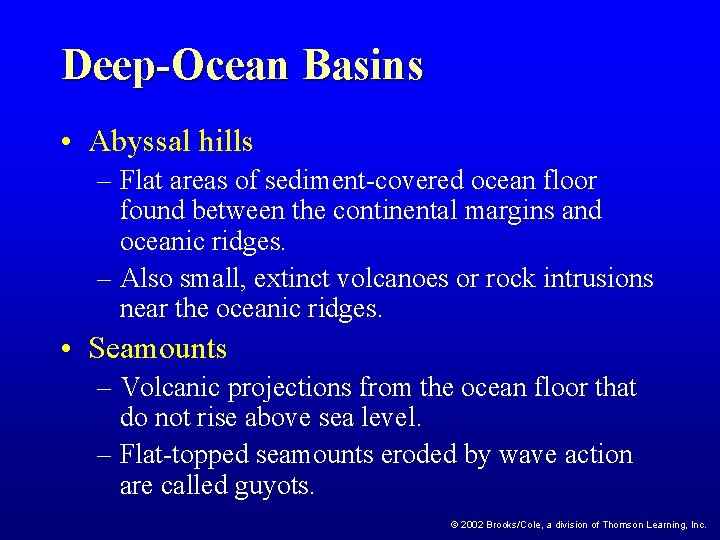
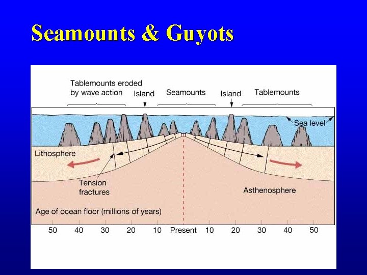
Deep-Ocean Basins • Abyssal hills – Flat areas of sediment-covered ocean floor found between the continental margins and oceanic ridges. – Also small, extinct volcanoes or rock intrusions near the oceanic ridges. • Seamounts – Volcanic projections from the ocean floor that do not rise above sea level. – Flat-topped seamounts eroded by wave action are called guyots. © 2002 Brooks/Cole, a division of Thomson Learning, Inc.
Seamounts & Guyots
Deep-Ocean Basins: Trenches Mariana trench the deepest (11, 020 m) Peru-Chile trench the longest ( 5900 km)
Ocean Sediments
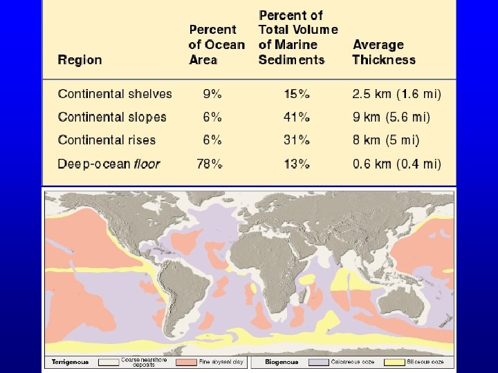
Seafloor Sediments • Particles entering the ocean • Accumulate – Rapidly on continental margin (neritic) – Slowly in the deep ocean (pelagic) • Reflect ocean history
Seafloor Sediments • Thickness varies – Thickest in trenches—Accumulations may approach 10 kilometers – Pacific Ocean—About 600 meters or less – Atlantic Ocean—From 500 to 1000 meters thick • Mud is the most common sediment on the deep-ocean floor
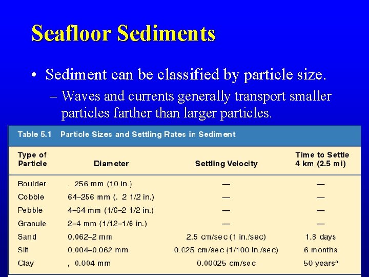
Seafloor Sediments • Sediment can be classified by particle size. – Waves and currents generally transport smaller particles farther than larger particles.
Seafloor Sediments • Types of seafloor sediments – Lithogenous sediment • Material weathered from continental rocks – Sands and muds from continental margins – Glacial deposits – Clays • Fine particles remain suspended for a long time • Oxidation often produces red and brown colored sediments
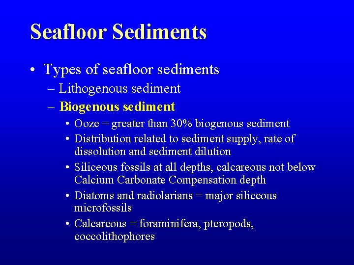
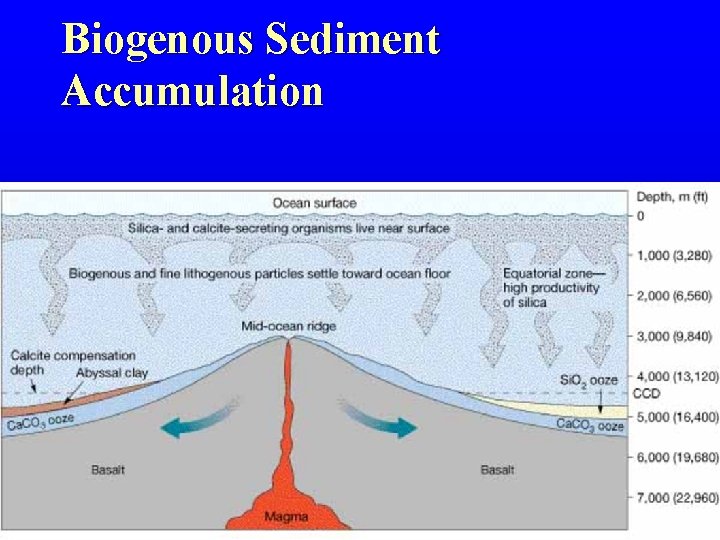
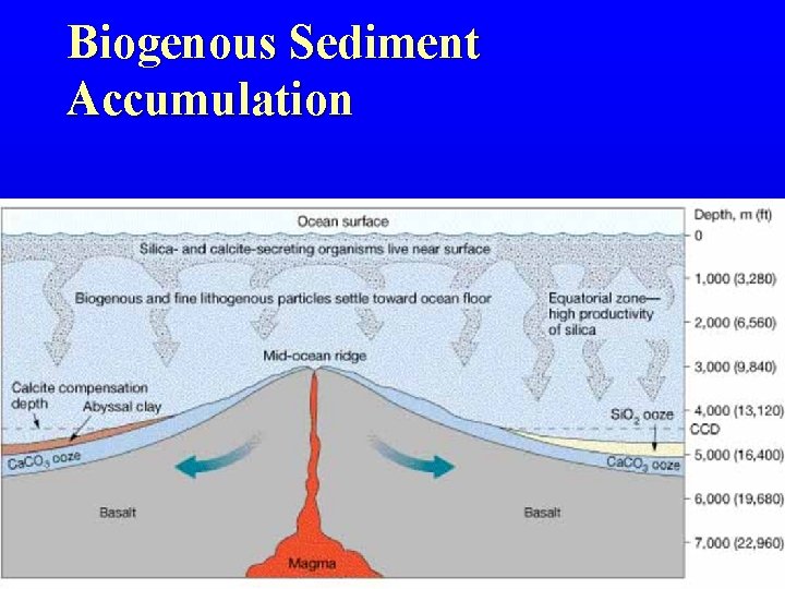
Seafloor Sediments • Types of seafloor sediments – Lithogenous sediment – Biogenous sediment • Ooze = greater than 30% biogenous sediment • Distribution related to sediment supply, rate of dissolution and sediment dilution • Siliceous fossils at all depths, calcareous not below Calcium Carbonate Compensation depth • Diatoms and radiolarians = major siliceous microfossils • Calcareous = foraminifera, pteropods, coccolithophores
Biogenous Sediment Accumulation
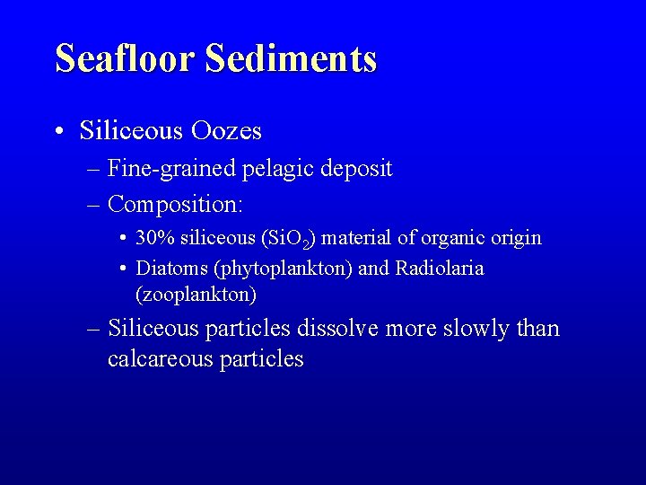
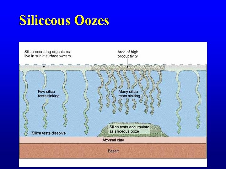
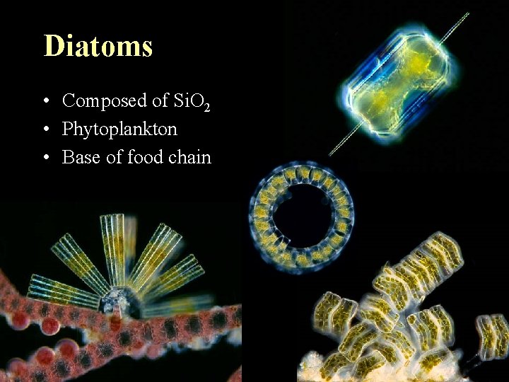
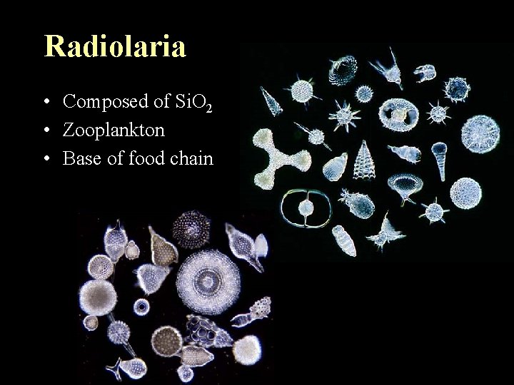
Seafloor Sediments • Siliceous Oozes – Fine-grained pelagic deposit – Composition: • 30% siliceous (Si. O 2) material of organic origin • Diatoms (phytoplankton) and Radiolaria (zooplankton) – Siliceous particles dissolve more slowly than calcareous particles
Siliceous Oozes
Diatoms • Composed of Si. O 2 • Phytoplankton • Base of food chain
Seafloor Sediments • Calcareous Oozes – Wide-spread in relatively shallow areas of the deep sea – Ca. CO 3 particles dissolve at “Carbonate Compensation Depth” = (CCD) • Atlantic: ~ 4, 000 m • Pacific: ~ 500 - 1, 500 m
Biogenous Sediment Accumulation
Radiolaria • Composed of Si. O 2 • Zooplankton • Base of food chain
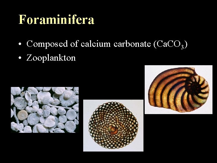
Foraminifera • Composed of calcium carbonate (Ca. CO 3) • Zooplankton
Seafloor Sediments • Types of seafloor sediments – Terrigenous sediment – Biogenous sediment – Hydrogenous sediment • Minerals that crystallize directly from seawater • Most common types include – – Manganese nodules Calcium carbonates Metal sulfides Evaporites
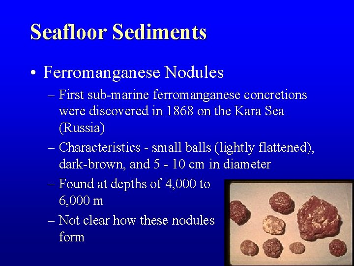
Seafloor Sediments • Ferromanganese Nodules – First sub-marine ferromanganese concretions were discovered in 1868 on the Kara Sea (Russia) – Characteristics - small balls (lightly flattened), dark-brown, and 5 - 10 cm in diameter – Found at depths of 4, 000 to 6, 000 m – Not clear how these nodules form
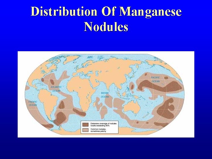
Distribution Of Manganese Nodules
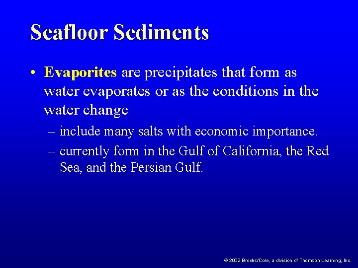
Seafloor Sediments • Evaporites are precipitates that form as water evaporates or as the conditions in the water change – include many salts with economic importance. – currently form in the Gulf of California, the Red Sea, and the Persian Gulf. © 2002 Brooks/Cole, a division of Thomson Learning, Inc.
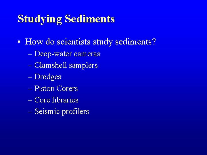
Studying Sediments • How do scientists study sediments? – Deep-water cameras – Clamshell samplers – Dredges – Piston Corers – Core libraries – Seismic profilers
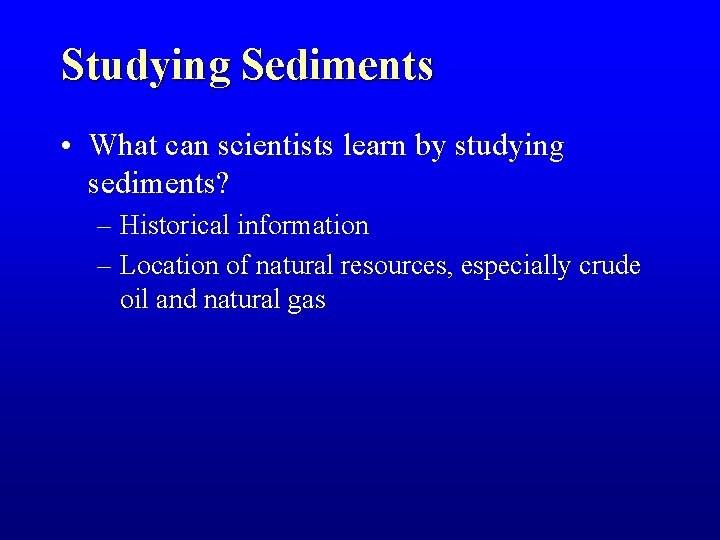
Studying Sediments • What can scientists learn by studying sediments? – Historical information – Location of natural resources, especially crude oil and natural gas
End