
Oceans Introduction The Blue Planet Seventyone percent of
Oceans
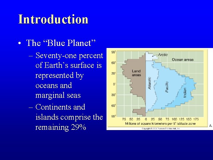
Introduction • The “Blue Planet” – Seventy-one percent of Earth’s surface is represented by oceans and marginal seas – Continents and islands comprise the remaining 29
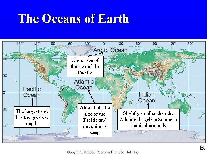
The Oceans of Earth About 7% of the size of the Pacific The largest and has the greatest depth About half the size of the Pacific and not quite as deep Slightly smaller than the Atlantic, largely a Southern Hemisphere body
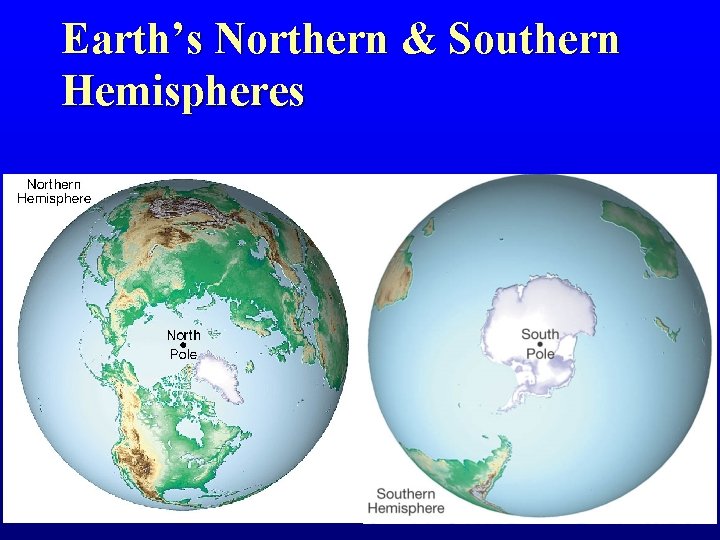
Earth’s Northern & Southern Hemispheres
The Composition of Seawater

Composition of Seawater • Salinity – Salinity is the total amount of solid material dissolved in water – Typically expressed as 0/00 or parts per thousand (ppt) – 350/00 is world average
Composition of Seawater • Salinity – Anion + cation = a salt • Salt = Na. Cl = Na+ + Cl • Na+ has a positive charge (cation) • Cl- has a negative charge (anion)
Composition of Seawater • Salinity – What goes in must equal what goes out • Addition of sea salts – Chemical weathering of rocks on continents (cations) – Volcanic eruptions / outgassing (anions)
Composition of Seawater • Salinity – What goes in must equal what goes out • Addition of sea salts • Removal of sea salts – – Sea spray Evaporites Biologic processes Magma at M. O. R.
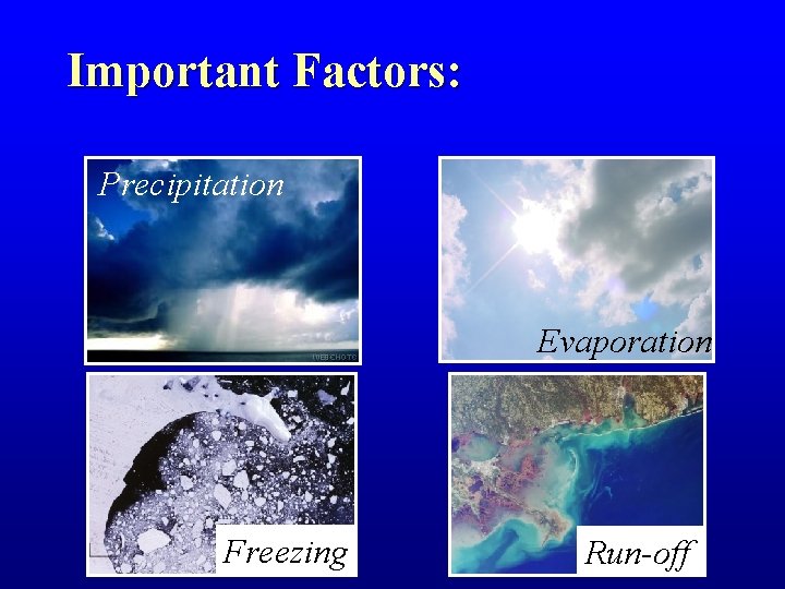
Important Factors: Precipitation Evaporation Freezing Run-off
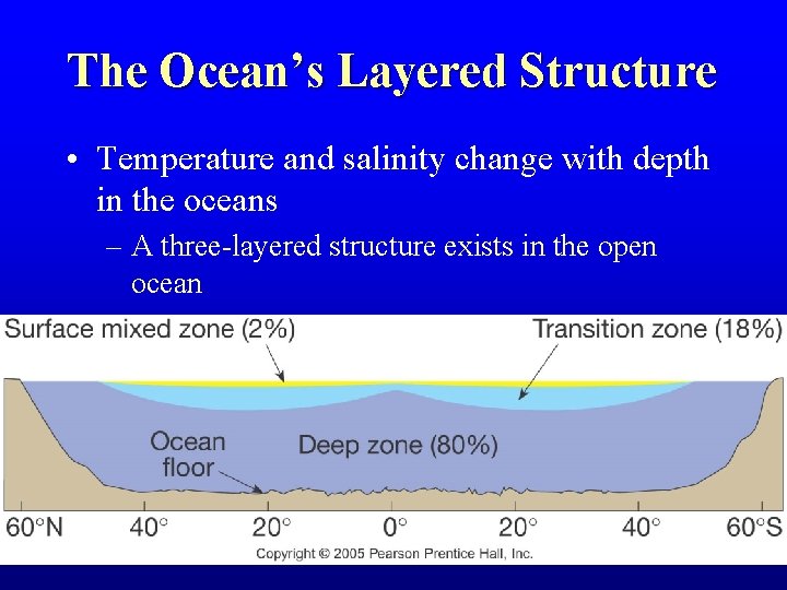
The Ocean’s Layered Structure • Temperature and salinity change with depth in the oceans – A three-layered structure exists in the open ocean
The Ocean’s Layered Structure • Temperature and salinity change with depth in the oceans – Salinity variations with depth correspond to the general three-layered structure described for temperature – Thermocline = zone of rapid temperature change – Halocline = zone of rapid salinity change
Features of the Ocean Floor
Mapping the Ocean Floor • Bathymetry – Measurement of ocean depths and the charting of the shape or topography of the ocean floor – Echo sounder (also called sonar) – Multibeam sonar – Measuring the shape of the ocean surface from space
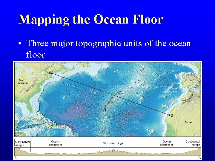
Mapping the Ocean Floor • Three major topographic units of the ocean floor
Continental Margins • Classifications of ocean floor – Continental Margins – the submerged outer edge of a continent – Ocean Basin – the deep seafloor beyond the continental margin
Continental Margins • There are two types of continental margins: – Passive margins • Also called Atlantic-type margins • Face the edges of diverging tectonic plates. • Very little volcanic or earthquake activity
Continental Margins • There are two types of continental margins: – Active margins • AKA as Pacific-type margins • Located near the edges of converging plates. • Active margins are the site of volcanic and earthquake activity.
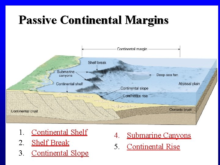
Passive Continental Margins 1. Continental Shelf 2. Shelf Break 3. Continental Slope 4. Submarine Canyons 5. Continental Rise
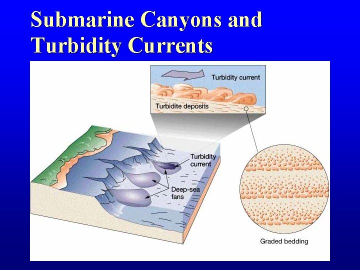
Submarine Canyons and Turbidity Currents
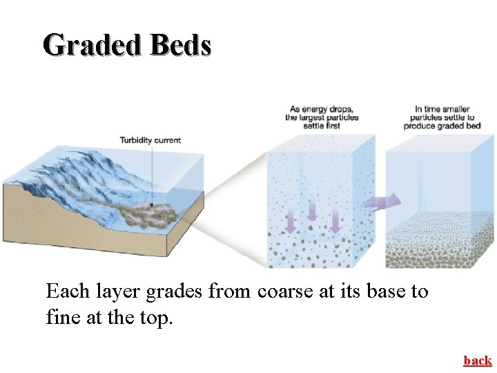
Graded Beds Each layer grades from coarse at its base to fine at the top. back
Active Continental Margins • Located primarily around the Pacific Ocean • Continental slope descends abruptly into a deep-ocean trench • Accumulations of deformed sediment and scraps of ocean crust form accretionary wedges • Some subduction zones have little or no accumulation of sediments
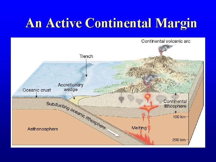
An Active Continental Margin
Deep-Ocean Basins • Features of the deep-ocean floor – Oceanic Ridges – Hydrothermal Vents – Abyssal Plains and Abyssal Hills – Seamounts and Guyots – Trenches and Island Arcs
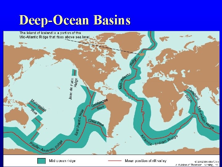
Deep-Ocean Basins
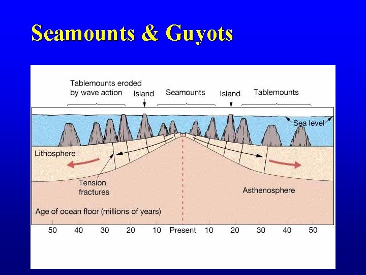
Seamounts & Guyots
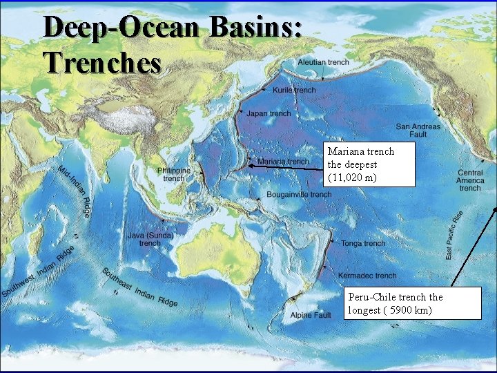
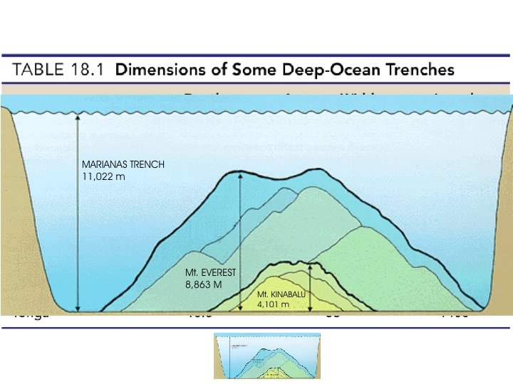
Deep-Ocean Basins: Trenches Mariana trench the deepest (11, 020 m) Peru-Chile trench the longest ( 5900 km)
Ocean Sediments
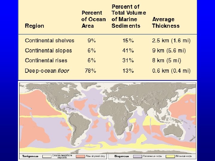
Seafloor Sediments • Particles entering the ocean • Accumulate – Rapidly on continental margin (pelagic) – Slowly in the deep ocean (neritic) • Reflect ocean history
Seafloor Sediments • Thickness varies – Thickest in trenches—Accumulations may approach 10 kilometers – Pacific Ocean—About 600 meters or less – Atlantic Ocean—From 500 to 1000 meters thick • Mud is the most common sediment on the deep-ocean floor
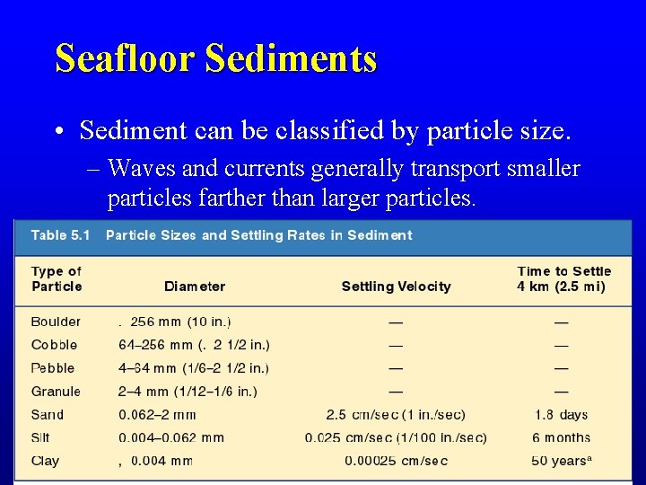
Seafloor Sediments • Sediment can be classified by particle size. – Waves and currents generally transport smaller particles farther than larger particles.
Seafloor Sediments • Types of seafloor sediments – Terrigenous sediment – Biogenous sediment – Hydrogenous sediment – Cosmogenous sediment
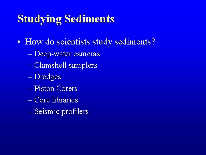
Studying Sediments • How do scientists study sediments? – Deep-water cameras – Clamshell samplers – Dredges – Piston Corers – Core libraries – Seismic profilers
Studying Sediments • What can scientists learn by studying sediments? – Historical information – Location of natural resources, especially crude oil and natural gas
Ocean Circulation
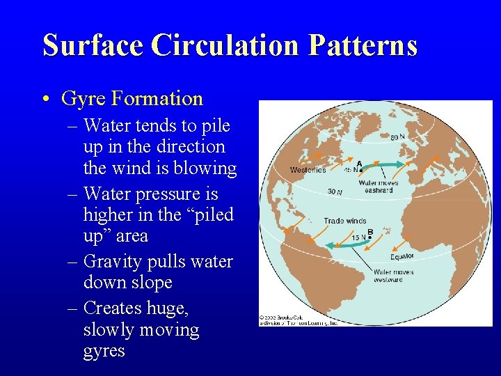
Surface Circulation Patterns • Gyre Formation – Water tends to pile up in the direction the wind is blowing – Water pressure is higher in the “piled up” area – Gravity pulls water down slope – Creates huge, slowly moving gyres
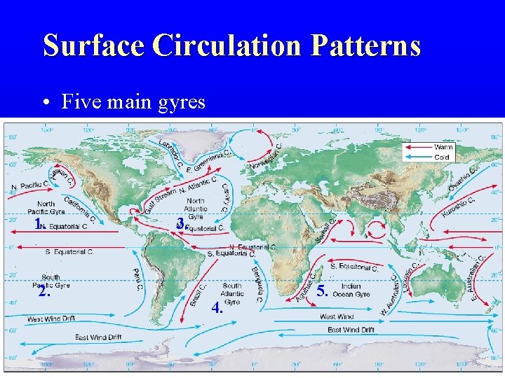
Surface Circulation Patterns • Five main gyres 1. 2. 3. 4. 5.
Surface Circulation Patterns • Deflected by the Coriolis effect – To the right in the Northern Hemisphere – To the left in the Southern Hemisphere
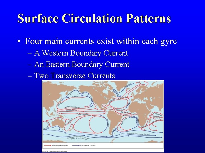
Surface Circulation Patterns • Four main currents exist within each gyre – A Western Boundary Current – An Eastern Boundary Current – Two Transverse Currents
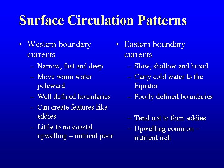
Surface Circulation Patterns • Western boundary currents – Narrow, fast and deep – Move warm water poleward – Well defined boundaries – Can create features like eddies – Little to no coastal upwelling – nutrient poor • Eastern boundary currents – Slow, shallow and broad – Carry cold water to the Equator – Poorly defined boundaries – Tend not to form eddies – Upwelling common – nutrient rich
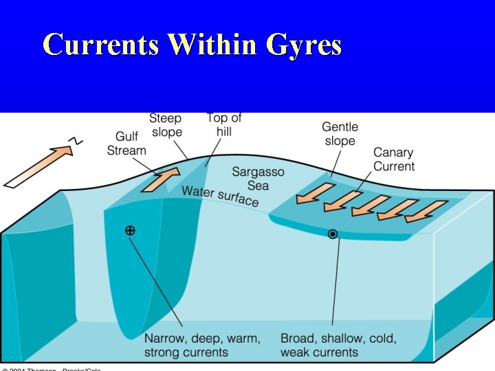
Currents Within Gyres © 2002 Brooks/Cole, a division of Thomson Learning, Inc.
Surface Circulation Patterns • Effects of Surface Circulation – Climate • Warm water currents bring warm, humid air to higher latitudes • Cold water currents bring cool, arid air to lower latitudes • Moderates global temperatures
Surface Circulation Patterns • Effects of Surface Circulation – Climate – Wind-induced vertical circulation • Upwelling is the upward motion of water. – This motion brings cold, nutrient rich water towards the surface. • Downwelling is downward motion of water. – It supplies the deeper ocean with dissolved gases.
Deep-ocean Circulation Patterns • Formation – A response to density differences – Factors creating a dense mass of water • Temperature—Cold water is dense • Salinity—Density increases with increasing salinity – Called thermohaline circulation
Waves
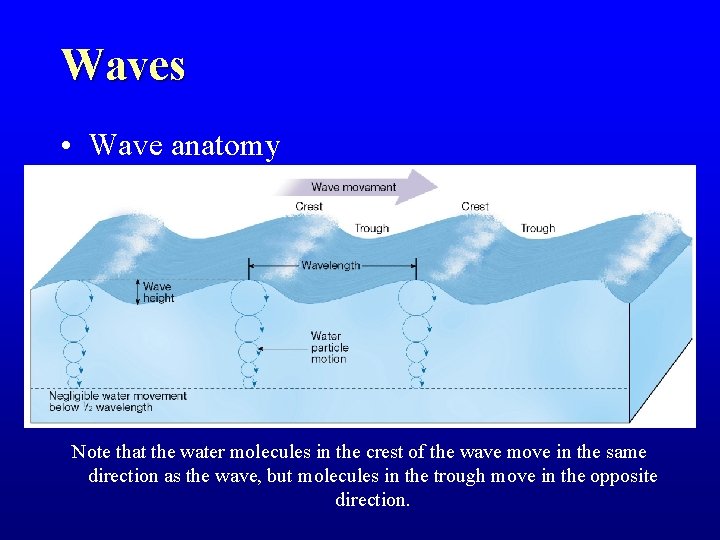
Waves • Wave anatomy Note that the water molecules in the crest of the wave move in the same direction as the wave, but molecules in the trough move in the opposite direction.
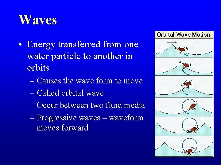
Waves • Energy transferred from one water particle to another in orbits – Causes the wave form to move – Called orbital wave – Occur between two fluid media – Progressive waves – waveform moves forward
Waves • Wavelength determines the size of the orbits • Water depth determines the shape of the orbits • Two broad categories – Deep-water Waves – Shallow-water Waves
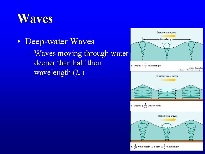
Waves • Deep-water Waves – Waves moving through water deeper than half their wavelength ( )
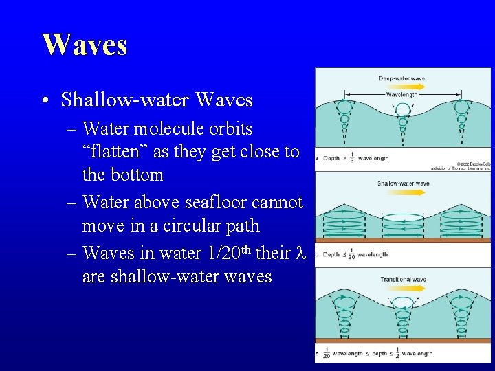
Waves • Shallow-water Waves – Water molecule orbits “flatten” as they get close to the bottom – Water above seafloor cannot move in a circular path – Waves in water 1/20 th their are shallow-water waves
Waves Wind Waves Approaching a Shore 1. Wave train moves towards shore 2. Circular motion of water molecules is interrupted 3. Wave slows as water becomes more shallow 4. Wave becomes too high for its wavelength 5. Water now moving faster than the wave 6. Wave breaks 7. Forms the surf
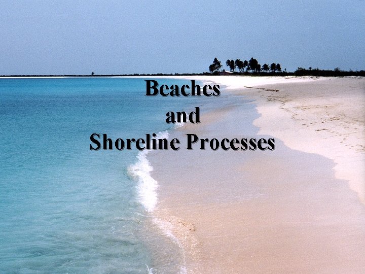
Beaches and Shoreline Processes
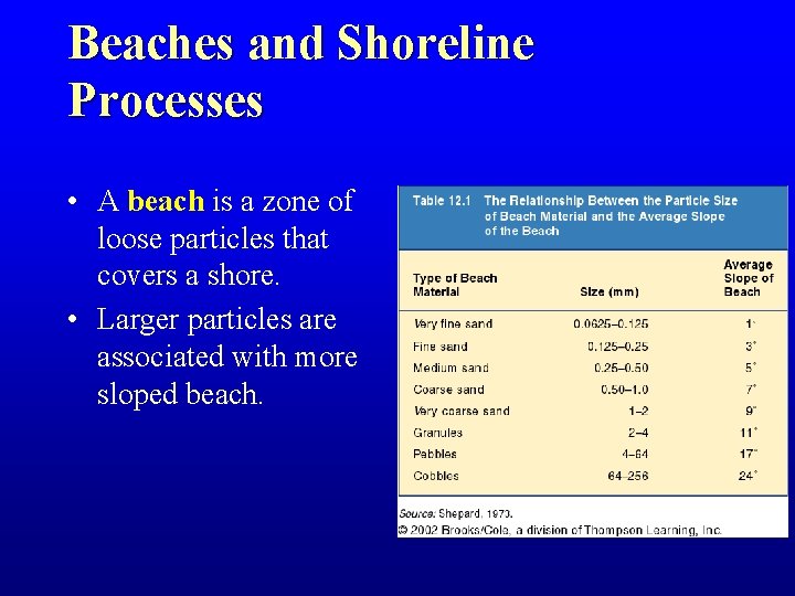
Beaches and Shoreline Processes • A beach is a zone of loose particles that covers a shore. • Larger particles are associated with more sloped beach.
Beaches and Shoreline Processes • Sediment Sources – Rivers and Streams – Eroding beach cliffs – 5 – 10% of beach sand – Sand from the seafloor immediately offshore
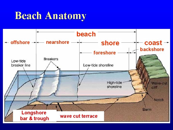
Beach Anatomy beach offshore nearshore foreshore Longshore bar & trough wave cut terrace coast backshore
Beaches & Shoreline Processes • Wave erosion – Erosion of shoreline by wave impact and pressure – Breaks down rock material and supplies sand to beaches (minor amount)
Beaches & Shoreline Processes • Wave refraction – Bending of a waves – Wave arrives parallel to shore – Results • Wave energy is concentrated against the sides and ends of the headland • Wave erosion straightens an irregular shoreline
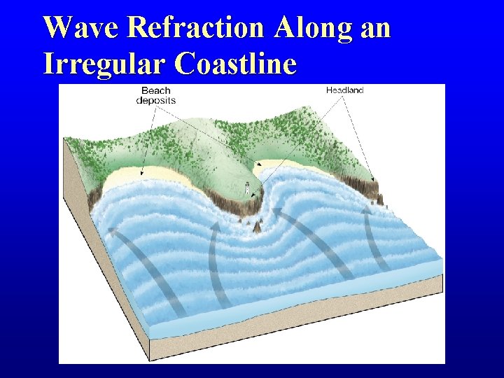
Wave Refraction Along an Irregular Coastline Figure 10. 12
Beaches & Shoreline Processes • Longshore transport – Beach Drift: sediment on beach moves in zigzag fashion via swash/backwash – Longshore Current: current moves down beach, caused by waves hitting beach at angle • Flows parallel to the shore • Transports sediments down the coast • Moves substantially more sediment than beach drift
Beach Drift & Longshore Currents
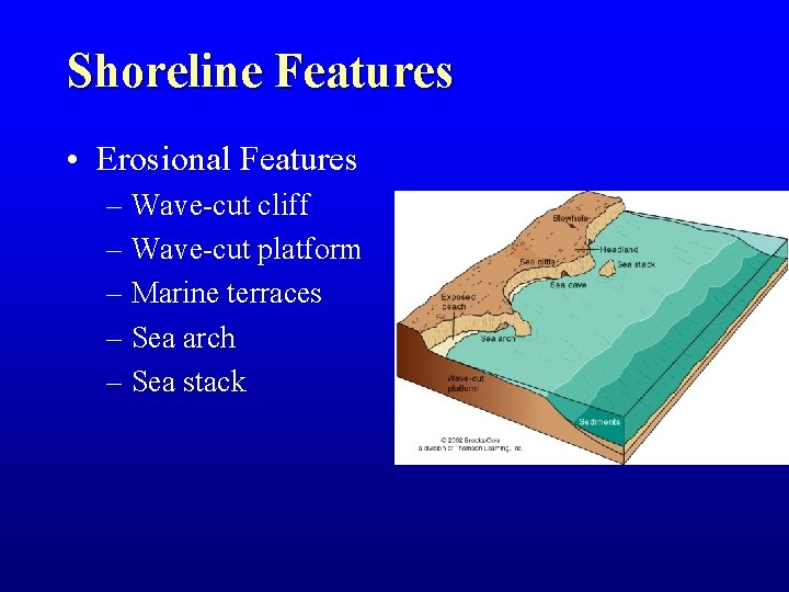
Shoreline Features • Erosional Features – Wave-cut cliff – Wave-cut platform – Marine terraces – Sea arch – Sea stack
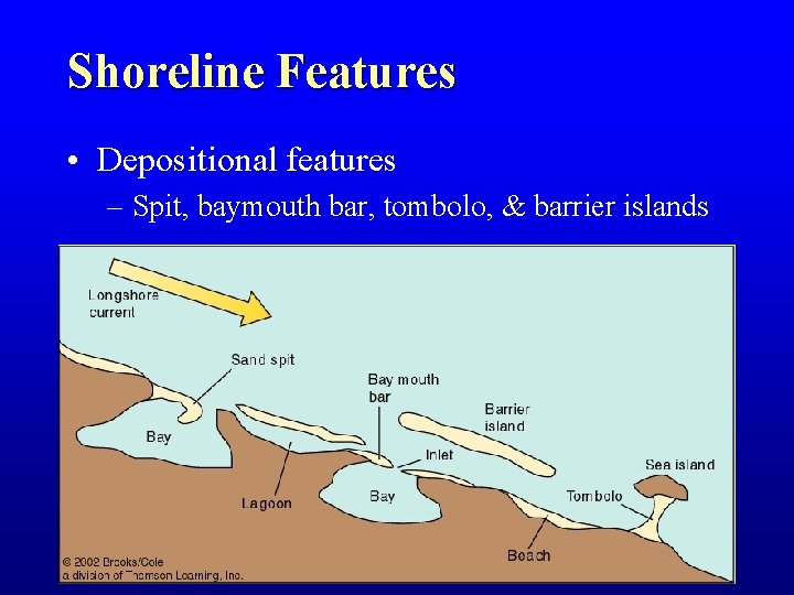
Shoreline Features • Depositional features – Spit, baymouth bar, tombolo, & barrier islands
Stabilizing the Shore • Shoreline erosion is influenced by the local factors – Proximity to sediment-laden rivers – Degree of tectonic activity – Topography and composition of the land – Prevailing wind and weather patterns – Configuration of the coastline
Stabilizing the Shore • Threats to the Sand Supply – Flood control dams – Southern California has 77 sand gravel quarries in stream channels – Paved river channels – reduces channel widening – Seawalls and riprap reduce cliff erosion and focus wave energy onto the beach
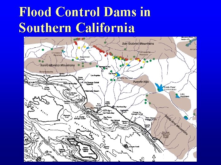
Flood Control Dams in Southern California
Stabilizing the Shore • Responses to erosion problems • Hard stabilization— Building structures – – Sea Walls Groins Jetties Breakwaters • Alternatives to hard stabilization – Beach nourishment by adding sand to the beach system – Relocating buildings away from beach – Returning to “natural” channels
Stabilizing the Shore • Erosion problems along U. S. Coasts – Atlantic and Gulf Coasts • Development occurs mainly on barrier islands – Face open ocean – Receive full force of storms • Development has taken place more rapidly than our understanding of barrier island dynamics
Stabilizing the Shore • Erosion problems along U. S. Coasts – Pacific Coast • Characterized by relatively narrow beaches backed by steep cliffs and mountain ranges • Major problem is the narrowing of the beaches – Sediment for beaches is interrupted by dams and reservoirs – Rapid erosion occurs along the beaches
Tides
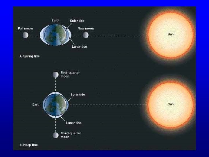
Tides • Changes in elevation of the ocean surface • Caused by the gravitational forces exerted upon the Earth by the – Moon, – and to a lesser extent by the Sun
Spring and Neap Tides • Spring Tides – During the period of a new moon, the moon and sun are lined up on the same side of the Earth – Produces the greatest range between high water and low water • Neap Tides – Produced when the moon is at a right angle to the line of centers of the Earth and the sun – The range between high and low water is small
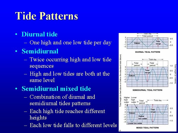
Tide Patterns • Diurnal tide – One high and one low tide per day • Semidiurnal – Twice occurring high and low tide sequences – High and low tides are both at the same level • Semidiurnal mixed tide – Combination of diurnal and semidiurnal tides patterns – Each high tide reaches different heights – Each low tide falls to different levels
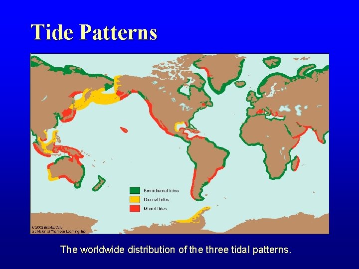
Tide Patterns The worldwide distribution of the three tidal patterns.
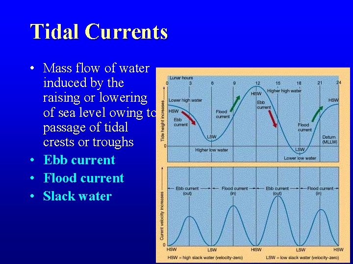
Tidal Currents • Mass flow of water induced by the raising or lowering of sea level owing to passage of tidal crests or troughs • Ebb current • Flood current • Slack water
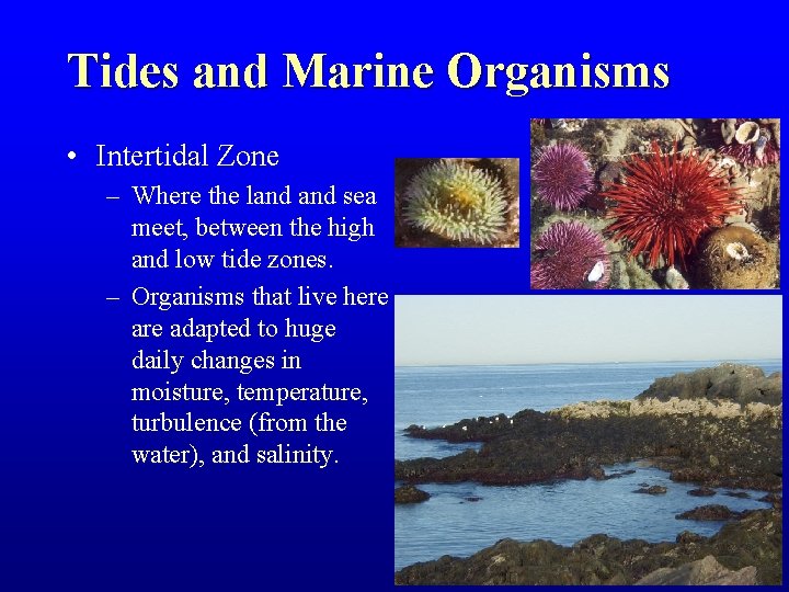
Tides and Marine Organisms • Intertidal Zone – Where the land sea meet, between the high and low tide zones. – Organisms that live here adapted to huge daily changes in moisture, temperature, turbulence (from the water), and salinity.
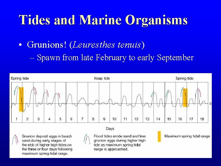
Tides and Marine Organisms • Grunions! (Leuresthes tenuis) – Spawn from late February to early September
End
- Slides: 82