OCEANOGRAPHY STUDY OF THE MARINE WORLD Overview 70


- Slides: 50

OCEANOGRAPHY STUDY OF THE MARINE WORLD

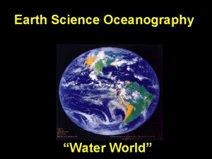
Overview • 70. 8% Earth covered by ocean • Interconnected global or world ocean • Oceans contain 97. 2% of surface water Fig. 1. 3 ab

Principal oceans • • • Pacific - Largest, deepest Atlantic - Second largest Indian - Mainly in Southern Hemisphere Arctic - Smallest, shallowest, ice-covered Antarctic or Southern Ocean - Connects Pacific, Atlantic, and Indian – South of about 50 o S latitude

Ocean vs. Sea • Smaller and shallower than oceans • Salt water • Usually enclosed by land – Sargasso Sea defined by surrounding ocean currents • The Seven Seas

Comparison of elevation and depth Oceans Land • Average depth 3729 m (12, 234 ft) • Average elevation 840 m (2756 ft) • Deepest ocean Mariana Trench 11, 022 m (36, 161 ft) • Highest mountain Mt. Everest 8850 m (29, 935 ft)

Fig. 1. 3 cd

GAINING KNOWLEDGE OF THE OCEANS

Early Explorers • Voyaging on water was important to many early civilizations • Cartographers recorded information about locations, landmarks and currents. • Today, charts are detailed graphic representations of water and water-related information

Early Explorers ~1500 B. C. – THE PHOENICIANS

Early Explorers • The Library at Alexandria, in Egypt, was founded in the third century B. C. • The principles of celestial navigation were invented at the Library at Alexandria. The ancient library in Alexandria, Egypt, contained more than half a million scrolls, which had to be organized by subject. Abu Dhabi Men's College Library

Early Explorers • The Greeks – Eratosthenes of Cyrene • 2 nd librarian at Alexandria. • First to calculate the circumference of Earth. - 40000 km • Invented a system of longitude and latitude.


Early Explorers • The Greeks – Aristotle (384 -322 B. C. ) • catalogued marine organisms – Pliny The Elder (23 -79 A. D. ) • related phases of the moon to the tides • described the ocean currents moving through the Straits of Gibraltar – Ptolemy (127 -151 A. D. ) • produced the first world atlas with then-known world boundaries

Early Explorers • The Polynesian colonies are an example of knowledge of oceans and marine science used to colonize a vast number of islands. • “Red Arrows” indicate the direction and order of settlement. © 2002 Brooks/Cole, a division of Thomson Learning, Inc.

Early Polynesians Sailed Thousands of Miles for Trade

Early Explorers • The Chinese – Invented (among other things) • • The Compass The central rudder Water-tight compartments Sails on multiple masts Thinkquest. com

The Middle Ages • The Vikings – Pirates & Raiders – Farmers & Explorers – Colonized: • Iceland, Greenland, Vinland (America) • Iceland to Greenland – 25 boats, ~600 people – 14 boats remained Sources: http: //en. wikipedia. org/wiki/Vikings http: //www. collectionscanada. ca/explorers/kids/index-e. html

The Vikings • Boats – “Knarrs” – merchant ships – Longboats (drakkar) – warships • Navigation table – Needle in center of table measured sun’s height – Bar around edge plotted ship’s course Sources: http: //en. wikipedia. org/wiki/Vikings http: //www. collectionscanada. ca/explorers/kids/index-e. html Models, Viking Ship Museum in Roskilde, Denmark (April 1991). Photo by Harri Blomberg. (http: //en. wikipedia. org/wiki/Image: Vikingeskibsmuseet_12. jpg)

The Vikings • Bjarni Herjólfsson – First to “find” North America in 986 A. D. • Leifr Eiriksson – First to set foot in North America in 995 A. D. • Thorfinnr Thordarson and Freydis Eiriksdøttir – First to colonize Vinland (1003 to 1015 A. D. ) • Snorri Karlsefni – First baby born in North America (a boy) Sources: http: //en. wikipedia. org/wiki/Vikings http: //www. collectionscanada. ca/explorers/kids/index-e. html

http: //en. wikipedia. org/wiki/Image: Vikings-Voyages. png

New World Exploration • Prince Henry The Navigator – 3 rd son of the royal family of Portugal – May have established a center for the study of marine science & navigation. – sponsored voyages down the coast of Mauretania (primarily slaving expeditions) Source: http: //en. wikipedia. org/wiki/

New World Exploration • Christopher Columbus (1451? – 1506) – “Discovered” North America while trying to find a western route to Asia A replica of the Santa Maria, Columbus' flagship. Photo by: Dietrich Bartel. Source: http: //en. wikipedia. org/wiki/I mage: Santa-Maria. jpg

1492 - Columbus’ first voyage “discovered” San Salvador (now the Bahamas), although the natives called it Guanahani Source: http: //en. wikipedia. org/wiki/

1493 - Columbus’ second voyage through Hispaniola, Juana (Cuba), and other islands; established the short-lived settlement of Isabela on Hispaniola Source: http: //en. wikipedia. org/wiki/

1498 - Columbus’ third voyage brought him to South America, which he thought was adjacent to China Source: http: //en. wikipedia. org/wiki/

1502 - Columbus’ fourth voyage was primarily to search for the Strait of Malacca to the Indian Ocean. Source: http: //en. wikipedia. org/wiki/

VESPUCCI, AMERIGO (1454 -1512) Italian navigator who explored the northern shore of South America during 4 voyages. The American continent was named in his honor in 1507. 1 st Voyage 3 rd Voyage 2 nd Voyage 4 th Voyage

Juan Ponce de León (14601521) • Spanish explorer, born in San Servos, León. • In 1493 he accompanied Christopher Columbus on his second voyage to America. • Explored Florida

Ferdinand Magellan (1480 - 1521) • initiator and leader of the first expedition to circumnavigate the globe (1519 -21) • 42, 000 miles - 22, 000 of them over waters no white man had ever seen - was an achievement without parallel in an era of fragile wooden ships. Detail from a map of Ortelius: Magellan's ship Victoria Source: http: //en. wikipedia. org/wiki/

James Cook (1728 – 1779) • The first real scientific oceanographic voyages. – Ships HMS Endeavour, Resolution, Adventure – Mapped many islands in Pacific – Systematically measured ocean characteristics – Marine chronograph (longitude) – Samples of marine life, land plants & animals, the ocean floor, & geologic formations – Recorded all of the information in logbooks. portrait by Nathaniel Dance, c. 1775, Natio Maritime Museum, Greenwich A general chart of the island of Newfoundland. Surveyed by James Cook and Michael Lane, and "publish'd according to Act of Parliament by Thomas Jefferys Geographer to the King, 1775. "

Cook's first voyage was to the South Pacific Ocean Copyright/Source

During his second voyage, Cook tried to find out if there was land at the South Pole Copyright/Source

During his third voyage to try and find the Northwest Passage, Cook became the first European to land on Vancouver Island Copyright/Source

HMS Challenger • The Royal Society of London & Charles Wyville Thomson borrowed the Challenger from the Royal Navy • 1870 – 1872 - the first expedition devoted solely to marine science – modified the ship for scientific work – separate laboratories for natural history and chemistry. Source: http: //en. wikipedia. org/wiki/

HMS Challenger • The results: the Report Of The Scientific Results of the Exploring Voyage of H. M. S. Challenger during the years 1873 -76, – – – 127500 km 492 deep sea soundings 133 bottom dredges 151 open water trawls 263 serial water temperature observations – about 4717 new species of marine life were discovered. Source: http: //en. wikipedia. org/wiki/

JOHN MURRAY (1841 - 1914) • 1872 – took over publishing 50 volumes & reports on the HMS Challenger voyage • coined the word “oceanography” • Mid-Atlantic Ridge & oceanic trenches • Saharan desert deposits in deep ocean sediments Source: http: //en. wikipedia. org/wiki/

TWENTIETH CENTURY EXPLORATIONS • Polar Expeditions (The Arctic) – 1564 - Jacques Cartier - Saint Lawrence River – 1845 – 1848 – Sir John Franklin (died with crew) – 1854 – Robert Mc. Clure finds Franklin crew & overland passage http: //earthobservatory. nasa. gov/Newsroom/New. Images/images. php 3? img_id=16340

TWENTIETH CENTURY EXPLORATIONS • Polar Expeditions (The Arctic) – Roald Amundsen • First Voyage (1897 – 1899) to Antarctica – first people to winter there • Second Voyage (1903 - 1906) to the Arctic – Fishing boat “Gjöa” – First to travel the Northwest Passage – Discovered the Magnetic North Pole wanders Sources: http: //en. wikipedia. org/wiki/ http: //www. collectionscanada. ca/explorers/kids/index-e. html Copyright/Source

Amundsen's Northwest Passage The Northwest Passage that Roald Amundsen navigated with great difficulty starting in 1903 is opening for the second year in a row, as shown in the AMSR-E sea ice product from the University of Bremen (Figure 4). The most recent operational analysis from the Canadian Ice Service and the U. S. National Ice Center on August 8 showed a small section of Amundsen’s historic path still blocked by a 50 kilometer (31 -mile) stretch of sea ice, although that should melt within the next few days. Amundsen’s route requires sailing through treacherous narrow and shallow channels, making it impractical for deep-draft commercial ships. The more important northern route, through the wide and deep Parry Channel, is still ice-clogged. The northern route opened in mid-August last year; it may still open up before the end of this year's melt season. source

TWENTIETH CENTURY EXPLORATIONS • Polar Expeditions (The Arctic) • Third Voyage (1910 – 1912) - back to Antarctica Roald Amundsen, Olavson Bjaaland, Hilmer Hanssen, Sverre H. Hassel and Oscar Wisting by their South Pole marker tent and flag Sources: 1, 2, 3

TWENTIETH CENTURY EXPLORATIONS • Polar Expeditions (The Arctic) – April 6 th, 1909, Robert Peary claimed to be the first person in recorded history to reach the North Pole – First people to reach the north Pole on foot/skis without outside help: Richard Weber (Canada) and Misha Malakhov (Russia) in 1995 North Pole Web Cam Photo. Source: http: //en. wikipedia. org/wiki/ http: //www. arctic. noaa. gov/gallery_np. html. Credit NOAA/Pacific Marine Environmental Laboratory.

TWENTIETH CENTURY EXPLORATIONS • Polar Expeditions (The Antarctic) – James Cook (1772 – 1775) first person to cross Antarctic Circle & circumnavigated Antarctica without actually sighting it – Fabian Gottlieb von Bellingshausen (Russia) circumnavigated continent during 1819 -1821 – Charles Wilkes (1840, US Navy) realized that Antarctica was a continent – James Clark Ross (Britain) sailed through ice shelf, discovered Mt Erebus (a volcano) Source: http: //en. wikipedia. org/wiki/

TWENTIETH CENTURY EXPLORATIONS • Polar Expeditions (The Antarctic) – Adrian de Gerlache (1898 -1899, Begium) – first expedition to winter in Antarctica – Roald Amundsen, third Voyage (1910 – 1912) back to Antarctica • First person to reach the South Pole – 1956 - US Navy established the Amundsen. Scott South Pole Station Source: http: //en. wikipedia. org/wiki/

source

TWENTIETH CENTURY EXPLORATIONS • METEOR EXPEDITION (1925) – first use of an echo sounder • U. S. S. ATLANTIS (1931) – first research ship built specifically for ocean studies, confirmed MAR. • HMS CHALLENGER (1951) – Discovered the deepest part of the ocean’s deepest trenches.

TWENTIETH CENTURY EXPLORATIONS • GLOMAR CHALLENGER (1968) – (Glomar = Global Marine) – First deep sea drilling vessel – Confirmed ages of sea floor sediments & Sea Floor Spreading Hypothesis – Evaporites in cores = first evidence that the Mediterranean Sea once dried up – led to the JOIDES Resolution and eventually the Deep Sea Drilling Program. Source: http: //en. wikipedia. org/wiki/

TWENTIETH CENTURY EXPLORATIONS • OCEANOGRAPHIC INSTITUTIONS – Musée Océanographique de Monaco • 1910 By Prince Albert of Monaco – Japan Marine Science and Technology Center (JAMSTEC) – Woods Hole Oceanographic Institute – Scripps Institution of Oceanography – National Oceanic and Atmospheric Administration (NOAA)

TWENTIETH CENTURY EXPLORATIONS • SATELLITE OCEANOGRAPHY – SEASAT (1978 – 1978) • first oceanographic satellite – Radar altimeter to measure spacecraft height above the ocean surface – Microwave scatterometer to measure wind speed and direction – Scanning multichannel microwave radiometer to measure sea surface temperature – Visible and infrared radiometer to identify cloud, land water features – Synthetic Aperture Radar (SAR) L-band, HH polarization, fixed look angle to monitor the global surface wave field and polar sea ice conditions Source: http: //en. wikipedia. org/wiki/

TWENTIETH CENTURY EXPLORATIONS • SATELLITE OCEANOGRAPHY – TOPEX/Poseidon (1995 – 2005) • Measures sea surface topography http: //sealevel. jpl. nasa. gov/technology. html

~ End ~
 Marine biology module 3 study guide
 Marine biology module 13 study guide
 Chapter 15 physical oceanography
 Chapter 15 physical oceanography
 Dip net oceanography
 Fleet numerical meteorology and oceanography center
 Chapter 15 physical oceanography
 The four principle oceans of the earth are the:
 Is oceanography an interdisciplinary science
 University of hawaii oceanography
 сплит institute of oceanography and fisheries
 Four main branches of oceanography
 Essentials of oceanography
 Oceanography
 Woods hole
 Chemistry oceanography
 Polynesians oceanography
 Scripps institute of oceanography
 Chemistry oceanography
 Chemical oceanography definition
 Chemistry oceanography
 Photo search
 Oceanography
 Institute of oceanography and fisheries
 Oceanography
 Oceanography
 History of oceanography
 Oceanography
 Neap tide spring tide
 Overview of the world
 Hát kết hợp bộ gõ cơ thể
 Bổ thể
 Tỉ lệ cơ thể trẻ em
 Voi kéo gỗ như thế nào
 Tư thế worms-breton
 Chúa sống lại
 Môn thể thao bắt đầu bằng từ đua
 Thế nào là hệ số cao nhất
 Các châu lục và đại dương trên thế giới
 Công thức tính độ biến thiên đông lượng
 Trời xanh đây là của chúng ta thể thơ
 Mật thư tọa độ 5x5
 Phép trừ bù
 Phản ứng thế ankan
 Các châu lục và đại dương trên thế giới
 Thơ thất ngôn tứ tuyệt đường luật
 Quá trình desamine hóa có thể tạo ra
 Một số thể thơ truyền thống
 Cái miệng xinh xinh thế chỉ nói điều hay thôi
 Vẽ hình chiếu vuông góc của vật thể sau

