Oceanography Ocean Floor Features Ocean Circulation Waves and


- Slides: 53
Oceanography • Ocean Floor Features • Ocean Circulation • Waves and Tides
Oceans • https: //www. youtube. com/watch? v=3 GRA 7 il. M 708
Ocean Topography
How do we get the information about the ocean floor? • Sonar – Boats using sonar to map the ocean floor as they pass over it. • Boats have to go in set patterns going back and forth just like you would mow a lawn to make sure it covers everything • Slow process • Satellites • Measure the ocean surface height as small as 3 -6 cm • These can be affected by features under the water, help to verify sonar readings • Submersibles • Small underwater craft that can be manned or unmanned. • Give a visual as well as other readings to verify the findings in detail
Sonar • https: //www. youtube. com/watch? v=-f. AAx. EIFe. LU
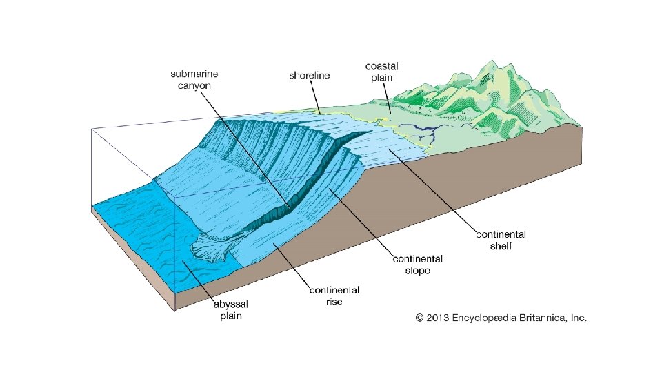
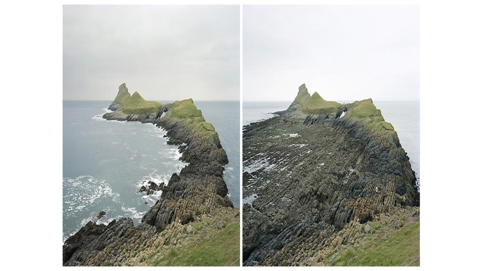
Starting at the beach • The area where a continental plate meets an oceanic plate is called a Continental Margin. • Most ocean features will be in this range due to plate tectonics
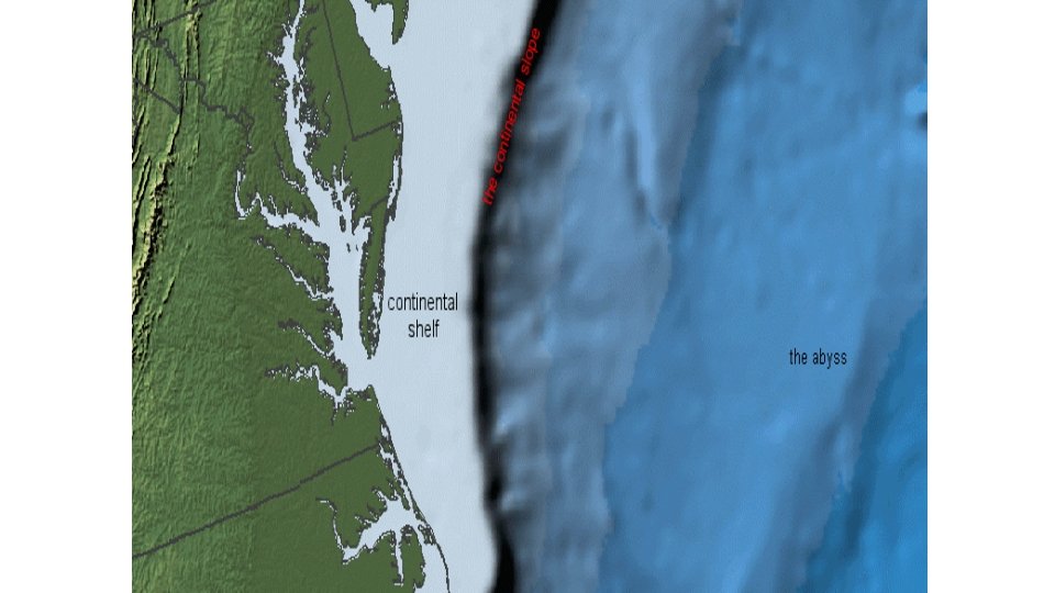
Beach to water • Continental Shelf • Gently sloped underwater surface • Some areas it is very short in width (convergent boundaries) while others can be quite large • Fairly flat, only dropping at about 2 meters per KM (6 feet per mile) • Great source of minerals, oil, natural gas, sand, gravel, and fishing
Continental Slope • The edge of the continental crust where it goes down to the oceanic crust • Much steeper where the water gets deep quickly • Can contain deep cuts called Submarine Canyons that can be ends of ancient rivers • They can also be formed from Turbidity Currents that have a lot of sediment moving at once • Because it is more muddy than normal seawater it is more dense and flows down the side eroding it
Continental Rise • Slope becomes much smaller as the ocean floor starts to flatten • No trenches in this area • Continental Slope leading down can be nearly 20 km wide but the rise can be 100’s of km wide
Ocean Basin Floor • 30% of Earth’s surface is ocean floor • Abyssal Plains • Very deep very flat areas after the continental rise • Probably the flattest places on earth due to lots of sediment settling there at a fairly even rate • Mid-Ocean Ridges • Occur all around the Earth due to seafloor spreading • Divergent oceanic plates allow magma to come up and form ridges and create new ocean floor
Ocean Topography
Ocean Currents
Ocean Circulation • Ocean Currents – Mass of ocean water moving from one place to another • Why is this important to know? • Impact on weather • Ocean travel – If you sail with the current you will not use as much energy and will arrive faster
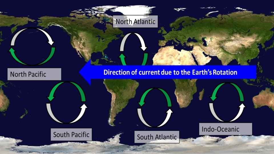
Ocean Currents • Surface Currents – Movement of the upper part of the ocean water due to the friction of wind blowing across it • Some are small in size • They tend not to last very long since they depend on the wind to be in a constant direction. They usually occur due to seasonal changes • Others are much larger and control the general current of the globe • This is due to the Coriolis effect (earth’s rotation making things move) • The atmosphere as a whole moving works with the water to create a circulation of cold and warm water
Ocean Currents • Basic Rules for Currents • Because of Earth’s Rotation, in the northern hemisphere the currents move clockwise and opposite in the southern hemisphere. • On the left side of a continent, the water goes from cold to hot (towards equator) • On the right side, the water goes from hot to cold (towards poles)
Ocean Currents
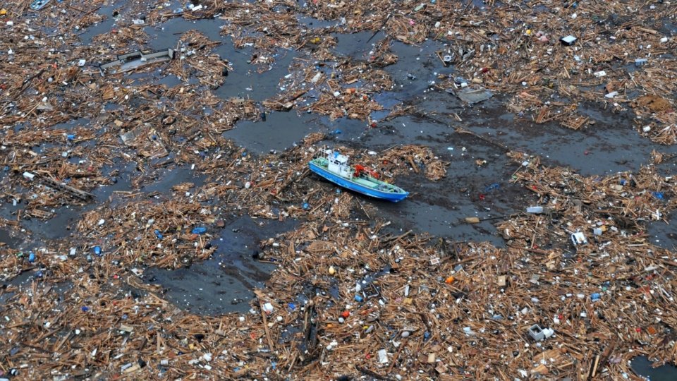
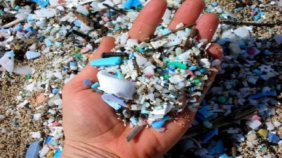
Ocean Currents • The area in the center of these circulating currents is called a Gyre • 5 main ones, North and South Pacific, North and South Atlantic, Indian Gyres • This become an area where a lot of our trash ends up that goes into the ocean and floats • Recently banned micro beads in beauty products because of their harmfulness to the waters
• https: //www. youtube. com/watch? v=Nh 6 lkv 1 udb 0
Ocean Currents and Climate • When ocean currents from warmer areas move north, they warm the air around it as well. It brings more rain and warmer areas farther away from the equator (East Coast US, Japan) • Same for polar air being brought south by the currents. It helps to moderate areas that should be very hot (west coast of Africa, Peru) with cooler atmosphere
Ocean Currents • Vertical movement - Up and down from top to bottom instead of across the surface • Upwelling – Caused by wind that cools the surface and makes colder water come up from the bottom • Brings a lot of dissolved nutrients from lower in the ocean to the surface that promote growth of animal life like plankton
Ocean Currents • Density Currents – Heavier water sinks down bringing less dense water to the surface • Can be caused by more salt being in the water (salinity) • Evaporation takes water away leaving more salt behind, or icebergs/glaciers melt adding more water • Or temperature changes ( heat expands and is less dense, cold contracts and is more dense)
Waves
Waves • What are they? • Transfer of energy through a liquid. One of the few ways we can visualize energy moving from one place to another. • Dropping a rock in a pond can create waves on a small scale • Storms far away often are the source of ocean waves. Wind moves the surface and that energy spreads out
Parts of a Wave • These parts are mostly the same as any other wave type (sound, radio, cell phone, wifi) • Crest – Top of a wave • Trough – Bottom of a wave • Wave Height – The vertical distance between a trough and a crest
Parts of a Wave • Wavelength – Distance from a crest of one wave to the crest of the next. Shows how quickly we can expect waves • Wave Period – Time it takes for one full wave to pass a certain point. Shows how fast they are moving.
Parts of a Wave
Wave Motion • Waves can travel a great distance in water because it encounters little resistance. • Waves generated in Antarctica have been measured to travel more than 10, 000 km and break in Alaska
Wave Motion • The water itself isn’t moving with the waves. This means that the water in Antarctica isn’t making that trip, just passing the energy on by way of the waves • The energy moves in a circular motion in the water, decreasing the deeper it goes until at have a wave length deep, it is essentially gone
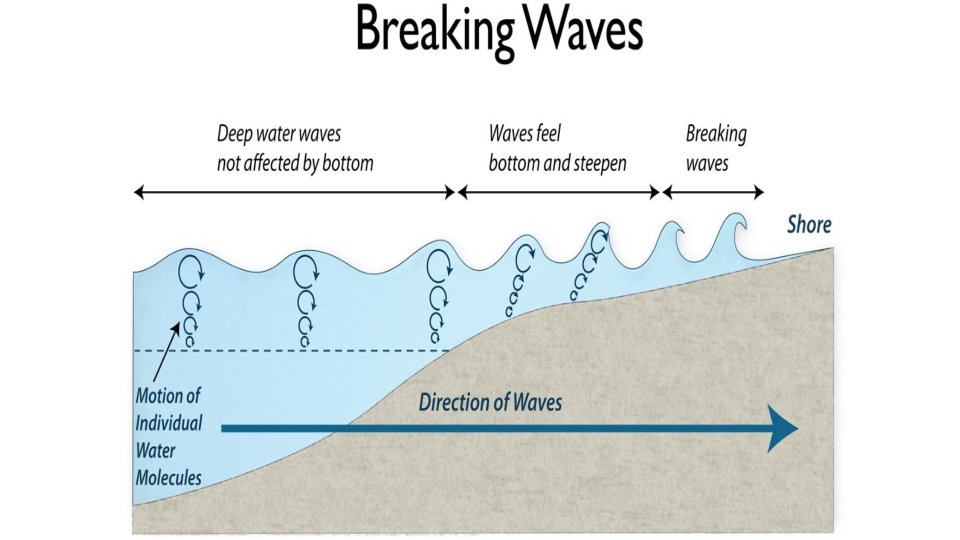
Breaking waves • This can happen in two ways • First way is the crest gets so high that the water simply can’t stay together anymore and it breaks • Think of a pirate movie with a bad storm in the ocean
Breaking Waves • Second is what we are more used to with waves at the beach • When water is in the open water it is not affected by the depth because that wave loses energy at have a wave length deep. • When the water comes to the shore, the water get shallow and starts to invade on that energy making it lower the wavelength and go higher, causing it to break • This is known as Surf
How to explain big waves • https: //www. youtube. com/watch? v=Zm. BNc. Vv. BUNs&t
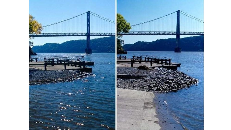
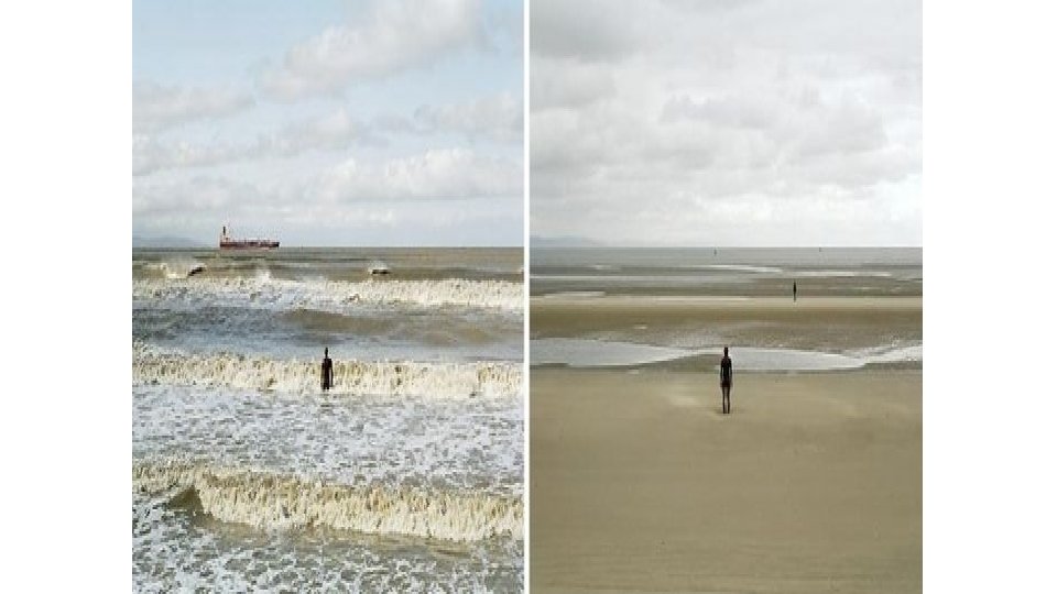
Tides • Tides are the regular changes in elevation of water • Referred to as High and Low Tides • Only happen if directly connected to the ocean or a large body of water
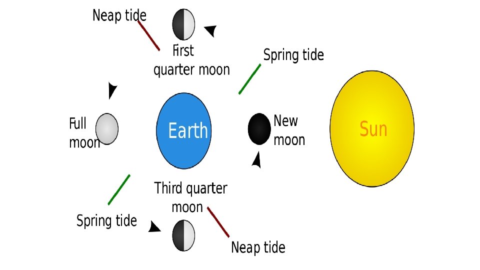
Tides • What causes the tides? • The gravity of the Sun and Moon are not strong enough to have much effect on us because we are mostly solid. • However it does have some influence on the water because it naturally wants to move around
Moon Position and Tides • The tide will be directly tied with the location of the moon in relation to the sun and Earth • If the moon and sun are on the same or direct opposite sides of the earth, New and Full Moon, this will cause the greatest fluctuation in the tide (higher highs, lower lows) • Spring Tide • If the moon is at a right angle, then it is the smallest tide changes. Quarter Moon • Neap tide
Tidal Patterns • There are three main types • Diurnal – • One high and one low tide each day • Gulf of Mexico
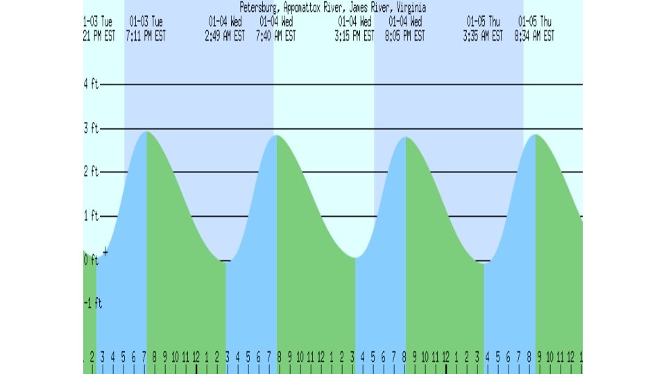
Tidal Patterns • Semidiurnal • 2 high and 2 low each day • Typically around the same heights • East coast US
Tidal Patterns • Mixed • 2 high and 2 low each day • Heights change • West Coast US
2: 52 AM EST -0. 06 m 7: 24 AM EST 7: 52 AM EST Wednesday 4 January Sunrise 0. 84 m 11: 22 AM EST 3: 18 PM EST 11: 39 PM EST (2. 76 feet) High Tide Moonrise -0. 02 m 5: 05 PM EST 8: 17 PM EST (-0. 19 feet) Low Tide (-0. 06 feet) Low Tide Sunset 0. 84 m (2. 76 feet) High Tide Moonset