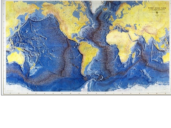
Ocean Notes I Features of the Ocean Floor


: organisms that drift with the ocean current a)")

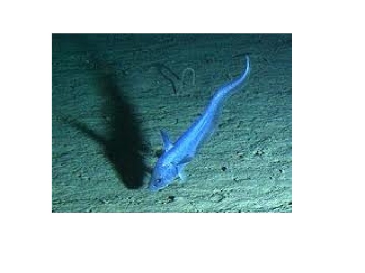
: animals that can swim • Ex: adult fish,")

: organisms that live on the ocean floor")


 temperature (does not change) 2. Transition Zone a. Thermocline")


 Amount of sunlight")


 currents move toward")


 1. Temperature changes density • Cold (more dense)- sinks")

- Slides: 87
Ocean Notes
I. Features of the Ocean Floor
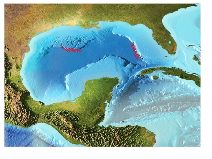
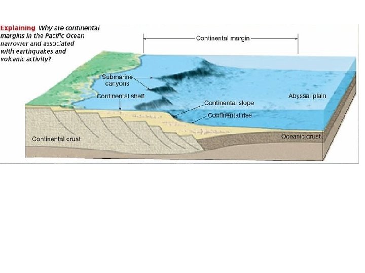
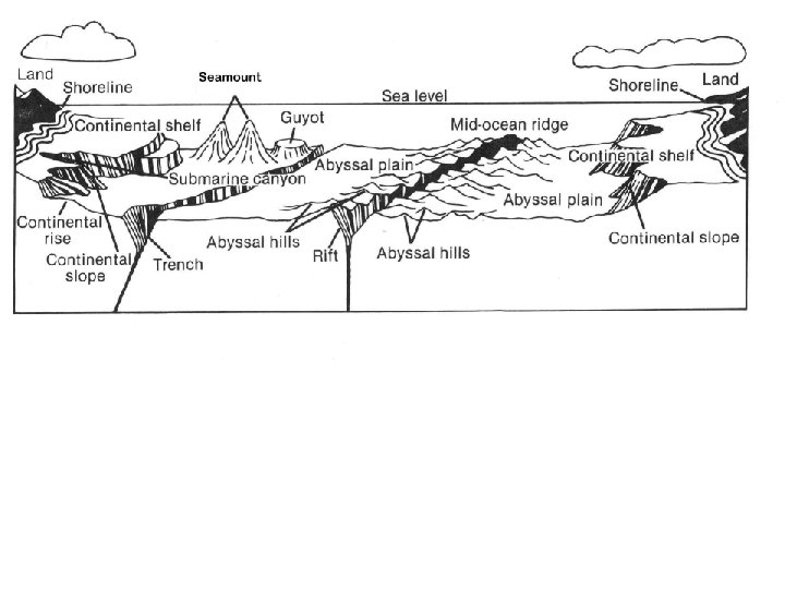
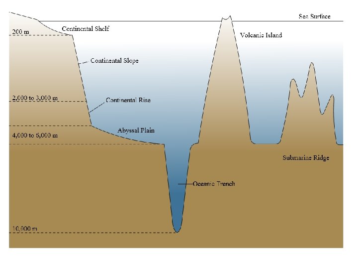
I. Features of the Ocean Floor A. There are 3 major regions on the ocean floor Ocean Basin Floor Continental Margin Mid Ocean Ridge
1. Continental Margin: zone between the continent and the ocean floor A. Continental shelf: the part of the continent that slopes gently away from the shoreline B. Continental slope: part of the continent between the shelf and the ocean floor (steeper)
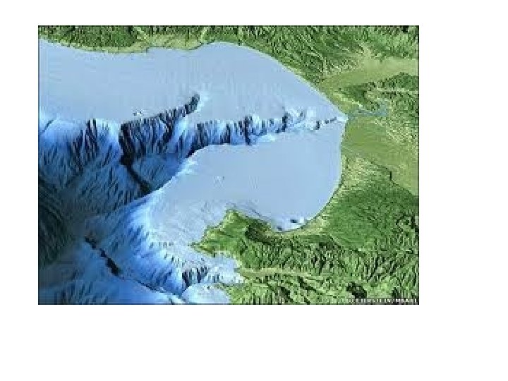
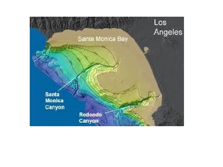
1. Continental Margin: zone between the continent and the ocean floor C. Submarine canyons: long valleys with steep sides that cut into the shelf D. Continental Rise: where the slope becomes les steep
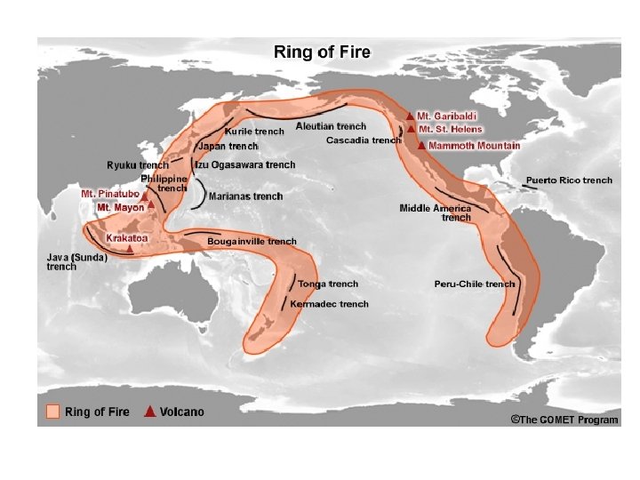
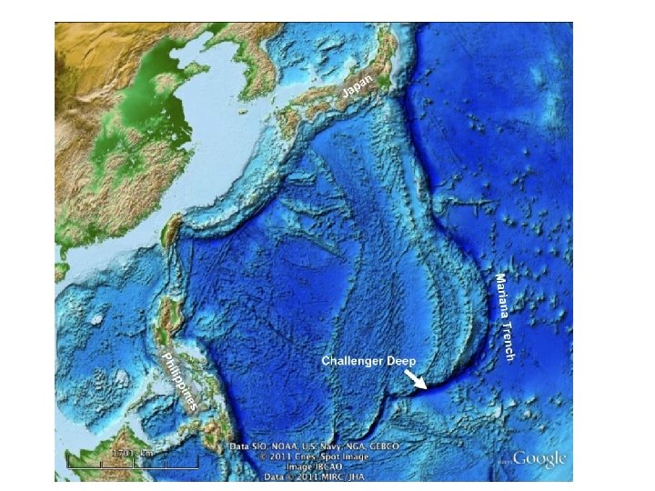
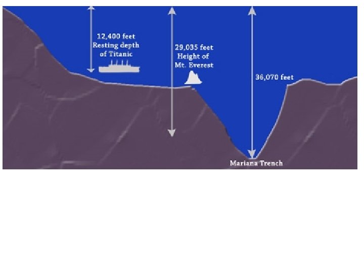
2. Ocean Basin floor: zone between the continent and the mid-ocean ridge A. Deep ocean trenches: long narrow creases in the ocean floor where two plates meet and one plate subducts
2. Ocean Basin floor: zone between the continent and the mid-ocean ridge B. Abyssal plains: Flat areas
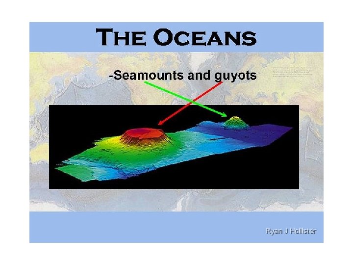
2. Ocean Basin floor: zone between the continent and the mid-ocean ridge C. Seamount: volcanic peak underwater D. Guyot: flat-topped inactive volcano
Picture Continental Rise
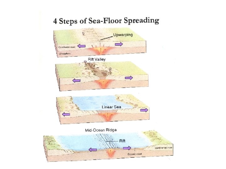
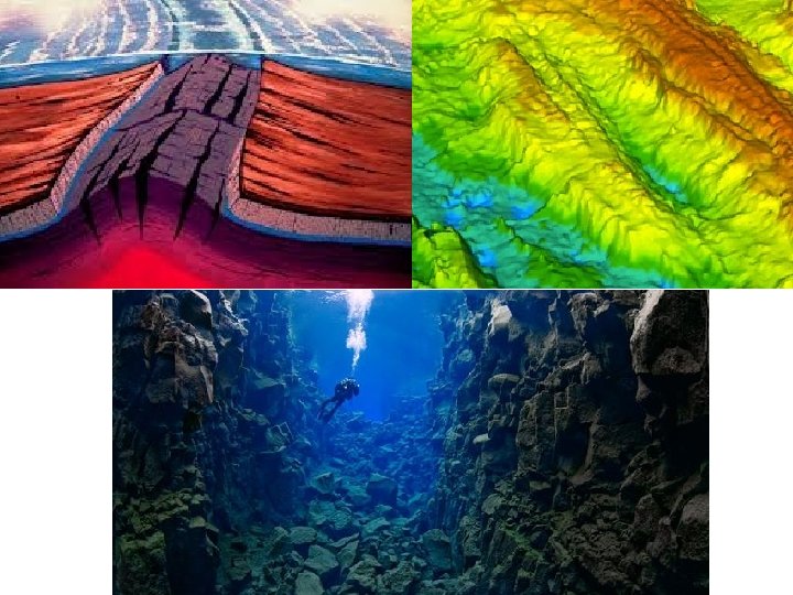
3. Mid-ocean ridge: Underwater mountains A. Happens at divergent boundaries B. Due to sea-floor spreading C. Rift: crack between the ridge
Identify Each of the Features
Continental slope seamount Abyssal plain Mid Ocean Ridge Volcanic island Continental shelf Trench
shoreline guyot continental shelf abyssal plain continental slope Mid-ocean ridge trench rifts
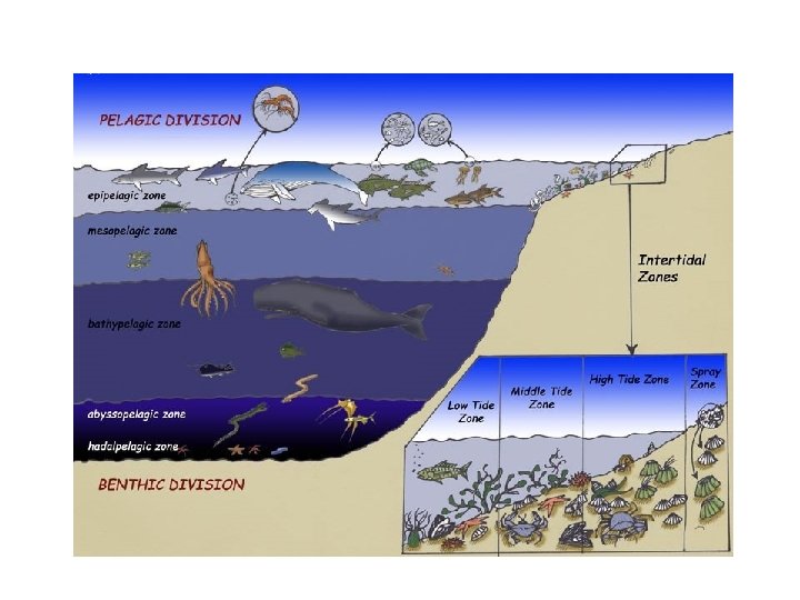
II. Marine Organisms EQ: How is the ocean divided?
I!. Marine Organisms v Marine organisms can be classified according to where they live and how they move
A. Three Classifications: 1. Plankton (floaters): organisms that drift with the ocean current a) Phytoplankton (plant plankton): aglae that can undergo photosynthesis b) Zooplankton (animal plankton): larval stages of fish, sea stars, lobsters, etc.
Plankton
A. Three Classifications: 2. Nekton (swimmers): animals that can swim • Ex: adult fish, marine mammals, squid
Nekton
A. Three Classifications: 3. Benthos (bottom dwellers): organisms that live on the ocean floor • Ex: seaweed, coral, sea stars, crabs
Benthos
B. Marine Life Zones Three factors are used to divide the ocean
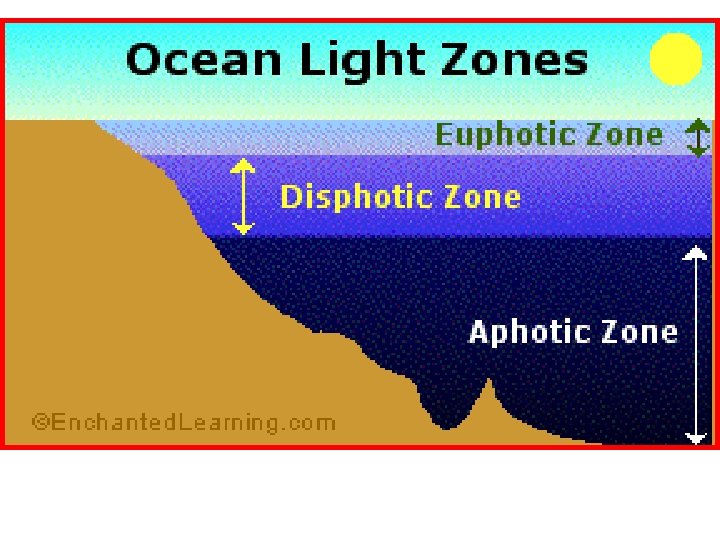
B. Marine Life Zones 1. Availability of Sunlight A. Photic zone: where sunlight reaches • Euphotic zone: best sunlight for photosynthesis B. Aphotic Zone: where sunlight can’t reach
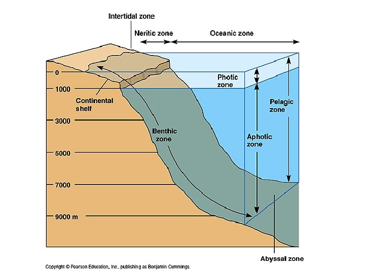
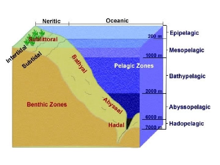
B. Marine Life Zones 2. Distance from shore A. Intertidal zone: narrow strip of land between high tide and low tide B. Neritic zone: continental shelf beyond low tide C. Oceanic zone: area beyond continental shelf (open ocean)
B. Marine Life Zones 3. Water Depth A. Pelagic Zone: Open ocean of any depth B. Benthic Zone: All of the sea bottom C. Abyssal Zone: The deep ocean floor (Part of the Benthic zone)
Marine Life Zones
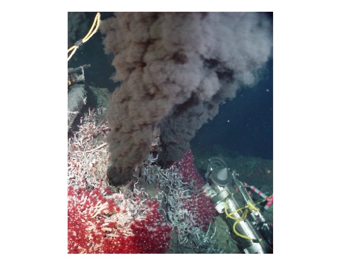
C. Hydrothermal Vents 1. Seawater seeps into the ocean floor through cracks in the crust. The water then becomes superheated and saturated with minerals. 2. Water temperatures of 100 o. C or higher support communities of organisms found nowhere else in the world
Hydrothermal Vents
Example: Tubeworms
III. The Composition of Seawater EQ: How does the amount of salt affect the density of sea water?
A. Salinity 1. Salinity is the total amount of solid material dissolved in water. 2. Measured in parts per thousand (‰) 3. Ocean water has a salinity of 35 ‰
• Where does all that salt come from?
A. Salinity 3. Ocean salt comes from. . . 1. Chemical weathering of rocks 2. Earths Interior: Volcanic eruptions
• Why do tropical areas tend to be more salty than temperate areas?
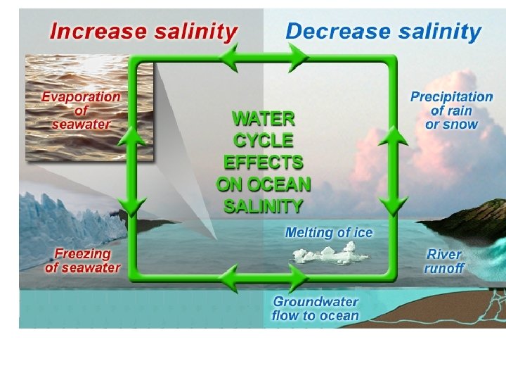
B. Factors affecting Salinity 1. Decreases Salinity because more water is added • • Icebergs melting Sea ice melting Precipitation (rain) Runoff (streams and rivers)
Natural Processes Affecting Salinity
B. Factors affecting Salinity 2. Increases Salinity because water is removed • • Evaporation Formation of sea ice
Global surface salinity Using the global surface salinity map, answer the following… 1. Where on Earth is the ocean the saltiest? 2. Why is the ocean saltier there?
1. Where on Earth is the ocean the saltiest? 2. Why is the ocean saltier there? Global surface Salinity
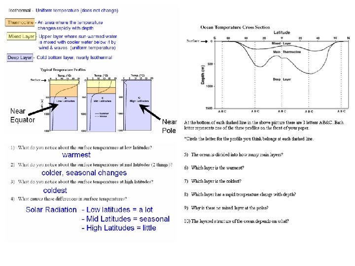
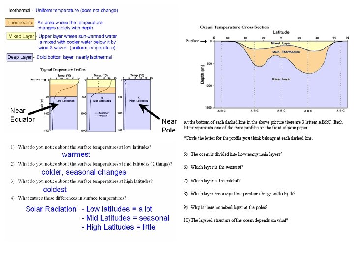
C. Ocean Temperature Variation 1. The surface temperature of the ocean varies with amount of sunlight it receives a. Low latitudes (equator)= lots of sunlight and has higher temperatures than high latitudes b. High latitudes (poles) = less sunlight and has lower temperatures
C. Ocean Temperature Variation 2. Temperature and depth of the ocean a. Surface water is warmed by sun and is usually warmer than deeper water
C. Ocean Temperature Variation b. Thermocline: layer of the ocean where there is a rapid change of temperature with depth • Not present in the high latitudes because the poles are cold at the surface
D. Ocean Density 1. Density is how heavy something is for its size (Density = mass/volume) 2. Density of water is affected by Cold water is more dense) a. Temperature (____ High salinity water is more dense) b. Salinity (_____
D. Ocean Density 3. Temperature plays a bigger role in density 4. High density seawater sinks below density seawater
D. Ocean Density 5. Pycnocline: The layer of the ocean where the density changes quickly a. Not found at high latitudes (poles)
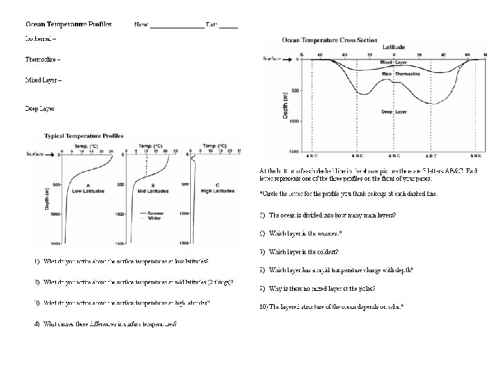
III. Ocean Layering EQ: How does the temperature of the ocean change with depth?
1. Isothermal - Uniform (even) temperature (does not change) 2. Transition Zone a. Thermocline - An area where the temperature changes rapidly with depth 3. Mixed Zone- Upper layer where sun-warmed water is mixed with cooler water below it by wind & waves. (uniform temperature) 4. Deep Zone - Cold bottom layer, nearly Isothermal
Near Equator Near Pole
warmest colder, seasonal changes coldest
warmest colder, seasonal changes coldest Solar Radiation - Low latitudes = a lot - Mid Latitudes = seasonal - High Latitudes = little
C B A B C
3 Mixed Zone Deep Zone Thermocline Not as much sunlight (cold) Amount of sunlight Temperature
V. Ocean Circulations EQ: How is surface water mixed around the globe?
A. Ocean Currents 1. Ocean currents are masses of ocean water that flow from one place to another (surface or deep below)
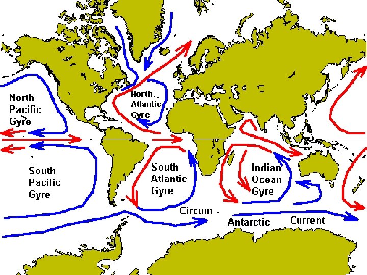
B. Surface Currents 1. Surface currents are horizontal movements of water a. Caused by wind (friction) b. Short lived c. Local 2. Gyres are huge circular moving currents a. Caused by wind b. Deflected by the Coriolis effect c. Global
B. Surface Currents 3. Coriolis effect: Because Earth’s rotation, currents are deflected to the right (clockwise) in the Northern hemisphere and to the left (counter clockwise) in the Southern hemisphere.
C. Ocean Currents and Climate 1. As warm equator (low latitude) currents move toward the poles (high latitude), they transfer their heat – This also warms the atmosphere 2. As cold polar (high latitude) currents move toward the equator (low latitude) they help to moderate the warm temperatures of the land nearby
C. Upwelling 1. Upwelling is a vertical movement caused by wind in which cold bottom water is brought up to the surface to replace warm surface water that has been blown away - It brings up nutrients which attracts plankton which attracts small fish which attracts big fish (& fishermen)
D. Upwelling • It brings up nutrients • which attracts plankton • which attracts small fish • which attracts big fish (& fishermen)
E. Density Currents (thermohaline current) 1. Temperature changes density • Cold (more dense)- sinks · Warm- floats 2. Salinity (amount of salt) changes density • • Freezing increases salinity (melting decreases) Evaporation increases salinity (rain decreases) v More salt means more dense 3. Vertical (up-down) current
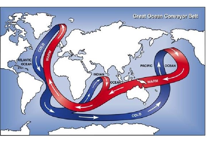
F. Conveyer Belt 1. Model of how water travels around the globe 2. Warm water travels to the poles • temperature drops and salinity increases • making it more dense • dense water sinks and moves towards the equator • cold, deep water upwells • upwelled water warms • cycle repeats