NWS Hazard Simplification Project Simplifying Clarifying Our Hazard
- Slides: 18

NWS Hazard Simplification Project: Simplifying & Clarifying Our Hazard Messages Darren Wright, National Marine Program Leader NWS Partners Webinar 1

Outline • NWS Watch, Warning and Advisory (WWA) system: • First Significant Repairs to the WWA System: Marine product “Reformatting & Consolidation” • Examples of “Reformatting & Consolidation” • Next Steps 2

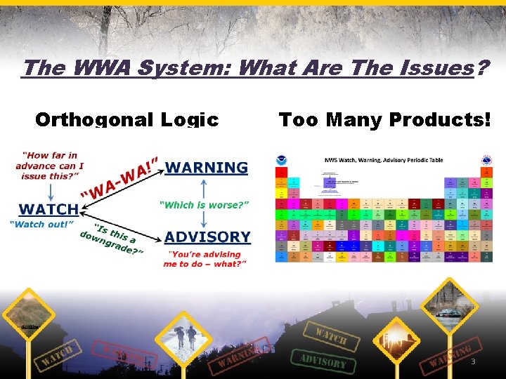
The WWA System: What Are The Issues? Orthogonal Logic Too Many Products! 3

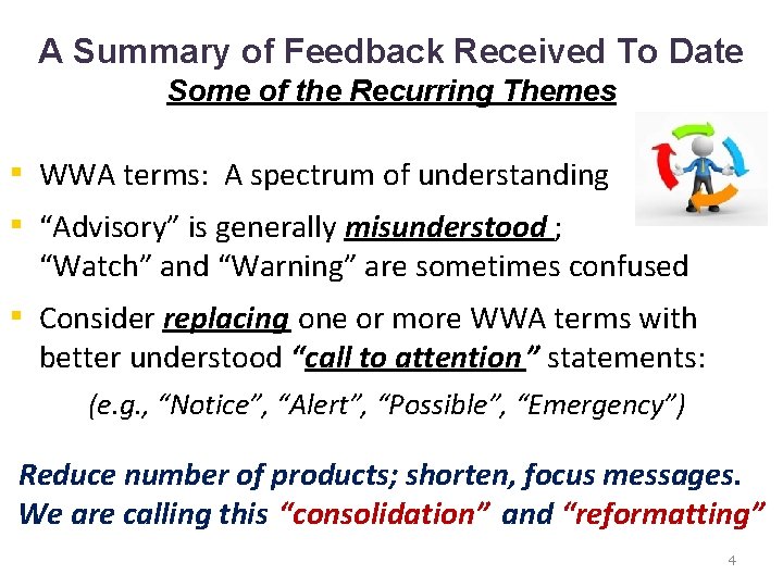
A Summary of Feedback Received To Date Some of the Recurring Themes ▪ WWA terms: A spectrum of understanding ▪ “Advisory” is generally misunderstood ; “Watch” and “Warning” are sometimes confused ▪ Consider replacing one or more WWA terms with better understood “call to attention ” statements: (e. g. , “Notice”, “Alert”, “Possible”, “Emergency”) Reduce number of products; shorten, focus messages. We are calling this “consolidation” and “reformatting” 4

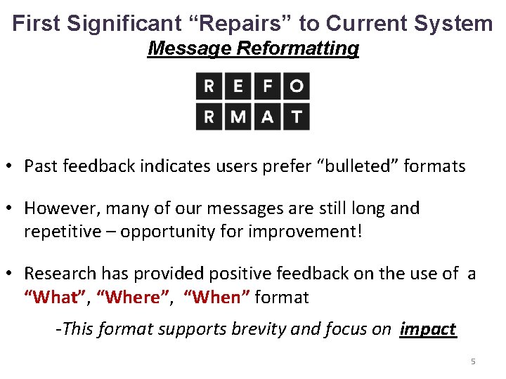
First Significant “Repairs” to Current System Message Reformatting • Past feedback indicates users prefer “bulleted” formats • However, many of our messages are still long and repetitive – opportunity for improvement! • Research has provided positive feedback on the use of a “What”, “Where”, “When” format -This format supports brevity and focus on impact 5

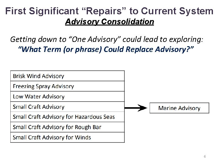
First Significant “Repairs” to Current System Advisory Consolidation Getting down to “One Advisory” could lead to exploring: “What Term (or phrase) Could Replace Advisory? ” 6

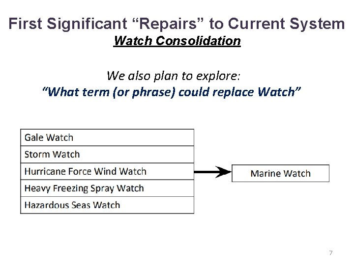
First Significant “Repairs” to Current System Watch Consolidation We also plan to explore: “What term (or phrase) could replace Watch” 7

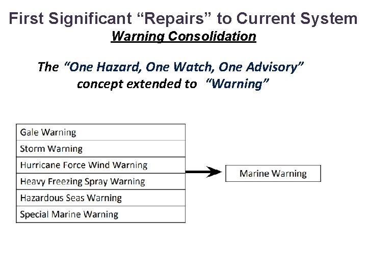
First Significant “Repairs” to Current System Warning Consolidation The “One Hazard, One Watch, One Advisory” concept extended to “Warning” 8

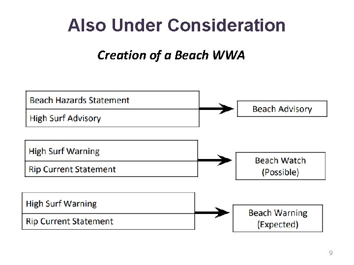
Also Under Consideration Creation of a Beach WWA 9

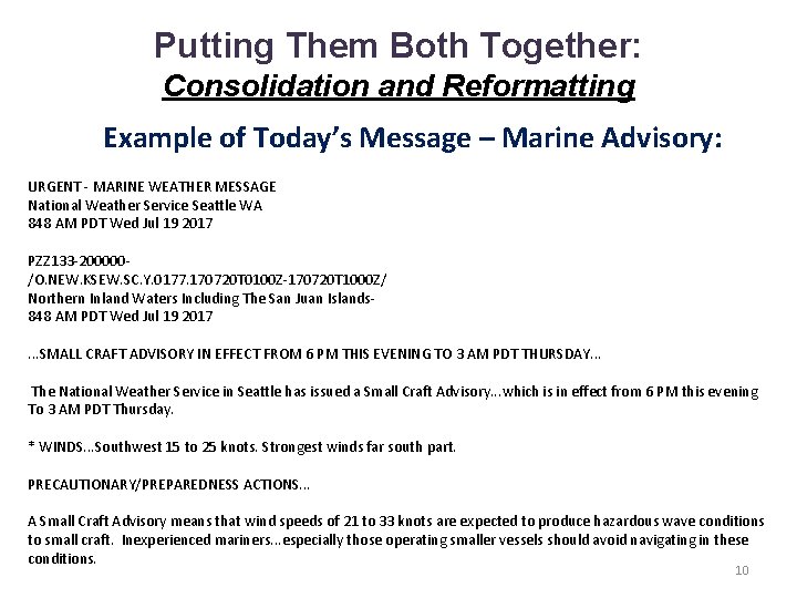
Putting Them Both Together: Consolidation and Reformatting Example of Today’s Message – Marine Advisory: URGENT - MARINE WEATHER MESSAGE National Weather Service Seattle WA 848 AM PDT Wed Jul 19 2017 PZZ 133 -200000/O. NEW. KSEW. SC. Y. 0177. 170720 T 0100 Z-170720 T 1000 Z/ Northern Inland Waters Including The San Juan Islands 848 AM PDT Wed Jul 19 2017. . . SMALL CRAFT ADVISORY IN EFFECT FROM 6 PM THIS EVENING TO 3 AM PDT THURSDAY. . . The National Weather Service in Seattle has issued a Small Craft Advisory. . . which is in effect from 6 PM this evening To 3 AM PDT Thursday. * WINDS. . . Southwest 15 to 25 knots. Strongest winds far south part. PRECAUTIONARY/PREPAREDNESS ACTIONS. . . A Small Craft Advisory means that wind speeds of 21 to 33 knots are expected to produce hazardous wave conditions to small craft. Inexperienced mariners. . . especially those operating smaller vessels should avoid navigating in these conditions. 10

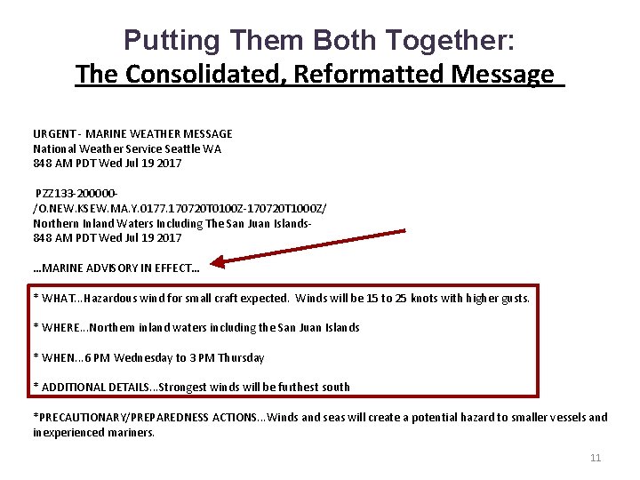
Putting Them Both Together: The Consolidated, Reformatted Message URGENT - MARINE WEATHER MESSAGE National Weather Service Seattle WA 848 AM PDT Wed Jul 19 2017 PZZ 133 -200000/O. NEW. KSEW. MA. Y. 0177. 170720 T 0100 Z-170720 T 1000 Z/ Northern Inland Waters Including The San Juan Islands 848 AM PDT Wed Jul 19 2017 …MARINE ADVISORY IN EFFECT… * WHAT. . . Hazardous wind for small craft expected. Winds will be 15 to 25 knots with higher gusts. * WHERE. . . Northern inland waters including the San Juan Islands * WHEN. . . 6 PM Wednesday to 3 PM Thursday * ADDITIONAL DETAILS. . . Strongest winds will be furthest south *PRECAUTIONARY/PREPAREDNESS ACTIONS. . . Winds and seas will create a potential hazard to smaller vessels and inexperienced mariners. 11

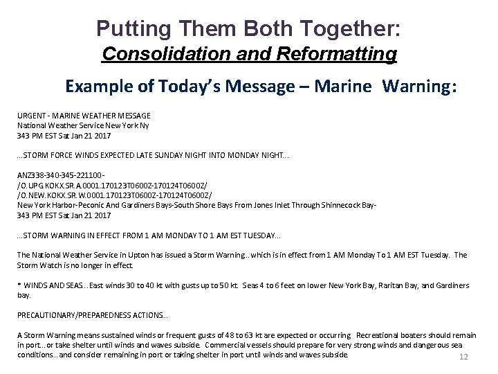
Putting Them Both Together: Consolidation and Reformatting Example of Today’s Message – Marine Warning: URGENT - MARINE WEATHER MESSAGE National Weather Service New York Ny 343 PM EST Sat Jan 21 2017 . . . STORM FORCE WINDS EXPECTED LATE SUNDAY NIGHT INTO MONDAY NIGHT. . . ANZ 338 -340 -345 -221100/O. UPG. KOKX. SR. A. 0001. 170123 T 0600 Z-170124 T 0600 Z/ /O. NEW. KOKX. SR. W. 0001. 170123 T 0600 Z-170124 T 0600 Z/ New York Harbor-Peconic And Gardiners Bays-South Shore Bays From Jones Inlet Through Shinnecock Bay 343 PM EST Sat Jan 21 2017. . . STORM WARNING IN EFFECT FROM 1 AM MONDAY TO 1 AM EST TUESDAY. . . The National Weather Service in Upton has issued a Storm Warning. . . which is in effect from 1 AM Monday To 1 AM EST Tuesday. The Storm Watch is no longer in effect. * WINDS AND SEAS. . . East winds 30 to 40 kt with gusts up to 50 kt. Seas 4 to 6 feet on lower New York Bay, Raritan Bay, and Gardiners bay. PRECAUTIONARY/PREPAREDNESS ACTIONS. . . A Storm Warning means sustained winds or frequent gusts of 48 to 63 kt are expected or occurring. Recreational boaters should remain in port. . . or take shelter until winds and waves subside. Commercial vessels should prepare for very strong winds and dangerous sea conditions. . . and consider remaining in port or taking shelter in port until winds and waves subside. 12

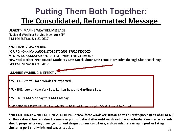
Putting Them Both Together: The Consolidated, Reformatted Message URGENT - MARINE WEATHER MESSAGE National Weather Service New York NY 343 PM EST Sat Jan 21 2017 ANZ 338 -340 -345 -221100/O. UPG. KOKX. MA. A. 0001. 170123 T 0600 Z-170124 T 0600 Z/ /O. NEW. KOKX. MA. W. 0001. 170123 T 0600 Z-170124 T 0600 Z/ New York Harbor-Peconic And Gardiners Bays-South Shore Bays From Jones Inlet Through Shinnecock Bay 343 PM EST Sat Jan 21 2017 …MARINE WARNING IN EFFECT… * WHAT. . . Storm Force Winds are expected. * WHERE. . . Lower New York Bay, Raritan Bay, and Gardiners Bay. * WHEN. . . 1 AM Monday to 1 AM Tuesday * ADDITIONAL DETAILS…East winds 30 to 40 kt with gusts up to 50 kt. Seas 4 to 6 feet. *PRECAUTIONARY/PREPAREDNESS ACTIONS. . . Storm force winds are sustained winds or frequent gusts of 48 to 63 kt. Recreational boaters should remain in port, or take shelter until winds and waves subside. Commercial vessels should prepare for very strong winds and dangerous sea conditions, and consider remaining in port or taking shelter in port until winds and waves subside. 13

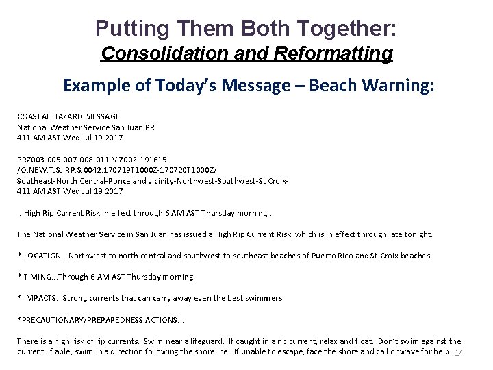
Putting Them Both Together: Consolidation and Reformatting Example of Today’s Message – Beach Warning: COASTAL HAZARD MESSAGE National Weather Service San Juan PR 411 AM AST Wed Jul 19 2017 PRZ 003 -005 -007 -008 -011 -VIZ 002 -191615/O. NEW. TJSJ. RP. S. 0042. 170719 T 1000 Z-170720 T 1000 Z/ Southeast-North Central-Ponce and vicinity-Northwest-Southwest-St Croix 411 AM AST Wed Jul 19 2017. . . High Rip Current Risk in effect through 6 AM AST Thursday morning. . . The National Weather Service in San Juan has issued a High Rip Current Risk, which is in effect through late tonight. * LOCATION. . . Northwest to north central and southwest to southeast beaches of Puerto Rico and St Croix beaches. * TIMING. . . Through 6 AM AST Thursday morning. * IMPACTS. . . Strong currents that can carry away even the best swimmers. *PRECAUTIONARY/PREPAREDNESS ACTIONS. . . There is a high risk of rip currents. Swim near a lifeguard. If caught in a rip current, relax and float. Don’t swim against the current. if able, swim in a direction following the shoreline. If unable to escape, face the shore and call or wave for help. 14

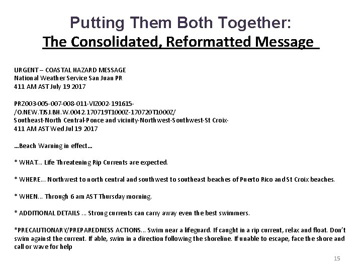
Putting Them Both Together: The Consolidated, Reformatted Message URGENT – COASTAL HAZARD MESSAGE National Weather Service San Juan PR 411 AM AST July 19 2017 PRZ 003 -005 -007 -008 -011 -VIZ 002 -191615/O. NEW. TJSJ. BH. W. 0042. 170719 T 1000 Z-170720 T 1000 Z/ Southeast-North Central-Ponce and vicinity-Northwest-Southwest-St Croix 411 AM AST Wed Jul 19 2017 …Beach Warning in effect… * WHAT. . . Life Threatening Rip Currents are expected. * WHERE. . . Northwest to north central and southwest to southeast beaches of Puerto Rico and St Croix beaches. * WHEN. . . Through 6 am AST Thursday morning. * ADDITIONAL DETAILS. . . Strong currents can carry away even the best swimmers. *PRECAUTIONARY/PREPAREDNESS ACTIONS. . . Swim near a lifeguard. If caught in a rip current, relax and float. Don’t swim against the current. If able, swim in a direction following the shoreline. If unable to escape, face the shore and call or wave for help 15

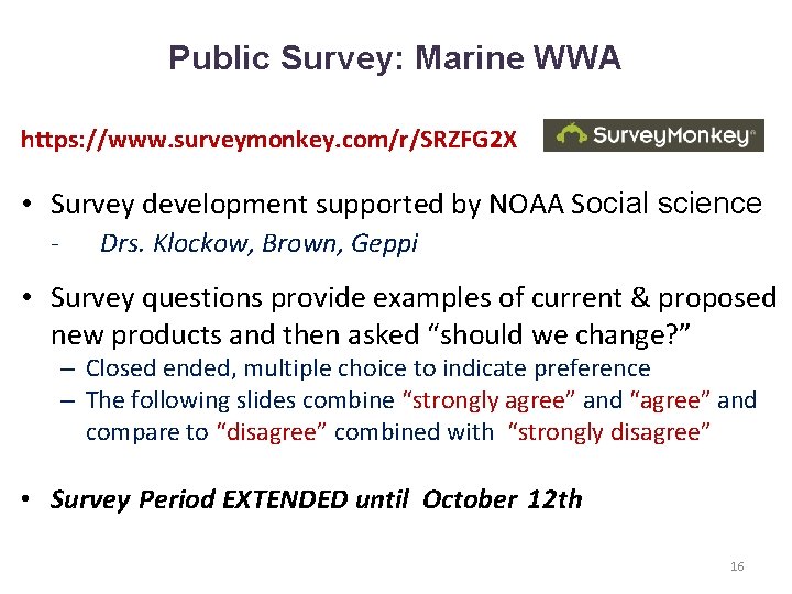
Public Survey: Marine WWA https: //www. surveymonkey. com/r/SRZFG 2 X • Survey development supported by NOAA Social science - Drs. Klockow, Brown, Geppi • Survey questions provide examples of current & proposed new products and then asked “should we change? ” – Closed ended, multiple choice to indicate preference – The following slides combine “strongly agree” and “agree” and compare to “disagree” combined with “strongly disagree” • Survey Period EXTENDED until October 12 th 16

Summary/Next Steps ▪ Public survey closes October 12. ▪ Any implemented changes would take effect no sooner than fall of 2018. ▪ No major software changes are needed for VTEC; some VTEC codes will simply be “retired”. 17

Thank You!. . . Your Feedback Is Welcome hazsimp@noaa. gov Darren Wright (darren. wright@noaa. gov) Survey - https: //www. surveymonkey. com/r/SRZFG 2 X 18