NWP Strategy of DWD 2005 2006 after 2006
- Slides: 11

NWP Strategy of DWD 2005 -2006 after 2006 GF XY DWD

2005 -2006 q. Global Forcast system GME – Resolution has been enhanced – Grid size 40 km – Levels: 40 km – Multi level soil model – Data Assimilation – Assimilation of radiances with 1 d-Var end of 2005 – 3 d-Var will replace OI end of 2006 – Observation space – flow dependent structure functions GF XY DWD 11/26/2020

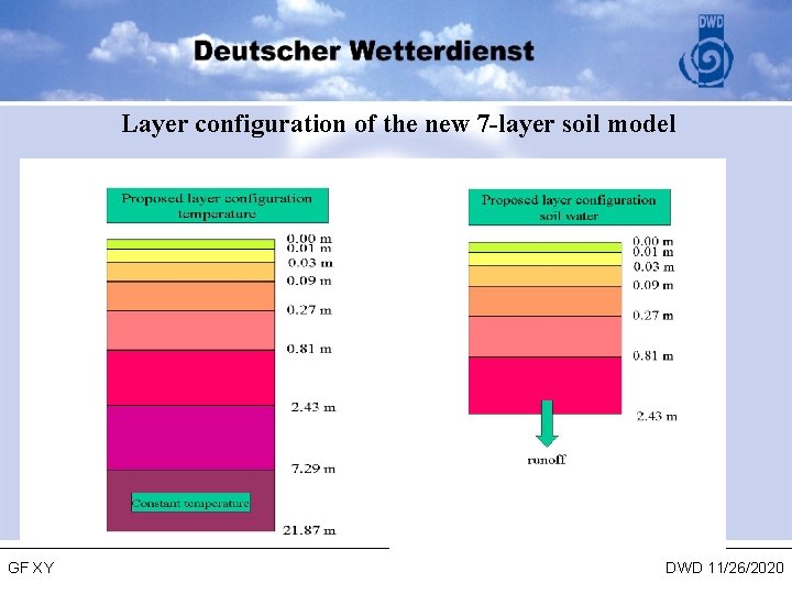
Layer configuration of the new 7 -layer soil model GF XY DWD 11/26/2020

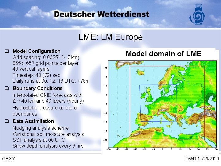
2005 -2006 q. Local Model Version LME – Extension of the model domain (covers Europe, Mediterranean Sea, Black Sea, North Sea, Baltic Sea) – Extension of the forecast range to 3 days – Operation will start on 28 September 2005 – 40 layers – Multi layer soil model – 1 d-Var assimilation of satellite observations (COSMO priority pilot project) – use of European wind profilers GF XY DWD 11/26/2020

LME: LM Europe q Model Configuration Grid spacing: 0. 0625° (~ 7 km) 665 x 657 grid points per layer 40 vertical layers Timestep: 40 (72) sec Daily runs at 00, 12, 18 UTC, +78 h q Boundary Conditions Interpolated GME forecasts with Δ ~ 40 km and 40 layers (hourly) Hydrostatic pressure at lateral boundaries q Data Assimilation Nudging analysis scheme Variational soil moisture analysis SST analysis at 00 UTC Snow depth analysis every 6 hrs GF XY Model domain of LME DWD 11/26/2020

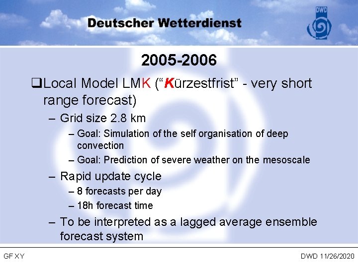
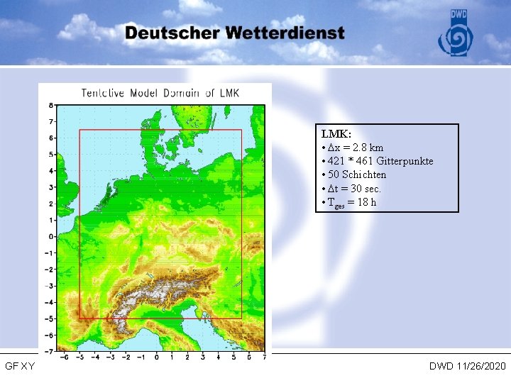
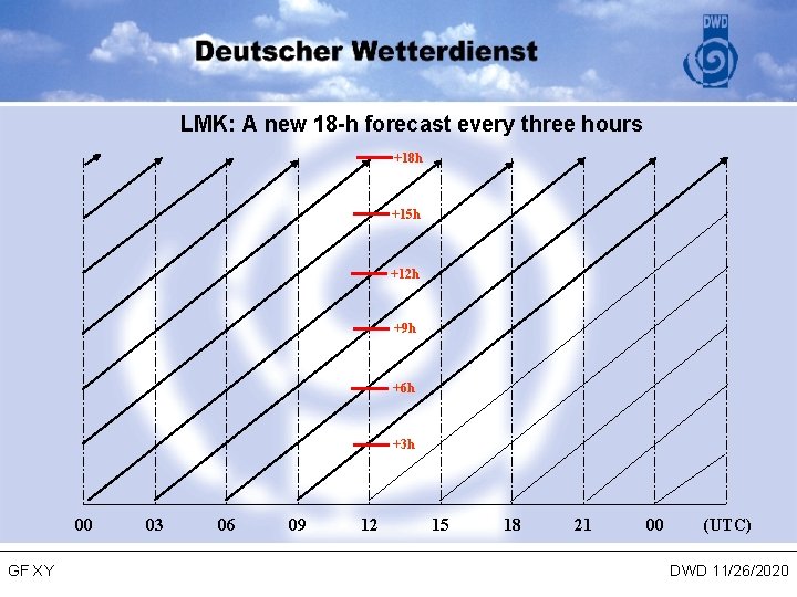
2005 -2006 q. Local Model LMK (“Kürzestfrist” - very short range forecast) – Grid size 2. 8 km – Goal: Simulation of the self organisation of deep convection – Goal: Prediction of severe weather on the mesoscale – Rapid update cycle – 8 forecasts per day – 18 h forecast time – To be interpreted as a lagged average ensemble forecast system GF XY DWD 11/26/2020

LMK: • x = 2. 8 km • 421 * 461 Gitterpunkte • 50 Schichten • t = 30 sec. • Tges = 18 h GF XY DWD 11/26/2020

LMK: A new 18 -h forecast every three hours +18 h +15 h +12 h +9 h +6 h +3 h 00 GF XY 03 06 09 12 15 18 21 00 (UTC) DWD 11/26/2020

2007 -2010 q. Computer resources – Extension of factor 10 of the performance in 2008 (request has not been approved by the German Government) q. Ensemble Prediction System basing on LME and LMK GF XY DWD 11/26/2020

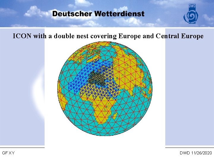
2007 -2010 q New unified global and regional forecast model ICON – – – Global model – limited area model Triangular grid Local grid refinement Compressible, conservation properties (mass, energy, . . . ) to be used for weather forecasting and climate modelling joint development with Max-Planck-Institute for Meteorology and Universities – http: //icon. enes. org GF XY DWD 11/26/2020

ICON with a double nest covering Europe and Central Europe GF XY DWD 11/26/2020