
NowcastForecast System of Prince William Sound Alaska PWSNFS



- Slides: 32
Nowcast/Forecast System of Prince William Sound, Alaska (PWS-NFS) INKWEON BANG CHRISTOPHER N. K. MOOERS OCEAN PREDICTION EXPERIMENTAL LABORATORY (OPEL) RSMAS, UNIVERSITY OF MIAMI, FLORIDA, USA
Outline • • • Introduction PWS-NFS with NDBC Wind PWS-NFS with PWS-RAMS Wind Process and Validation Studies Challenges
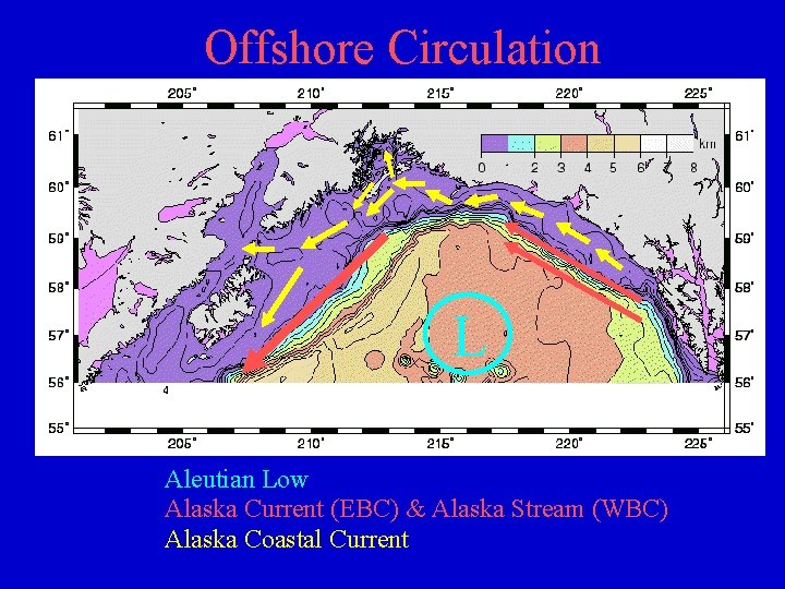
Offshore Circulation L Aleutian Low Alaska Current (EBC) & Alaska Stream (WBC) Alaska Coastal Current
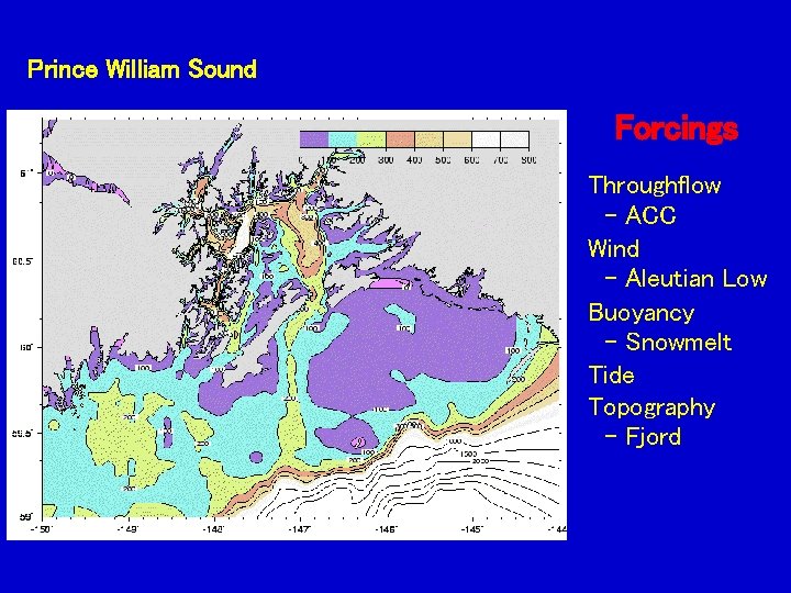
Prince William Sound Forcings Throughflow - ACC Wind - Aleutian Low Buoyancy - Snowmelt Tide Topography - Fjord
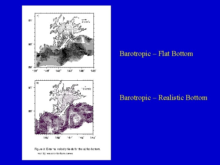
Barotropic – Flat Bottom Barotropic – Realistic Bottom
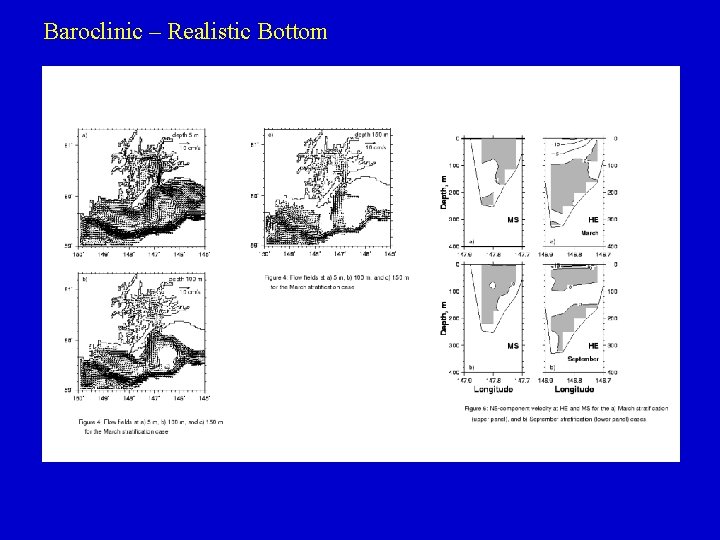
Baroclinic – Realistic Bottom
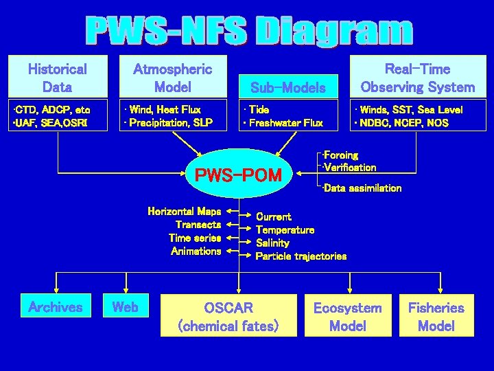
Historical Data Atmospheric Model Sub-Models • CTD, ADCP, etc • UAF, SEA, OSRI • Wind, Heat Flux • Precipitation, SLP • Tide • Freshwater Flux PWS-POM Horizontal Maps Transects Time series Animations Archives Web Real-Time Observing System • Winds, SST, Sea Level • NDBC, NCEP, NOS • Forcing • Verification • Data assimilation Current Temperature Salinity Particle trajectories OSCAR (chemical fates) Ecosystem Model Fisheries Model
Model Domain and Locations of Observations by NDBC, NOS, PWSSC
Attributes of PWS-POM • • • North of HE & MS expand to NGOA (North of 59 o. N, 150 o. W ~ 145 o. W) 0. 01 o 0. 02 o (~1. 1 km) 15 levels more vertical levels (26 levels) External timestep = 5 seconds, Internal timestep = 2. 5 minutes HORCON = 0. 2, TPRNI=1. 0 HORCON = 0. 1, TPRNI=0. 2 Maximum depth = 500 m full depth Climatological T/S at open boundary from a larger domain model (Global NCOM) Radiation boundary condition at open boundary Mellor-Yamada 2. 5 vertical turbulence closure scheme Smagorinsky horizontal turbulence closure scheme
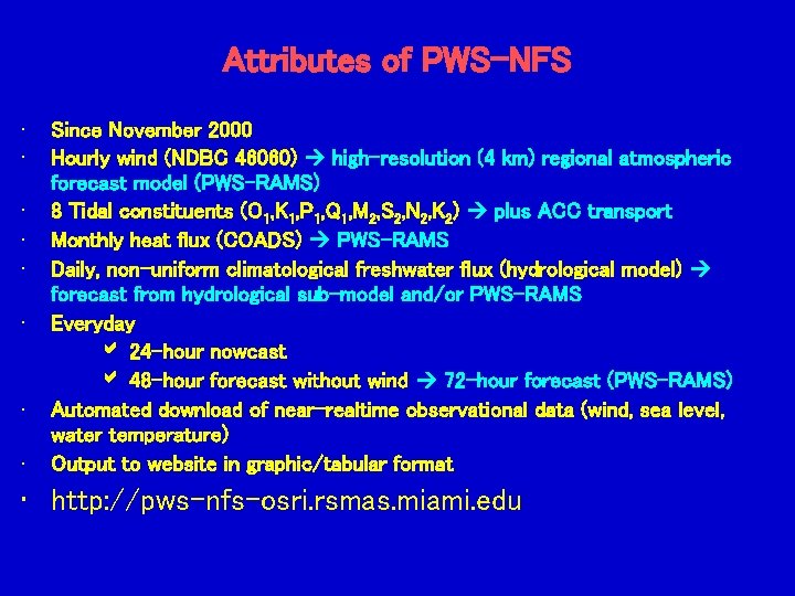
Attributes of PWS-NFS • • Since November 2000 Hourly wind (NDBC 46060) high-resolution (4 km) regional atmospheric forecast model (PWS-RAMS) 8 Tidal constituents (O 1, K 1, P 1, Q 1, M 2, S 2, N 2, K 2) plus ACC transport Monthly heat flux (COADS) PWS-RAMS Daily, non-uniform climatological freshwater flux (hydrological model) forecast from hydrological sub-model and/or PWS-RAMS Everyday 24 -hour nowcast 48 -hour forecast without wind 72 -hour forecast (PWS-RAMS) Automated download of near-realtime observational data (wind, sea level, water temperature) Output to website in graphic/tabular format • http: //pws-nfs-osri. rsmas. miami. edu
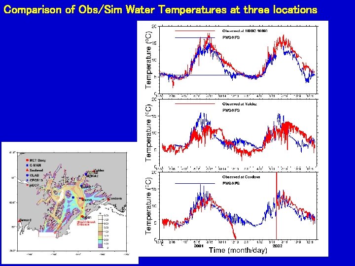
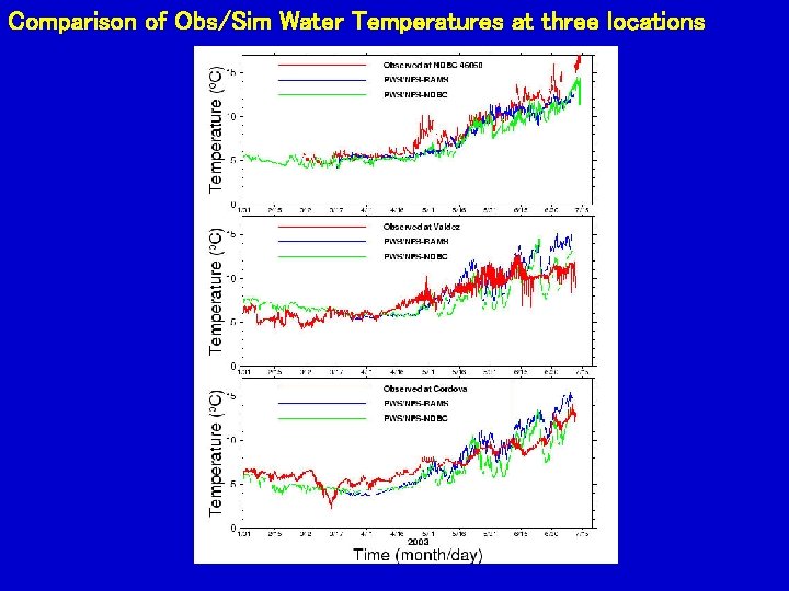
Comparison of Obs/Sim Water Temperatures at three locations
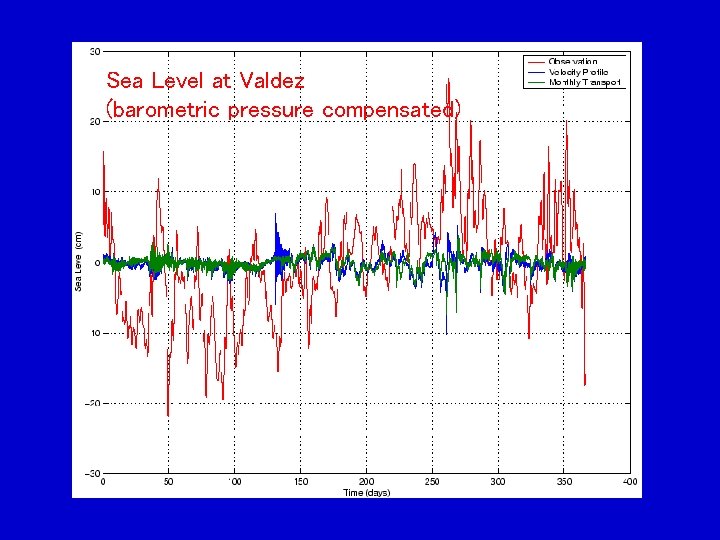
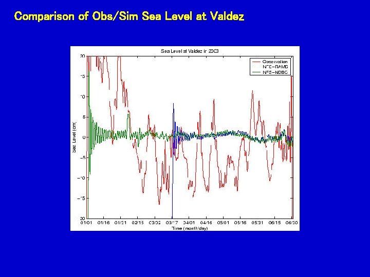
Sea Level at Valdez (barometric pressure compensated)
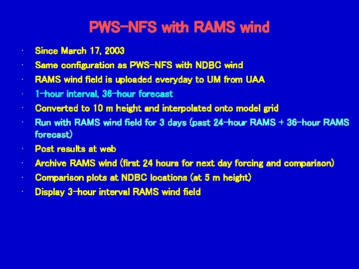
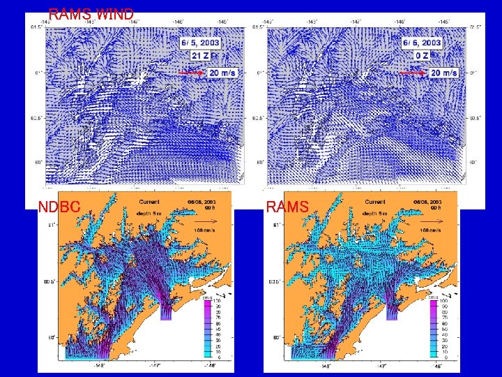
PWS-NFS with RAMS wind • • • Since March 17, 2003 Same configuration as PWS-NFS with NDBC wind RAMS wind field is uploaded everyday to UM from UAA 1 -hour interval, 36 -hour forecast Converted to 10 m height and interpolated onto model grid Run with RAMS wind field for 3 days (past 24 -hour RAMS + 36 -hour RAMS forecast) Post results at web Archive RAMS wind (first 24 hours for next day forcing and comparison) Comparison plots at NDBC locations (at 5 m height) Display 3 -hour interval RAMS wind field
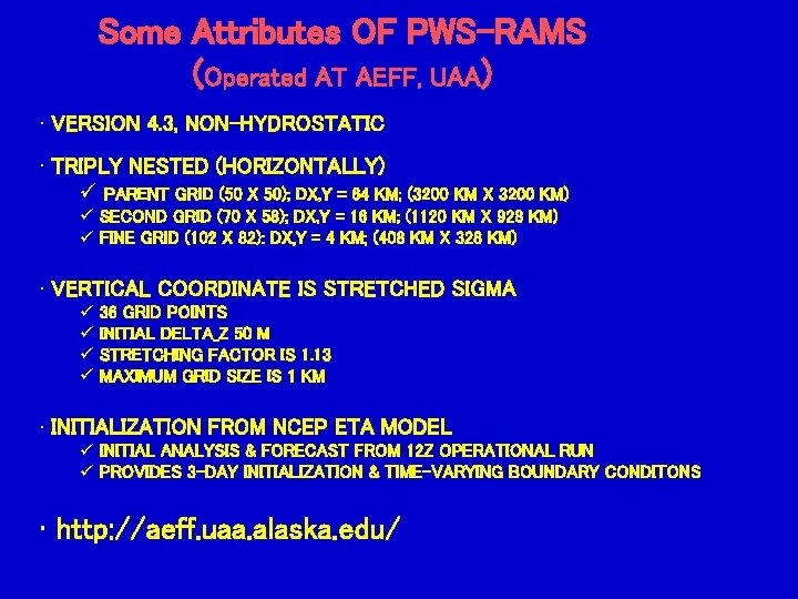
Some Attributes OF PWS-RAMS (Operated AT AEFF, UAA) • VERSION 4. 3, NON-HYDROSTATIC • TRIPLY NESTED (HORIZONTALLY) ü PARENT GRID (50 X 50); DX, Y = 64 KM; (3200 KM X 3200 KM) ü SECOND GRID (70 X 58); DX, Y = 16 KM; (1120 KM X 928 KM) ü FINE GRID (102 X 82): DX, Y = 4 KM; (408 KM X 328 KM) • VERTICAL COORDINATE IS STRETCHED SIGMA ü 36 GRID POINTS ü INITIAL DELTA_Z 50 M ü STRETCHING FACTOR IS 1. 13 ü MAXIMUM GRID SIZE IS 1 KM • INITIALIZATION FROM NCEP ETA MODEL ü INITIAL ANALYSIS & FORECAST FROM 12 Z OPERATIONAL RUN ü PROVIDES 3 -DAY INITIALIZATION & TIME-VARYING BOUNDARY CONDITONS • http: //aeff. uaa. alaska. edu/
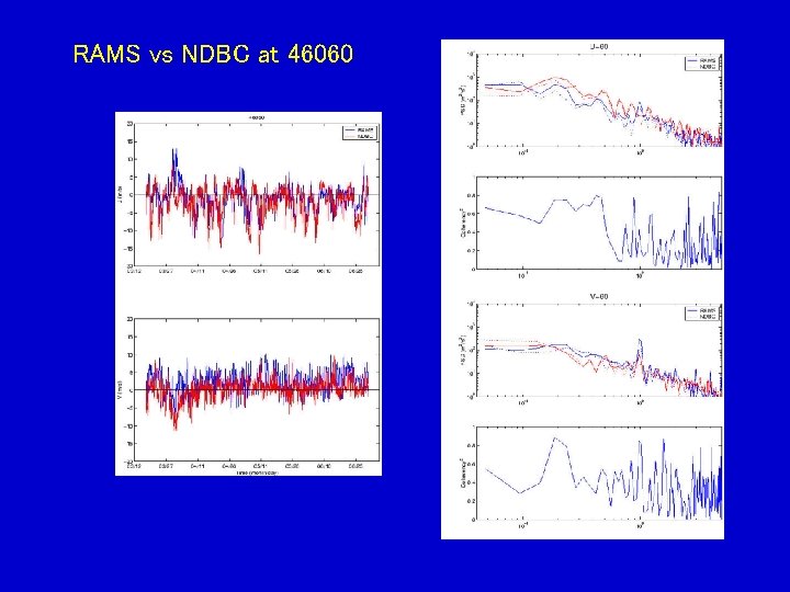
RAMS vs NDBC at 46060
RAMS WIND NDBC RAMS
Comparison of Obs/Sim Water Temperatures at three locations
Comparison of Obs/Sim Sea Level at Valdez
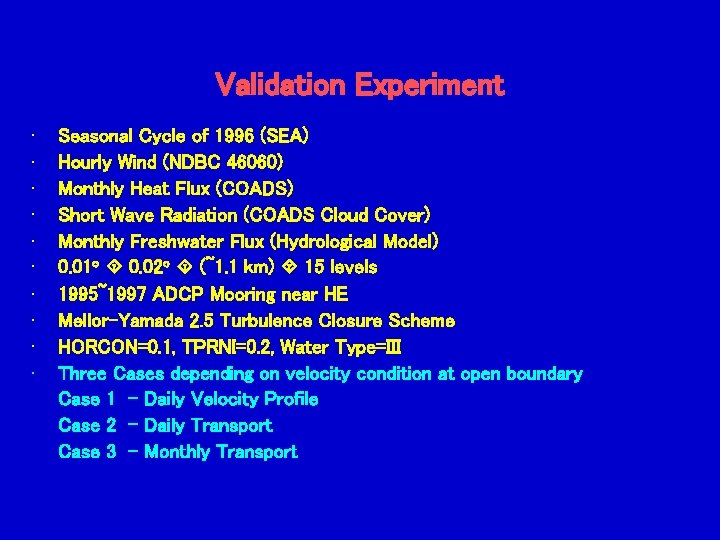
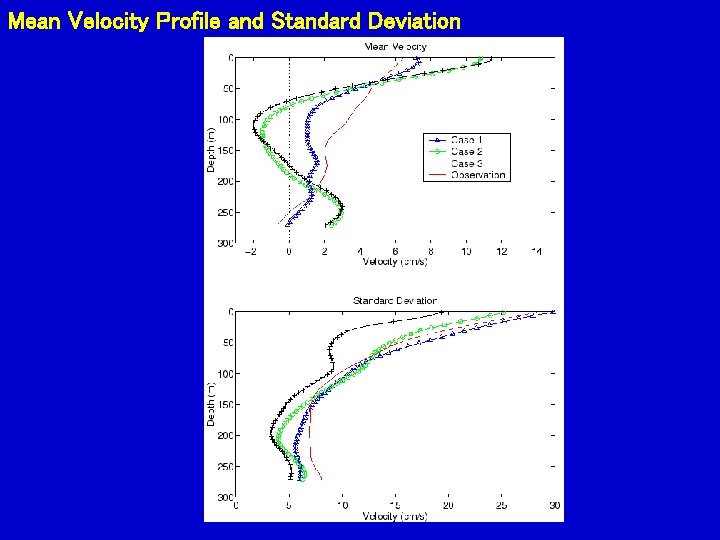
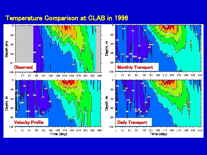
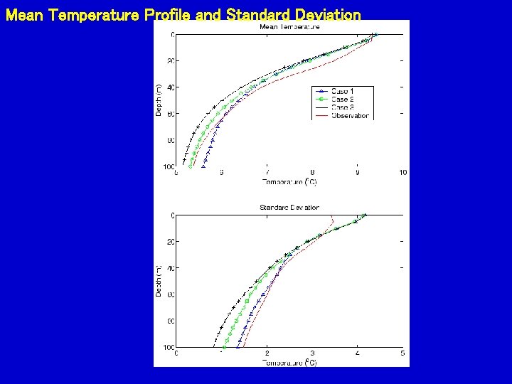
Validation Experiment • • • Seasonal Cycle of 1996 (SEA) Hourly Wind (NDBC 46060) Monthly Heat Flux (COADS) Short Wave Radiation (COADS Cloud Cover) Monthly Freshwater Flux (Hydrological Model) 0. 01 o 0. 02 o (~1. 1 km) 15 levels 1995~1997 ADCP Mooring near HE Mellor-Yamada 2. 5 Turbulence Closure Scheme HORCON=0. 1, TPRNI=0. 2, Water Type=III Three Cases depending on velocity condition at open boundary Case 1 - Daily Velocity Profile Case 2 - Daily Transport Case 3 - Monthly Transport
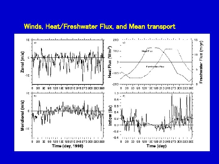
Winds, Heat/Freshwater Flux, and Mean transport
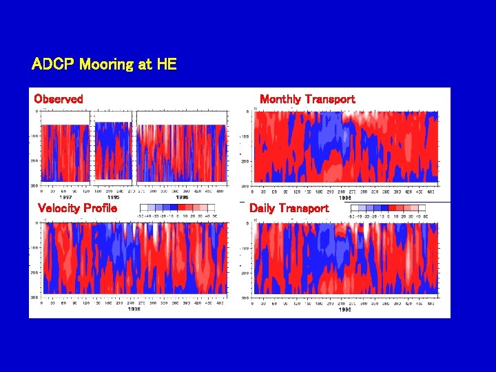
ADCP Mooring at HE Observed Velocity Profile Monthly Transport Daily Transport
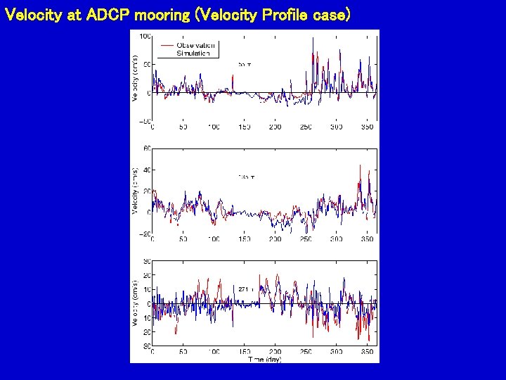
Velocity at ADCP mooring (Velocity Profile case)
Mean Velocity Profile and Standard Deviation
Temperature Comparison at CLAB in 1996 Observed Monthly Transport Velocity Profile Daily Transport
Mean Temperature Profile and Standard Deviation
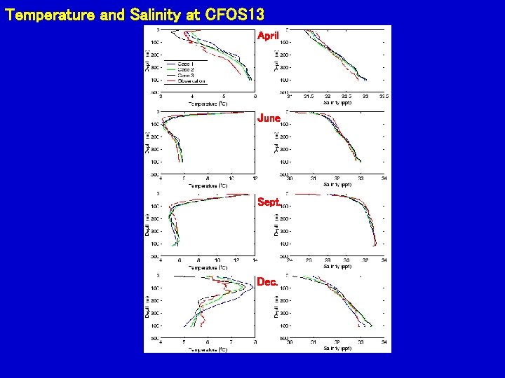
Temperature and Salinity at CFOS 13 April June Sept. Dec.
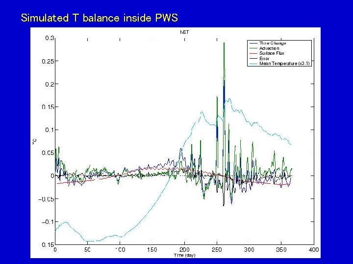
Simulated T balance inside PWS
Decomposition of T/S advection [RIGHT COLUMN: T = S]
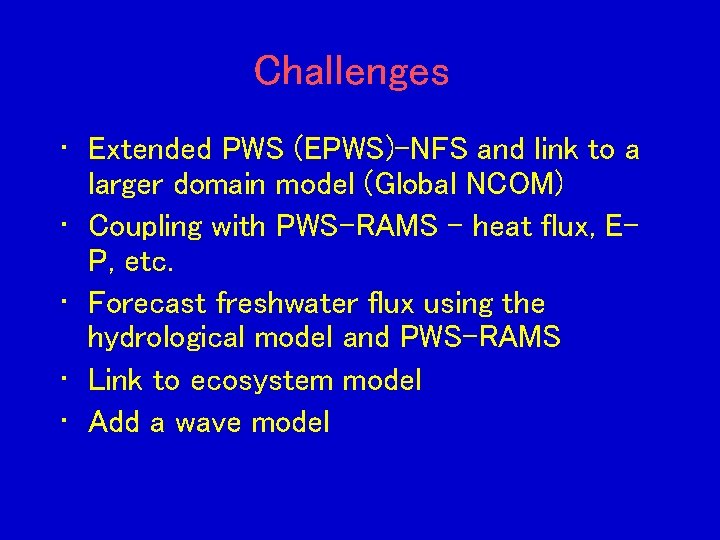
Challenges • Extended PWS (EPWS)-NFS and link to a larger domain model (Global NCOM) • Coupling with PWS-RAMS – heat flux, EP, etc. • Forecast freshwater flux using the hydrological model and PWS-RAMS • Link to ecosystem model • Add a wave model
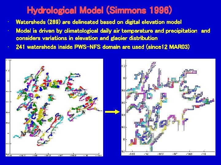
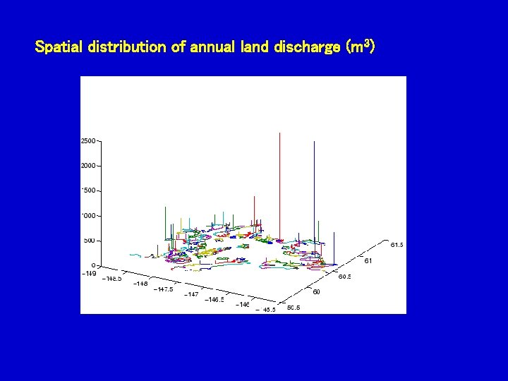
Hydrological Model (Simmons 1996) • • • Watersheds (289) are delineated based on digital elevation model Model is driven by climatological daily air temperature and precipitation and considers variations in elevation and glacier distribution 241 watersheds inside PWS-NFS domain are used (since 12 MAR 03)
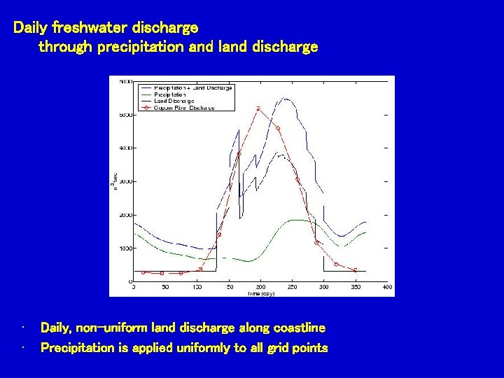
Daily freshwater discharge through precipitation and land discharge • • Daily, non-uniform land discharge along coastline Precipitation is applied uniformly to all grid points
Spatial distribution of annual land discharge (m 3)