North South Take Different Paths CHAPTER 11 Challenges


- Slides: 24
North & South Take Different Paths CHAPTER 11
Challenges of Growth 11. 4 Focus Question: How did Westward expansion intensify the debate over slavery?
Moving West
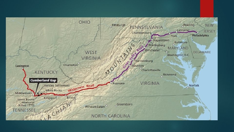
Challenges of Growth 11. 4 1775 – Daniel Boone, the most famous early pioneer, organized a group of 30 men to clear a new route to the West. The Wilderness Road = main route across the Appalachians
Challenges of Growth 11. 4 As western populations grew, many areas applied to become states. Even though the Northwest Ordinance was passed under the Articles of Confederation (while the Constitutional Convention was meeting in Philadelphia, PA), it remained the policy for adopting new states under the Constitution.
NW Ordinance 3 -Step Process to Statehood: 1. When territory was just being settled, Congress would appoint a governor, secretary, and 3 judges. 2. Once territory had 5, 000 free adult male settlers, it could elect a legislature. 3. When population reached 60, 000 it could apply for statehood.
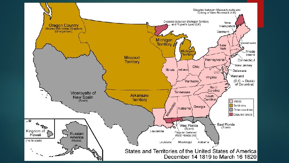
Challenges of Growth 11. 4 From 1792 – 1819 a total of 8 states joined the Union: Kentucky (1792) Ohio (1803) Indiana (1816) Illinois (1818) Tennessee (1796) Louisiana (1812) Mississippi (1817) Alabama (1819)
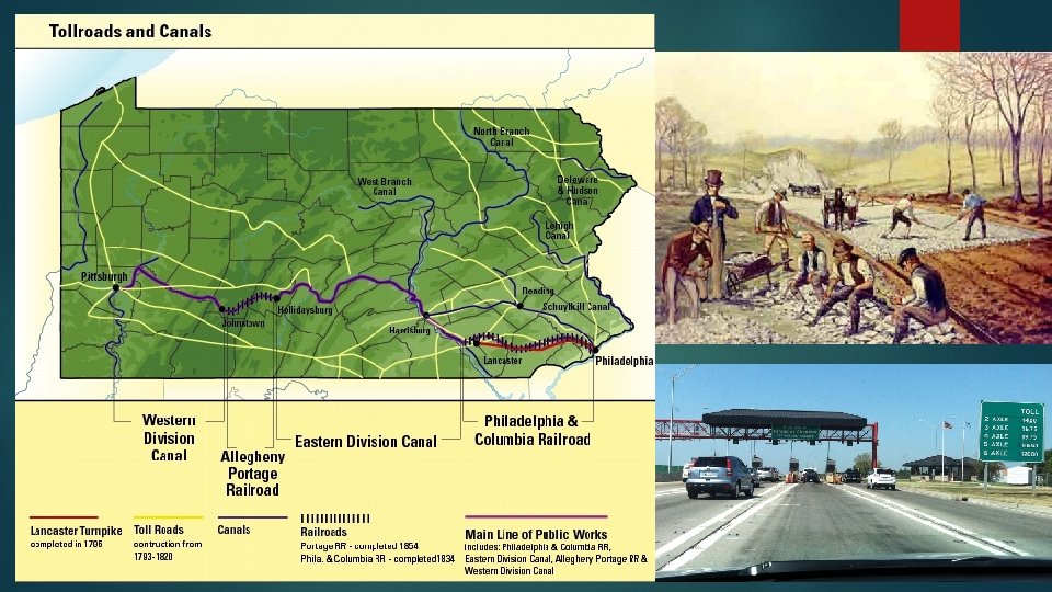
Challenges of Growth 11. 4 Private companies began building turnpikes, where travelers would have to pay a toll to pass on the road. 1795 – Lancaster Turnpike between Lancaster and Pennsylvania in Philadelphia became the 1 st long-distance stone road in the U. S.
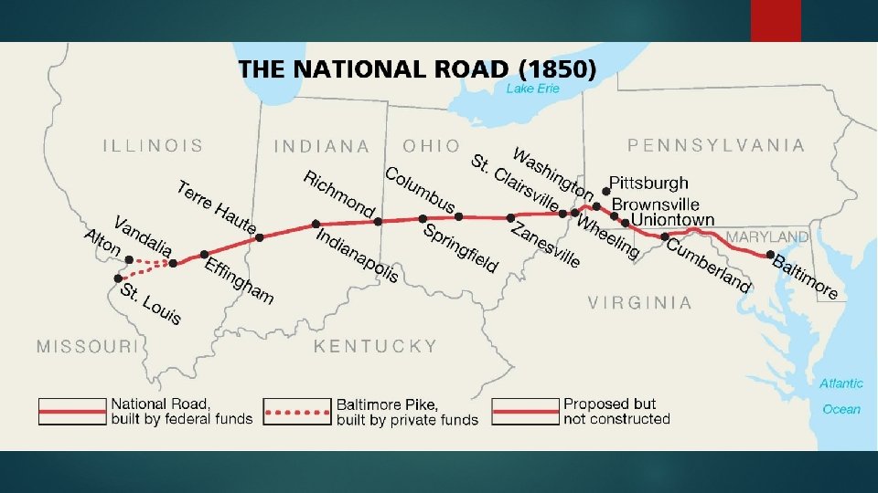
Challenges of Growth 11. 4 The National Road was the 1 st federally funded road. Construction began in 1811 in Maryland, stretching to western Virginia. By 1850 it reached Illinois.
Challenges of Growth 11. 4 Fastest, cheapest way to ship goods was by water. Major rivers ran North/South Solution = canals built East to West Canal = channel dug across land filled with water
Challenges of Growth 11. 4 1825 - The Erie Canal connected the Hudson River to Lake Erie in New York, allowing goods to be moved from the Midwest down the Hudson to New York City. NYC became the richest city in the nation!
https: //www. youtube. com/watch? v=o. Mz 7 e. Cj 732 w
https: //www. youtube. com/watch? v=EIOZcf. HJo. F 8
Challenges of Growth 11. 4 Biggest issue of Westward Expansion = Slavery!!! The Free-Soilers Political party that emerged in mid-19 th century. Northerners who opposed slavery in new territories. Objections based on economics, not moral convictions against slavery. Believed slavery drove down wages for white workers.
Challenges of Growth 11. 4 1819 – U. S. had 11 free states & 11 slave states Missouri had been seeking statehood, as a slave state, for 2 years. Northerners totally opposed! Another slave state would tip the balance in the Senate, making the South more powerful.
Challenges of Growth 11. 4 During the next session of Congress, Maine applied for statehood as a “free” state. Admission of both a slave state & a free state would maintain balance in the Senate!
Challenges of Growth 11. 4 1820 – Senator Henry Clay persuaded Congress to adopt the Missouri Compromise! 1. 2. 3. 4. Maine would be admitted as a free state Missouri as a slave state Louisiana Territory north of Missouri would be free Southern slave owners could hunt escaped fugitives into “free” regions and return them to slavery.
https: //www. youtube. com/watch? v=sd 5 F 6 En. H 6 I 0
Challenges of Growth 11. 4 Debate over Missouri Compromise Southerners = Angry Congress had given itself power to regulate slavery Northerners = Angry Congress allowed slavery to expand into another state