North America Provinces and Territories of Canada Provinces


- Slides: 17
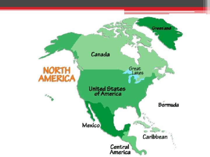
North America
Provinces and Territories of Canada Provinces: Alberta, British Columbia, Manitoba, New Brunswick, Newfoundland Labrador, Nova Scotia, Ontario, Prince Edward Island, Quebec, and Saskatchewan. Territories: Northwest Territories, Nunavut, and Yukon.
Nunavut The newest, largest, northernmost, and least populous territory of Canada established April 1 1999 Its islands have expanses of tundra, craggy mountains and remote villages accessible only by plane or boat.
The Great Lakes • Lakes Superior, Michigan, Huron, Erie, and Ontario • Created by glacial erosion. • The largest system of fresh surface water on earth, containing roughly 18% of the world's fresh surface water.
North America • The third-largest continent • Divided into five physical regions: - Mountainous west - Great Plains - Canadian Shield - Eastern region - Caribbean
The Rockies • The Rockies are North America’s largest mountain chain • Stretch from the province of British Columbia, Canada, to the U. S. state of New Mexico. • The Rocky Mountains are part of a system of parallel mountain ranges known as the Cordilleras.
The Cordilleras • A long series of mountain ranges including the volcanic mountain ranges in Guatemala, Honduras, Nicaragua, Costa Rica, and Panama **Volcanic eruptions and earthquakes occur frequently in this region. - destroy towns and cities. - rich, fertile soils
Earth’s youngest mountains • Cascade Range of the U. S. states of Washington, Oregon, and California. • Formed only about a million years ago—a blink of an eye in Earth’s long history.
The Great Plains • The Great Plains lie in the middle of the continent in Canada and the United States. • Rich deposits of oil and natural gas, and deep, rich soil • Called the “Breadbasket of North America, ” because grain grown in this region feeds a large part of the world.
Agricultural Wonderland • Much of the fertile soil was formed from material deposited during the most recent glacial period 18 000 years ago. • As glaciers retreated, streams of melted ice dropped sediment on the land, building layers of productive soil.
The Canadian Shield • The Canadian Shield is a raised but relatively flat plateau. • Extends over eastern, central, and northwestern Canada. • Characterized by a rocky landscape with an astounding number of lakes.
Biome in the Canadian Shield • The tundra is a biome common to the Canadian Shield. • Tundra is where low temperatures and precipitation levels hinder tree growth. • The tundra is characterized by permafrost—soil that is frozen for two or more years.
Eastern region of North America • This varied region extends from the wetland regions east of the mountains toward the sandy beaches of the Atlantic coast. • Mined for rich deposits of coal and other minerals
Biome in the Eastern region of North America • Wetland areas are a biome of the eastern region and consist of areas of land whose soil is saturated with permanent or seasonal moisture. • The Florida Everglades is the largest wetland system in the United States
Caribbean Region of North America • The Caribbean Region includes more than 7, 000 islands, islets, reefs, and cays. • Some have relatively flat and sandy terrain while others are rugged, mountainous, and volcanic.
Biome of the Caribbean Region • The coral reefs of the Caribbean Sea are among the most spectacular biomes in North America. • • Coral reefs are made of millions of tiny animals—corals—that form a hard shell around their bodies. • Brightly colored tropical fish, as well as sharks, sea turtles, sea stars, and sea horses, are animals native to the Caribbean’s coral reefs.