NOAAs National Weather Service IFPNDFD Conceptual Overview Michael
- Slides: 29

NOAA’s National Weather Service IFP/NDFD Conceptual Overview Michael Tomlinson Office of Climate Water and Weather Services NWS Partners’ Workshop September 11, 2003

The NWS Strategic Plan Deliver a credible, timely, and relevant suite of seamless weather, water, and climate products and services which exploit technology to the fullest to meet customer and partner needs. § Post NWS products and data on the Internet in graphic-oriented format (2002) § Prepare and disseminate NWS forecast products in digital form (2003)

Benefits of Interactive Forecast Preparation (IFP) – Maximizes human contribution to forecast process – Provides more forecast detail in time and space – Enables more effective communication with users (e. g. , graphics) – Increases the usefulness of NWS forecasts to customers and partners

How Does IFP Work? – A 7 -day digital forecast database is established at each WFO – Forecasters continuously interactively modify the contents of the database using the latest observations and model guidance – NWS text, tabular, voice, and graphic products are generated from the database – The database itself is provided as an NWS product to customers and partners

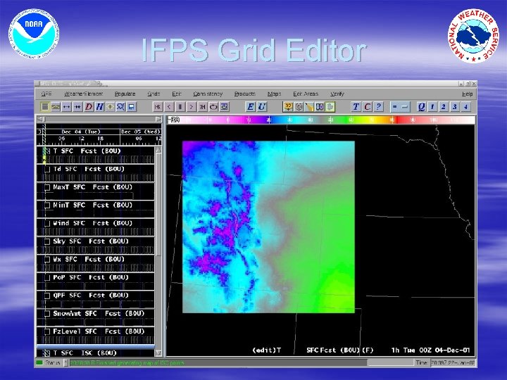
IFPS Grid Editor

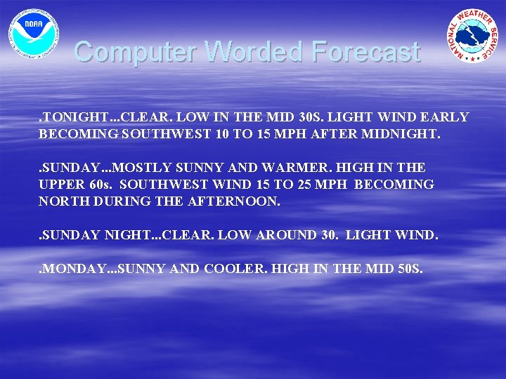
Computer Worded Forecast. TONIGHT. . . CLEAR. LOW IN THE MID 30 S. LIGHT WIND EARLY BECOMING SOUTHWEST 10 TO 15 MPH AFTER MIDNIGHT. . SUNDAY. . . MOSTLY SUNNY AND WARMER. HIGH IN THE UPPER 60 s. SOUTHWEST WIND 15 TO 25 MPH BECOMING NORTH DURING THE AFTERNOON. . SUNDAY NIGHT. . . CLEAR. LOW AROUND 30. LIGHT WIND. . MONDAY. . . SUNNY AND COOLER. HIGH IN THE MID 50 S.

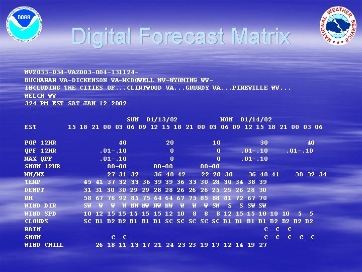
Digital Forecast Matrix WVZ 033 -034 -VAZ 003 -004 -131124 BUCHANAN VA-DICKENSON VA-MCDOWELL WV-WYOMING WVINCLUDING THE CITIES OF. . . CLINTWOOD VA. . . GRUNDY VA. . . PINEVILLE WV. . . WELCH WV 324 PM EST SAT JAN 12 2002 EST POP 12 HR QPF 12 HR MAX QPF SNOW 12 HR MN/MX TEMP DEWPT RH WIND DIR WIND SPD CLOUDS RAIN SNOW WIND CHILL SUN 01/13/02 MON 01/14/02 15 18 21 00 03 06 09 12 15 18 21 00 03 06 45 31 58 SW 10 SC 40. 01 -. 10 00 -00 27 31 41 37 32 31 30 30 67 76 92 W W W 12 15 15 B 1 B 2 32 33 29 85 NW 15 B 1 36 29 75 NW 15 B 1 20 0 0 00 -00 36 40 39 39 28 28 64 64 NW NW 15 12 B 1 SC 42 36 26 67 W 10 SC 33 26 75 W 8 SC 10 0 0 00 -00 22 28 30 28 26 25 85 88 W SW 8 8 SC SC 30. 01 -. 10 30 30 25 81 S 12 B 1 34 26 72 S 15 B 1 C C 26 18 11 13 17 21 24 23 23 19 17 12 14 36 38 28 67 SW 15 B 1 40. 01 -. 10 40 41 30 32 34 39 30 70 SW 10 10 10 5 5 B 1 B 2 B 2 C C C C 19 27

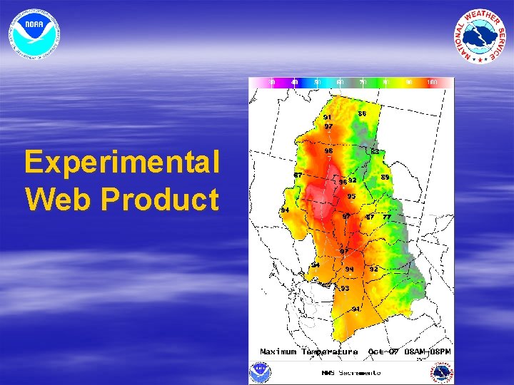
Experimental Web Product

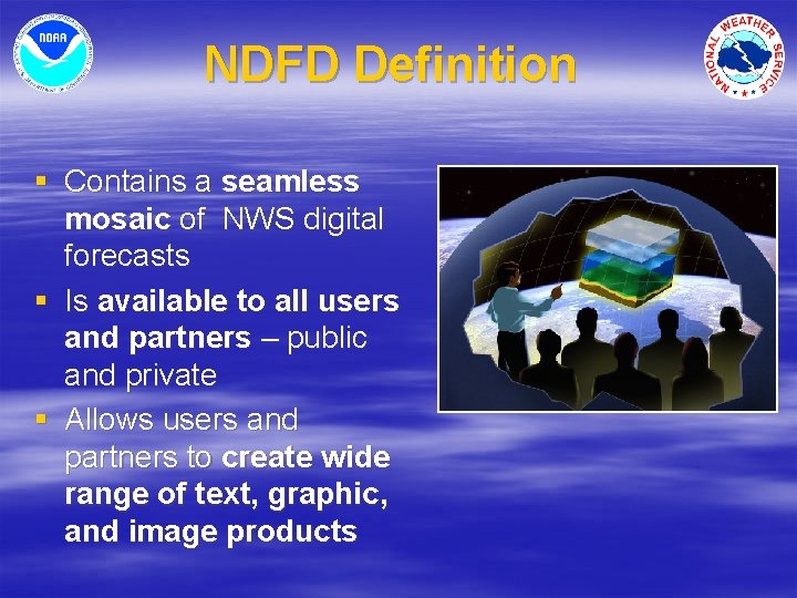
NDFD Definition § Contains a seamless mosaic of NWS digital forecasts § Is available to all users and partners – public and private § Allows users and partners to create wide range of text, graphic, and image products

NDFD Benefits § Provides weather information to “drive” applications developed by private sector: § - Decision support systems that fit the § § § forecast to the problem - Weather information along a path - Text generation in more than one language - Forecasts for vehicles and hand-held devices with GPS - Controls for smart appliances (e. g. , heating, cooling, irrigation) - Graphics for mass media

NDFD Forecast Elements § The NDFD will contain: § Weather, water, and climate forecasts from WFOs, RFCs, and NCEP Service Centers § Elements that support generation of current WFO products § Digital watch, warning, and advisory information § Elements that would attract user development of graphics and decision tools § The official NWS forecast for each element

Current NDFD Experimental Elements § § § § § Daytime maximum and nighttime minimum temperature Probability of Precipitation (12 hour) Significant weather Sky cover Temperature Dewpoint temperature Wind direction and speed Precipitation amount (QPF) Snow amount Wave height

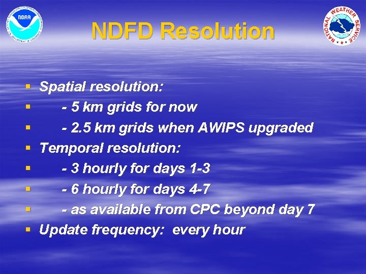
NDFD Resolution § § § § Spatial resolution: - 5 km grids for now - 2. 5 km grids when AWIPS upgraded Temporal resolution: - 3 hourly for days 1 -3 - 6 hourly for days 4 -7 - as available from CPC beyond day 7 Update frequency: every hour

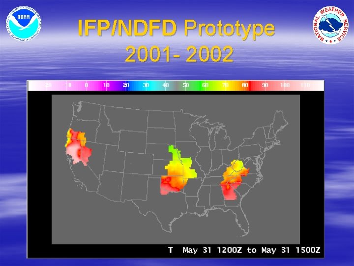
IFP/NDFD Prototype 2001 - 2002

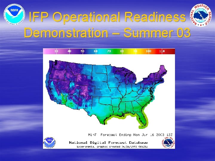
IFP Operational Readiness Demonstration – Summer 03

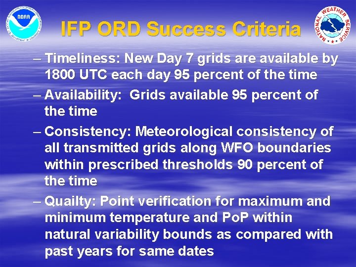
IFP ORD Success Criteria – Timeliness: New Day 7 grids are available by 1800 UTC each day 95 percent of the time – Availability: Grids available 95 percent of the time – Consistency: Meteorological consistency of all transmitted grids along WFO boundaries within prescribed thresholds 90 percent of the time – Quailty: Point verification for maximum and minimum temperature and Po. P within natural variability bounds as compared with past years for same dates

IFP Performance (August 2003) – Timeliness: New day 7 grids from each WFO are available by 1800 UTC each day 85 -95 percent of the time. [varies by element] – Availability: Grids available 95 percent of the time. – Consistency: Meteorological consistency along WFO CWA boundaries of all transmitted grids are within prescribed thresholds 90 -95 percent of the time. [varies by element]

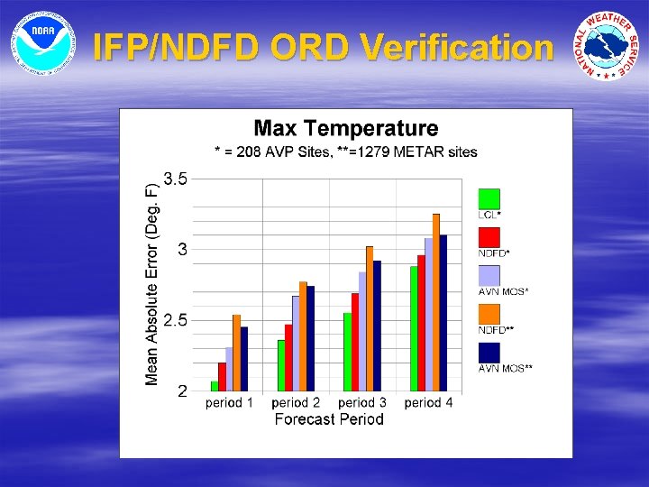
IFP/NDFD ORD Verification

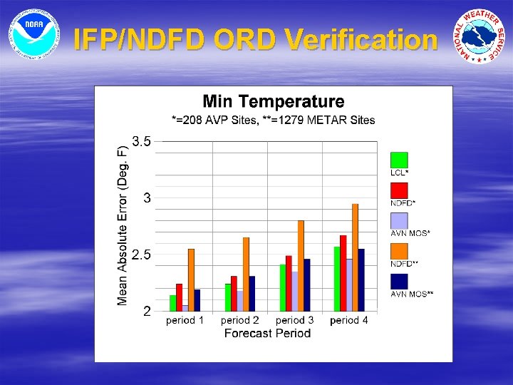
IFP/NDFD ORD Verification

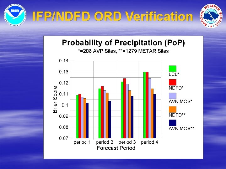
IFP/NDFD ORD Verification

NDFD Technical workshop § Key Participant Recommendations: – Explore providing Grids in Net. CDF format – Provide grid product update information – Provide “change only” access – Ensure conformity with digital data standards – Expand NDFD domain to aviation and oceans – Continue efforts to add probabilistic information – Find a way to get expanded NDFD information out to partners/users

In The Works § § § Digital data standards and NDFD metadata NDFD expansion to the Gulf and High Seas Validation of science in NDFD “tools” Publish collaboration thresholds by element NDFD “What’s New” web page Plan targeted NDFD user group meetings on consistency and collaboration thresholds

NDFD Beyond 2003 Finer temporal and spatial resolution – Additional forecast elements § § Derived parameters, fire weather, marine Probabilistic Digital forecasts from NCEP service centers 3 D grids capable of supporting aviation services – Watches, Warnings, and Advisories § based on Valid Time Event Codes § excluding short-fused convective – Meteorological objects (in BUFR) – Interactive web services

NDFD Elements Under Development § § § Apparent temperature (Heat index + wind chill) Relative humidity Wind gust speed Max/min relative humidity Lightning Activity Level Mixing height Transport wind direction and speed Haines index Visibility Ice coverage Swell height and direction

Probabilities in NDFD (August 2003) – Po. P 12 – Prob/Cvrg Codes for specific precip types (e. g. , snow, tstm) § Slight Chance/Isolated (20%) § Chance/Scattered (30%-50%) § Likely/Numerous (60%-70%) § Occasional/Definite/Widespread (80%-100%)

Probabilities in NDFD (proposed) – – Percent probability of frozen precipitation Percent probability of freezing precipitation Percent probability of thunderstorms Exceedence forecasts for set confidence levels § § § Max QPF Max wind speed Max wave height Max max temp (summer) Min min temp (winter) Max snow amount

Digital Forecasts From NCEP Service Centers – CPC – Temperature and precipitation anomalies – HPC – Surface front forecasts (BUFR) – OPC & TPC – Offshore and high seas wind, wave, and pressure forecasts – AWC – Aviation objects in BUFR (phase 1) – 3 D grids (phase 2)

3 D Grids To Support Aviation Services – Important to NWS, but. . . – Manipulating grids of clouds and weather is HARD – Cloud layers , ceilings, visibilities, and PROB 40 not easy to represent digitally – Will need help of user community

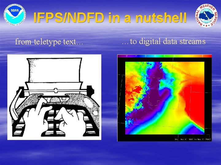
IFPS/NDFD in a nutshell from teletype text… …to digital data streams