NOAAs Hurricane Research HFIP Hurricane Edouard AOMLHurricane Research
- Slides: 22

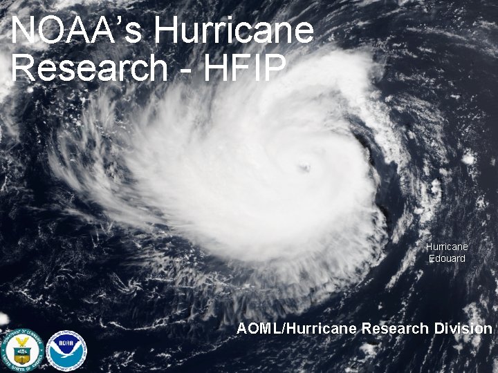
NOAA’s Hurricane Research - HFIP Hurricane Edouard AOML/Hurricane Research Division

Vision • Organize hurricane community to dramatically improve numerical forecast guidance to NHC in 5 -10 years Goals • Improve forecast accuracy for track & intensity by 20% in 5 years, 50% in 10 years • Extend forecast guidance to 7 days with skill comparable to current 5 day forecasts • Increase probability of predicting (POD) Rapid intensification (RI) at Day 1 to 90% & 60% at Day 5 NOAA Hurricane Forecast Improvement Project Meeting the Nation’s Needs http: //www. hfip. org/ 2

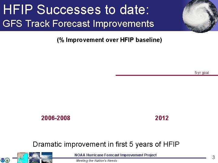
HFIP Successes to date: GFS Track Forecast Improvements (% Improvement over HFIP baseline) 5 -yr goal 2006 -2008 2012 Dramatic improvement in first 5 years of HFIP NOAA Hurricane Forecast Improvement Project Meeting the Nation’s Needs 3

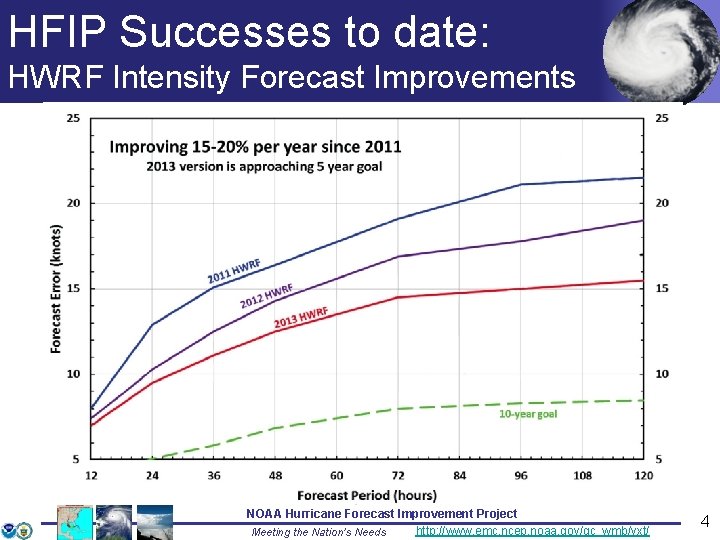
HFIP Successes to date: HWRF Intensity Forecast Improvements NOAA Hurricane Forecast Improvement Project http: //www. emc. ncep. noaa. gov/gc_wmb/vxt/ Meeting the Nation’s Needs 4

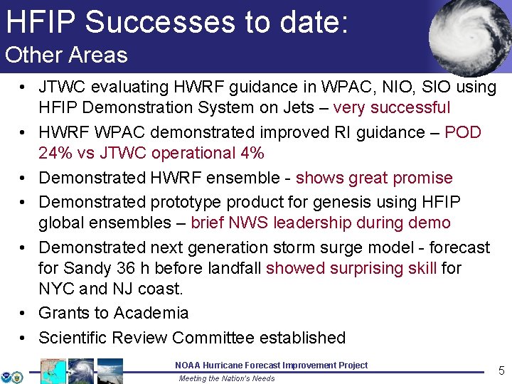
HFIP Successes to date: Other Areas • JTWC evaluating HWRF guidance in WPAC, NIO, SIO using HFIP Demonstration System on Jets – very successful • HWRF WPAC demonstrated improved RI guidance – POD 24% vs JTWC operational 4% • Demonstrated HWRF ensemble - shows great promise • Demonstrated prototype product for genesis using HFIP global ensembles – brief NWS leadership during demo • Demonstrated next generation storm surge model - forecast for Sandy 36 h before landfall showed surprising skill for NYC and NJ coast. • Grants to Academia • Scientific Review Committee established NOAA Hurricane Forecast Improvement Project Meeting the Nation’s Needs 5

HFIP Successes to date: HWRF in WPAC • HFIP running HWRF in WPAC for JTWC 2012 -2013 • Results indicate that HWRF track forecasts are comparable to global model and better than other regional models in region • HWRF Intensity forecasts are better than other model guidance in WPAC • JTWC is using HWRF model output in their operational forecasts NOAA Hurricane Forecast Improvement Project http: //www. emc. ncep. noaa. gov/gc_wmb/vxt/ Meeting the Nation’s Needs 6

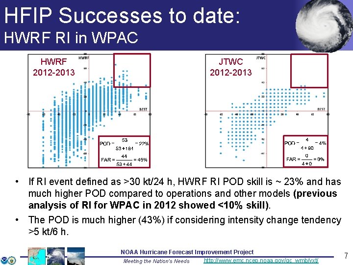
HFIP Successes to date: HWRF RI in WPAC HWRF 2012 -2013 JTWC 2012 -2013 • If RI event defined as >30 kt/24 h, HWRF RI POD skill is ~ 23% and has much higher POD compared to operations and other models (previous analysis of RI for WPAC in 2012 showed <10% skill). • The POD is much higher (43%) if considering intensity change tendency >5 kt/6 h. NOAA Hurricane Forecast Improvement Project http: //www. emc. ncep. noaa. gov/gc_wmb/vxt/ Meeting the Nation’s Needs 7

HFIP Successes to date: HWRF ensembles HWRF ensemble mean (HWMN) track/intensity forecasts improve over HWRF at all lead times, in all 3 basins. NOAA Hurricane Forecast Improvement Project http: //www. emc. ncep. noaa. gov/gc_wmb/vxt/ Meeting the Nation’s Needs 8

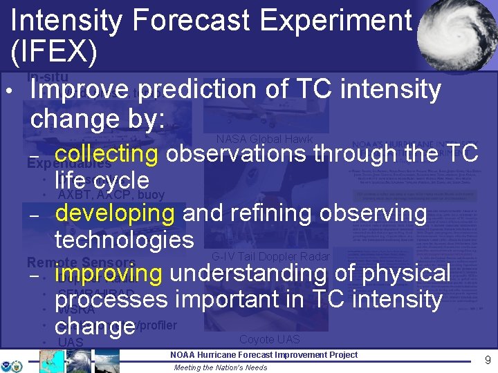
Intensity Forecast Experiment (IFEX) In-situ • Wind, press. , temp. Improve prediction of TC intensity change by: • NASA Global Hawk collecting observations through the TC • life Dropsondes cycle • AXBT, AXCP, buoy – developing and refining observing technologies G-IV Tail Doppler Radar Remote Sensors – • improving understanding of physical Doppler Radar • SFMR/HIRAD important in TC intensity • processes WSRA • change Scatterometer/profiler Coyote UAS • UAS – Expendables 9 NOAA Hurricane Forecast Improvement Project Meeting the Nation’s Needs 9

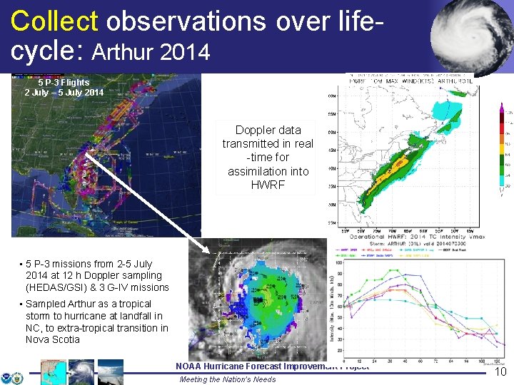
Collect observations over lifecycle: Arthur 2014 5 P-3 Flights 2 July – 5 July 2014 Doppler data transmitted in real -time for assimilation into HWRF • 5 P-3 missions from 2 -5 July 2014 at 12 h Doppler sampling (HEDAS/GSI) & 3 G-IV missions • Sampled Arthur as a tropical storm to hurricane at landfall in NC, to extra-tropical transition in Nova Scotia 10 NOAA Hurricane Forecast Improvement Project Meeting the Nation’s Needs 10

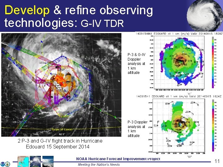
Develop & refine observing technologies: G-IV TDR P-3 & G-IV Doppler analysis at 1 km altitude P-3 Doppler analysis at 1 km altitude 2 P-3 and G-IV flight track in Hurricane Edouard 15 September 2014 11 NOAA Hurricane Forecast Improvement Project Meeting the Nation’s Needs 11

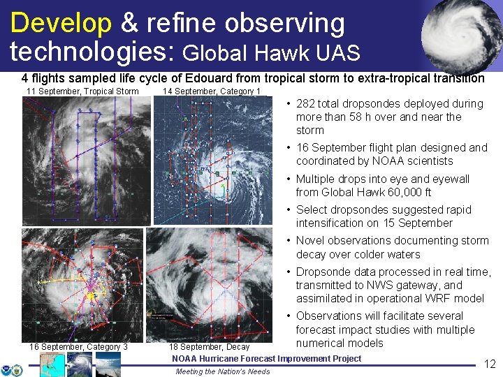
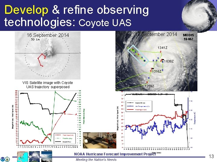
Develop & refine observing technologies: Global Hawk UAS 4 flights sampled life cycle of Edouard from tropical storm to extra-tropical transition 11 September, Tropical Storm 14 September, Category 1 • 282 total dropsondes deployed during more than 58 h over and near the storm • 16 September flight plan designed and coordinated by NOAA scientists • Multiple drops into eye and eyewall from Global Hawk 60, 000 ft • Select dropsondes suggested rapid intensification on 15 September • Novel observations documenting storm decay over colder waters • Dropsonde data processed in real time, transmitted to NWS gateway, and assimilated in operational WRF model 16 September, Category 3 12 • Observations will facilitate several forecast impact studies with multiple numerical models 18 September, Decay NOAA Hurricane Forecast Improvement Project Meeting the Nation’s Needs 12

Develop & refine observing technologies: Coyote UAS 17 September 2014 16 September 2014 MODIS 1640 Z 1420 Z 1341 Z 1638 Z 1316 Z VIS Satellite image with Coyote UAS trajectory superposed 13 1259 Z NOAA Hurricane Forecast Improvement Project Meeting the Nation’s Needs 13

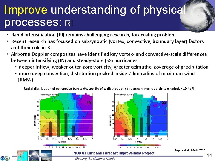
Improve understanding of physical processes: RI • Rapid intensification (RI) remains challenging research, forecasting problem • Recent research has focused on subsynoptic (vortex, convective, boundary layer) factors and their role in RI • Airborne Doppler composites have identified key vortex- and convective-scale differences between intensifying (IN) and steady-state (SS) hurricanes • deeper inflow, weaker outer-core vorticity, greater azimuthal coverage of precipitation • more deep convection, distribution peaked inside 2 -km radius of maximum wind (RMW) Radial distribution of convective bursts (%, top 1% of w distribution) and axisymmetric vorticity (shaded, x 10 -4 s-1) 14 NOAA Hurricane Forecast Improvement Project Meeting the Nation’s Needs Rogers et al. , MWR, 2013 14

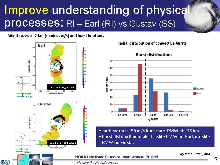
Improve understanding of physical processes: RI – Earl (RI) vs Gustav (SS) Wind speed at 2 km (shaded, m/s) and burst locations Radial distribution of convective bursts RMW 13: 40 UTC Aug 30 2010 shear motion 22: 26 UTC Aug 31 2008 • both storms ~ 50 m/s hurricane, RMW of ~35 km • burst distribution peaked inside RMW for Earl, outside RMW for Gustav shear motion 15 NOAA Hurricane Forecast Improvement Project Meeting the Nation’s Needs Rogers et al. , MWR, 2014 15

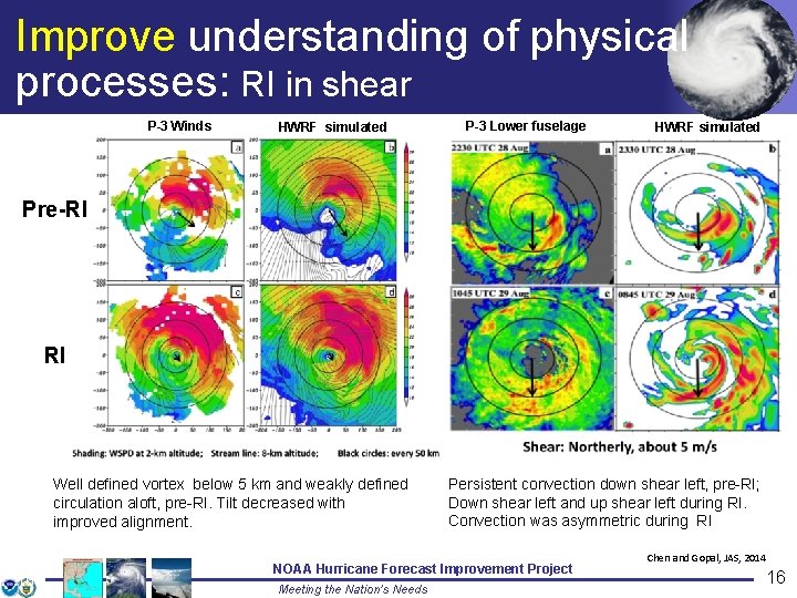
Improve understanding of physical processes: RI in shear P-3 Winds HWRF simulated P-3 Lower fuselage HWRF simulated Pre-RI RI Well defined vortex below 5 km and weakly defined circulation aloft, pre-RI. Tilt decreased with improved alignment. 16 Persistent convection down shear left, pre-RI; Down shear left and up shear left during RI. Convection was asymmetric during RI NOAA Hurricane Forecast Improvement Project Meeting the Nation’s Needs Chen and Gopal, JAS, 2014 16

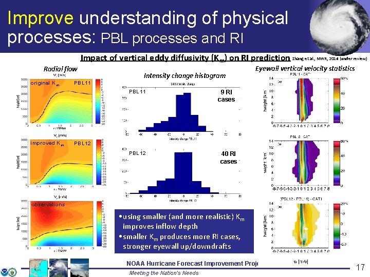
Improve understanding of physical processes: PBL processes and RI Radial flow original Km Impact of vertical eddy diffusivity (Km) on RI prediction Zhang et al. , MWR, 2014 (under review) Intensity change histogram PBL 11 improved Km Eyewall vertical velocity statistics 9 RI cases PBL 12 40 RI cases observations • using smaller (and more realistic) Km improves inflow depth • smaller Km produces more RI cases, stronger eyewall up/downdrafts NOAA Hurricane Forecast Improvement Project Meeting the Nation’s Needs 17

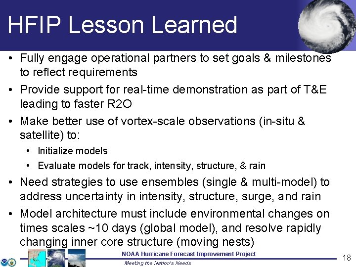
HFIP Lesson Learned • Fully engage operational partners to set goals & milestones to reflect requirements • Provide support for real-time demonstration as part of T&E leading to faster R 2 O • Make better use of vortex-scale observations (in-situ & satellite) to: • Initialize models • Evaluate models for track, intensity, structure, & rain • Need strategies to use ensembles (single & multi-model) to address uncertainty in intensity, structure, surge, and rain • Model architecture must include environmental changes on times scales ~10 days (global model), and resolve rapidly changing inner core structure (moving nests) NOAA Hurricane Forecast Improvement Project Meeting the Nation’s Needs 18

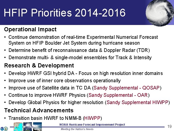
HFIP Priorities 2014 -2016 Operational Impact • Continue demonstration of real-time Experimental Numerical Forecast System on HFIP Boulder Jet System during hurricane season • Determine benefit of reconnaissance data & Doppler Radar (TDR) • Demonstrate multi- & single-model ensembles for Track & Intensity Research & Development • • • Develop HWRF GSI hybrid DA - Focus on high resolution inner domains Improve use of inner core observations operationally Improve use of Satellite data in TC DA (Sandy Supplemental - QOSAP) Continue to improve HWRF Physics (Sandy Supplemental - OAR) Develop Global Physics for higher resolution (Sandy Supplemental HIWPP) Technical Advancements • Transition basin HWRF to NMM-B (HIWPP) NOAA Hurricane Forecast Improvement Project Meeting the Nation’s Needs 19

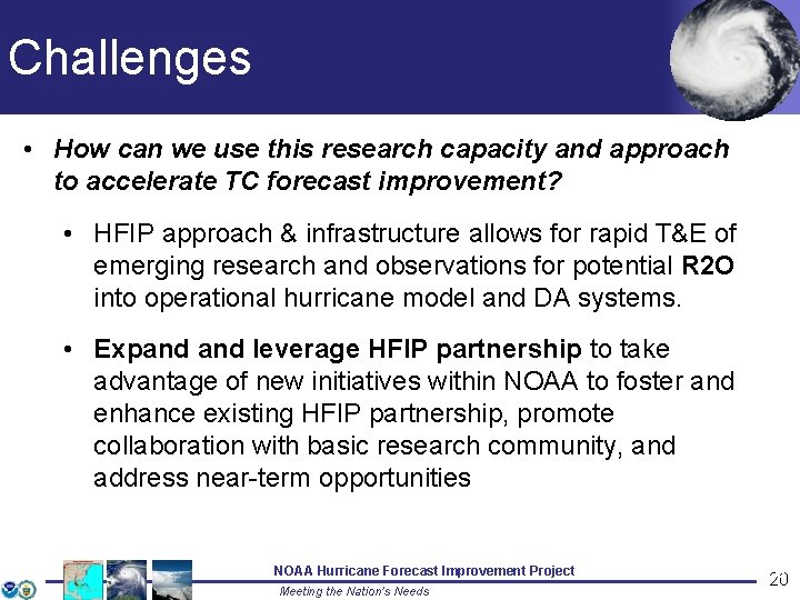
Challenges • How can we use this research capacity and approach to accelerate TC forecast improvement? • HFIP approach & infrastructure allows for rapid T&E of emerging research and observations for potential R 2 O into operational hurricane model and DA systems. • Expand leverage HFIP partnership to take advantage of new initiatives within NOAA to foster and enhance existing HFIP partnership, promote collaboration with basic research community, and address near-term opportunities NOAA Hurricane Forecast Improvement Project Meeting the Nation’s Needs 20 20

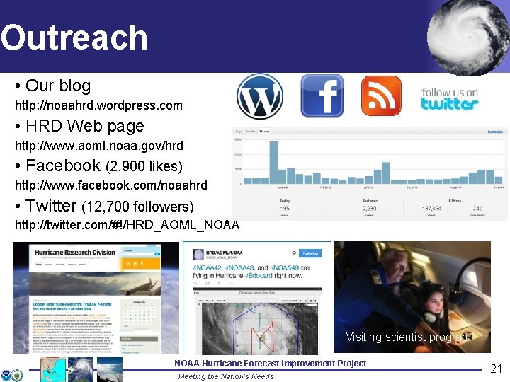
Outreach • Our blog http: //noaahrd. wordpress. com • HRD Web page http: //www. aoml. noaa. gov/hrd • Facebook (2, 900 likes) http: //www. facebook. com/noaahrd • Twitter (12, 700 followers) http: //twitter. com/#!/HRD_AOML_NOAA Tweets from the eye Visiting scientist program 21 NOAA Hurricane Forecast Improvement Project Meeting the Nation’s Needs 21

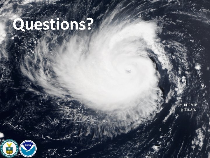
Questions? Hurricane Edouard