NOAA Hurricane Intensity Forecast Experiment IFEX Background Joint
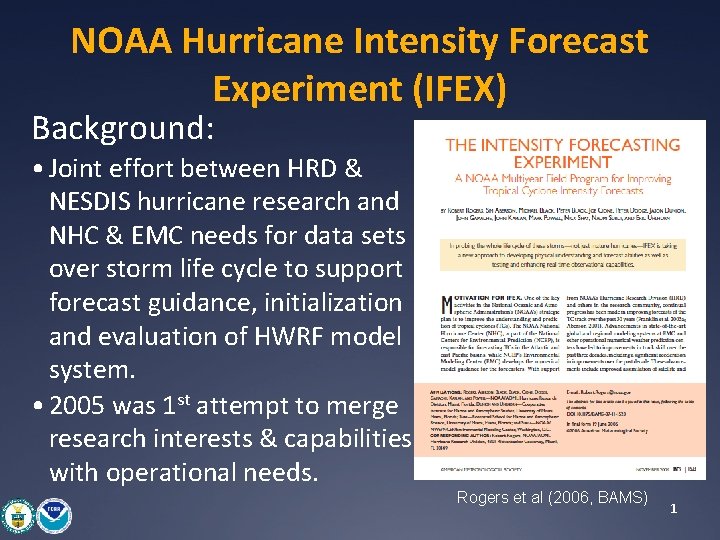
NOAA Hurricane Intensity Forecast Experiment (IFEX) Background: • Joint effort between HRD & NESDIS hurricane research and NHC & EMC needs for data sets over storm life cycle to support forecast guidance, initialization and evaluation of HWRF model system. • 2005 was 1 st attempt to merge research interests & capabilities with operational needs. Rogers et al (2006, BAMS) 1
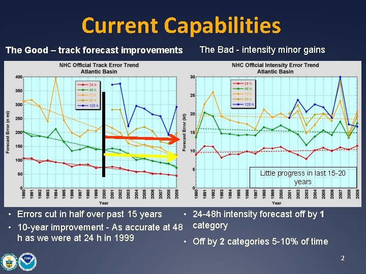
Current Capabilities The Good – track forecast improvements The Bad - intensity minor gains Little progress in last 15 -20 years • Errors cut in half over past 15 years • 24 -48 h intensity forecast off by 1 • 10 -year improvement - As accurate at 48 category h as we were at 24 h in 1999 • Off by 2 categories 5 -10% of time 2
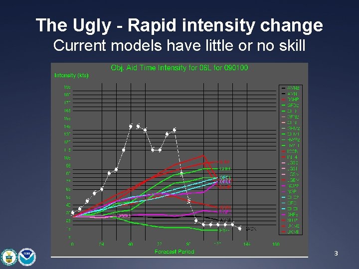
The Ugly - Rapid intensity change Current models have little or no skill 3
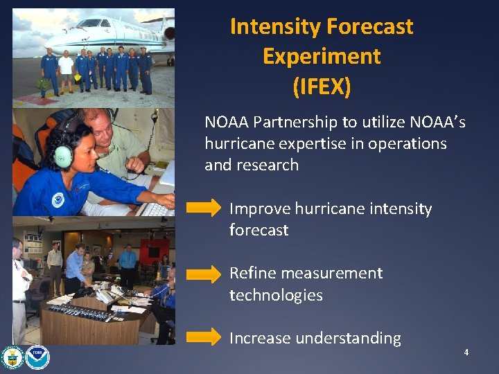
Intensity Forecast Experiment (IFEX) NOAA Partnership to utilize NOAA’s hurricane expertise in operations and research Improve hurricane intensity forecast Refine measurement technologies Increase understanding 4
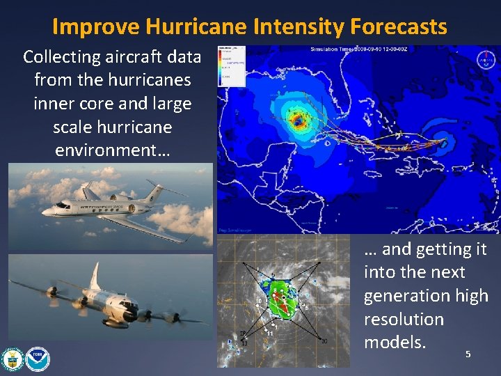
Improve Hurricane Intensity Forecasts Collecting aircraft data from the hurricanes inner core and large scale hurricane environment… … and getting it into the next generation high resolution models. 5
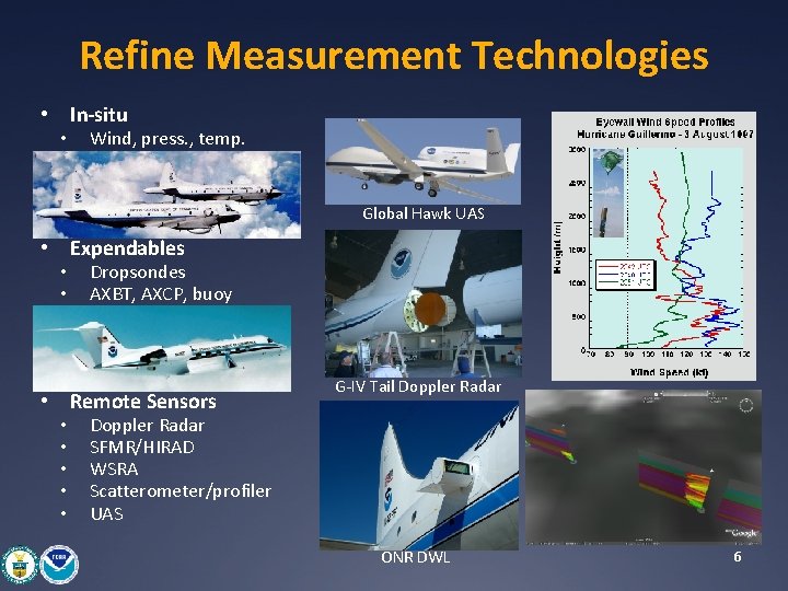
Refine Measurement Technologies • In-situ • Wind, press. , temp. Global Hawk UAS • Expendables • • Dropsondes AXBT, AXCP, buoy • Remote Sensors • • • G-IV Tail Doppler Radar SFMR/HIRAD WSRA Scatterometer/profiler UAS ONR DWL 6
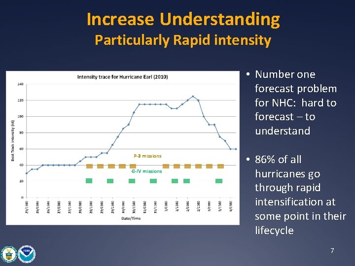
Increase Understanding Particularly Rapid intensity • Number one forecast problem for NHC: hard to forecast – to understand P-3 missions G-IV missions • 86% of all hurricanes go through rapid intensification at some point in their lifecycle 7
Multi-Agency Collaborations NASA TCSP (2005), NAMMA (2006), GRIP (2010) (Rainfall, Microphysics/Aerosol, Genesis, and Rapid Intensification) • DC-8 • ER-2 • Global Hawk NSF RAINEX (2005), Upper-ocean Sampling (2005 -2008), PREDICT (2010) (Rainbands, Ocean mixed-layer interaction, and Genesis • NRL P-3 • G-V 8
NOAA Hurricane Intensity Forecast Experiment (IFEX) Lessons learned: • Coordination insures WP-3 D and G-IV aircraft serve NOAA’s research and operational interests. • Optimum use of hurricane flight hours & expendables. • Provide capacity to support NOAA HFIP. • Provides opportunity to engage and educate outside research community in use of aircraft observations. • Provides capacity to train future hurricane researchers utilizing NOAA tools to improve operations and promote research 9
Questions? 10
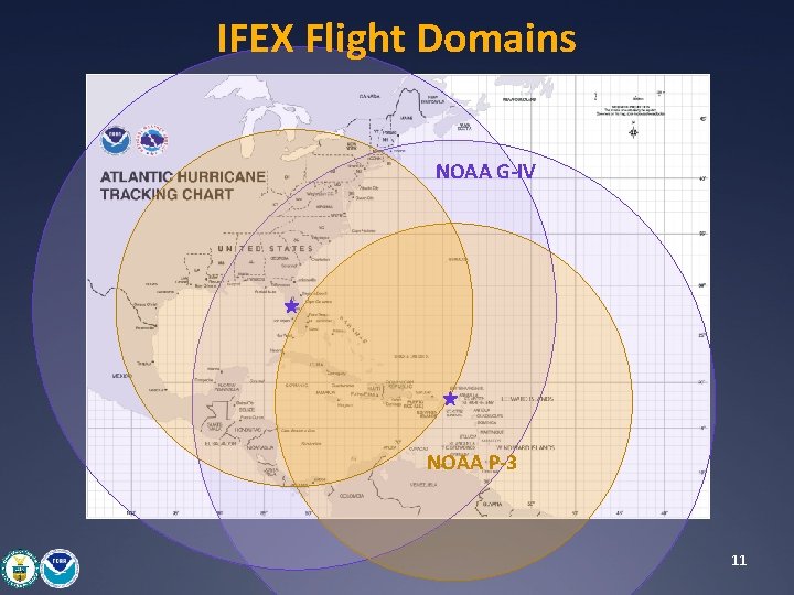
IFEX Flight Domains NOAA G-IV NOAA P-3 11
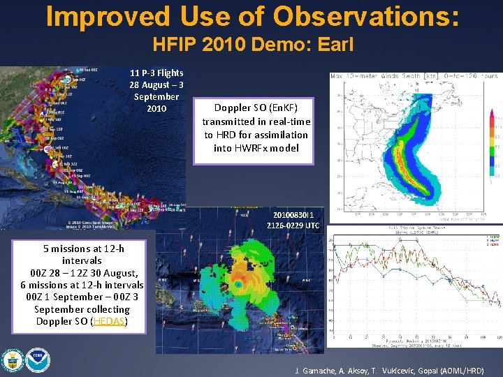
Improved Use of Observations: HFIP 2010 Demo: Earl 11 P-3 Flights 28 August – 3 September 2010 Doppler SO (En. KF) transmitted in real-time to HRD for assimilation into HWRFx model HWRFx/HEDAS 20100831 00 UTC 20100830 I 1 2126 -0229 UTC • 5 missions at 12 -h intervals • 00 Z 28 – 12 Z 30 August, 6 missions at 12 -h intervals 00 Z 1 September – 00 Z 3 September collecting Doppler SO (HEDAS) HWRFx/HEDAS 20100831 00 UTC J. Gamache, A. Aksoy, T. Vukicevic, Gopal (AOML/HRD)
- Slides: 12