NLGIS a web based historical GIS for everyone

NLGIS a web based historical GIS for everyone Onno Boonstra Radboud Universiteit DANS

NLGIS a web based historical GIS for everyone • Historical Geographical Information Systems on the web ▫ some examples ▫ differences between them ▫ not suited very well for historical research • what does a historical researcher want from a Historical GIS? ▫ three demands to be met • the NLGIS project ▫ a web based historical GIS for everyone
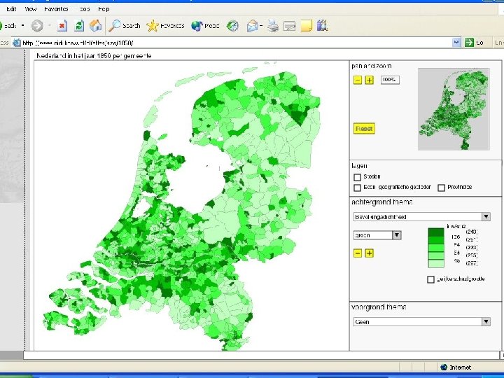
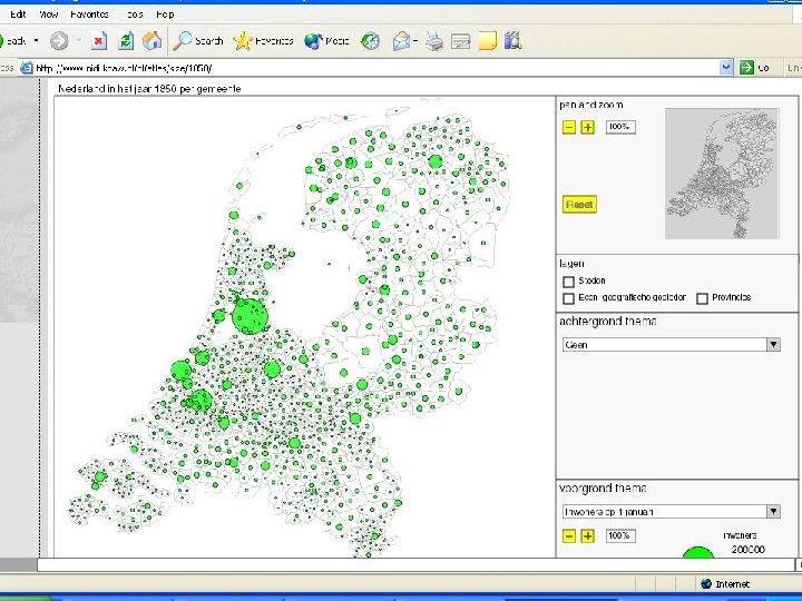
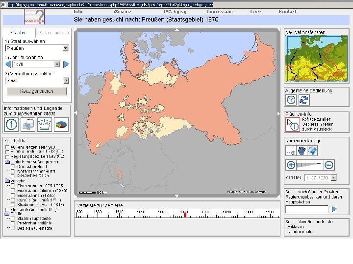
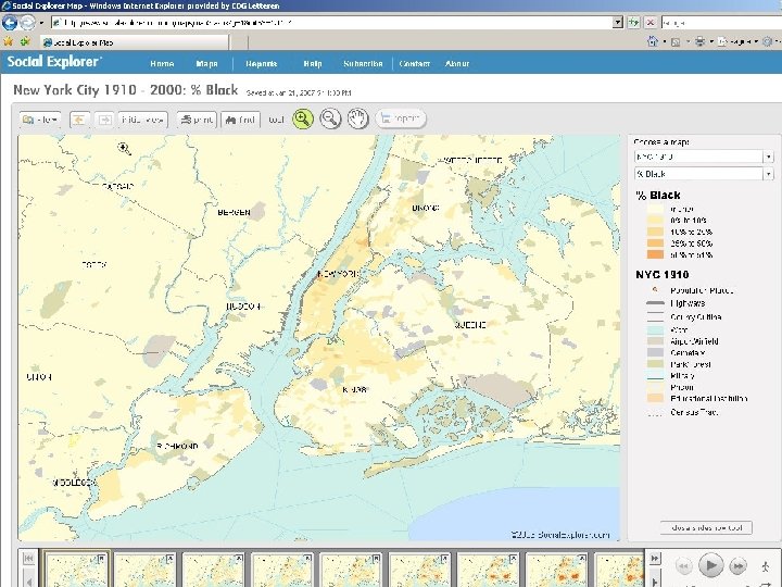
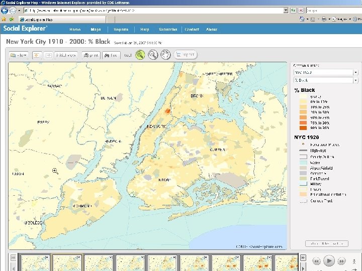
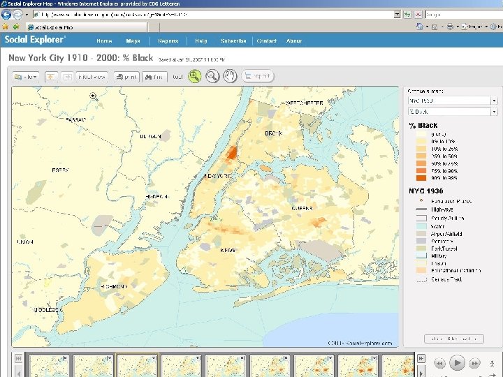

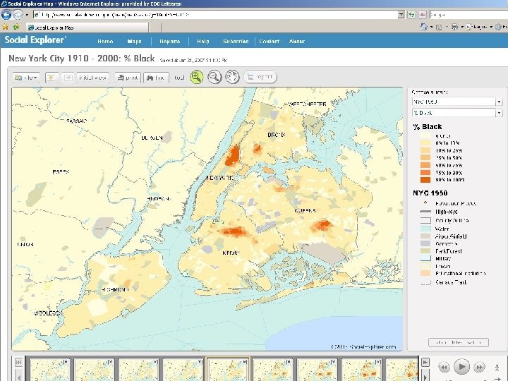
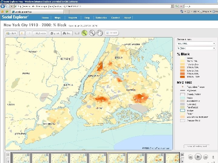
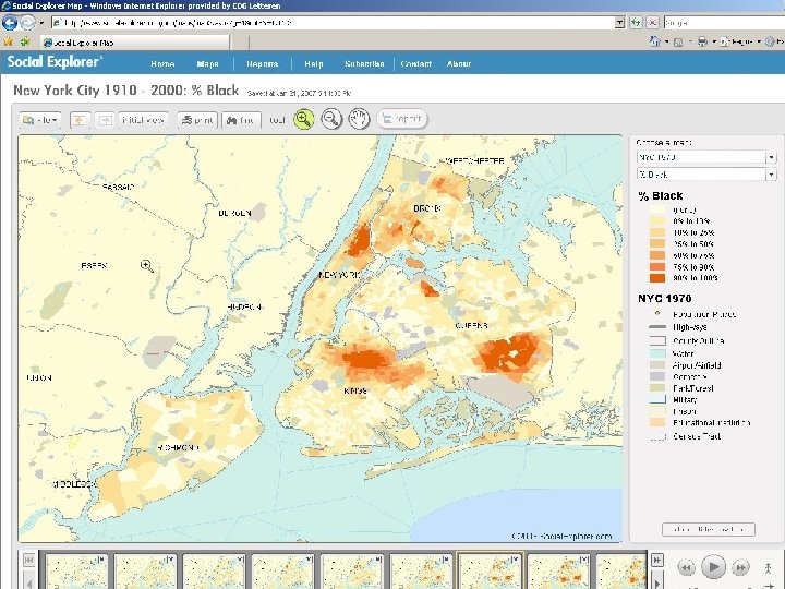
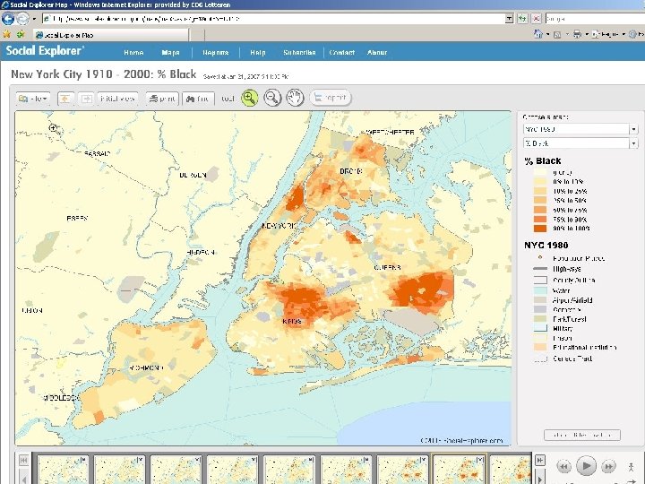
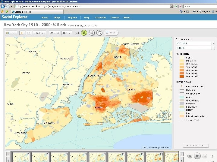
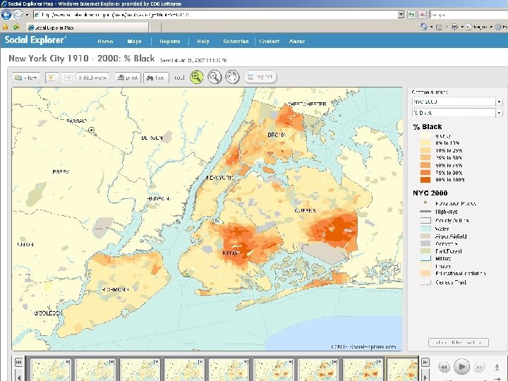

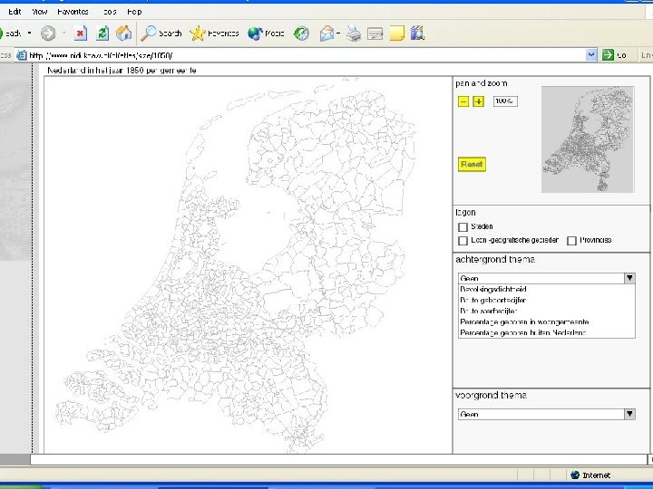
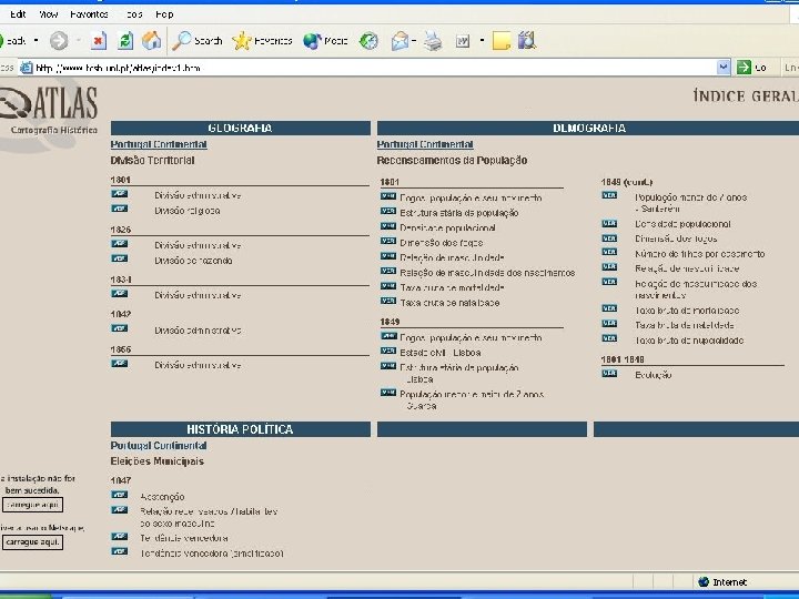
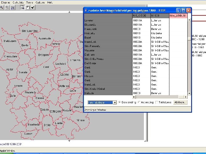
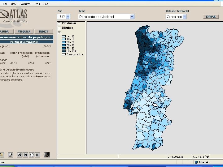
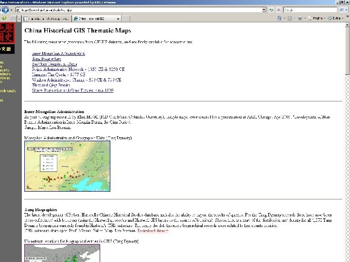
NLGIS a web based historical GIS for everyone Status quo: web based Historical Geographical Information Systems ▫ various visualization methods ▫ various ways to show changes through time ▫ various uses of contextual information ▫ ranging from easy-to-use to sophisticated

NLGIS a web based historical GIS for everyone Status quo: web based Historical Geographical Information Systems ▫ various visualization methods ▫ various ways to show changes through time ▫ various uses of contextual information ▫ ranging from easy-to-use to sophisticated but … ▫ not for historical researchers

NLGIS a web based historical GIS for everyone what does a historical researcher want from a Historical GIS? Demand # 1

NLGIS a web based historical GIS for everyone what does a historical researcher want from a Historical GIS? Demand # 1 A historical researcher wants a web based HGIS to allow the upload of data of his own

NLGIS a web based historical GIS for everyone what does a historical researcher want from a Historical GIS? Demand # 1 A historical researcher wants a web based HGIS to allow the upload of data of his own - with ease

NLGIS a web based historical GIS for everyone what does a historical researcher want from a Historical GIS? Demand # 2

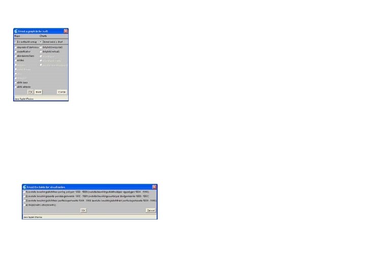

NLGIS a web based historical GIS for everyone what does a historical researcher want from a Historical GIS? Demand # 2 A historical researcher wants a web based Historical GIS first of all to have a simple web design. Only when this demand is met, the historical researcher wants the number of user defined possibilities to mould the data into a visual representation to be maximized.

NLGIS a web based historical GIS for everyone what does a historical researcher want from a Historical GIS? Demand # 3

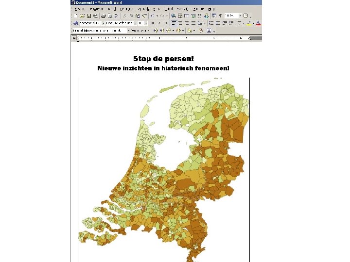
NLGIS a web based historical GIS for everyone what does a historical researcher want from a Historical GIS? Demand # 3 A historical researcher wants a web based HGIS to allow his maps to be downloadable – at least into a Word document

NLGIS a web based historical GIS for everyone the NLGIS project • initially, part of the DANS Dutch Census project ▫ comparable to Belgian Historical GIS ▫ all census data available within GIS ▫ all municipals divisions 1812 -1971 ▫ all submunicipal divisions 1859 -1971 ▫ tools to manipulate census data • as a consequence, very complex • solution: ▫ more GIS with less GIS: NLGIS

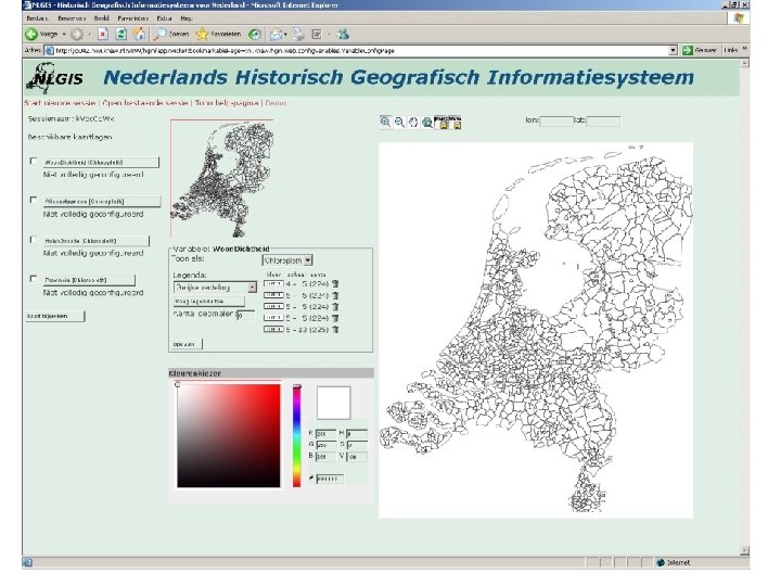
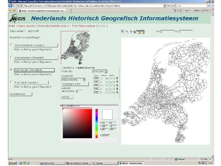
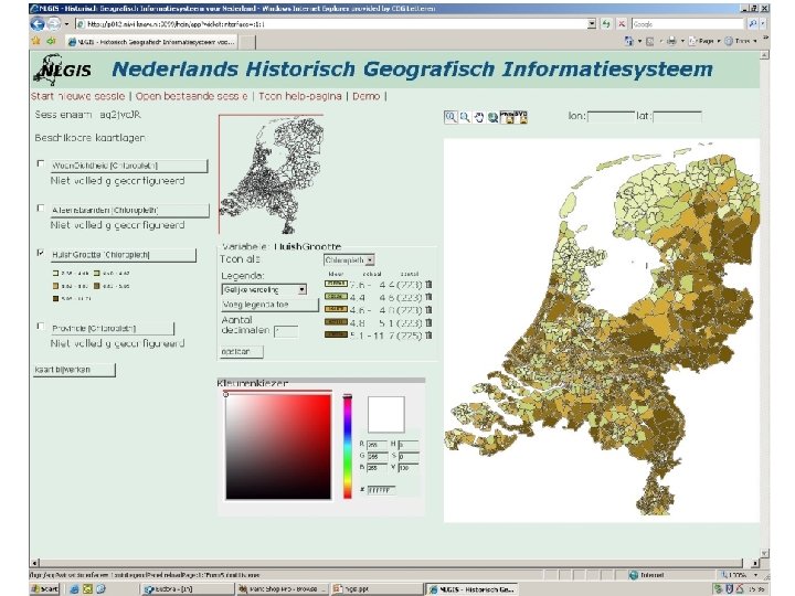
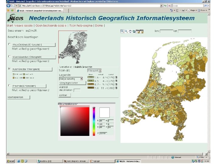
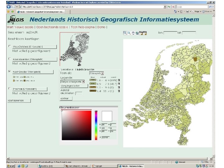
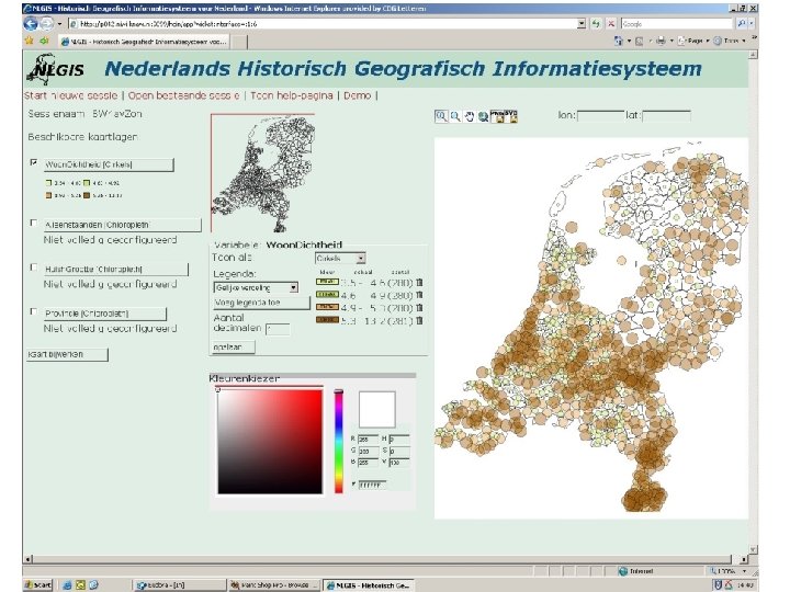
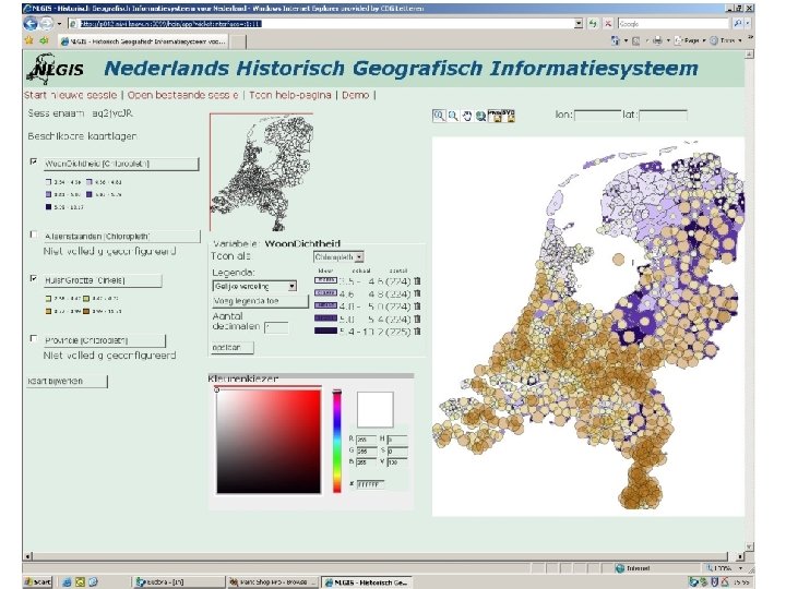
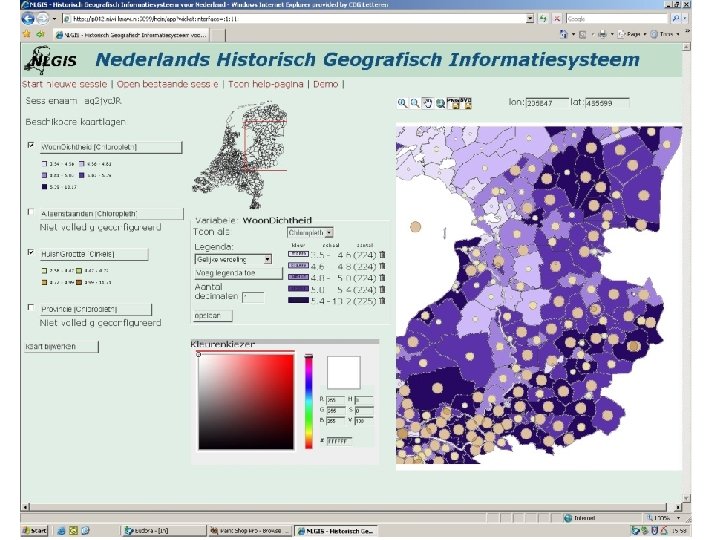
NLGIS a web based historical GIS for everyone the NLGIS project: more GIS with less GIS ▫ put no data in NLGIS, only shapefiles with municipal and provincial boundaries; ▫ allow user to upload data and to link them to NLGIS shapefiles by himself ; ▫ create a set of GIS tools with which a user can visualize regional differences; ▫ make sure that such maps can be downloaded in such a way that they are fit to be included in standard software for documents and multimedia presentations

http: //ip 042. niwi. knaw. nl: 9099/hgin/app

NLGIS a web based historical GIS for everyone the NLGIS project: more GIS with less GIS ▫ put no data in NLGIS, only shapefiles with municipal and provincial boundaries; ▫ allow user to upload data and to link them to NLGIS shapefiles by himself ; ▫ create a set of GIS tools with which a user can visualize regional differences; ▫ make sure that such maps can be downloaded in such a way that they are fit to be included in standard software for documents and multimedia presentations

NLGIS a web based historical GIS for everyone the NLGIS project: more GIS with less GIS put no data in NLGIS, only shapefiles with municipal and provincial boundaries; ▫ allow user to upload data and to link them to NLGIS shapefiles by himself ; ▫ create a set of GIS tools with which a user can visualize regional differences; ▫ make sure that such maps can be downloaded in such a way that they are fit to be included in standard software for documents and multimedia presentations

NLGIS a web based historical GIS for everyone the NLGIS project: more GIS with less GIS put no data in NLGIS, only shapefiles with municipal and provincial boundaries; allow user to upload data and to link them to NLGIS shapefiles by himself ; ▫ create a set of GIS tools with which a user can visualize regional differences; ▫ make sure that such maps can be downloaded in such a way that they are fit to be included in standard software for documents and multimedia presentations

NLGIS a web based historical GIS for everyone the NLGIS project: more GIS with less GIS put no data in NLGIS, only shapefiles with municipal and provincial boundaries; allow user to upload data and to link them to NLGIS shapefiles by himself ; create a set of GIS tools with which a user can visualize regional differences; ▫ make sure that such maps can be downloaded in such a way that they are fit to be included in standard software for documents and multimedia presentations

NLGIS a web based historical GIS for everyone the NLGIS project: more GIS with less GIS put no data in NLGIS, only shapefiles with municipal and provincial boundaries; allow user to upload data and to link them to NLGIS shapefiles by himself ; create a set of GIS tools with which a user can visualize regional differences; make sure that such maps can be downloaded in such a way that they are fit to be included in standard software for documents and multimedia presentations

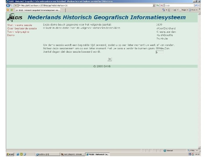
NLGIS a web based historical GIS for everyone the NLGIS project NLGIS ▫ prototype: http: //ip 042. niwi. knaw. nl: 9099/hgin/app ▫ najaar 2007 gereed ▫ http: //www. nlgis. nl meer informatie ▫ Onno Boonstra ▫ DANS

NLGIS a web based historical GIS for everyone the NLGIS project
- Slides: 51