Near Realtime use of NASA LANCE and EOSDIS


- Slides: 8

Near Real-time use of NASA LANCE and EOSDIS Capabilities at NRL Josh Cossuth U. S. Naval Research Laboratory, Remote Sensing Division, Washington, DC Office of Naval Research, Arlington, VA

NRL Satellite Products Background Motivation (mid-1990 s): Given the global extent of U. S. Naval operations, there was a demand signal to create new techniques and tools from satellite meteorology. Opportunity: NRL had unique skill set and data access to research and leverage the Defense Meteorological Satellite Program (DMSP) for near real-time support. • The internet was used as a new medium to deliver unique content (SSM/I, OLS) to a wide range of users. • Able to be accessed by Navy and Do. D personnel, NOAA and civilian interests, and even international partners. • Transition to FNMOC ensured 24/7 operational support for mission critical products NRL/NASA LANCE | 2

Background: New Observations Expansion (Early to Mid-2000 s): The strong demand signal for near real-time delivery of research data allowed new partnerships and products to be demonstrated. • MODIS was almost instantly shown to provide significant added value to operations, nowcasting, and analyses. • The responsiveness of the TRMM/TMI science team to operational allowed hurricane forecasters to augment their capabilities quickly. NRL/NASA LANCE | 3

Leveraging LANCE at NRL Early Adoption (Late 2000 s): Given the significant success, Kim Richardson strongly advocated and interfaced with NASA to quickly demonstrate capabilities and user response. • NRL Satellite Applications team (Steve Miller, Joe Turk, Kim Richardson, Jeff Hawkins) leveraged LANCE data to test and demonstrate new techniques and algorithms directly to the user. NRL/NASA LANCE | 4

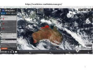
Current Meteorological Usage NRL TC Webpage NRL Nex. Sat • Top sensors continue to be: • MODIS • FIRMS • VIIRS • AMSR 2 • Other teams use AIRS, MISR, MLS, MOPITT, OMI, OMPS, Blue/Black marble for modeling and research • GIBS/Worldview clients, APIs, and tools are extensively used for ad hoc operations through development NRL/NASA LANCE | 5

NRL Future: Common Software The Geolocated Information Processing System (Geo. IPS®) • Geo. IPS® is an establishment of LONGTERM data ingest and processing capabilities for both research and operations. • NRL developed software package (python-based framework) for next generation METOC data ingest, processing, and output. • Function: Download, read, and process native-format geospatial data sets for research and operational use. • Output products: Qualitative and quantitative imagery and data products. • Algorithm and functionality developments are done modularly for stable and efficient upgrades/modifications. Interacting with community to develop an open source environmental data processing system replacing legacy proprietary software. NRL/NASA LANCE | 6

NRL Future: New Datasets There are near real-time uses for almost everything! NRL/NASA LANCE | 7

How to expand advocacy? There are near real-time uses for almost everything! • Increasing users and operational capability to use middle/upper atmosphere information: GOLD, ICON • Ocean and ice modeling is data limited: GRACE-FO, CYGNSS, SWOT, NISAR, SMAP, Ice. SAT-2 • More and advanced capabilities for the atmosphere: Cubesats (Raincube, TEMPEST-D, TROPICS), Geo. CARB, PACE • How can we establish a formalized method for users to advocate for additional NRT NASA data, interact with the science and management teams (…acknowledging different limitations for different missions)? • Can LANCE be organized such that data from SIPS, cost-capped missions, and international partners can be considered and possibly integrated? NRL/NASA LANCE | 8
