NATURAL RESOURCE MANAGEMENT GULLY CONTROL MEASURES RICHA RAI


- Slides: 21

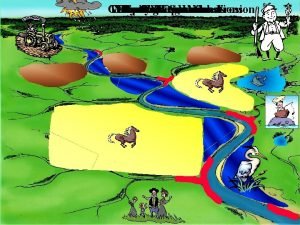
NATURAL RESOURCE MANAGEMENT GULLY CONTROL MEASURES RICHA RAI (39)

Introduction What is Gully? Gullies are the landform that are created by running water eroding sharply into a hillsides. How gullies are formed? Gullies are generally formed by an increase in surface runoff.

Areas of Concern Reduction in cultivable land n Increased velocity of run-off water n Reduces storage capacity of reservoirs and dams. n n Source: www. fao. org

FACTORS AFFECTING GULLY FORMATION n 1. 2. 3. 4. 5. 6. 7. MAN-MADE FACTORS Improper land use Forest and grass fires Overgrazing Mining Road construction Livestock and vehicle trails Destructive logging

Physical Factors n a) b) c) Precipitation Monthly distribution of rainfall Rainfall intensity and run-off Rapid snowmelts Topography Shape of catchment Size of catchment Gradient of the slope.

n Soil properties n Vegetative cover

Criteria for selecting control measures 1. Gully catchment area – the larger the area is , the greater will be the surface runoff. Thus more water will enter the gully which may further make the case worst. So, large structures are preffered to stop this incoming water like check dams.

2. The Gradient n The steeper the slope will be the greater will be the speed with which water will flow, more speed of water may lead to more erosion of soil, so those structures should be made that can reduce the speed of incoming water.

3. Length of the gully channel n If the length of the gully channel will be large than with due time the speed of the water flowing in it will get reduce, on other hand if the length of gully will be small the chances of erosion increases.

Types of Control Measures n n Mechanical: Any earthern, stone or masonry structure constructed across the slope. Vegetative: Any live bund or vegetation established across the slope.

Vegetative Filter Strips n n Stripes of plant species Reduces velocity of water flow, arresting silt. Adoptable in all areas irrespective of soil and rainfall Semi-permanent vegetative measure plantandsoil. unl. edu/. . . /site. Ima ges/P 325 LG. jpg

Brush wood check dams n n Driving wooden pegs into the ground Intertwining brush wood Adoptable in all areas Semi permanent mechanical & vegetative measure. www. fao. org/DOCREP/006/AD 082 E/images/3_3. jpg

Loose Boulder Check Dams n n Porous checks Loose boulders Adoptable in all areas Semi permanent mechanical measure. www. fao. org/DOCREP/006/AD 08 2 E/images/3_9. jpg

Percolation Tanks n n n Embankments across natural depressions in arable, non-arable and community lands. Recharges ground water Permanent mechanical measures raigarh. nic. in/images/jal 6. jpg

Gabion Structures n n Wire woven baskets filled with stones Trap erosion debris during heavy rains in active gullies Adoptable in high slope & heavy rainfall areas conducting high velocity runoff, carrying large sediments and cutting of banks. Semi permanent mechanical measure www. chandla. com/image/ne w 1/poto 19. gif

Rubble Dams n n n Rubble (A loose mass of angular fragments of rock ) obstructions. Adoptable in all areas Semi permanent mechanical measure www. cr. nps. gov/. . . /graphics/R oosevelt 1. jpg

CHUTE SPILLWAY n n Open channels with steep slopes Consist of Inlet, vertical curve section, steep slope channel & outlet Constructed in areas of steep slopes & sudden drops Permanent mechanical measure statelibrary. vic. gov. au/. . . /0/1/im/rw 001931. jpg

Nala Bunds n n Earthen embankments across nala Regulates excess flow through channel Adopted in low to medium rainfall areas Permanent mechanical measure kar. nic. in/watershed/nal a_bund. jpg

Drop Structure n n Dams constructed across nala Excess run off passes through weir Check water velocity & permit storage Permanent mechanical measure www. ars. usda. gov/images/do cs/5537_5721/dec 2. gif

References n n http: //www. fao. org/DOCREP/006/AD 082 E/ AD 082 e 02. htm Information kit produced by MYRADA and the International Institute of Rural Reconstruction.

 Richa rai
 Jacks gully tip
 Soil erosion control measures
 Paul gully hart
 Pasteur point oxygen cascade
 Summary response essay
 Richa shukla pregnant
 Dr richa tiwari
 Richa colon
 Gis hrm
 Repeated-measures design
 Resource loading vs resource leveling
 Perbedaan resource loading dan resource levelling
 Time management in human resource management
 Retail organization structure
 Role of personnel management
 Classes in rio vista natural resource park
 Natural resource ecology laboratory
 Consequences of unemployment
 Pinch point signage
 Demolition hazards and controls
 Thermal pollution control
