NATS 101 Section 13 Lecture 26 Thunderstorms and

- Slides: 30

NATS 101 Section 13: Lecture 26 Thunderstorms and Severe Weather Part I

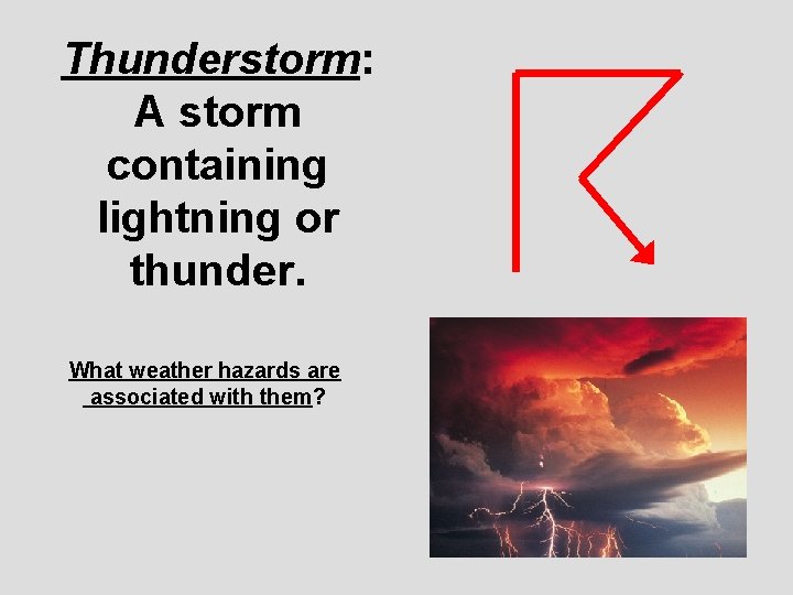
Thunderstorm: A storm containing lightning or thunder. What weather hazards are associated with them?

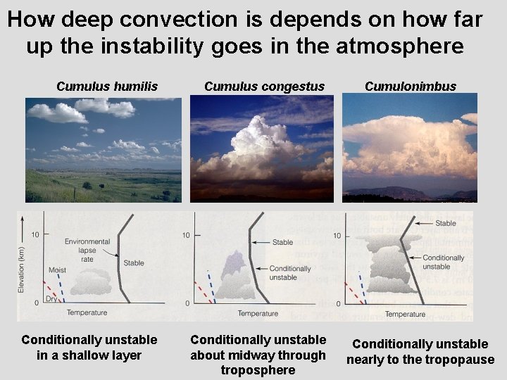
Basic ingredient for thunderstorm… A conditionally unstable environment through a deep enough layer in the troposphere to develop a cumulonimbus cloud

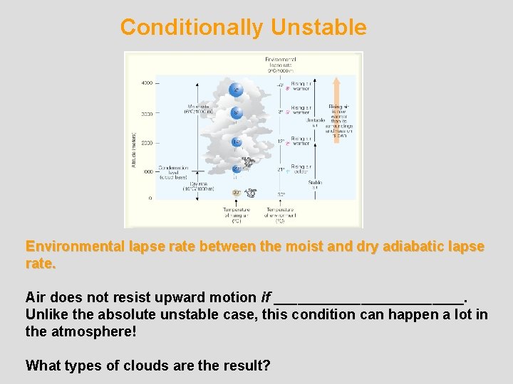
Conditionally Unstable Environmental lapse rate between the moist and dry adiabatic lapse rate. Air does not resist upward motion if ____________. Unlike the absolute unstable case, this condition can happen a lot in the atmosphere! What types of clouds are the result?

How deep convection is depends on how far up the instability goes in the atmosphere Cumulus humilis Cumulus congestus Conditionally unstable in a shallow layer Conditionally unstable about midway through troposphere Cumulonimbus Conditionally unstable nearly to the tropopause

In meteorology, this potential energy associated with conditional instability has a special name CAPE Convective Available Potential Energy

Air mass thunderstorm (Ordinary Cell Thunderstorm) “Garden variety” thunderstorm that starts out as a puffy cumulus cloud, grows into a cumulonimbus, and then quickly dissipates. How long does this take?

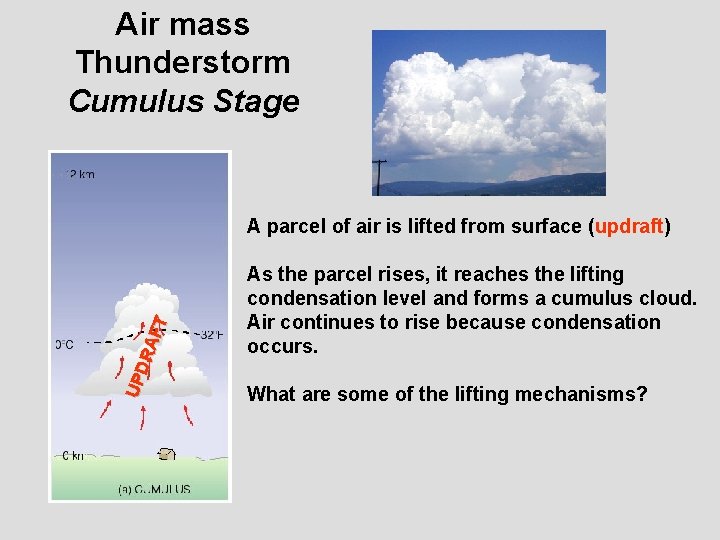
Air mass Thunderstorm Cumulus Stage UPD RA FT A parcel of air is lifted from surface (updraft) As the parcel rises, it reaches the lifting condensation level and forms a cumulus cloud. Air continues to rise because condensation occurs. What are some of the lifting mechanisms?

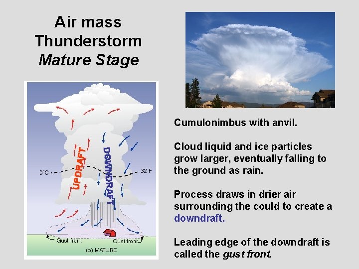
Air mass Thunderstorm Mature Stage DOWNDRAFT UPDRA FT Cumulonimbus with anvil. Cloud liquid and ice particles grow larger, eventually falling to the ground as rain. Process draws in drier air surrounding the could to create a downdraft. Leading edge of the downdraft is called the gust front.

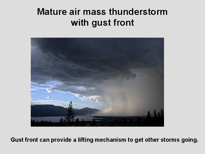
Mature air mass thunderstorm with gust front Gust front can provide a lifting mechanism to get other storms going.

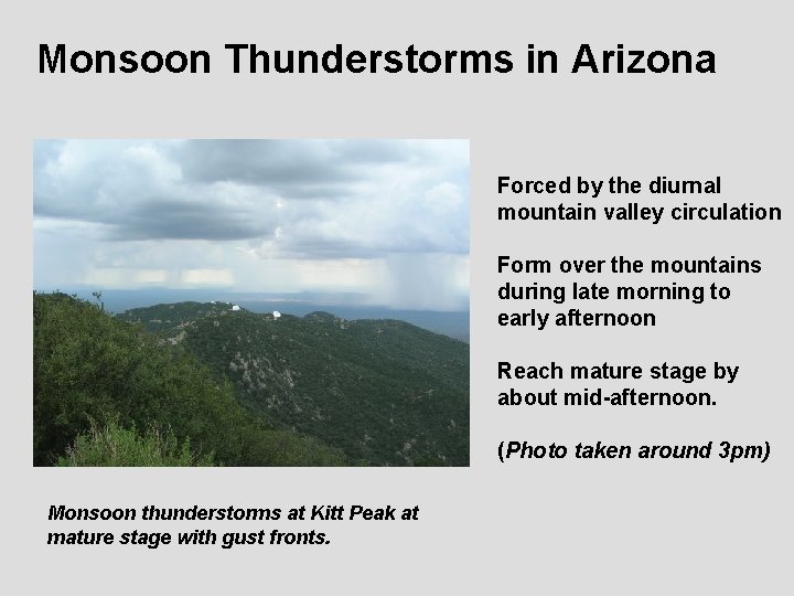
Monsoon Thunderstorms in Arizona Forced by the diurnal mountain valley circulation Form over the mountains during late morning to early afternoon Reach mature stage by about mid-afternoon. (Photo taken around 3 pm) Monsoon thunderstorms at Kitt Peak at mature stage with gust fronts.

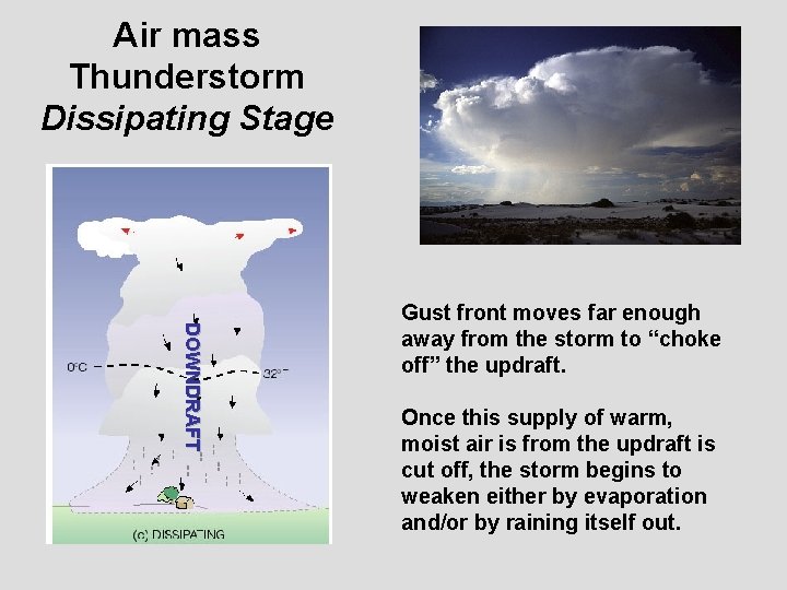
Air mass Thunderstorm Dissipating Stage DOWNDRAFT Gust front moves far enough away from the storm to “choke off” the updraft. Once this supply of warm, moist air is from the updraft is cut off, the storm begins to weaken either by evaporation and/or by raining itself out.

Again, the air mass thunderstorm is the “garden variety” one… To get more the more organized, longer lived severe thunderstorms, we need a combination of more ingredients

Ingredients for severe thunderstorms INGREDIENT 1: CONDITIONAL INSTABILITY Needs to be through the depth of the troposphere Make the atmosphere more conditionally unstable by: __________ near the surface __________ aloft INGREDIENT 2: WIND SHEAR Change in horizontal wind speed through a vertical depth. If the wind speed changes direction as well that’s even better!

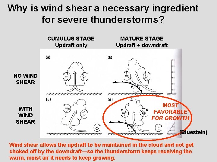
Why is wind shear a necessary ingredient for severe thunderstorms? CUMULUS STAGE Updraft only MATURE STAGE Updraft + downdraft NO WIND SHEAR WITH WIND SHEAR MOST FAVORABLE FOR GROWTH (Bluestein) Wind shear allows the updraft to be maintained in the cloud and not get choked off by the downdraft—so the thunderstorm keeps receiving the warm, moist air it needs to keep growing.

Where to look for severe thunderstorms (in central and eastern U. S. ) In the vicinity of a mid-latitude cyclone Strong upper level winds from the north and west Surface winds from the south to southeast (a low-level jet) Fronts, particularly in front of and at a cold front. What is this called? Drylines: transition zone between dry c. T air and moist m. T air Very common in the southern Great Plains. THESE CAN ENHANCE: 1. THE VERTICAL WIND SHEAR 2. CONDITIONAL INSTABILITY (i. e. CAPE)

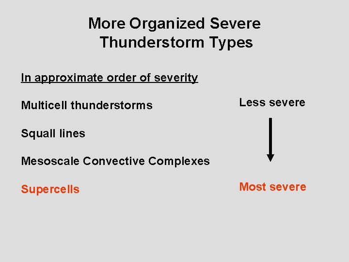
More Organized Severe Thunderstorm Types In approximate order of severity Multicell thunderstorms Less severe Squall lines Mesoscale Convective Complexes Supercells Most severe

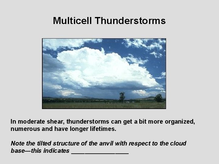
Multicell Thunderstorms In moderate shear, thunderstorms can get a bit more organized, numerous and have longer lifetimes. Note the tilted structure of the anvil with respect to the cloud base—this indicates _________

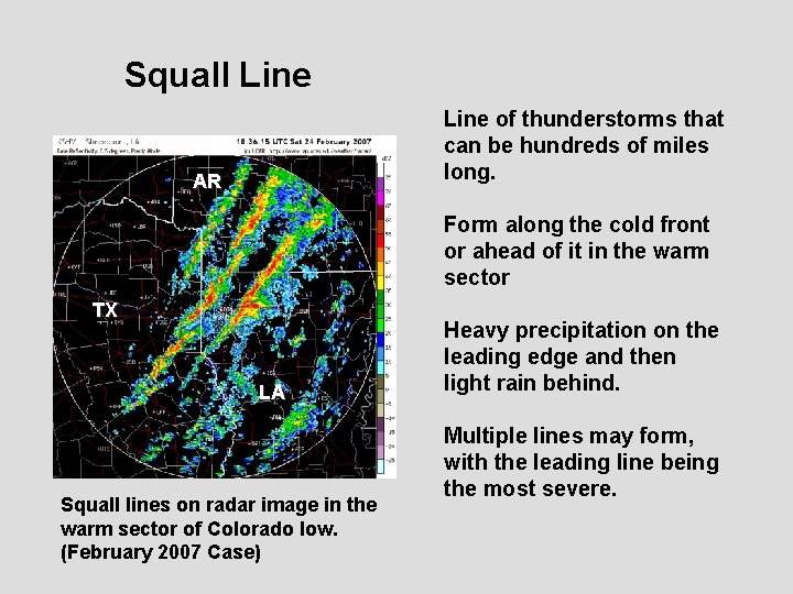
Squall Line of thunderstorms that can be hundreds of miles long. AR Form along the cold front or ahead of it in the warm sector TX LA Squall lines on radar image in the warm sector of Colorado low. (February 2007 Case) Heavy precipitation on the leading edge and then light rain behind. Multiple lines may form, with the leading line being the most severe.

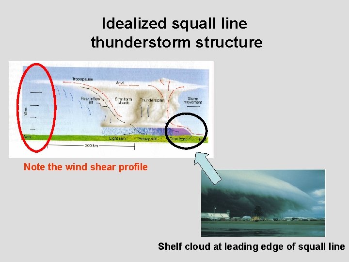
Idealized squall line thunderstorm structure Note the wind shear profile Shelf cloud at leading edge of squall line

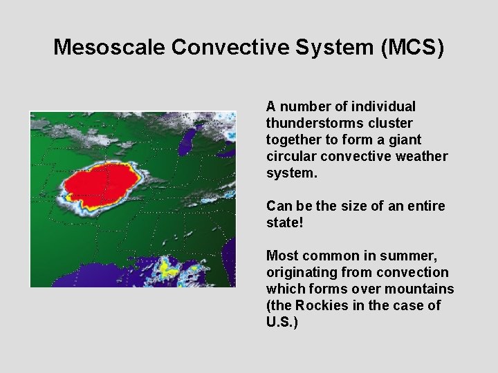
Mesoscale Convective System (MCS) A number of individual thunderstorms cluster together to form a giant circular convective weather system. Can be the size of an entire state! Most common in summer, originating from convection which forms over mountains (the Rockies in the case of U. S. )

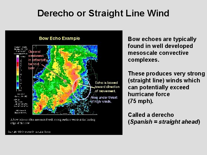
Derecho or Straight Line Wind Bow echoes are typically found in well developed mesoscale convective complexes. These produces very strong (straight line) winds which can potentially exceed hurricane force (75 mph). Called a derecho (Spanish = straight ahead)

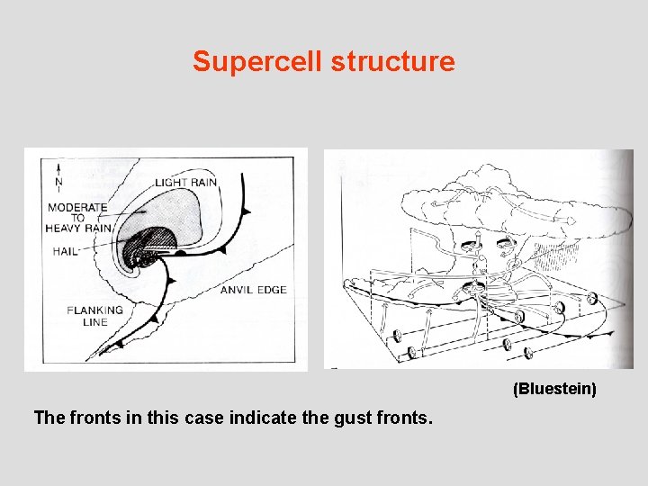
SUPERCELL A BIG ISOLATED THUNDERSTORM THAT CONSISTS OF A ROTATING UPDRAFT. THE MOST SEVERE TYPE OF THUNDERSTORM!

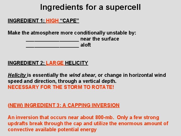
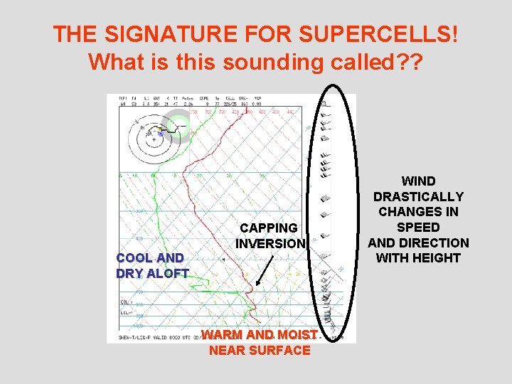
Ingredients for a supercell INGREDIENT 1: HIGH “CAPE” Make the atmosphere more conditionally unstable by: __________ near the surface __________ aloft INGREDIENT 2: LARGE HELICITY Helicity is essentially the wind shear, or change in horizontal wind speed and direction, through a vertical depth. NECESSARY FOR THE STORM TO ROTATE! (NEW) INGREDIENT 3: A CAPPING INVERSION An inversion that occurs near about 800 -mb. Only a few strong updrafts break through the cap and utilize the enormous amount of convective available potential energy

THE SIGNATURE FOR SUPERCELLS! What is this sounding called? ? CAPPING INVERSION COOL AND DRY ALOFT WARM AND MOIST NEAR SURFACE WIND DRASTICALLY CHANGES IN SPEED AND DIRECTION WITH HEIGHT

Supercell structure (Bluestein) The fronts in this case indicate the gust fronts.

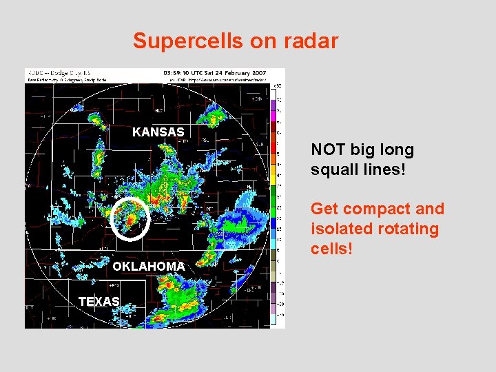
Supercells on radar KANSAS NOT big long squall lines! Get compact and isolated rotating cells! OKLAHOMA TEXAS

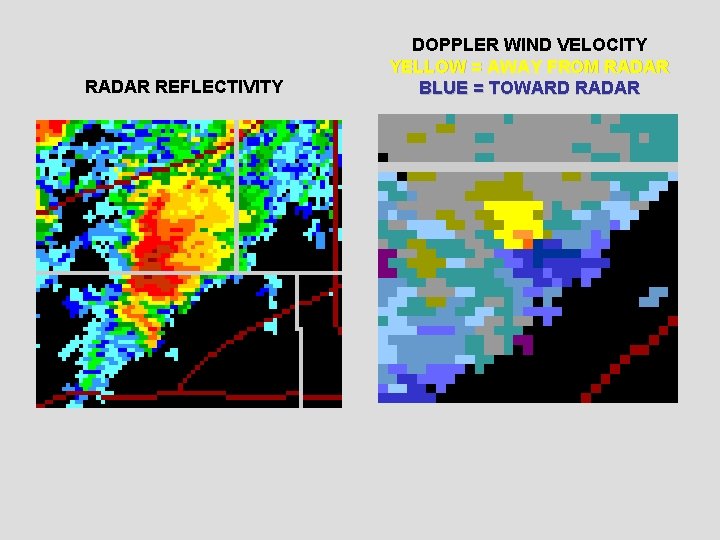
RADAR REFLECTIVITY DOPPLER WIND VELOCITY YELLOW = AWAY FROM RADAR BLUE = TOWARD RADAR

Summary of Lecture 26 A thunderstorm is a storm containing lightning or thunder. Associated weather hazards include heavy rain, hail, high winds, and tornadoes. Basic ingredient for a thunderstorm is a conditionally unstable environment deep enough to develop cumulonimbus clouds. The air mass thunderstorm is the “garden variety” thunderstorm that forms in an environment of low vertical wind shear and lasts an hour or less. Cumulus stage: Updraft only Mature stage: Updraft + downdraft with gust front. Dissipating stage: Updraft ceases, storm rains out or evaporates Wind shear allows the updraft to be maintained in a cumuliform cloud, allowing the thunderstorm to keep growing and have a long lifetime. Severe thunderstorms include: multicell, squall line, mesoscale convective complex, and supercell. Know the differences between these types.

Reading Assignment and Review Questions Reading: Chapter 14 (cont. ) Chapter 14 Review Questions Review: 1, 2, 3, 4, 5, 6, 7, 23, 25 (8 th ed. ) 1, 2, 3, 4, 5, 6, 9, 11, 12, 14, 15, 29, 35 (9 th ed. ) Thought: 1 -3, 9 Problems and Ex. : 1, 5