NATS 101 Section 13 Lecture 23 MidLatitude Cyclones

- Slides: 33

NATS 101 Section 13: Lecture 23 Mid-Latitude Cyclones

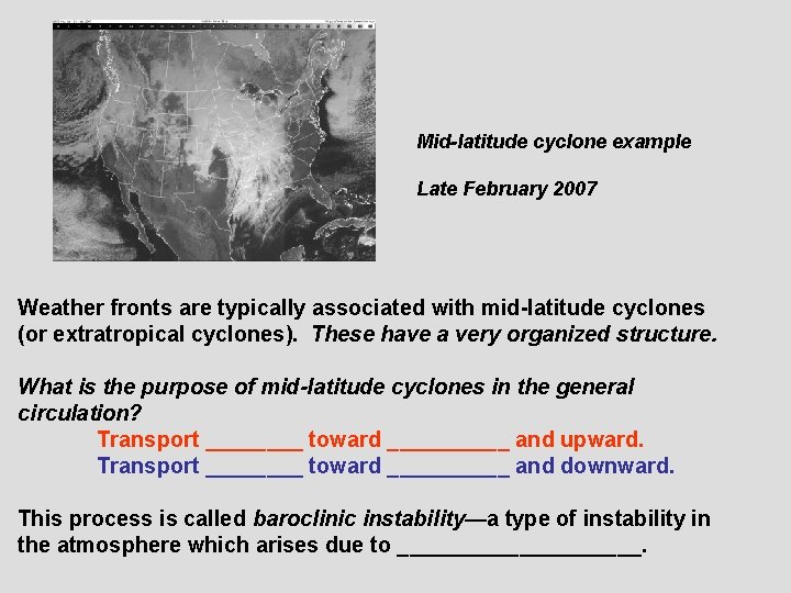
Mid-latitude cyclone example Late February 2007 Weather fronts are typically associated with mid-latitude cyclones (or extratropical cyclones). These have a very organized structure. What is the purpose of mid-latitude cyclones in the general circulation? Transport ____ toward _____ and upward. Transport ____ toward _____ and downward. This process is called baroclinic instability—a type of instability in the atmosphere which arises due to __________.

Questions for today’s discussion How do mid-latitude cyclones form? How are they related to weather fronts? What is their typical life cycle? How are they associated with upper-level features?

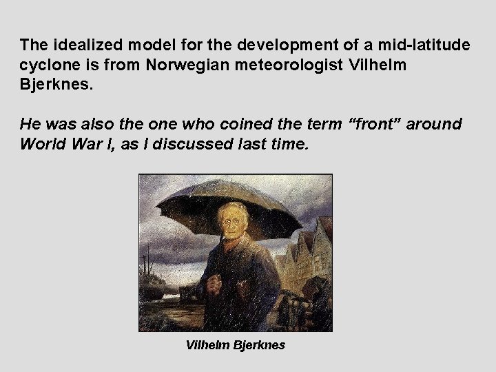
The idealized model for the development of a mid-latitude cyclone is from Norwegian meteorologist Vilhelm Bjerknes. He was also the one who coined the term “front” around World War I, as I discussed last time. Vilhelm Bjerknes

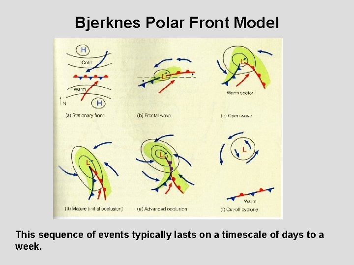
Bjerknes Polar Front Model This sequence of events typically lasts on a timescale of days to a week.

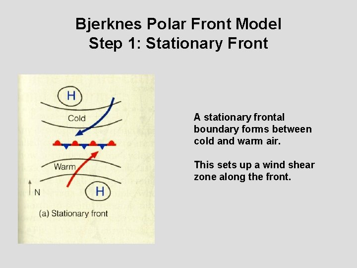
Bjerknes Polar Front Model Step 1: Stationary Front A stationary frontal boundary forms between cold and warm air. This sets up a wind shear zone along the front.

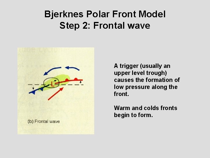
Bjerknes Polar Front Model Step 2: Frontal wave A trigger (usually an upper level trough) causes the formation of low pressure along the front. Warm and colds fronts begin to form.

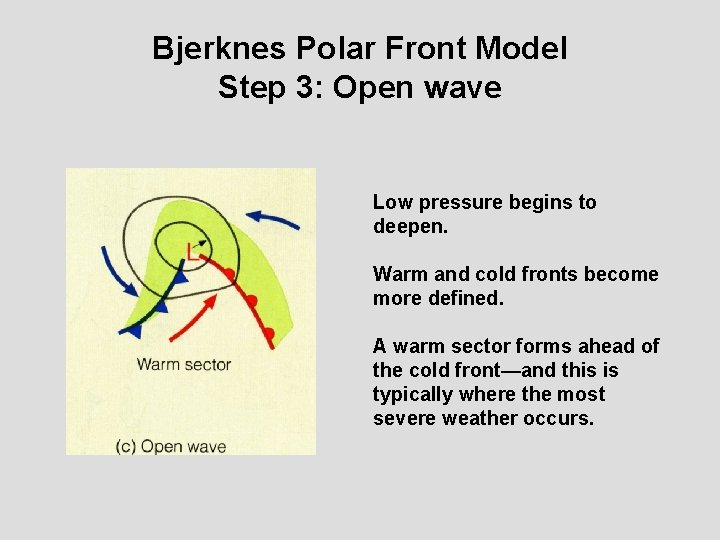
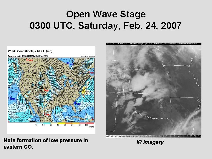
Bjerknes Polar Front Model Step 3: Open wave Low pressure begins to deepen. Warm and cold fronts become more defined. A warm sector forms ahead of the cold front—and this is typically where the most severe weather occurs.

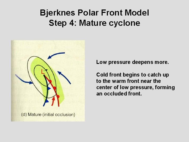
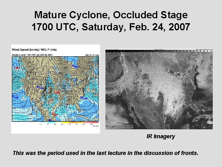
Bjerknes Polar Front Model Step 4: Mature cyclone Low pressure deepens more. Cold front begins to catch up to the warm front near the center of low pressure, forming an occluded front.

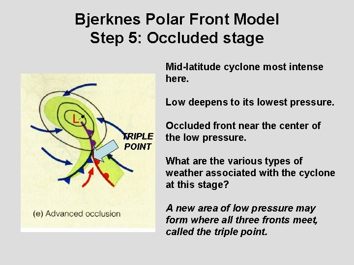
Bjerknes Polar Front Model Step 5: Occluded stage Mid-latitude cyclone most intense here. Low deepens to its lowest pressure. TRIPLE POINT Occluded front near the center of the low pressure. What are the various types of weather associated with the cyclone at this stage? A new area of low pressure may form where all three fronts meet, called the triple point.

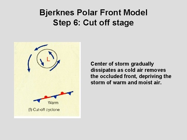
Bjerknes Polar Front Model Step 6: Cut off stage Center of storm gradually dissipates as cold air removes the occluded front, depriving the storm of warm and moist air.

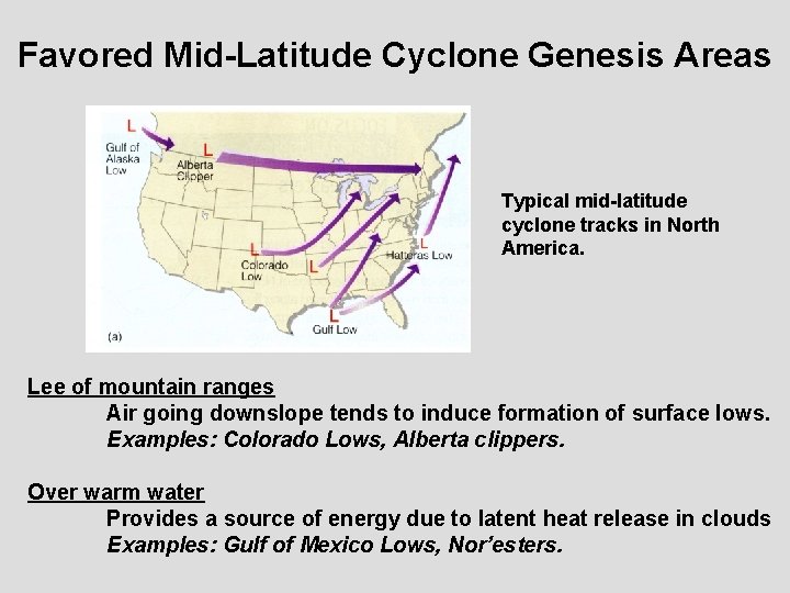
Favored Mid-Latitude Cyclone Genesis Areas Typical mid-latitude cyclone tracks in North America. Lee of mountain ranges Air going downslope tends to induce formation of surface lows. Examples: Colorado Lows, Alberta clippers. Over warm water Provides a source of energy due to latent heat release in clouds Examples: Gulf of Mexico Lows, Nor’esters.

The late February 2007 case we’ve been looking at is a good example of a Colorado low.

Open Wave Stage 0300 UTC, Saturday, Feb. 24, 2007 Note formation of low pressure in eastern CO. IR Imagery

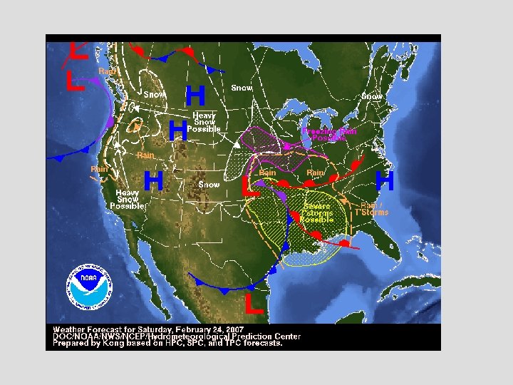
Mature Cyclone, Occluded Stage 1700 UTC, Saturday, Feb. 24, 2007 IR Imagery This was the period used in the last lecture in the discussion of fronts.


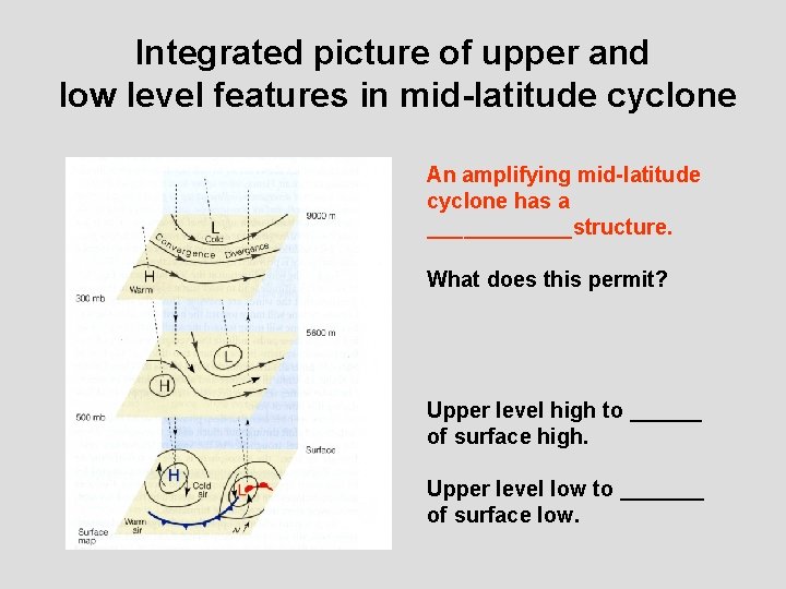
What is happening at upper-levels in a mid-latitude cyclone? Key idea is that for a mid-latitude cyclone to keep intensifying it needs: ______ below ______ aloft

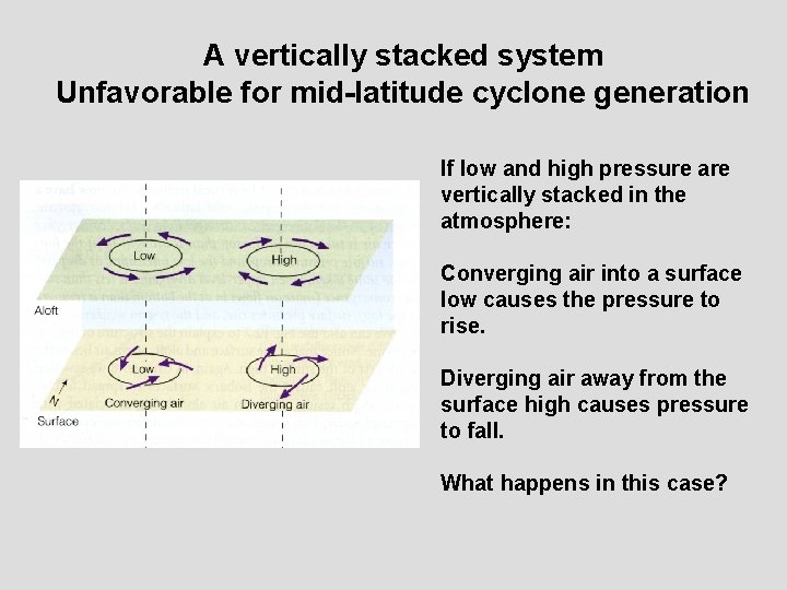
A vertically stacked system Unfavorable for mid-latitude cyclone generation If low and high pressure are vertically stacked in the atmosphere: Converging air into a surface low causes the pressure to rise. Diverging air away from the surface high causes pressure to fall. What happens in this case?

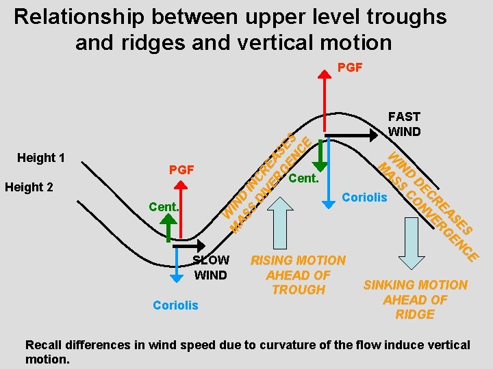
Relationship between upper level troughs and ridges and vertical motion PGF Height 2 Cent. SLOW WIND Coriolis FAST WIND Cent. S CE SE EN EA RG R C VE DE N D CO IN S W AS M Height 1 W M IN AS D S IN DI CR VE E RG AS EN ES C E PGF Coriolis RISING MOTION AHEAD OF TROUGH SINKING MOTION AHEAD OF RIDGE Recall differences in wind speed due to curvature of the flow induce vertical motion.

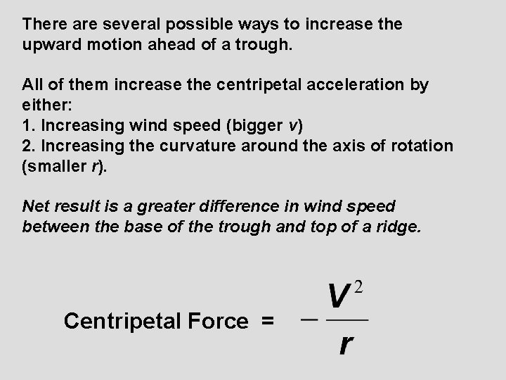
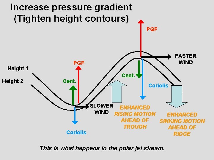
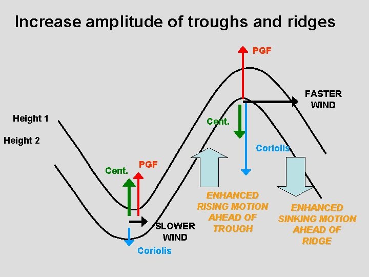
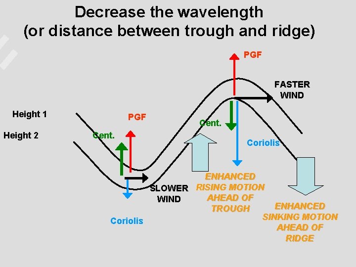
There are several possible ways to increase the upward motion ahead of a trough. All of them increase the centripetal acceleration by either: 1. Increasing wind speed (bigger v) 2. Increasing the curvature around the axis of rotation (smaller r). Net result is a greater difference in wind speed between the base of the trough and top of a ridge. Centripetal Force =

Increase pressure gradient (Tighten height contours) PGF Height 1 Height 2 FASTER WIND PGF Cent. Coriolis SLOWER ENHANCED WIND RISING MOTION Coriolis AHEAD OF TROUGH ENHANCED SINKING MOTION AHEAD OF RIDGE This is what happens in the polar jet stream.

Increase amplitude of troughs and ridges PGF FASTER WIND Height 1 Cent. Height 2 Coriolis Cent. PGF ENHANCED RISING MOTION AHEAD OF SLOWER TROUGH WIND Coriolis ENHANCED SINKING MOTION AHEAD OF RIDGE

Decrease the wavelength (or distance between trough and ridge) PGF FASTER WIND Height 1 Height 2 PGF Cent. Coriolis ENHANCED SLOWER RISING MOTION AHEAD OF WIND ENHANCED TROUGH SINKING MOTION Coriolis AHEAD OF RIDGE

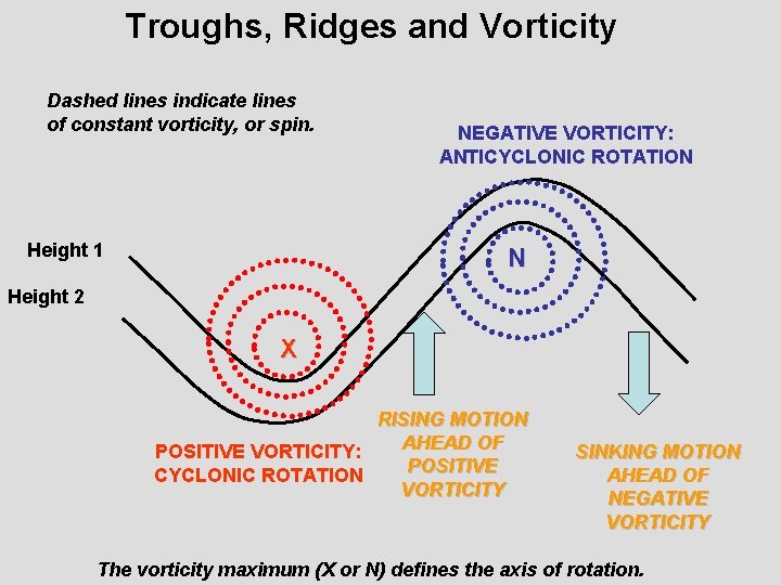
Another way to look at it is with the concept of vorticity, or “spin” in the atmosphere. This is more the norm in reading an actual weather chart. Greater curvature More vorticity.

Troughs, Ridges and Vorticity Dashed lines indicate lines of constant vorticity, or spin. Height 1 NEGATIVE VORTICITY: ANTICYCLONIC ROTATION N Height 2 X RISING MOTION AHEAD OF POSITIVE VORTICITY: POSITIVE CYCLONIC ROTATION VORTICITY SINKING MOTION AHEAD OF NEGATIVE VORTICITY The vorticity maximum (X or N) defines the axis of rotation.

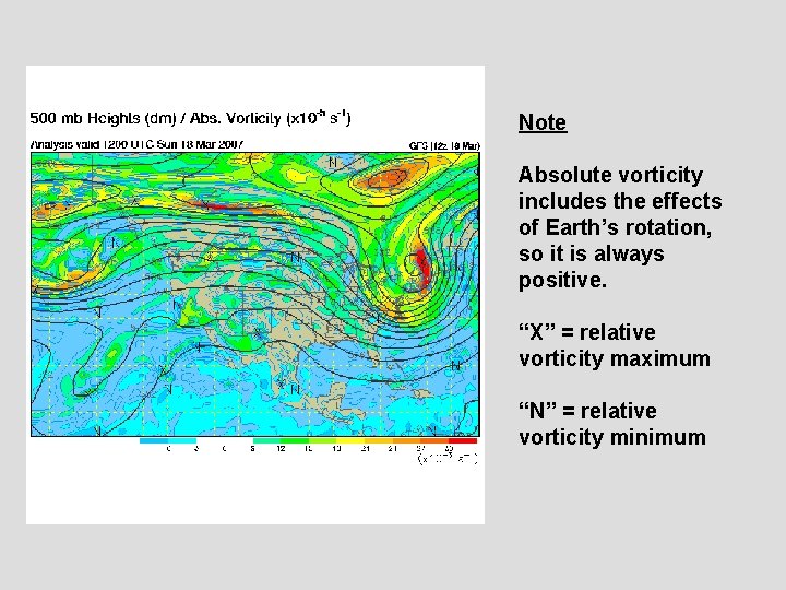
Note Absolute vorticity includes the effects of Earth’s rotation, so it is always positive. “X” = relative vorticity maximum “N” = relative vorticity minimum

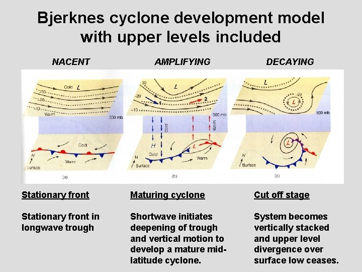
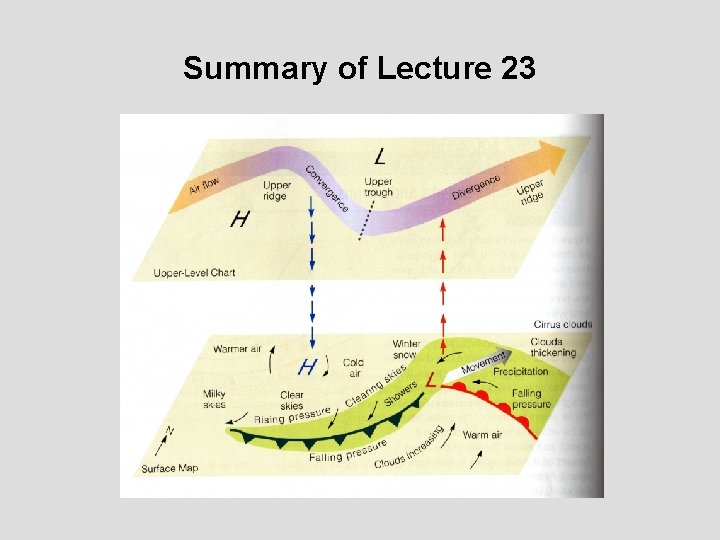
Integrated picture of upper and low level features in mid-latitude cyclone An amplifying mid-latitude cyclone has a ______structure. What does this permit? Upper level high to ______ of surface high. Upper level low to _______ of surface low.

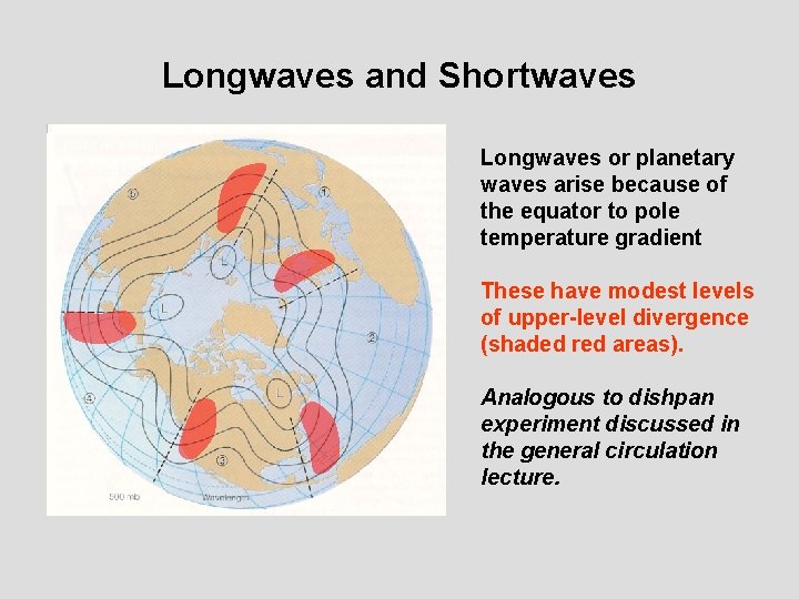
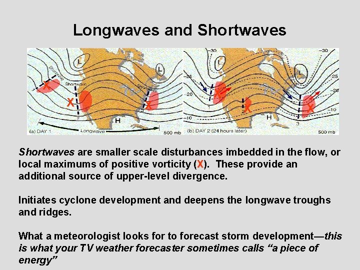
Longwaves and Shortwaves Longwaves or planetary waves arise because of the equator to pole temperature gradient These have modest levels of upper-level divergence (shaded red areas). Analogous to dishpan experiment discussed in the general circulation lecture.

Longwaves and Shortwaves X X X Shortwaves are smaller scale disturbances imbedded in the flow, or local maximums of positive vorticity (X). These provide an additional source of upper-level divergence. Initiates cyclone development and deepens the longwave troughs and ridges. What a meteorologist looks for to forecast storm development—this is what your TV weather forecaster sometimes calls “a piece of energy”

Bjerknes cyclone development model with upper levels included NACENT AMPLIFYING DECAYING Stationary front Maturing cyclone Cut off stage Stationary front in longwave trough Shortwave initiates deepening of trough and vertical motion to develop a mature midlatitude cyclone. System becomes vertically stacked and upper level divergence over surface low ceases.

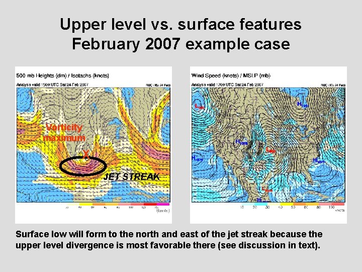
Upper level vs. surface features February 2007 example case Vorticity maximum X JET STREAK Surface low will form to the north and east of the jet streak because the upper level divergence is most favorable there (see discussion in text).

Summary of Lecture 23

Reading Assignment and Review Questions Reading: Chapter 13 Chapter 12 Questions for Review (8 th ed. ): 1, 2, 3, 4, 5, 6, 7, 8, 9, 10, 11, 12, 14, 17 (9 th ed. ): 1, 2, 3, 4, 5, 6, 7, 8, 9, 10, 11, 12, 13, 15, 18 Questions for Thought: 2, 5, 7, 8 Problems and Exercises: 1, 2