NATS 101 Section 13 Lecture 13 Precipitation Precipitation


- Slides: 33

NATS 101 Section 13: Lecture 13 Precipitation

Precipitation: Any form of water particles —liquid or solid—that falls from the atmosphere and reaches the ground How do we get there?

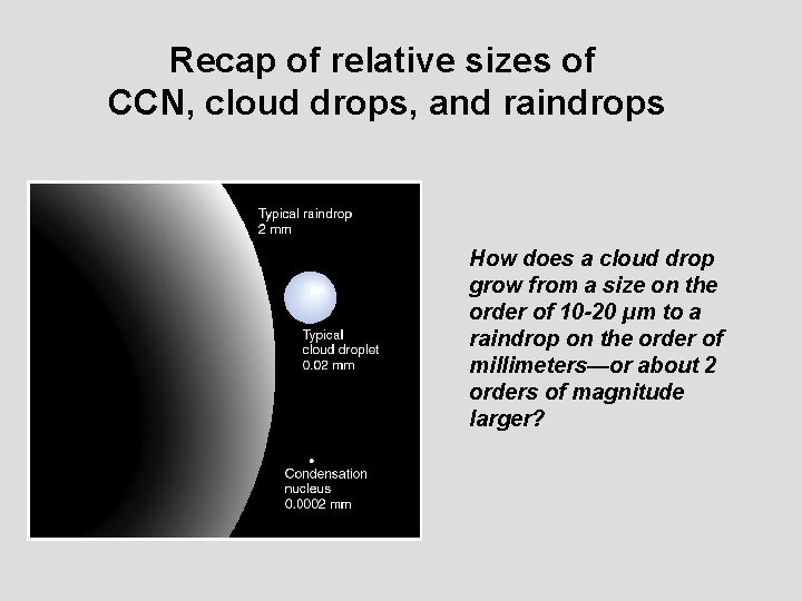
Recap of relative sizes of CCN, cloud drops, and raindrops How does a cloud drop grow from a size on the order of 10 -20 µm to a raindrop on the order of millimeters—or about 2 orders of magnitude larger?

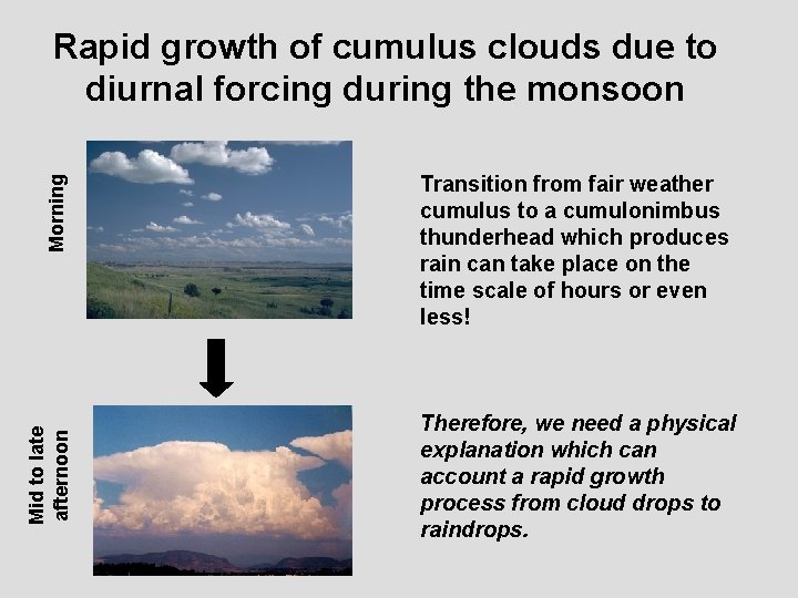
Mid to late afternoon Morning Rapid growth of cumulus clouds due to diurnal forcing during the monsoon Transition from fair weather cumulus to a cumulonimbus thunderhead which produces rain can take place on the time scale of hours or even less! Therefore, we need a physical explanation which can account a rapid growth process from cloud drops to raindrops.

Cloud Drop Growth Possibility #1: Drops grow independently by condensation in a saturated or supersaturated environment Two factors to consider: Curvature of the drop Presence of hygroscopic CCN

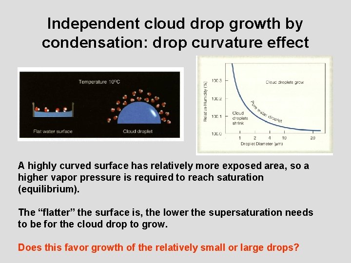
Independent cloud drop growth by condensation: drop curvature effect A highly curved surface has relatively more exposed area, so a higher vapor pressure is required to reach saturation (equilibrium). The “flatter” the surface is, the lower the supersaturation needs to be for the cloud drop to grow. Does this favor growth of the relatively small or large drops?

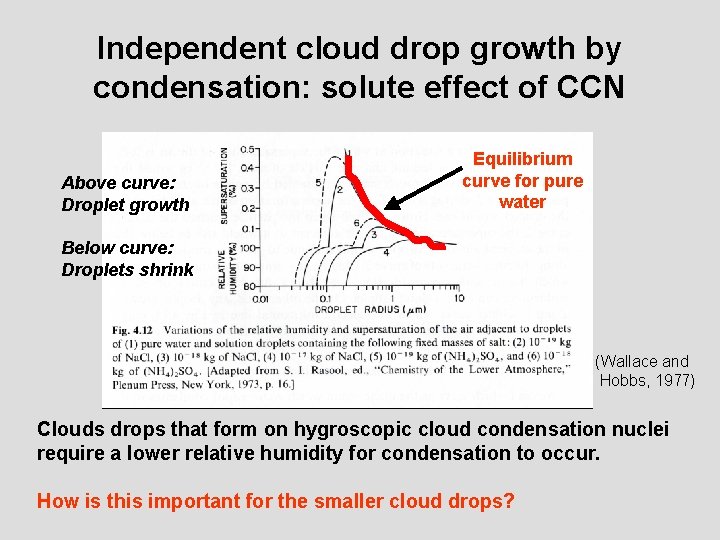
Independent cloud drop growth by condensation: solute effect of CCN Above curve: Droplet growth Equilibrium curve for pure water Below curve: Droplets shrink (Wallace and Hobbs, 1977) Clouds drops that form on hygroscopic cloud condensation nuclei require a lower relative humidity for condensation to occur. How is this important for the smaller cloud drops?

Even through individual drop may be favored by the effects of drop curvature or the solubility of CCN, these processes are too slow to account for the rapid drop growth The bigger drops must somehow interact with the smaller drops.

Drop Growth Possibility #2: Drops grow by colliding and coalescing with each other.

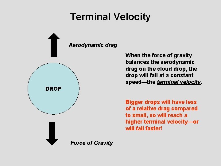
Terminal Velocity Aerodynamic drag When the force of gravity balances the aerodynamic drag on the cloud drop, the drop will fall at a constant speed—the terminal velocity. DROP Bigger drops will have less of a relative drag compared to small, so will reach a higher terminal velocity—or will faster! Force of Gravity

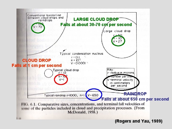
LARGE CLOUD DROP Falls at about 30 -70 cm per second CLOUD DROP Falls at 1 cm per second RAINDROP Falls at about 650 cm per second (Rogers and Yau, 1989)

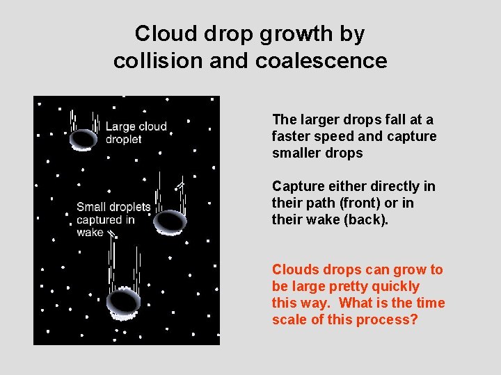
Cloud drop growth by collision and coalescence The larger drops fall at a faster speed and capture smaller drops Capture either directly in their path (front) or in their wake (back). Clouds drops can grow to be large pretty quickly this way. What is the time scale of this process?

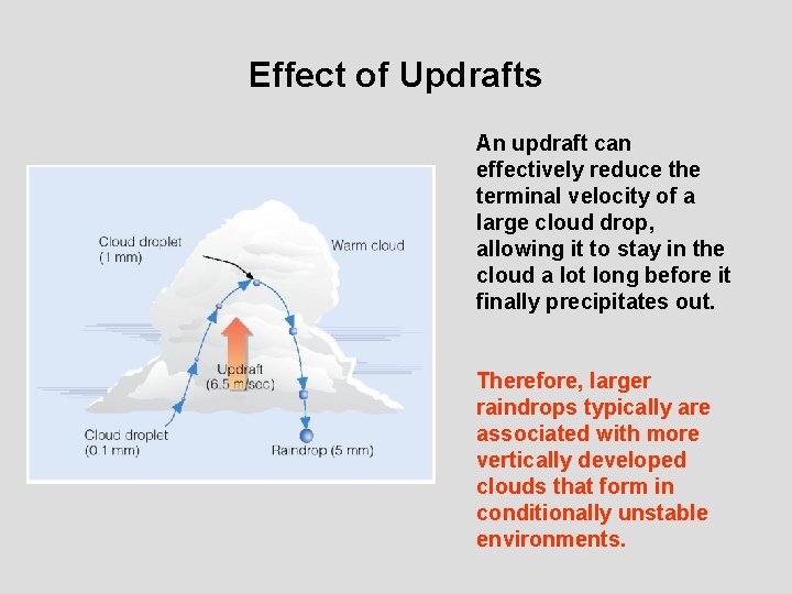
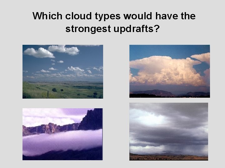
Effect of Updrafts An updraft can effectively reduce the terminal velocity of a large cloud drop, allowing it to stay in the cloud a lot long before it finally precipitates out. Therefore, larger raindrops typically are associated with more vertically developed clouds that form in conditionally unstable environments.

Which cloud types would have the strongest updrafts?

So far we focused our discussion to warm clouds—without ice. What happens in a cloud with both water and ice?

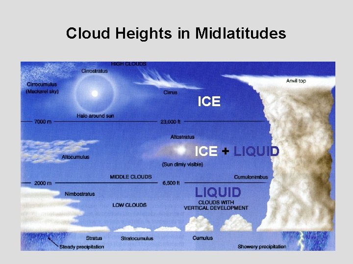
Cloud Heights in Midlatitudes ICE + LIQUID

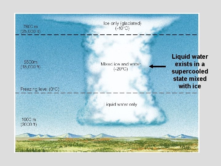
Liquid water exists in a supercooled state mixed with ice

The growth of ice crystals follows a similar logic to that of water droplets discussed earlier Possibilities: Individual ice crystals grow by sublimation Ice crystals combine

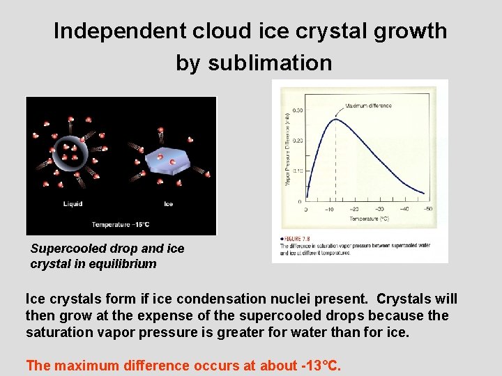
Independent cloud ice crystal growth by sublimation Supercooled drop and ice crystal in equilibrium Ice crystals form if ice condensation nuclei present. Crystals will then grow at the expense of the supercooled drops because the saturation vapor pressure is greater for water than for ice. The maximum difference occurs at about -13°C.

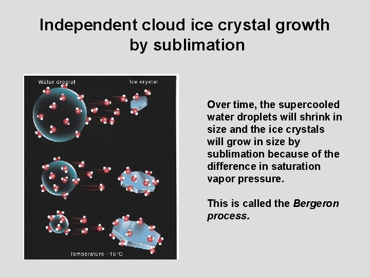
Independent cloud ice crystal growth by sublimation Over time, the supercooled water droplets will shrink in size and the ice crystals will grow in size by sublimation because of the difference in saturation vapor pressure. This is called the Bergeron process.

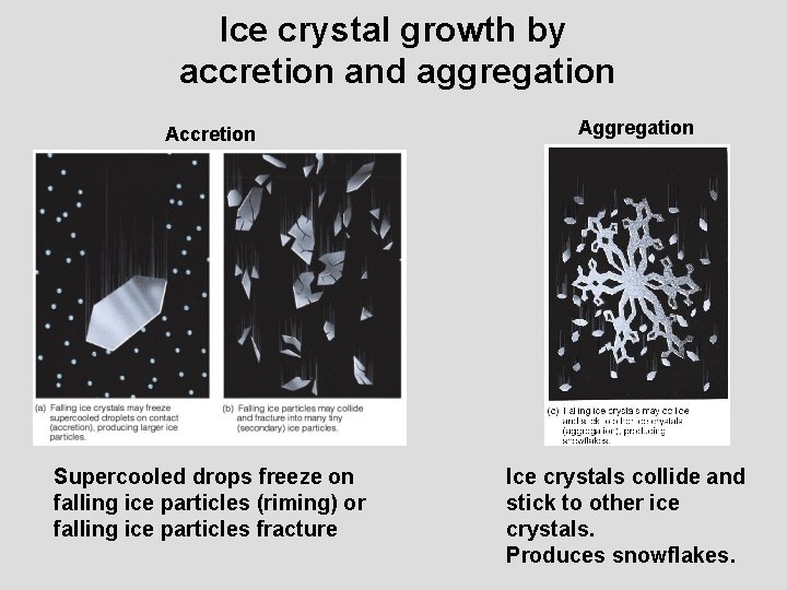
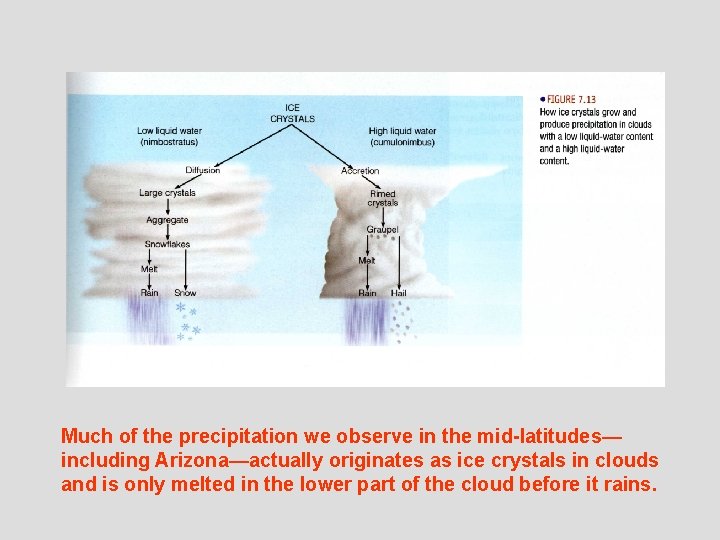
Ice crystal growth by accretion and aggregation Accretion Supercooled drops freeze on falling ice particles (riming) or falling ice particles fracture Aggregation Ice crystals collide and stick to other ice crystals. Produces snowflakes.

Much of the precipitation we observe in the mid-latitudes— including Arizona—actually originates as ice crystals in clouds and is only melted in the lower part of the cloud before it rains.

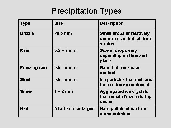
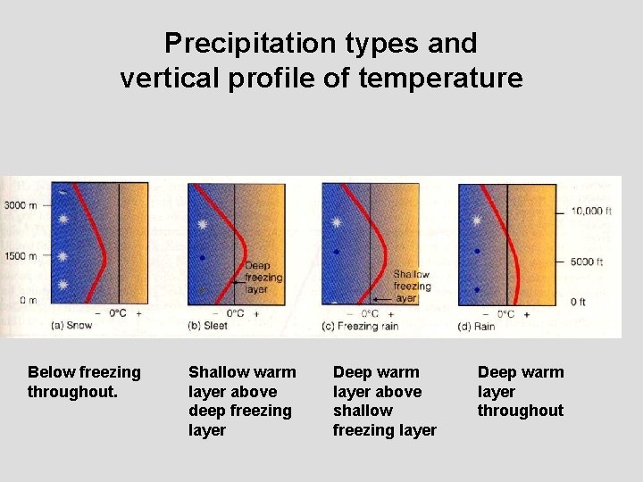
Precipitation Types Type Size Description Drizzle <0. 5 mm Small drops of relatively uniform size that fall from stratus Rain 0. 5 – 5 mm Size of drops vary depending on time and place Freezing rain 0. 5 – 5 mm Rain that freezes on contact Sleet 0. 5 – 5 mm Ice particles that melt and then re-freeze on decent Snow 1 – 2 mm Aggregated ice crystals that remain frozen during decent Hail 5 to 10 cm or larger Hard pellets of ice from cumulonimbus

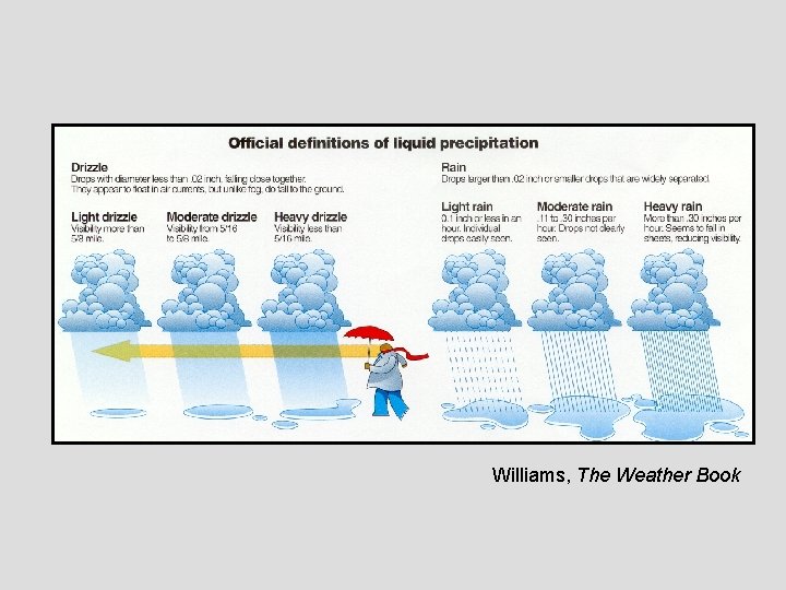
Williams, The Weather Book

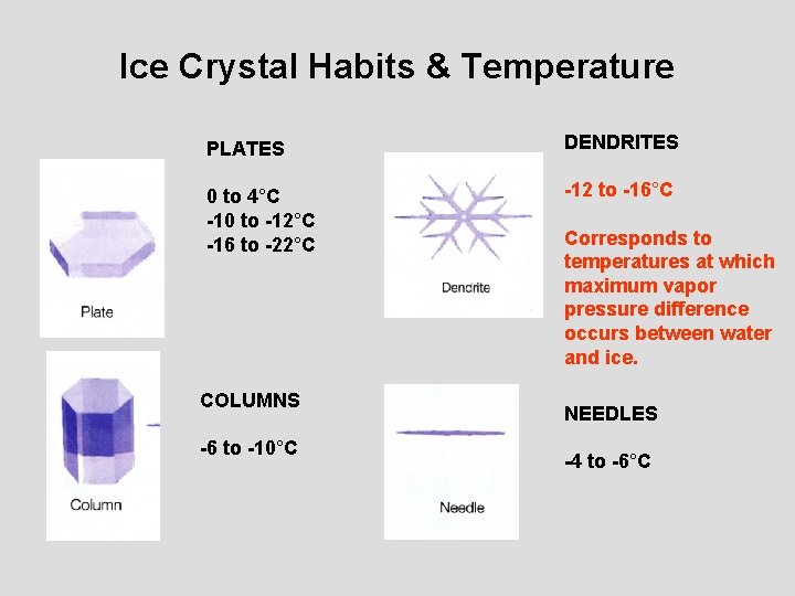
Ice Crystal Habits & Temperature PLATES DENDRITES 0 to 4°C -10 to -12°C -16 to -22°C -12 to -16°C COLUMNS -6 to -10°C Corresponds to temperatures at which maximum vapor pressure difference occurs between water and ice. NEEDLES -4 to -6°C

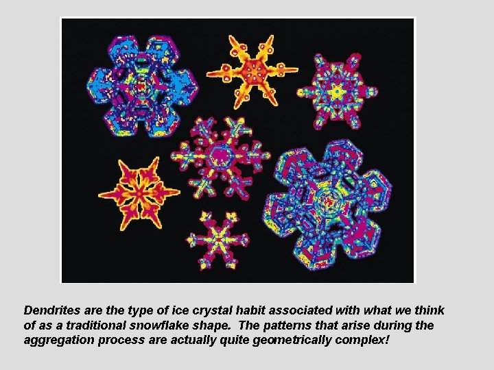
Dendrites are the type of ice crystal habit associated with what we think of as a traditional snowflake shape. The patterns that arise during the aggregation process are actually quite geometrically complex!

Precipitation types and vertical profile of temperature Below freezing throughout. Shallow warm layer above deep freezing layer Deep warm layer above shallow freezing layer Deep warm layer throughout

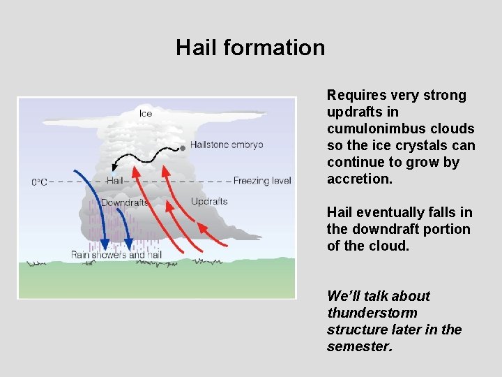
Hail formation Requires very strong updrafts in cumulonimbus clouds so the ice crystals can continue to grow by accretion. Hail eventually falls in the downdraft portion of the cloud. We’ll talk about thunderstorm structure later in the semester.

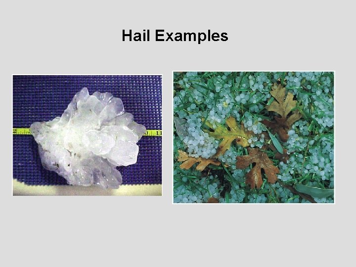
Hail Examples

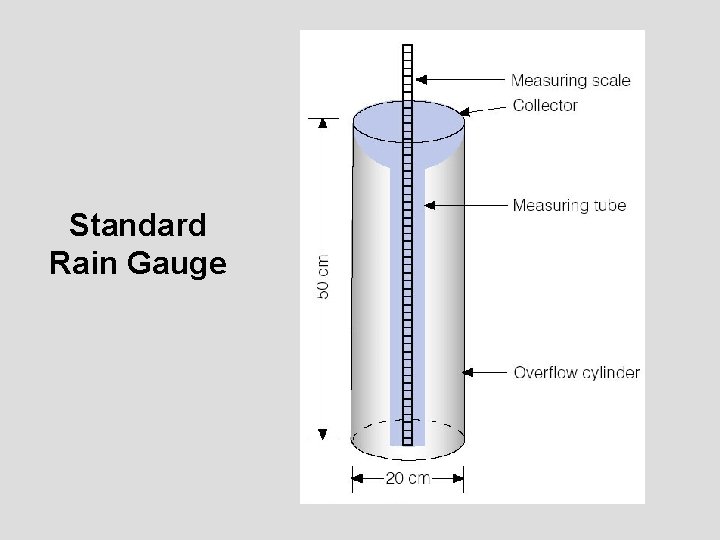
Standard Rain Gauge

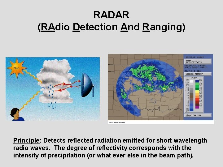
RADAR (RAdio Detection And Ranging) Principle: Detects reflected radiation emitted for short wavelength radio waves. The degree of reflectivity corresponds with the intensity of precipitation (or what ever else in the beam path).

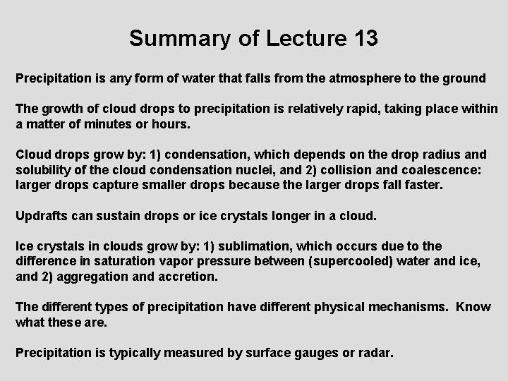
Summary of Lecture 13 Precipitation is any form of water that falls from the atmosphere to the ground The growth of cloud drops to precipitation is relatively rapid, taking place within a matter of minutes or hours. Cloud drops grow by: 1) condensation, which depends on the drop radius and solubility of the cloud condensation nuclei, and 2) collision and coalescence: larger drops capture smaller drops because the larger drops fall faster. Updrafts can sustain drops or ice crystals longer in a cloud. Ice crystals in clouds grow by: 1) sublimation, which occurs due to the difference in saturation vapor pressure between (supercooled) water and ice, and 2) aggregation and accretion. The different types of precipitation have different physical mechanisms. Know what these are. Precipitation is typically measured by surface gauges or radar.

Reading Assignment and Review Questions Chapter 8 pp. 192 -202 (8 th ed. ) pp. 194 -205 (9 th ed. )