NATS 101 Section 13 Lecture 11 Clouds Cloud
- Slides: 35

NATS 101 Section 13: Lecture 11 Clouds


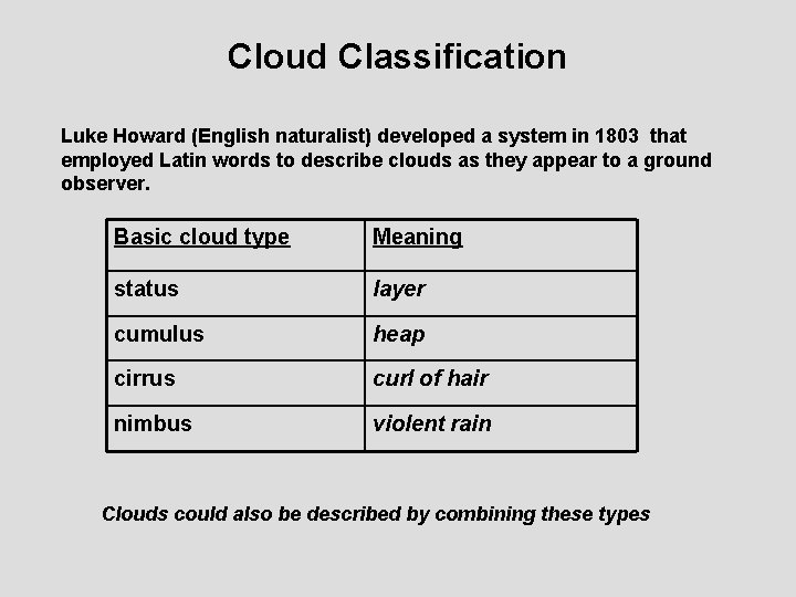
Cloud Classification Luke Howard (English naturalist) developed a system in 1803 that employed Latin words to describe clouds as they appear to a ground observer. Basic cloud type Meaning status layer cumulus heap cirrus curl of hair nimbus violent rain Clouds could also be described by combining these types

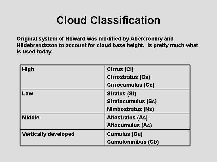
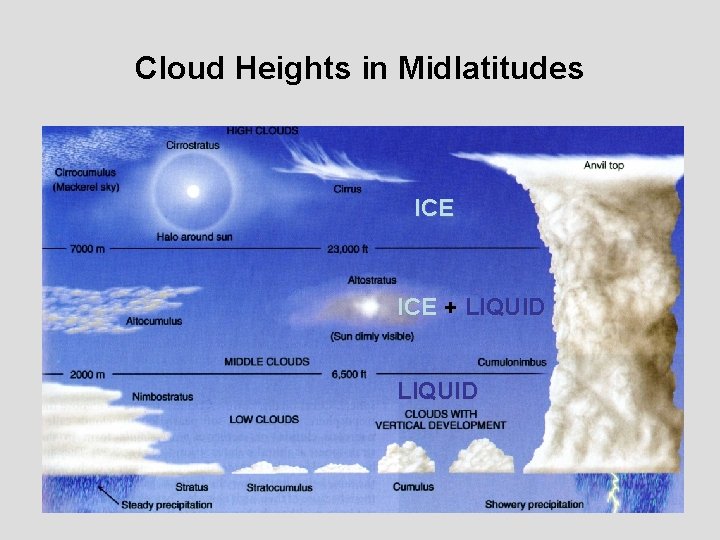
Cloud Classification Original system of Howard was modified by Abercromby and Hildebrandsson to account for cloud base height. Is pretty much what is used today. High Cirrus (Ci) Cirrostratus (Cs) Cirrocumulus (Cc) Low Stratus (St) Stratocumulus (Sc) Nimbostratus (Ns) Middle Altostratus (As) Altocumulus (Ac) Vertically developed Cumulus (Cu) Cumulonimbus (Cb)

Cloud Heights in Midlatitudes ICE + LIQUID

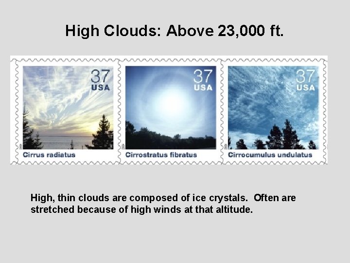
High Clouds: Above 23, 000 ft. High, thin clouds are composed of ice crystals. Often are stretched because of high winds at that altitude.

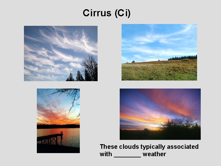
Cirrus (Ci) These clouds typically associated with ____ weather

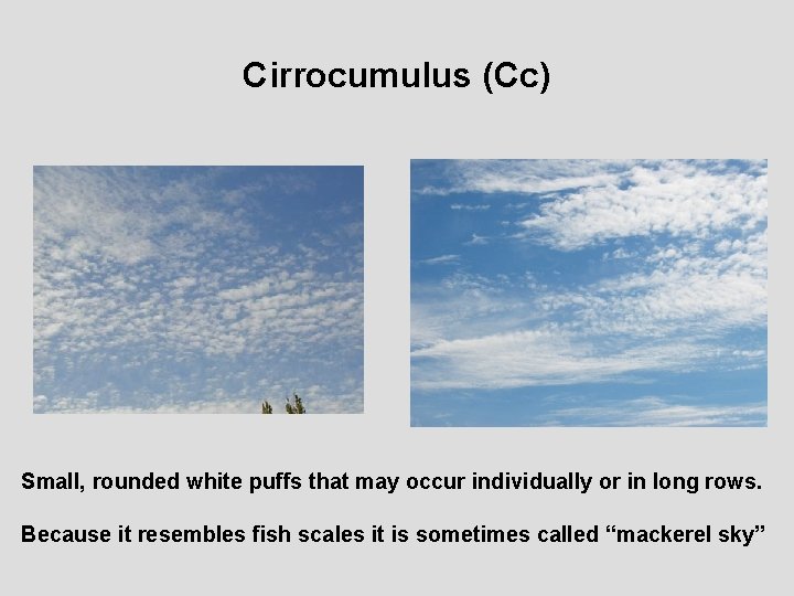
Cirrocumulus (Cc) Small, rounded white puffs that may occur individually or in long rows. Because it resembles fish scales it is sometimes called “mackerel sky”

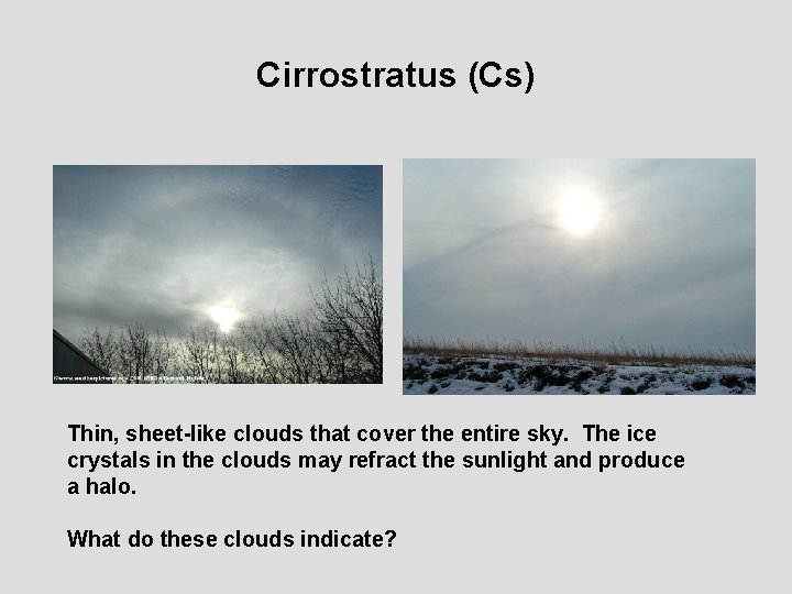
Cirrostratus (Cs) Thin, sheet-like clouds that cover the entire sky. The ice crystals in the clouds may refract the sunlight and produce a halo. What do these clouds indicate?

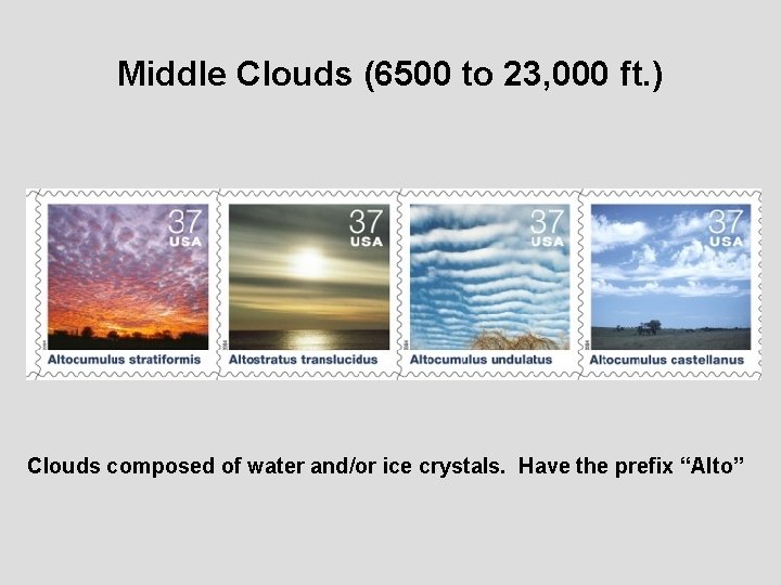
Middle Clouds (6500 to 23, 000 ft. ) Clouds composed of water and/or ice crystals. Have the prefix “Alto”

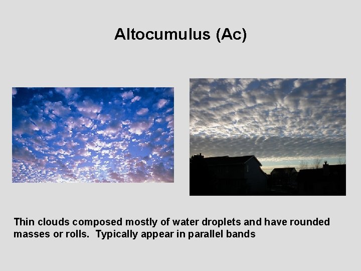
Altocumulus (Ac) Thin clouds composed mostly of water droplets and have rounded masses or rolls. Typically appear in parallel bands

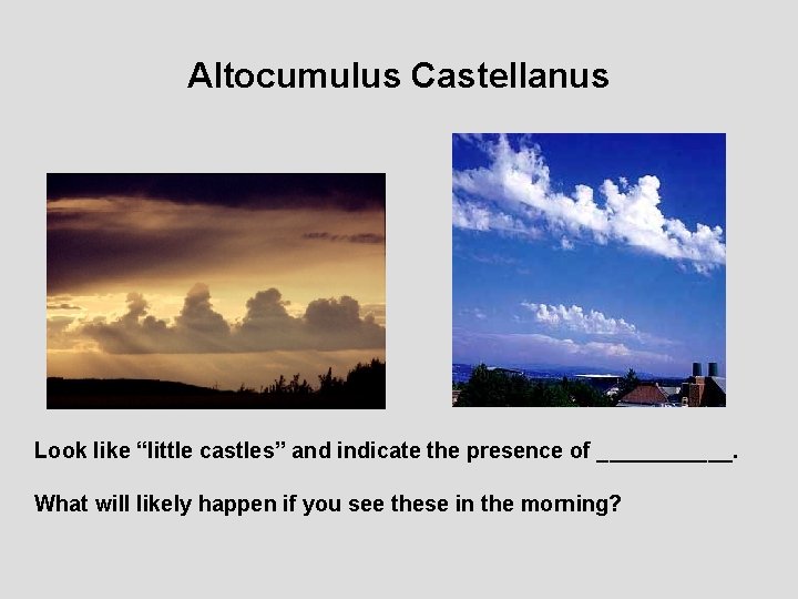
Altocumulus Castellanus Look like “little castles” and indicate the presence of ______. What will likely happen if you see these in the morning?

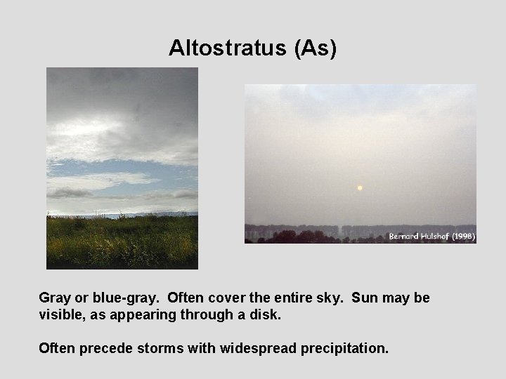
Altostratus (As) Gray or blue-gray. Often cover the entire sky. Sun may be visible, as appearing through a disk. Often precede storms with widespread precipitation.

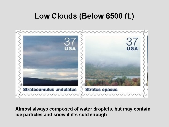
Low Clouds (Below 6500 ft. ) Almost always composed of water droplets, but may contain ice particles and snow if it’s cold enough

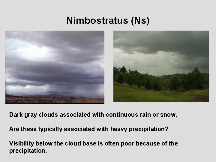
Nimbostratus (Ns) Dark gray clouds associated with continuous rain or snow, Are these typically associated with heavy precipitation? Visibility below the cloud base is often poor because of the precipitation.

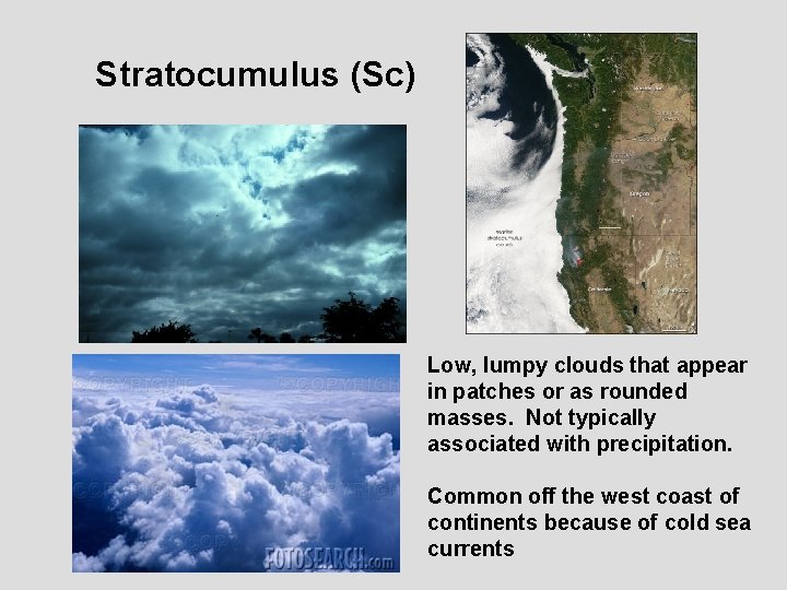
Stratocumulus (Sc) Low, lumpy clouds that appear in patches or as rounded masses. Not typically associated with precipitation. Common off the west coast of continents because of cold sea currents

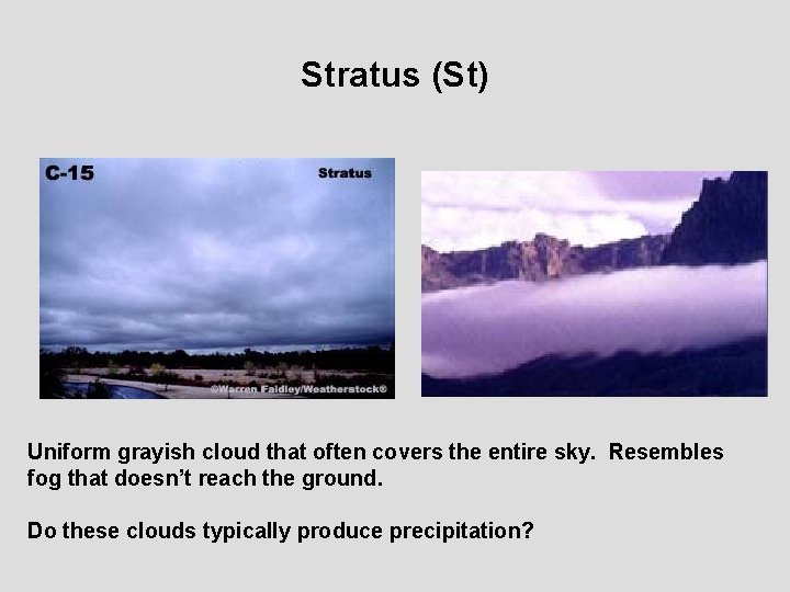
Stratus (St) Uniform grayish cloud that often covers the entire sky. Resembles fog that doesn’t reach the ground. Do these clouds typically produce precipitation?

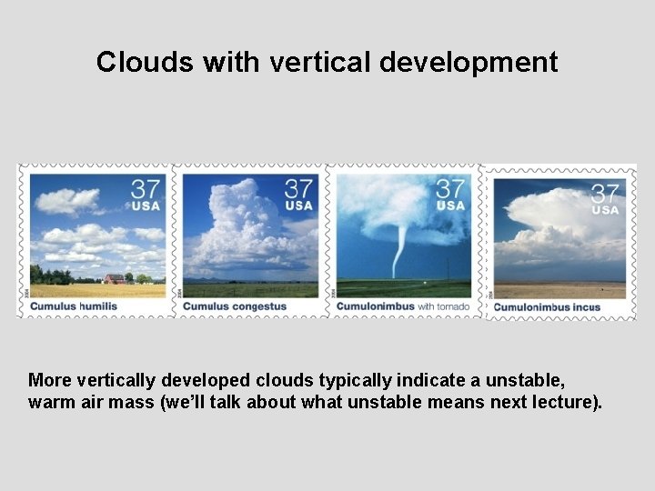
Clouds with vertical development More vertically developed clouds typically indicate a unstable, warm air mass (we’ll talk about what unstable means next lecture).

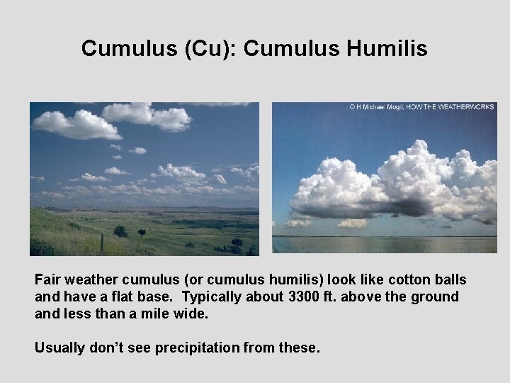
Cumulus (Cu): Cumulus Humilis Fair weather cumulus (or cumulus humilis) look like cotton balls and have a flat base. Typically about 3300 ft. above the ground and less than a mile wide. Usually don’t see precipitation from these.

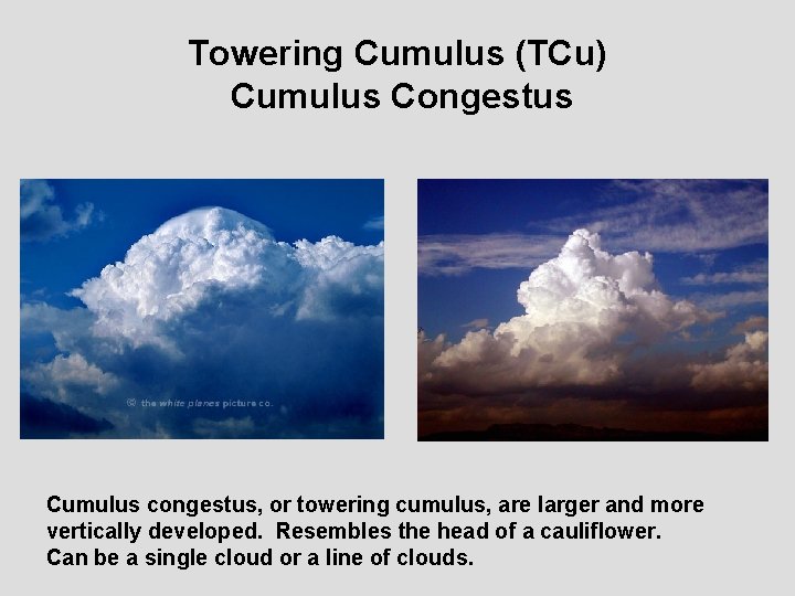
Towering Cumulus (TCu) Cumulus Congestus Cumulus congestus, or towering cumulus, are larger and more vertically developed. Resembles the head of a cauliflower. Can be a single cloud or a line of clouds.

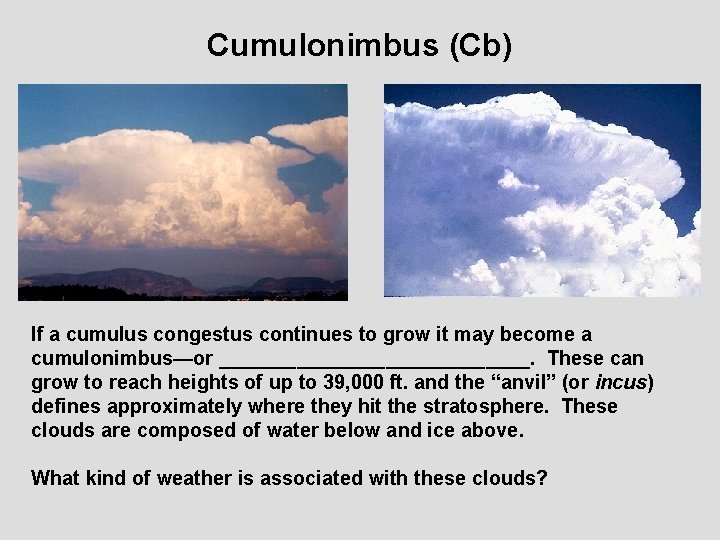
Cumulonimbus (Cb) If a cumulus congestus continues to grow it may become a cumulonimbus—or ______________. These can grow to reach heights of up to 39, 000 ft. and the “anvil” (or incus) defines approximately where they hit the stratosphere. These clouds are composed of water below and ice above. What kind of weather is associated with these clouds?

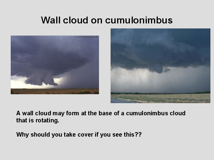
Wall cloud on cumulonimbus A wall cloud may form at the base of a cumulonimbus cloud that is rotating. Why should you take cover if you see this? ?

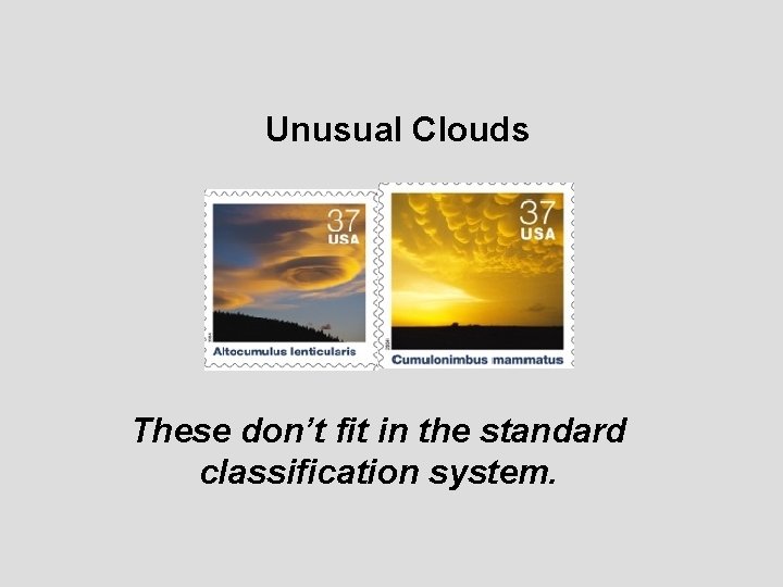
Unusual Clouds These don’t fit in the standard classification system.

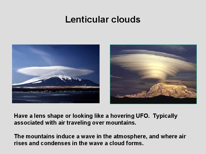
Lenticular clouds Have a lens shape or looking like a hovering UFO. Typically associated with air traveling over mountains. The mountains induce a wave in the atmosphere, and where air rises and condenses in the wave a cloud forms.

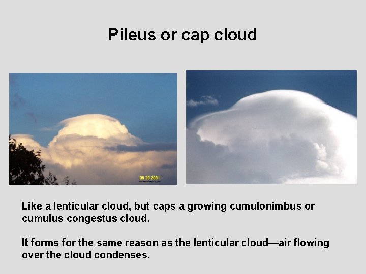
Pileus or cap cloud Like a lenticular cloud, but caps a growing cumulonimbus or cumulus congestus cloud. It forms for the same reason as the lenticular cloud—air flowing over the cloud condenses.

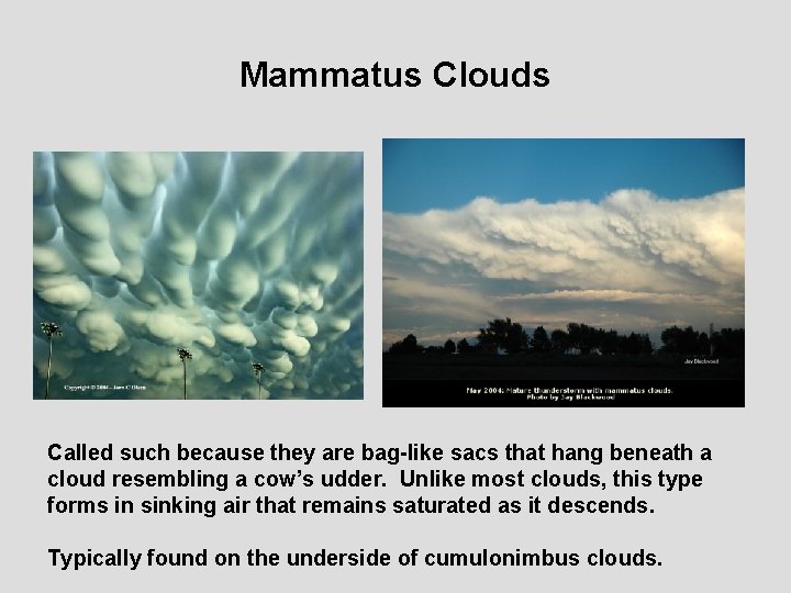
Mammatus Clouds Called such because they are bag-like sacs that hang beneath a cloud resembling a cow’s udder. Unlike most clouds, this type forms in sinking air that remains saturated as it descends. Typically found on the underside of cumulonimbus clouds.

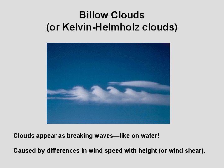
Billow Clouds (or Kelvin-Helmholz clouds) Clouds appear as breaking waves—like on water! Caused by differences in wind speed with height (or wind shear).

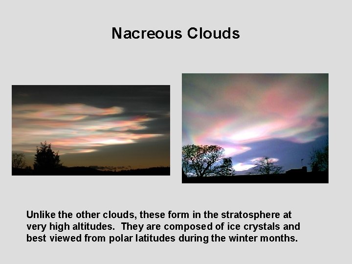
Nacreous Clouds Unlike the other clouds, these form in the stratosphere at very high altitudes. They are composed of ice crystals and best viewed from polar latitudes during the winter months.

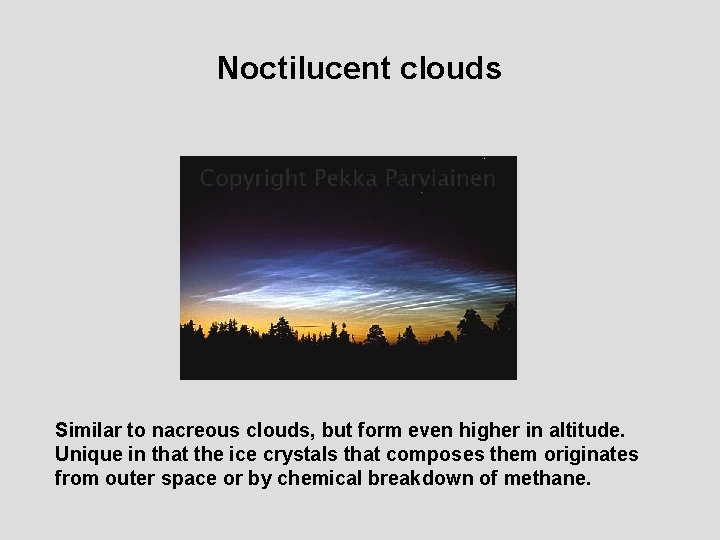
Noctilucent clouds Similar to nacreous clouds, but form even higher in altitude. Unique in that the ice crystals that composes them originates from outer space or by chemical breakdown of methane.

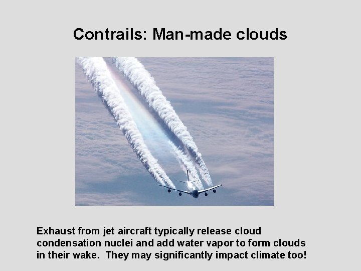
Contrails: Man-made clouds Exhaust from jet aircraft typically release cloud condensation nuclei and add water vapor to form clouds in their wake. They may significantly impact climate too!

Detecting Clouds in Satellite Pictures Just how does the weatherman get that picture?

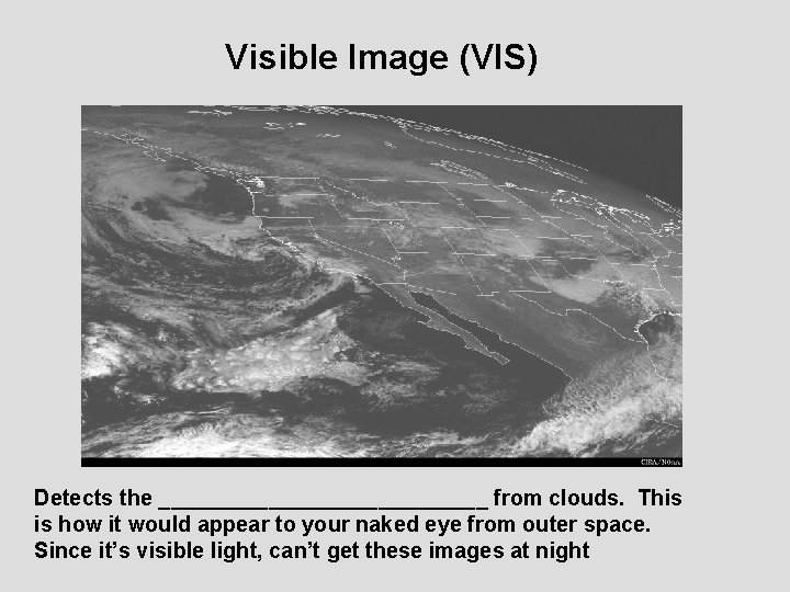
Visible Image (VIS) Detects the ______________ from clouds. This is how it would appear to your naked eye from outer space. Since it’s visible light, can’t get these images at night

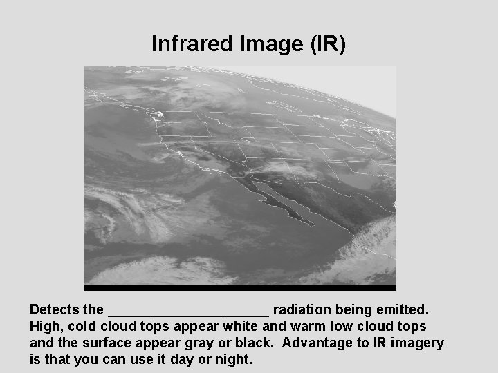
Infrared Image (IR) Detects the ___________ radiation being emitted. High, cold cloud tops appear white and warm low cloud tops and the surface appear gray or black. Advantage to IR imagery is that you can use it day or night.

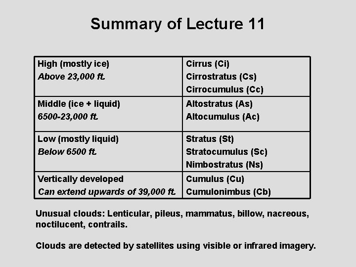
Summary of Lecture 11 High (mostly ice) Above 23, 000 ft. Cirrus (Ci) Cirrostratus (Cs) Cirrocumulus (Cc) Middle (ice + liquid) 6500 -23, 000 ft. Altostratus (As) Altocumulus (Ac) Low (mostly liquid) Below 6500 ft. Stratus (St) Stratocumulus (Sc) Nimbostratus (Ns) Vertically developed Can extend upwards of 39, 000 ft. Cumulus (Cu) Cumulonimbus (Cb) Unusual clouds: Lenticular, pileus, mammatus, billow, nacreous, noctilucent, contrails. Clouds are detected by satellites using visible or infrared imagery.

Reading Assignment Reading: All of Chapter 6