National Hydrography Dataset Bill Smith NHD Maintenance Training

National Hydrography Dataset Bill Smith NHD Maintenance Training U. S. Department of the Interior U. S. Geological Survey

Geodatabase, Feature Dataset, Feature Class, and Features Geodatabase Feature Dataset Feature Class Feature

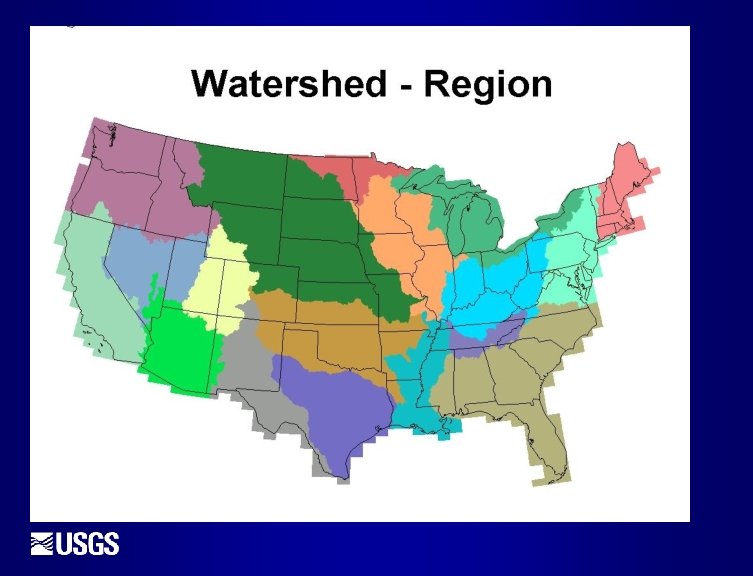
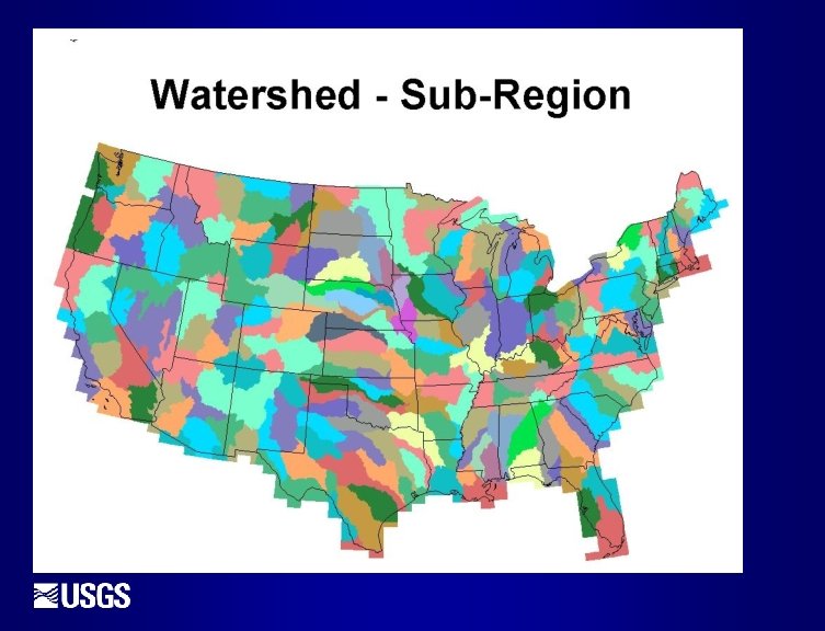
What is a Sub. REGION versus a Sub. BASIN? Regions – the USGS recognizes 21 major geographic REGIONS, 18 located within the continental United States. Will soon add 22 nd Region for Guam. Sub. Regions – Regions are divided into Sub. Regions. Nationally, there are 222 Sub. Regions. Basins – Sub. Regions are divided into Basins, also known as River Basins. Sub. Basins – The smallest subdivision recognized by the USGS. Almost all sub. Basins are larger than 700 square miles in size. Water. Sheds – Sub. Basins may be divided into Water. Sheds. A Water. Shed is an area of land where all water that drains off it runs into the same place. Sub. Water. Sheds – Water. Sheds may be divided into Sub. Water. Sheds.

What is a HUC? 110901050101 Sub. Water. Sheds – 12 digits Water. Sheds – 10 digits Sub. Basins – 8 digits Basins – 6 digits Sub. Regions – 4 digits
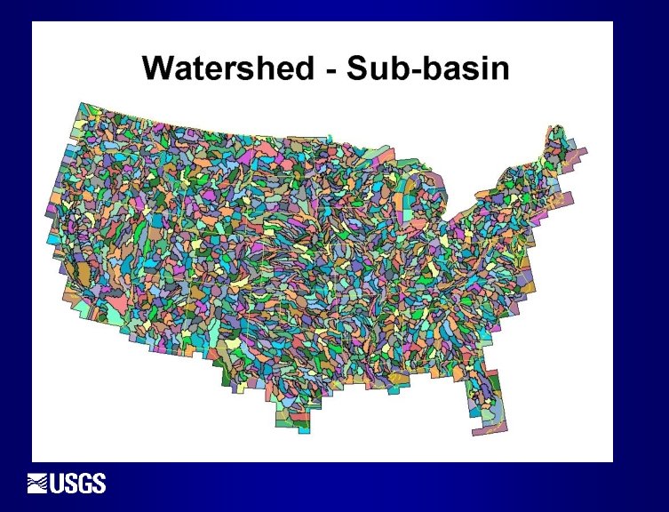

Certified Sub. Basin Boundaries The original Sub. Basin and Sub. Region boundaries were created using 1: 250, 000 -scale data, typically compiled from contour files. 15 States have recompiled the boundaries using 1: 24, 000 -scale data. Once completed and accepted, these 1: 24, 0000 -scale boundary files become ‘Certified’. Most Sub. Region and Sub. Basin boundaries have not been certified!


Questions ?
- Slides: 10