National Hydrography Data Use and Applications National Hydrography


- Slides: 38
National Hydrography Data Use and Applications
National Hydrography Dataset Water resources data development: • NHD is the national spatial data standard for mapped surface water resource data • NHD development funded by USGS • NHD datasets (geodatabase format) available from USGS at: http: //nhd. usgs. gov
Format of the NHD • NHD is a relational database • Mapped features in NHD: – Flowlines (streams, artificial paths) – Waterbodies (lakes, etc. ) NHD Data Model – Very complex, but necessary – Areas (wide rivers) – Points (springs, gauging stations, locks) • Tabular data in NHD: – Attribute tables – Flow tables – Metadata
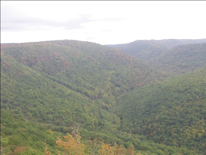
Included in the NHD For Mapping: • • • Streams Canals/ditches Lakes Reservoirs Other features Points Artificial paths Streams Canals Coastline NHD with Google Earth imagery, North Carolina
Included in the NHD For Modeling: 1. Direction of flow 2. Routes – Built-in distance measurements along lines – Used in linear referencing Direction of flow
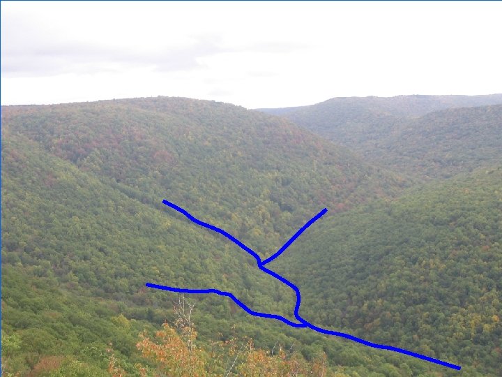
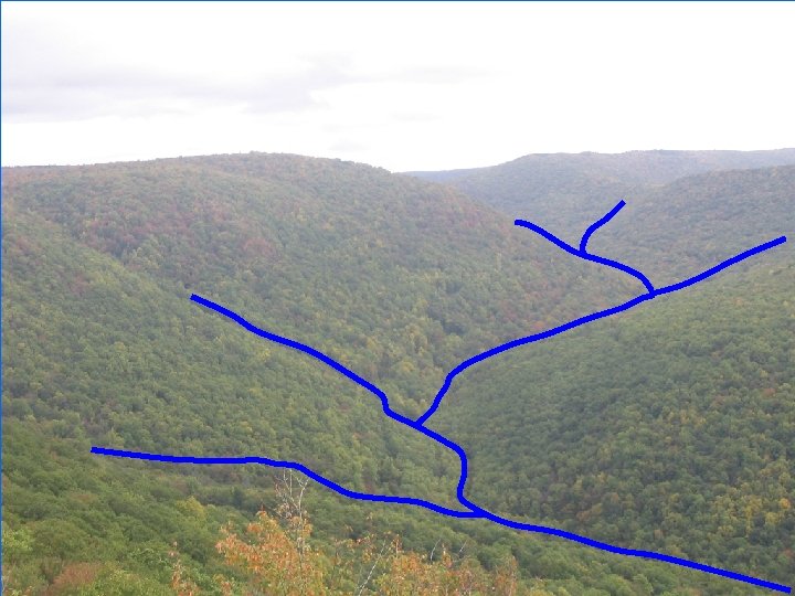
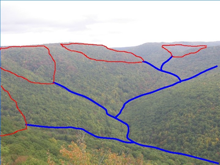
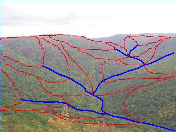
Headwatersheds
Pass through watersheds
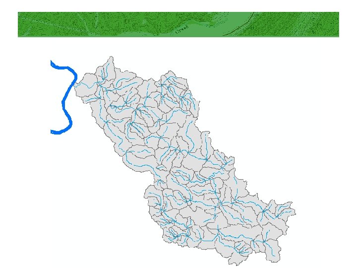
Watershed modeling • Segment level watersheds can be used in watershed modeling • Also compiled flow tables for each watershed Outlet Watershed Schematic: Simplified segment-level watersheds and associated flow table
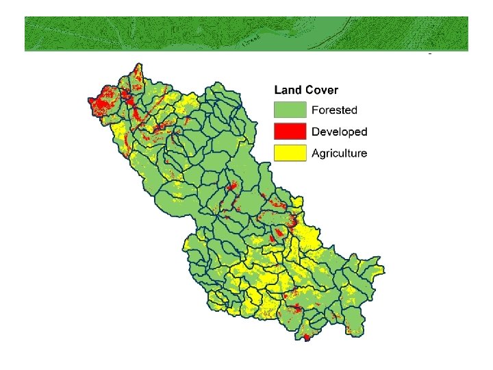
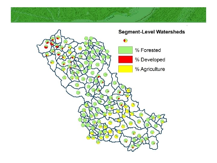
Watershed modeling • Uses of watersheds and flow-based modeling: – Compile statistics for stream based on land cover in contributing area upstream – Can compile cumulative watershed statistics – Can select upstream or downstream watersheds for any location
Watershed modeling Using watersheds: Other cumulative statistics for contributing drainage area upstream Upper Little Sandy Cumulative area upstream Abandoned minelands
Watershed modeling Tools have also been developed to determine minimum distance upstream to features of interest: Upper Little Sandy Distance to closest upstream mine permit
Modeling results • Results from lower Cheat River • Mining Index as a predictor stream impairment by watershed
Uses of modeling results • Watershed modeling is used in assessment of the influence of landscape factors on instream water quality and biota • Linking landscape factors is made possible by mapped segmentlevel watersheds
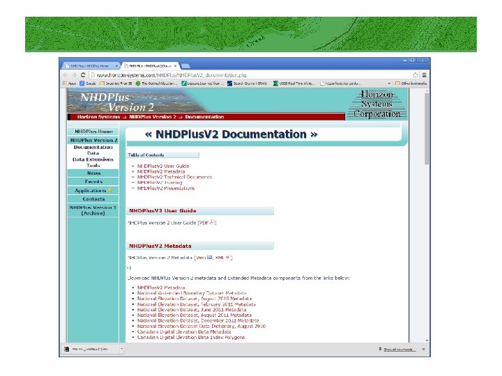
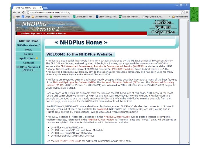
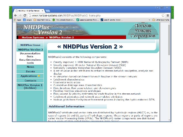
NHD Plus • NHDPlus is an enhanced version of the 1: 100, 000 “medium” resolution National Hydrography Dataset. The NHDPlus is created and maintained by Horizon Systems Corporation with support from the EPA and USGS. • There are two versions of NHDPlus: NHDPlus Version 1 (which is still available, but archived) and NHDPlus version 2. Recommend using/downloading NHDPlus version 2. The unique feature IDs and catchment boundaries have changed between the two versions, so they are NOT compatible.
http: //www. horizon-systems. com/nhdplus/
Included in the NHDPlus version 2 • • • • Greatly improved 1: 100 K National Hydrography Dataset (NHD) Greatly improved 30 meter National Elevation Dataset (NED) Nationally complete Watershed Boundary Dataset (WBD) A set of value added attributes to enhance stream network navigation, analysis and display An elevation-based catchment for each flowline in the stream network Catchment characteristics Headwater node areas Cumulative drainage area characteristics Flow direction, flow accumulation and elevation grids Flowline min/max elevations and slopes Flow volume & velocity estimates for each flowline in the stream network Catchment attributes and network accumulated attributes Various grids from the hydro-enforcement process including the hydro-enforced DEM.
Guide for installing
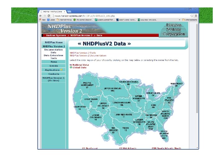
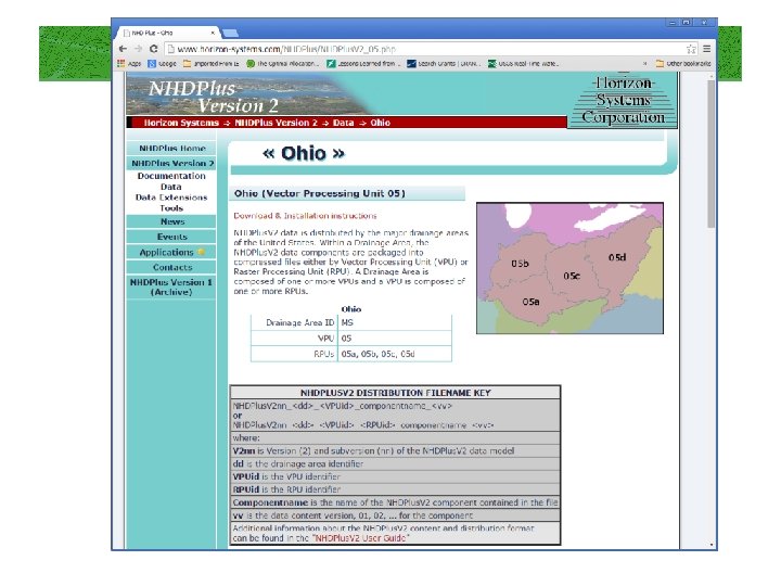
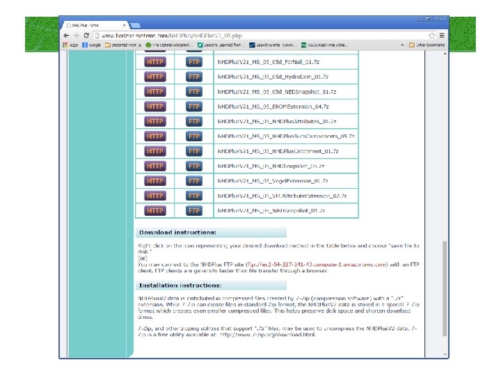
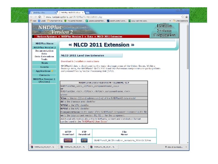
Useful datasets to download See NHDPlus v 2 Users Guide for a description of field names/contents in each dataset below. NHD Snapshot (this includes the NHD flowlines (streams), waterbodies, area features, etc. it is called a “snapshot” because it is not updated as the NHD is updated – it is from a single point in time when the NHDPlus v 2 was created (not generally a problem) NED Snapshot (this includes the NED elevation data) NHDPlus Catchment: these are the catchment boundaries. They are generally related to the flowlines using FEATUREID (which is same as flowline COMID) and may be joined using those attributes. However, there is not always a 1: 1 relationship between flowlines & catchments (not all flowlines will have catchments I think) but usually doesn’t cause an issue, unless you are using “homegrown” routines to navigate the flow network. NHDPlus Attributes: an attribute table (dbf) that can be joined to the catchments and/or flowlines. Includes lots of useful information, including stream order, whether segment is a divergence or not, cumulative area Vogel Extension: Includes flow estimates (mean annual flow) for each catchment/flowline Precipitation and Temperature: mean annual precipitation and mean annual temperature datasets by catchment (note values – see Users Guide). Data from PRISM. NLCD data extension: NLCD 2011 data have been summarized already by NHDPlus catchments. If this is needed, can be downloaded here: http: //www. horizon-systems. com/NHDPlus/V 2 NLCD 2011. php. WBD Snapshot: WBD is watershed boundary dataset (NRCS 12 -digit watersheds).
Download the NHD tool
Notes handout with this section • Pick it up here.
Summary • Segment level watersheds are delineated to match stream scale using updated elevation • NHD hydrology provides backbone for the network model to examine cumulative measures and indices • Further analyses are easily computed for insights into many issues • Can be scaled up in hierarchy
Comments / Questions?