National Geodetic Surveys National Height Modernization Program Southeast


 http: //www. ngs. noaa. gov/INFO/NGS")


- Slides: 17
National Geodetic Survey’s National Height Modernization Program Southeast and Caribbean Region Semi-Annual Meeting January 27, 2011 Renee Shields Height Modernization Manager
The National Geodetic Survey 10 year Plan -- Mission, Vision and Strategy 20082022 • To define, maintain and provide access to the National Spatial Reference Systemto meet our nation’s economic, social, and environmental needs • 2022 Targets: – NAD 83 and NAVD 88 replaced – Modernize the Geopotential (Vertical) Datum http: //www. ngs. noaa. gov/INFO/NGS 10 yearplan. pdf
Program Status • Funding – 21 Grants currently funded – FY 06 -FY 09; some multi-year • Program Activities – current – Monthly NHMP Coordination Teleconferences – Regional: Great Lakes, SE/Carib. – FGCS Vert Ref System Work Group
Program Status • Program Activities – current – USGS stream gage conversion – USGS/COE/NOAA coastal water level gage conversion/update
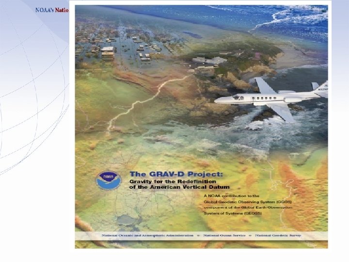
Program Status • Projects – current – GRAV-D – IGLD – Southern Louisiana re-survey • Projects - planned – NC Floodplain Mapping Pilot – Geoid slope validation survey – NSPS Surveying USA (not NGS)
Program Status • Models and Tools – VDatum – HTDP, VTDP – Locus – OPUS DB, Projects • Data products – data sheets
Program Status • Past events – Federal Summit – Workshops, forums: MO, OH – FIG Conference, Australia • Upcoming, planned – Workshops: NJ, AK, IA, MD – ACSM/Survey Summit/ESRI UC – 2 nd Federal Summit, 2012
Program Status • Advisor Program • Corbin Workshops, Webinars planned • Feb 15 -17, Digital Leveling • May, River, Valley Crossings
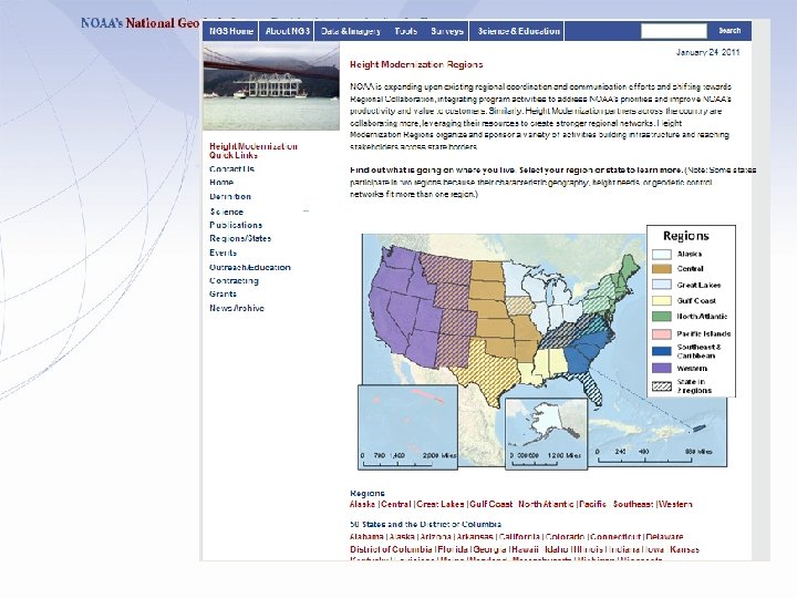
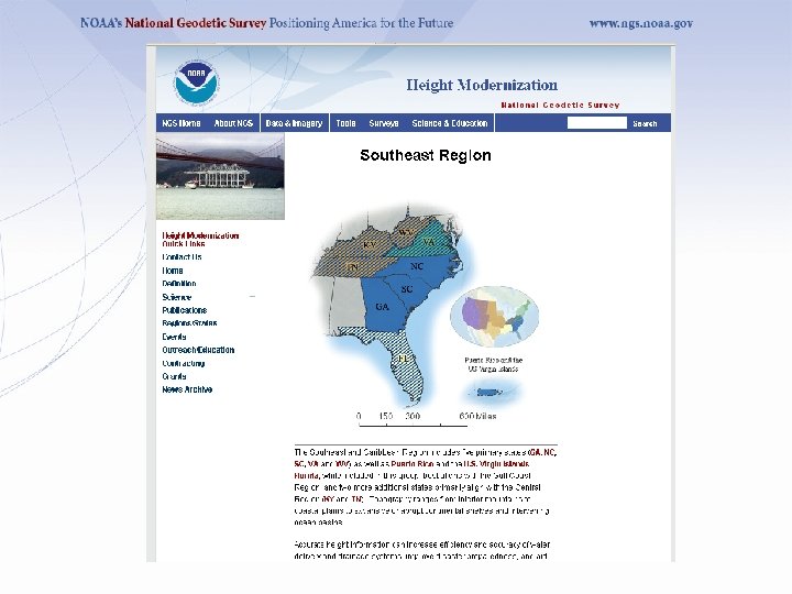
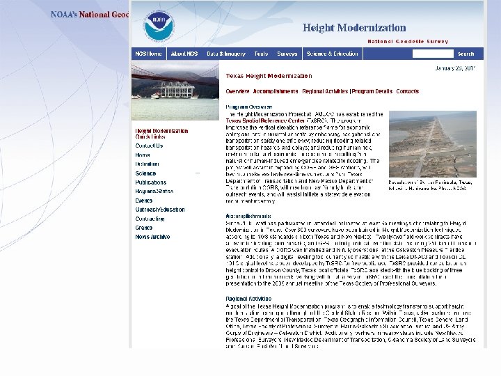
Updated Height Modernization web site
Program Status Coordinate with New Datum Managers Joe Evjen Geometric Datum Project Manager 301 -713 -3194, x 109 Joe. evjen@noaa. gov Mark Eckl Geopotential Datum Project Manager 301 -713 -3215, x 117 Mark. eckl@noaa. gov
Additional Information The NGS 10 year plan (2008 -2018) http: //www. ngs. noaa. gov/INFO/NGS 10 yearplan. pdf The GRAV-D Project http: //www. ngs. noaa. gov/GRAV-D Socio-Economic Benefits of CORS and GRAV-D http: //www. ngs. noaa. gov/PUBS_LIB/Socio-Economic. Benefitsof. CORSand. GRAV-D. pdf
Full Report: http: //www. nap. edu/catalog. php? record_id=12954
Fast is fine, but accuracy is everything. – Wyatt Earp A witty saying proves nothing. - Voltaire Questions Renee Shields Height Modernization Manager 301 -713 -3231, x 116 Renee. Shields@noaa. gov http: //www. ngs. noaa. gov/heightmod/Events. Archive. shtml