
Munich Satellite Navigation Summit 2010 Bei Dou COMPASS
Munich Satellite Navigation Summit 2010 Bei. Dou (COMPASS) Navigation Satellite System Development China Satellite Navigation Office Mar. 9 th-11 th, 2010, Munich 1

u The governmental website of Bei. Dou Satellite Navigation System was launched on Jan. 15, 2010. u “www. beidou. gov. cn” or “www. compass. gov. cn”. u The English version will be online soon. 2
Contents 1. Basic principles 2. System General Description 3. System Deployment 4. Applications 5. Compatibility and Interoperability 6. Conclusion 3
Contents 1. Basic principles 2. System General Description 3. System Deployment 4. Applications 5. Compatibility and Interoperability 6. Conclusions 4
China determined to develop an independent satellite navigation system in 1980 s’. The Bei. Dou navigation demonstration system was completed in 2003, since then it has been used in many areas. Now the Bei. Dou navigation satellite system is under construction. 5
Basic Principles ØOpenness ØIndependency ØCompatibility ØGradualness 6
Basic Principles u Openness Bei. Dou will provide high quality open services free of charge from direct users, and worldwide use of Bei. Dou is encouraged. China will widely and thoroughly communicate with other countries on satellite navigation issues to facilitate the development of GNSS technologies and the industry. 7
Basic Principles u. Independency China will develop and operate Bei. Dou system independently, and Bei. Dou can independently provide services for global users and particularly provide high quality services in Asia-Pacific region. 8
Basic Principles u. Compatibility Bei. Dou will pursue solutions to realize compatibility and interoperability with other satellite navigation systems. 9
Basic Principles u. Gradualness The construction of Bei. Dou system follows a stepby-step pattern based on technical and economic evolution in China. Bei. Dou will provide long-term continuous services for users, improve system performance and ensure smooth transition during all life cycle. 10
Contents 1. Basic principles 2. System General Description 3. System Deployment 4. Applications 5. Compatibility and Interoperability 6. Conclusions 11
System Description ØSystem Structure ØSignal Characteristics ØTime System ØCoordinate System ØServices and Performances 12
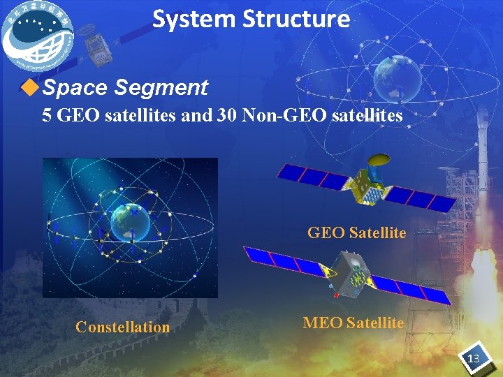
System Structure u. Space Segment 5 GEO satellites and 30 Non-GEO satellites GEO Satellite Constellation MEO Satellite 13
System Structure u. Ground Segment The ground segment consists of Master Control Station, Upload Stations and Monitor Stations. 14
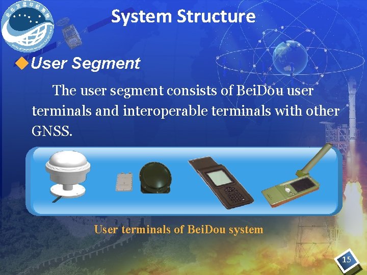
System Structure u. User Segment The user segment consists of Bei. Dou user terminals and interoperable terminals with other GNSS. User terminals of Bei. Dou system 15

System structure u. User Segment The development of user terminals is making progress steadily and related policies and standards are being studied and developed. The technical preparation for publishing Bei. Dou SIS ICD (v 1. 0) has been finished, and the ICD as well as its update will be gradually released on the governmental website of Bei. Dou System. 16
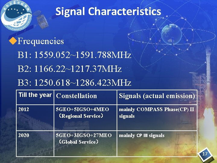
Signal Characteristics u. Frequencies B 1: 1559. 052~1591. 788 MHz B 2: 1166. 22~1217. 37 MHz B 3: 1250. 618~1286. 423 MHz Till the year Constellation Signals (actual emission) 2012 5 GEO+5 IGSO+4 MEO (Regional Service) mainly COMPASS Phase(CP) II signals 2020 5 GEO+3 IGSO+27 MEO (Global Service) mainly CP III signals 17
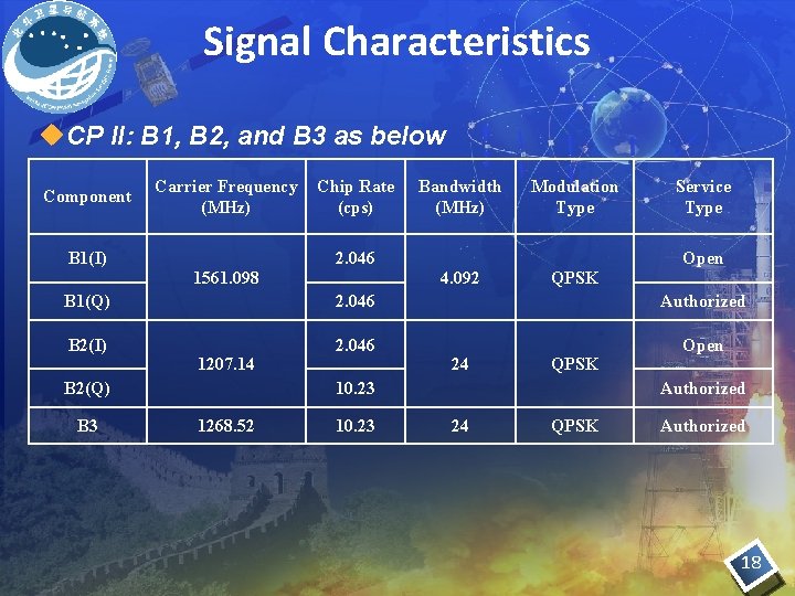
Signal Characteristics u. CP II: B 1, B 2, and B 3 as below Component B 1(I) Carrier Frequency (MHz) 1561. 098 Chip Rate (cps) 2. 046 Bandwidth (MHz) 4. 092 Modulation Type QPSK Service Type Open B 1(Q) 2. 046 Authorized B 2(I) 2. 046 Open 1207. 14 B 2(Q) B 3 24 QPSK 10. 23 1268. 52 10. 23 Authorized 24 QPSK Authorized 18
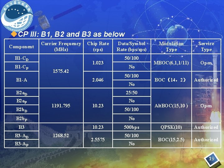
u. CP III: B 1, B 2 and B 3 as below Component Carrier Frequency (MHz) B 1 -CD B 1 -CP Chip Rate (cps) 1. 023 1575. 42 B 1 -A 2. 046 Data/Symbol Rate (bps/sps) 50/100 No B 2 a. D 25/50 B 2 a. P No B 2 b. D 1191. 795 10. 23 B 2 b. P B 3 -AP Service Type MBOC(6, 1, 1/11) Open BOC(14,2) Authorized Alt. BOC(15, 10 ) Open QPSK(10) Authorized BOC(15, 2. 5) Authorized No B 3 -AD 50/100 Modulation Type 10. 23 1268. 52 2. 5575 500 bps 50/100 No 19
Time System u Bei. Dou time is named as BDT, traced to UTC, and synchronized with UTC within 100 ns. The epoch time of BDT is UTC 00 d 2006. u Interoperability of BDT with GPS/Galileo time was considered in the design of Bei. Dou time system. The offset between BDT and GPST/ GST will be measured and broadcast. 20
Coordinate System u. Bei. Dou uses China Geodetic System 2000 (CGS 2000) u. Coinciding with ITRF at a few cm level, and for most applications the difference between CGS 2000 and ITRF can be ignored. 21
Services and Performances u Two kinds of global services n Open Service:free and open to users • Positioning Accuracy: 10 m • Timing Accuracy: 20 ns • Velocity Accuracy: 0. 2 m/s n Authorized Service: ensure high reliable use even in complex situation. 22
Services and Performances u Two kinds of regional services n Wide area differential service • Positioning accuracy: 1 m n short message service 23
Contents 1. Basic principles 2. System General Description 3. System Deployment 4. Applications 5. Compatibility and Interoperability 6. Conclusion 24
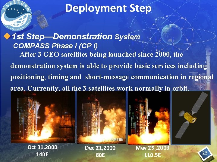
Deployment Step u 1 st Step—Demonstration System COMPASS Phase I (CP I) After 3 GEO satellites being launched since 2000, the demonstration system is able to provide basic services including positioning, timing and short-message communication in regional area. Currently, all the 3 satellites work normally in orbit. Oct 31, 2000 140 E Dec 21, 2000 80 E May 25 , 2003 110. 5 E 25
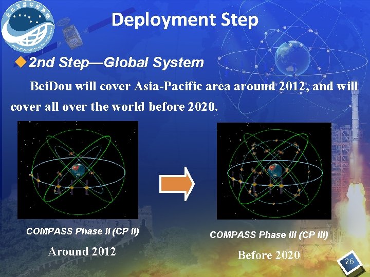
Deployment Step u 2 nd Step—Global System Bei. Dou will cover Asia-Pacific area around 2012, and will cover all over the world before 2020. COMPASS Phase II (CP II) COMPASS Phase III (CP III) Around 2012 Before 2020 26
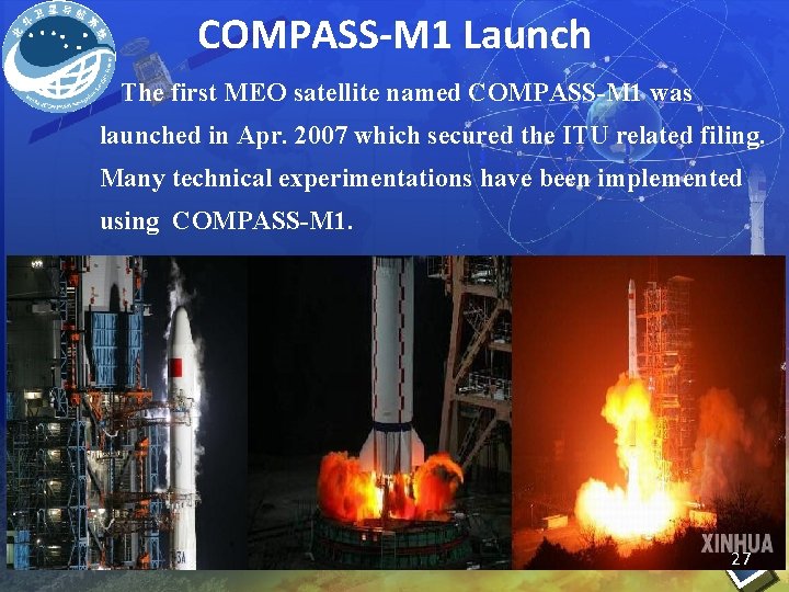
COMPASS-M 1 Launch The first MEO satellite named COMPASS-M 1 was launched in Apr. 2007 which secured the ITU related filing. Many technical experimentations have been implemented using COMPASS-M 1. 27
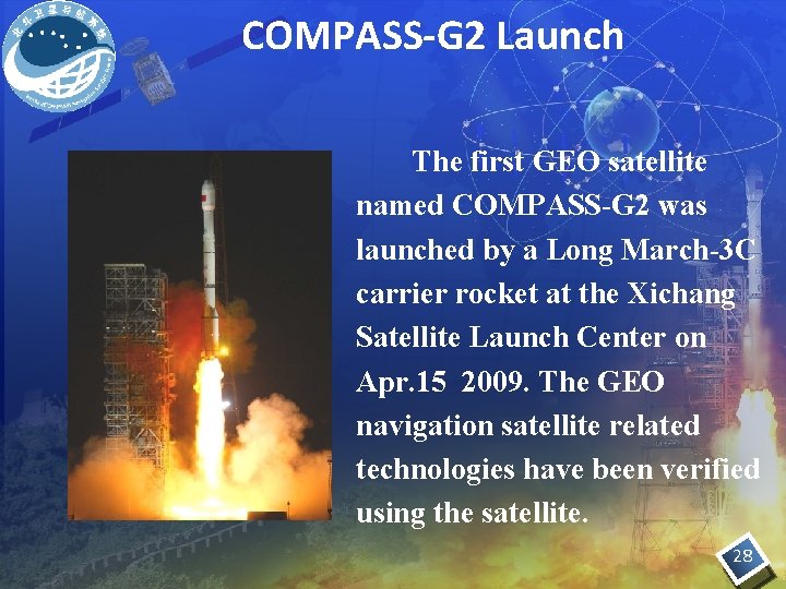
COMPASS-G 2 Launch The first GEO satellite named COMPASS-G 2 was launched by a Long March-3 C carrier rocket at the Xichang Satellite Launch Center on Apr. 15 2009. The GEO navigation satellite related technologies have been verified using the satellite. 28
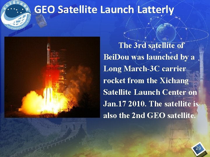
GEO Satellite Launch Latterly The 3 rd satellite of Bei. Dou was launched by a Long March-3 C carrier rocket from the Xichang Satellite Launch Center on Jan. 17 2010. The satellite is also the 2 nd GEO satellite. 29
u. On Jan. 22, the satellite was located at 160°E and started transmitting signals. u Now the satellite is in-orbit test. 30
Launch Schedule ØMore than 10 satellites will be put in orbit and the system will provide regional service before the end of 2012. 31
Contents 1. Basic principles of the State Policy 2. System General Description 3. System Deployment 4. Applications 5. Compatibility and Interoperability 6. Conclusion 32
Applications u Bei. Dou Navigation Demonstration System has played important roles in various areas. - Surveying and mapping - Communication - Water conservancy - Disaster mitigation - Marine - Transportation - Mining - Forest fire rescue - etc. 33
Contents 1. Basic principles of the State Policy 2. System General Description 3. System Deployment 4. Applications 5. Compatibility and Interoperability 6. Conclusion 34
Compatibility and Interoperability Ø Views on Compatibility and Interoperability Ø Related Bilateral Activities 35
Compatibility u Compatibility: the ability of multiple satellite navigation system to be used separately or together, without causing harmful interference with use of each individual service or signal. u International Telecommunication Union provides a framework for discussion on radiofrequency compatibility. 36
Compatibility u Spectrum overlap: Ø There actually exist some cases of frequency overlap between signals of different systems and it is feasible for navigation systems to share the same frequency spectrum. Ø The frequency spectrum overlap of open signals is beneficial for the realization of interoperability for many applications. 37
Compatibility Spectrum separation of authorized service : u The authorized service signal spectrum separation with open service signals is beneficial. u Signal design should consider many factors. u Due to the quite limit of frequency resources, authorized signal spectrum separation is very difficult at present. u It’s very difficult to satisfy the frequency resource requirements of modernization signals of existing systems and the signals of new systems to be built. 38
Interoperability u. Interoperability: the ability of open services of multiple satellite navigation system to be used together to provide better capabilities at the user level than would be achieved by relying solely on one service, without significantly increasing the complexity of receiver. 39
Interoperability u Benefit gained is larger than cost paid u Provide better capabilities at the user level u Be easy for developing and manufacturing of interoperable receivers u Broadcast interoperability information including the time differences between various System Time mutually u Comparative max received power is beneficial for interoperability u Common frequency spectrum is important u Frequency diversity is beneficial for the improvement of anti-jamming capability u Possible interoperable signal s u B 1 -C : 1575. 42 MHz u B 2 a: 1176. 45 MHz u B 2 b: 1207. 14 MHz 40
Related Bilateral Activities Bei. Dou GPS Four meetings on frequency compatibility coordination : u The 1 st Meeting was held in Geneva in June 2007. u The 2 nd Meeting was held in Xi’an in May 2008. u The 3 rd Meeting was held in Geneva in Oct 2008. u The 4 th Meeting was held in Sanya in Dec 2009. 41
Related Bilateral Activities Bei. Dou Galileo u The 1 st frequency compatibility coordination meeting was held in Beijing in May 2007. u The 1 st Technical Working Group meeting on Compatibility and Interoperability was held in Beijing in Sep 2008. u The 2 nd TWG meeting was held in Beijing in Dec 2008. u The 3 rd TWG meeting was held in Brussels in Jun 2009. u The 2 nd frequency compatibility coordination meeting was held in Beijing in Jan 2010. u The 4 th TWG meeting was held in Beijing in Jan 2010. 42
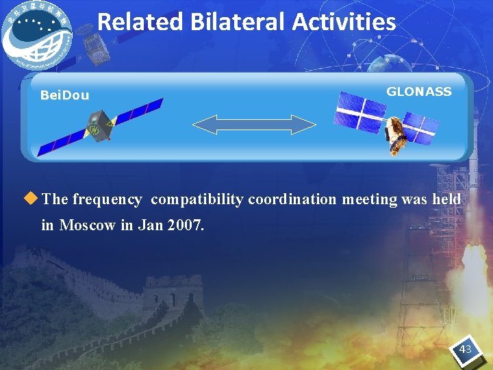
Related Bilateral Activities Bei. Dou GLONASS u The frequency compatibility coordination meeting was held in Moscow in Jan 2007. 43
Contents 1. Basic principles of the State Policy 2. System General Description 3. System Deployment 4. Applications 5. Compatibility and Interoperability 6. Conclusion 44
Conclusion u. Currently, Bei. Dou is developing as planned. u. As an important GNSS, Bei. Dou seeks win -win development with other systems through active cooperation and mutual benefits. 45

Thanks for your attention! 46
- Slides: 46