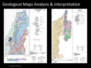
Mr Julius Mattai Geological Mapping Analysis Manager National


- Slides: 17

Mr Julius Mattai - Geological Mapping & Analysis Manager, National Minerals Agency Setting Standards for GIS in Sierra Leone Freetown GIS Conference 2013 Supported by…

Purpose and Plan of Presentation Purpose q To increase awareness of GIS standards for spatial data documentation, collection and exchange so that spatial data can be efficiently and effectively shared across organisational boundaries Plan q GIS as an Enterprise Information System that demands standards q Highlight the key problems the GIS community faces in Sierra Leone q An overview of GIS standards and Spatial Data Infrastructure (SDI) q Setting standards for GIS in Sierra Leone q Issues for discussion

GIS - An Enterprise Information System That Demands Standards Software Hardware Data GIS Information People Business Processes UN Programmes/Projects EPA MWR Investors Settlements Topography Socio-economic Rehabilitated Areas Land Use Mining Sensitive Area NMA MLCPE Academia World Bank /Af. DB Projects Infrastructure Information Technology (IT) Information Systems (IS) Business Processes Farmlands Wetlands Biodiversity Utilities SSLMTA Consultants EU/USAID Projects Air Quality & Climate Vegetation Slope & Aspect, MAFFS Demands GIS Standards for Integration, Collaboration and Interoperability CSOs Other. SLIS/DACO NGOs

GIS Data is Complex and Difficult to Manage GIS/Spatial data is complex – includes identity, location, shape, relationship, orientation and other attributes, and stored in various formats NMA Semi-Structured/Unstructured Structured q Spatial data models (vectors/raster, ) EPA-SL q Databases q Remote sensing and satellite imagery Consultants q Aerial photos and digital maps/models q Spreadsheets q Graphics, audio and video q Proprietary and open source formats q Text/numbers Extracted Exported Imported Migrated Validated Edited CSO Reported Updated Aggregated Cleansed Reviewed Referenced Academia Transformed Mined Backed up Converted Modelled Recovered Ministries, Departments Integrated & Agencies Segregated UN & World Bank Analysed Projects Mapped Archived Deleted

Key Problems the GIS Community Faces in Sierra Leone Lack of GIS Standards and Data Integration q GIS data and information stored and managed without GIS standards q No spatial data integration or interoperability across organisations Lack of Data Sharing and Shared Metadata q Information does flow freely across MDAs and organisations q Data about data is lacking - Difficulty finding and assessing data Poor Data Quality and Security q Missing information about data currency (timeliness), accuracy, resolution, consistency, completeness & relevance, etc q Little or no adherence to Copyright and Intellectual Property Right – Piracy and use of “cracked” software

Key Problems the GIS Community Faces in Sierra Leone Inconsistent Spatial Data q Merging spatial data from different departments or organisations often leads to inconsistent and conflicting data and information Incomplete and Inaccurate Data q GIS data and information are often incorrect, out of date, missing or not-fit-for-purpose Data Redundancy and Inconsistency q The presence of duplicate spatial data in multiple data files in several places within the same department or organisation

Key Questions About Spatial Data…Metadata What? Where? When? Where did you get the GIS data from? Why? Which GIS Standards did you use? How? Who?

GIS Standards and Spatial Data Infrastructure (SDI) GIS Standards are common methods, protocols or conventions that enables GIS stakeholders (users and providers) to share, collaborate, integrate, interoperate, coordinate and communicate GIS resources Sharing of GIS Resources Requires GIS Standards q Hardware, Network Communications and Physical Connections q Application Software, Operating Systems and Data Formats q Databases and Development Tools q Desktop, Server, Web and Mobile Applications Spatial Data Infrastructure (SDI) • The fundamental spatial datasets; the standards that enable integration; the distribution networks that provide access; the standards and policies that ensure compatibility; and the people, at each level – workgroup, departmental, organisational, local, regional, national or global

People & Institutions Legal Framework & Policies Spatial Data Infrastructure (SDI) and GIS Standards Hardware, Software & Network Communications Discovery Access Protocols Clearinghouse Services Metadata Spatial Reference Systems Thematic Datasets GIS Standards

SDI – Key to Decentralized Spatial Data Management & Integration NMA Spatial MAFFS Non-Spatial Business Systems metadata Business Systems Local Data GIS Standards metadata Local Data & Systems Infrastructure EPA-SL Spatial Virtual Data Warehouse Non-Spatial Business Systems Local Data metadata Publish, Access, Share QA/QC, Insert, Extract Embedded GIS User Casual GIS User www. epa-sl. org GIS Portal Services Desktop GIS User

Types of GIS Standards Open Standards (ISO/TC) q Standards are voluntary; ISO/TC 211 - Geographic information/Geomatics Metadata Standards q Standards for metadata; ISO 19115: Geographic information - Metadata System Standards q Geographic information & application domain standards Abstract Standard q Framework standards; e. g. , Geographic Information – Reference Model Industry Standards Groups (e. g. , OGC) q Closed and dominated by the major financial contributors; WMS, WFS, De facto Standards q Proprietary and locked-in technology Standards for Many Different Things q Information, Service, Catalogue, Interface, Model, Product, Procedure, etc Concrete Standard q Information, Service, Catalogue/Registry, Interface, Model, Procedure, etc

No Need to Re-invent the Wheel – Use International GIS Standards American National Standards Institute (ANSI) Global Spatial Data Infrastructure (GSDI) World Wide Web Consortium (W 3 C) Open Geospatial Consortium (OGC) Industry Standards Organisations Working on GIS Standards European Committee for Standardization (CEN) International Organization for Standardization (ISO) Digital Geographic Information Working Group (DGIWG) Federal Geographic Data Committee (FGDC)

Setting Standards For GIS in Sierra Leone q Compile further information in support of national efforts to standardize geographic information q Provide motivation for GIS standardization efforts in terms of development agenda q Improve interactions with international and national standards bodies and gain its support in GIS standards development q Draw upon existing standards to fast track standard development q Establish structures to ensure broad participation in standards development q Support GIS standardisation through policy and legal mechanisms

Setting Standards For GIS in Sierra Leone q Improve GIS metadata development and usage of metadata and clearinghouses q Make available information resources relevant to GIS standards development and implementation q Involve universities and training institutions in developing standards and providing tools for standards implementation q Improve communication about GIS standards through newsletters q Use existing networking opportunities, where people can meet to advance GIS standards/share experiences face to face q Compile an inventory of institutions and expertise that can provide technical standardization support

But First…Issues for Discussion Who assumes the overall collective leadership role? Who determines what GIS Standards are needed? Who advocates for the user community of GIS Standards? Who pays for the GIS Standards development and implementation processes? Setting GIS Standards for Sierra Leone Who are the appropriate players and what are their respective roles? Who tests the GIS Standards for conformance? Who drafts the GIS Standards? Who should communicate what to whom?

Setting GIS Standards in Sierra Leone Requires Collaboration at Higher Level All partners must agree and then respect q Responsibilities q Infrastructure q Communication q Content

Questions & Answers Thank You! Julius Mattai Geological Mapping & Analysis Manager jmattai@nma. gov. sl 078 898 260
 Memory parameters
 Forward mapping vs backward mapping
 Prinsip analisis dan desain
 Compare continental drift and plate tectonics
 Geological influence on architecture
 Differentiate between geological and accelerated erosion
 Law of inclusions
 Dharma wijewickreme
 Geological map sweden
 Us geological survey floating pan
 Geological outcrop map
 Geological map interpretation
 Geological processes
 Rock dating
 Geologic time scale graphic organizer
 Archean era
 Geological disaster example
 Geological events
