Mountain Waves Forecasting Tools for Pilot Preparedness Sarah

- Slides: 18

Mountain Waves: Forecasting & Tools for Pilot Preparedness Sarah Rogowski Meteorologist, NWS CWSU Salt Lake City Scott Birch Regional Aviation Meteorologist, NWS Western Region Headquarters

Mountain Waves Can Ruin Your Flight Visual Indicators Types of Waves Downslope Winds PIREPs

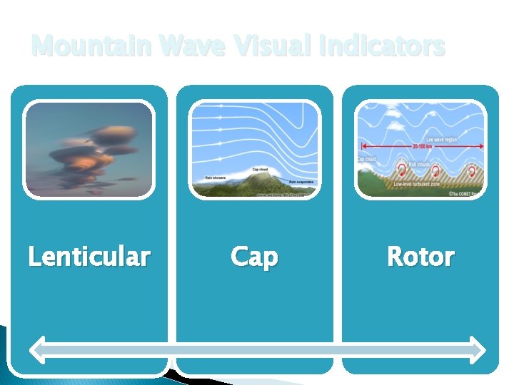
Mountain Wave Visual Indicators Lenticular Cap Rotor

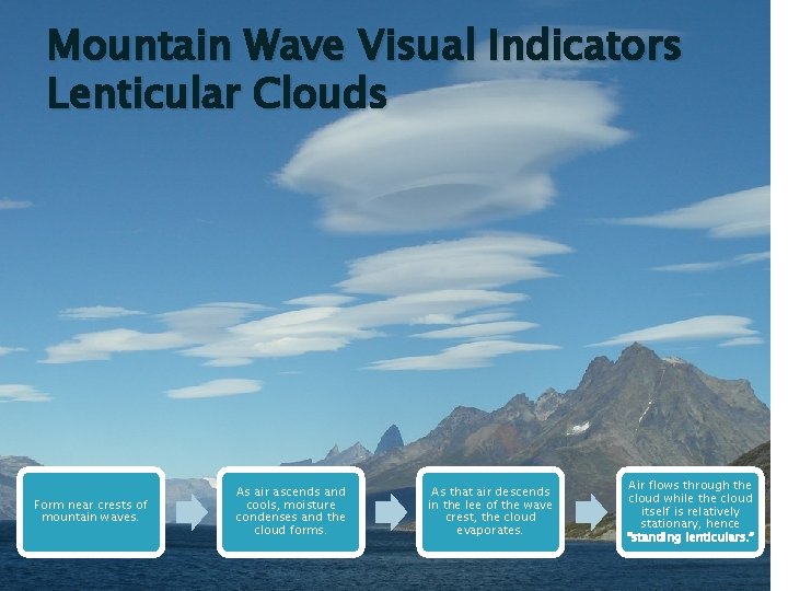
Mountain Wave Visual Indicators Lenticular Clouds Form near crests of mountain waves. As air ascends and cools, moisture condenses and the cloud forms. As that air descends in the lee of the wave crest, the cloud evaporates. Air flows through the cloud while the cloud itself is relatively stationary, hence “standing lenticulars. ”

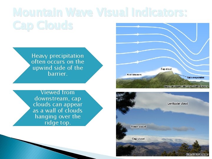
Mountain Wave Visual Indicators: Cap Clouds Heavy precipitation often occurs on the upwind side of the barrier. Viewed from downstream, cap clouds can appear as a wall of clouds hanging over the ridge top.

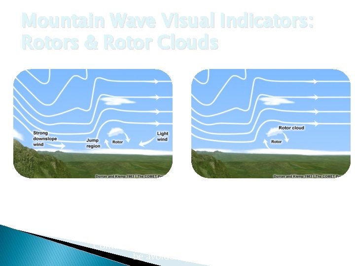
Mountain Wave Visual Indicators: Rotors & Rotor Clouds Typically occur at or below mountain-top level and within 20 NM of the ridge line. Cloud found near the top of the rotor circulation and under higher lenticular clouds. Contains strong turbulence and should be avoided by pilots.

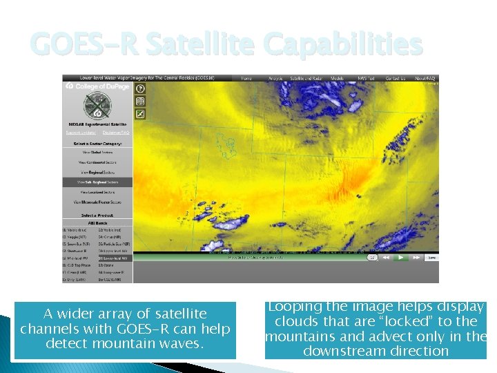
GOES-R Satellite Capabilities A wider array of satellite channels with GOES-R can help detect mountain waves. Looping the image helps display clouds that are “locked” to the mountains and advect only in the downstream direction

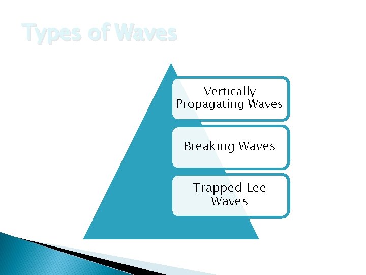
Types of Waves Vertically Propagating Waves Breaking Waves Trapped Lee Waves

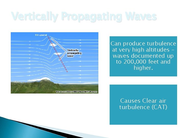
Vertically Propagating Waves Can produce turbulence at very high altitudes waves documented up to 200, 000 feet and higher. Often most severe within the first wavelength downwind of the mountain barrier. Causes Clear air turbulence (CAT)

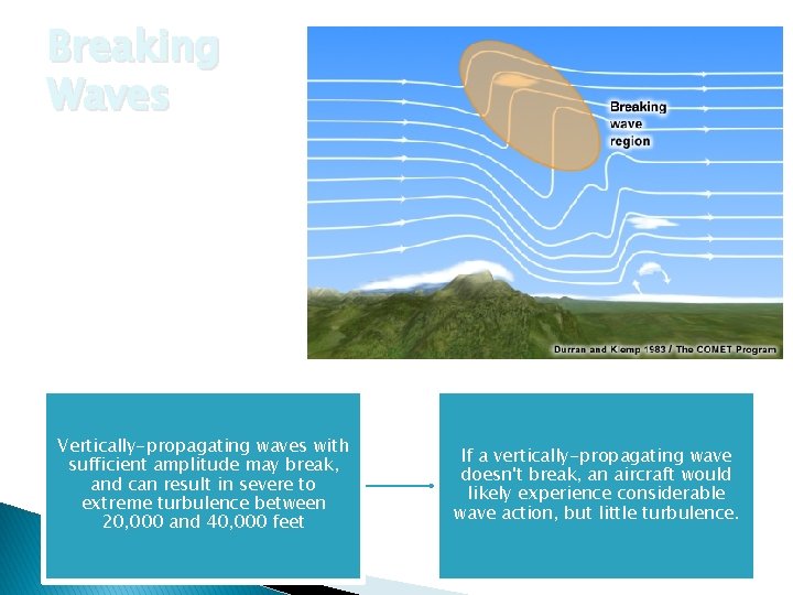
Breaking Waves Vertically-propagating waves with sufficient amplitude may break, and can result in severe to extreme turbulence between 20, 000 and 40, 000 feet If a vertically-propagating wave doesn't break, an aircraft would likely experience considerable wave action, but little turbulence.

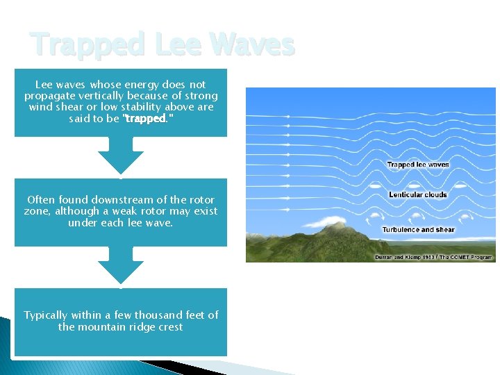
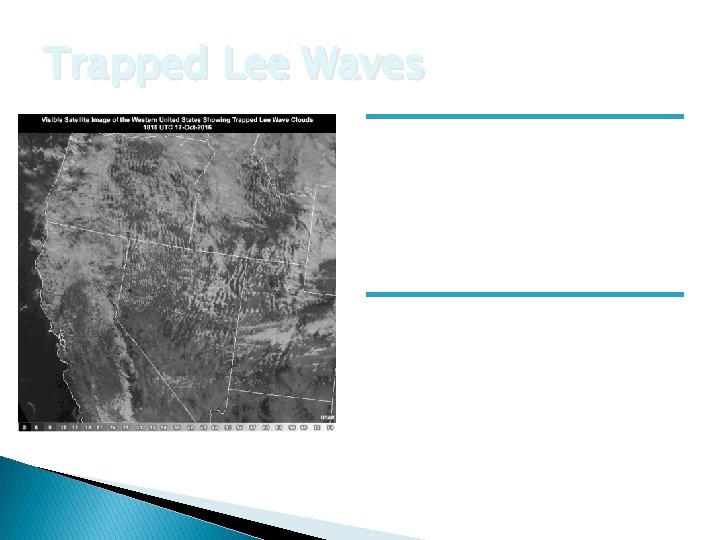
Trapped Lee Waves Lee waves whose energy does not propagate vertically because of strong wind shear or low stability above are said to be "trapped. " trapped Often found downstream of the rotor zone, although a weak rotor may exist under each lee wave. Typically within a few thousand feet of the mountain ridge crest

Trapped Lee Waves Turbulence is generally below 25, 000 feet. Strong turbulence can develop below the lenticular cloud base.

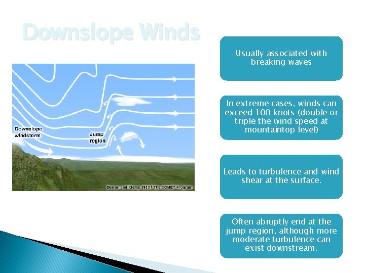
Downslope Winds Usually associated with breaking waves In extreme cases, winds can exceed 100 knots (double or triple the wind speed at mountaintop level) Leads to turbulence and wind shear at the surface. Jump Region: extremely turbulent area that can extend up to 10, 000 feet Often abruptly end at the jump region, although more moderate turbulence can exist downstream.

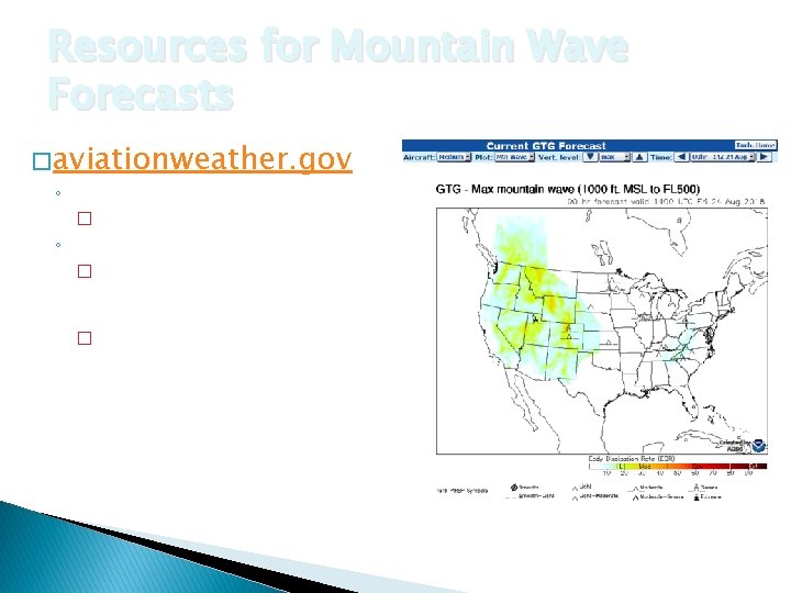
Resources for Mountain Wave Forecasts � aviationweather. gov ◦ Forecast -> Turbulence -> GTG � Look for bright colors! ◦ Tools -> GFA Tool -> Winds � Look for cross-barrier (perpendicular) winds at ridge top & jet stream levels � Look for gusty surface winds

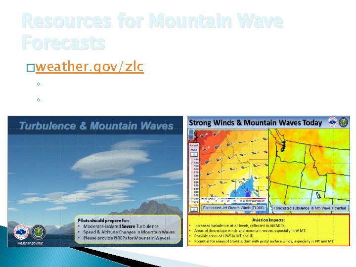
Resources for Mountain Wave Forecasts � weather. gov/zlc ◦ “Weather Story” image on the top right corner ◦ Current Hazards -> CWAs and MISs

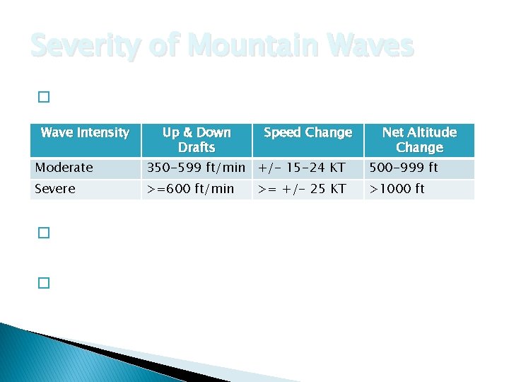
Severity of Mountain Waves � No official ICAO criteria for severity!! Wave Intensity Up & Down Drafts Speed Change Net Altitude Change Moderate 350 -599 ft/min +/- 15 -24 KT 500 -999 ft Severe >=600 ft/min >1000 ft � General >= +/- 25 KT criteria developed to create a more consistent forecast/product. � PIREPs with DETAILS are key in providing quality data to pilots!!

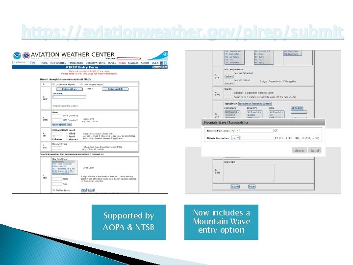
https: //aviationweather. gov/pirep/submit Supported by AOPA & NTSB Now includes a Mountain Wave entry option

Mountain Waves Can Ruin Your Flight Visual Indicators Types of Waves Downslope Winds PIREPs