Model Output Statistics What form does a MOS
- Slides: 8

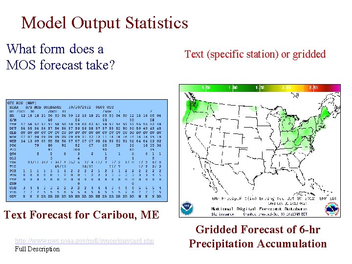
Model Output Statistics What form does a MOS forecast take? Text (specific station) or gridded Text Forecast for Caribou, ME http: //www. nws. noaa. gov/mdl/synop/mavcard. php Full Description Gridded Forecast of 6 -hr Precipitation Accumulation

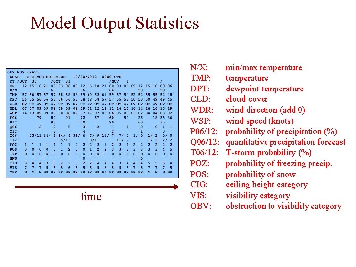
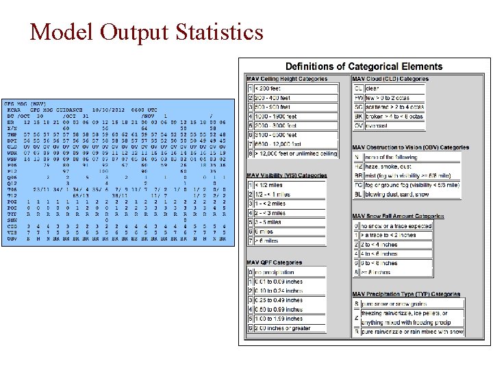
Model Output Statistics time N/X: TMP: DPT: CLD: WDR: WSP: P 06/12: Q 06/12: T 06/12: POZ: POS: CIG: VIS: OBV: min/max temperature dewpoint temperature cloud cover wind direction (add 0) wind speed (knots) probability of precipitation (%) quantitative precipitation forecast T-storm probability (%) probability of freezing precip. probability of snow ceiling height category visibility category obstruction to visibility category

Model Output Statistics

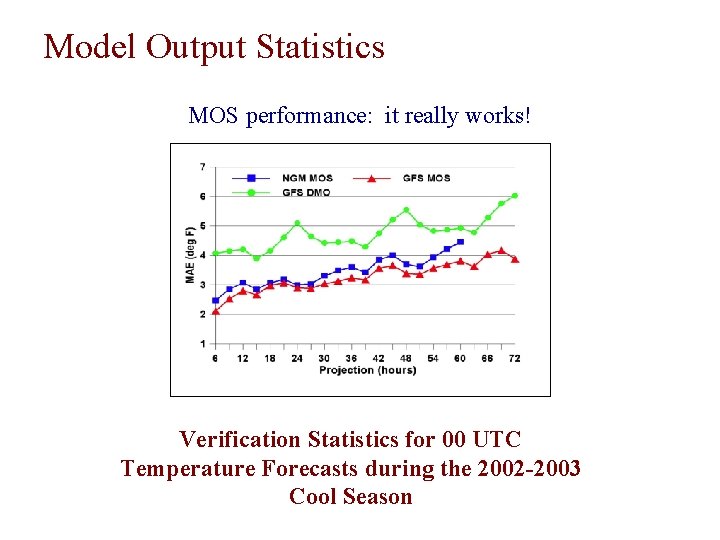
Model Output Statistics MOS performance: it really works! Verification Statistics for 00 UTC Temperature Forecasts during the 2002 -2003 Cool Season

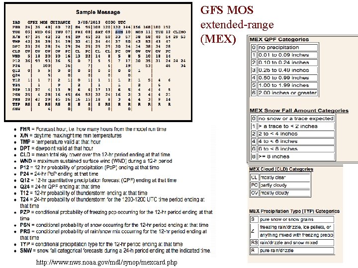
GFS MOS extended-range (MEX) http: //www. nws. noaa. gov/mdl/synop/mexcard. php

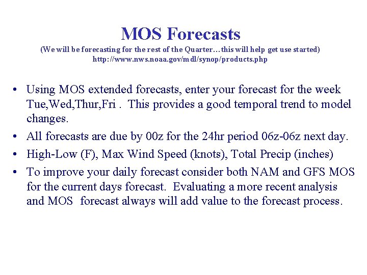
MOS Forecasts (We will be forecasting for the rest of the Quarter…this will help get use started) http: //www. nws. noaa. gov/mdl/synop/products. php • Using MOS extended forecasts, enter your forecast for the week Tue, Wed, Thur, Fri. This provides a good temporal trend to model changes. • All forecasts are due by 00 z for the 24 hr period 06 z-06 z next day. • High-Low (F), Max Wind Speed (knots), Total Precip (inches) • To improve your daily forecast consider both NAM and GFS MOS for the current days forecast. Evaluating a more recent analysis and MOS forecast always will add value to the forecast process.

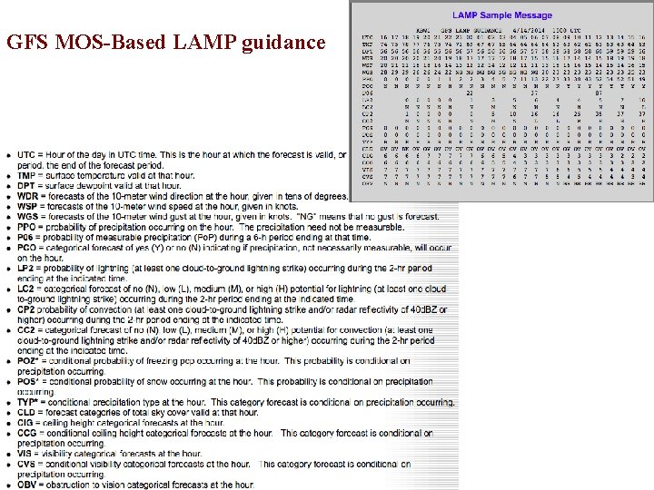
GFS MOS-Based LAMP guidance

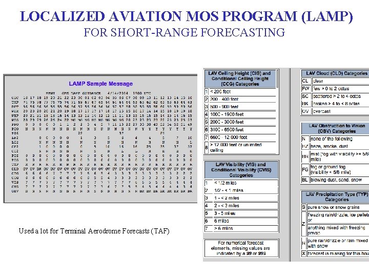
LOCALIZED AVIATION MOS PROGRAM (LAMP) FOR SHORT-RANGE FORECASTING Used a lot for Terminal Aerodrome Forecasts (TAF)