MISSISSIPPI STUDIES Chapter 1 PreTest Get out a


 • • • • CHICKASAW")

 • Had 25 to")

 • One of three largest tribes")

 Hernando de Soto explored")

")
 (included southern halves")


- Slides: 54
MISSISSIPPI STUDIES Chapter 1
Pre-Test • Get out a clean sheet of paper • Number the paper 1 through 5 and answer the following questions 1. What were two of the main Indian Tribes in Mississippi? 2. Who were the first Europeans in Mississippi? • A. Spanish B. French C. British 3. What is the average summer temperature in Mississippi? • A. 70 B. 80 C. 90 4. Which of the following is considered the coldest month in Mississippi? • A. November B. December C. January 5. Who discovered the Mississippi River? • A. Hernando De. Soto B. Robert de La. Salle C. D’Iberville
Early Mississippi History • Mississippi has a deep history or Native Americans • Many of our cities and counties have Native American names • Even the name Mississippi is derived from Indian words meaning Great River
Prehistoric Cultures • Paleo Culture 10, 000 B. C. – 8, 000 B. C. • Archaic Culture 8, 000 B. C. – 500 B. C. • Woodland Culture 500 B. C. – 1, 000 A. D. • Mississippian Culture 1, 000 A. D. – 1, 600 A. D.
Early Mississippi History • Paleo Indians were the first people in Mississippi • It is believed they crossed the land bridge connecting Alaska and Russia • Mounds are the most visible legacy of the Native Americans • Uses: religious temples, homes, and burials • Emerald Mound in Mississippi is the 2 nd largest in the US • Most Native Americans live in clans • Clan – is a group of people who are related to each other
Early Native Americans • Paleo – Ice Age – Earliest Americans crossed land bridge from Siberia into Alaska (and downward from there) • Archaic – Climate warmer and drier – Native Americans adjusted to climate and became less nomadic • Woodland – Highly organized societies in Mississippi and Ohio River valleys developed – Built burial mounds over tombs – Moundbuilders – lived alongside rivers and streams (see slides below) – Villages grew larger and tied together politically – Used bow and arrow
Mississippian • built religious buildings and the homes of chiefs on top of their flat, rectangular mounds • Choctaw connect their early history with a mound called Nanih Waiya [Na’-na Wai’-a] along the Pearl River in southeastern Winston County
In Natchez
The Temple Mound at Winterville
Mound sites in Mississippi • Bear Creek • Pharr • Owl Creek • Bynum • Winterville • Jaketown • Nanih Waiya • Pocahontas • Boyd • Emerald • Grand Village
Mississippi Tribes (tribes in red indicate the larger tribes) • • • • CHICKASAW (north Mississippi) TAPOSA CHAKCHIUMA IBITOUPA TIOU YAZOO HOUMA KOROA TUNICA NATCHEZ (south Mississippi) CHOCTAW (central Mississippi) ACOLAPISSA BILOXI PASCAGOULA
CHOCTAW • Connect early history with Nanih Waiya (Winston County) • Had 25 to 30 villages and each person had a voice in government • Major crop: maize (corn) • One of three largest tribes • The only major visible tribe in Mississippi today • (Choctaw Code Talkers – Choctaw nation – not just Mississippi) http: //www. youtube. com/watch? v=3 Y 0 mm. Vxxr 3 w
NATCHEZ • “Great Sun” chief lived on top of mound here • Major crop: maize (corn) • One of three largest tribes • http: //www. wlbt. com/story/15279745/emerald-mound-in-natchez
CHICKASAW • Major crop: maize (corn) • One of three largest tribes
MISSISSIPPIAN NATIVE AMERICANS Smaller tribes: Choula, Pascagoula, Tunica, Biloxi Larger tribes: Chickasaw, Choctaw, Natchez Major crop: maize (corn) Well organized and had developed ways of life that fit into environment (HUMAN-ENVIRONMENT INTERACTION) • Each village included several clans (groups of related families) • Punished criminals • Protected individuals from violence • Exogamy: practice of marrying outside the clan • Polygyny: having more than one wife (occasionally, a man in tribe had two wives) • Built villages close to streams/creeks • Religious beliefs: centered on sun and the sacred fires (represented sun on Earth); believed in many spirits associated with nature and animals • •
SPANISH EXPLORERS • First to visit MS • (1539 -1542) Hernando de Soto explored area searching for gold and silver • Attacked north of Mobile by Native Americans but NA did not know how to fight soldiers so were defeated • Introduced horses/hogs to America • MAIN OUTCOME: diseases spread from Spanish to Native Americans who had no immunity to them • Repeatedly attacked by Native Americans • Reached Gulf of Mexico and sailed to Mexico • Never returned
FRENCH EXPLORERS • Visited MS after Spaniards • Originally settled in Quebec, Canada and explored from there • 1673: Louis Jolliet (trader) and Father Jacques Marquette (missionary) sailed down MS River and reached present-day site Rosedale, MS • Turned around when they realized that river flowed into Gulf and not Pacific Ocean • 1682: Rene Cavelier, de La Salle, Henri de Tonti, and Father Membre traveled down MS River and claimed region for France • From 1699 to 1763, the future state of Mississippi was a part of the French colony of Louisiana. • During these years, the French explored the region, established settlements and military outposts, engaged in political and economic relations with the area’s American Indians, and sought to establish a profitable economy • Fort Maurepas – first permanent settlement in MS
French: built Fort Rosalie in 1716 (Natchez)
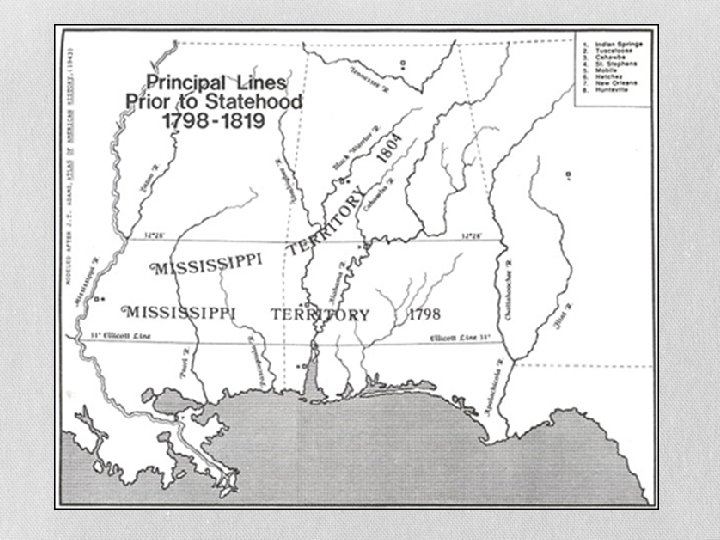
BRITISH MISSISSIPPI • MS officially part of province West Florida (1763) (included southern halves of Alabama and MS as well as parts of Florida) • 1783 Treaty of Paris (between US and Great Britain…peace treaty of Revolutionary War): US controlled southern boundary at 31 degrees north latitude • Spain held territory south of that line (refused to give up Natchez District which was north of line) • Spain signed the Treaty of San Lorenzo (Pinckney’s Treaty) in 1795 in which it recognized the 31 st parallel as the boundary between Spanish Florida and the United States.
SETTLEMENTS • Spain, England, and France established colonial settlements in eastern North America • First European settlement in MS – Ocean Springs • Mississippi ruled first by French, then English, and finally Spain • Mississippi Territory - after centuries of control by several European powers, the land that would become Mississippi became a part of the United States at the close of the 18 th century… April 7, 1798, Congress created the Mississippi Territory
Mississippi Territory • Most Europeans living in the territory lived along the MS River • Natchez was the capital of the territory • By 1817 the Mississippi Territory applied for statehood • However the US Congress did not want to allow it to be a state because it was too large • As a result the split the territory • December 10, 1817 MS became the 20 th state of the US
MISSISSIPPI’S CLIMATE
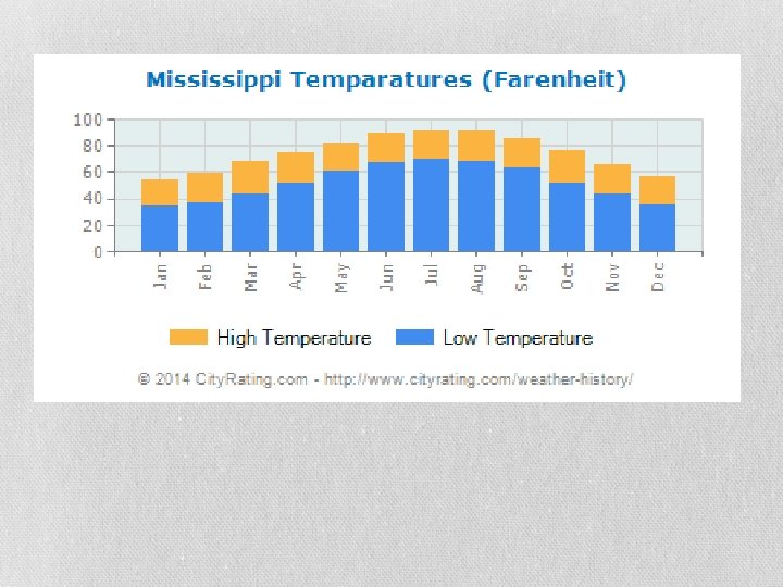
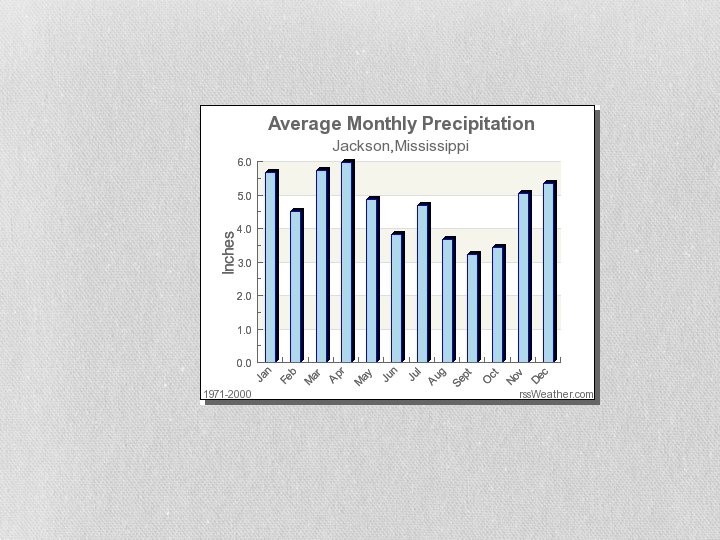
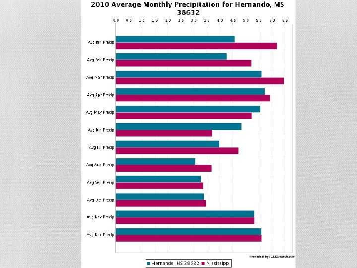
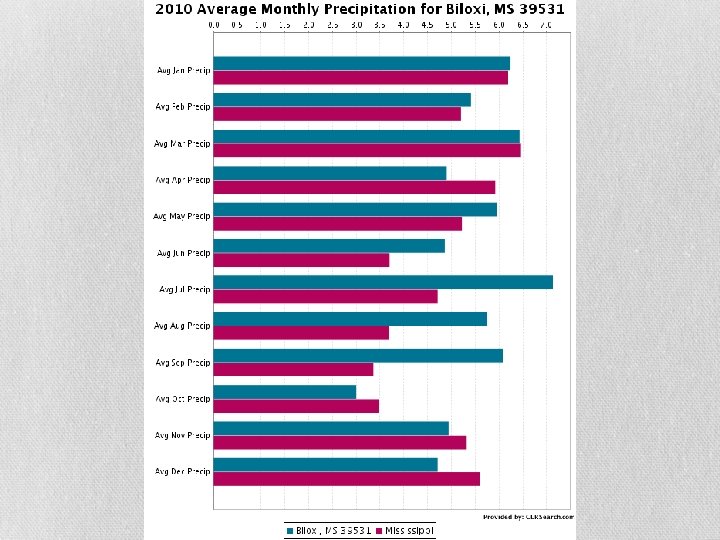
Mississippi’s Climate • Climate – conditions of the atmosphere over a long period of time • Weather – conditions of the atmosphere over a short period of time • Humid subtropical climate (long hot summers; short mild winters) • Average yearly temperature is 62 degrees • Average summer temperature is 80 degrees • Average winter temperature is 48 degrees • January is the coldest month • Receives about 55 inches of rainfall a year • Because of MS’s climate agriculture is important to its economy • Growing season
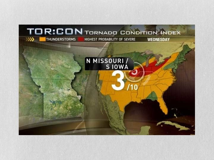
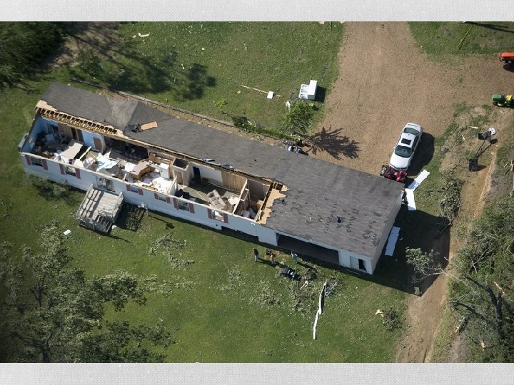
Storms • Tornadoes • Funnel shaped clouds that cause massive destruction • Smith County in MS and the state of MS are the most likely places in the nation to receive a tornado • MS has more deaths from tornadoes than any other state • Tornadoes are measured on the Fujita Scale • The weather channel now also uses Tor: con
TOR: CON Value Descriptions 8+ Very high probability of a tornado 6 - High probability of a tornado 4 - Moderate chance of a tornado nearby, but hail and/or high wind gusts possible 2 - Low chance of a tornado, but hail and/or high wind gusts possible 0 - Near-zero chance of a tornado or a severe thunderstorm
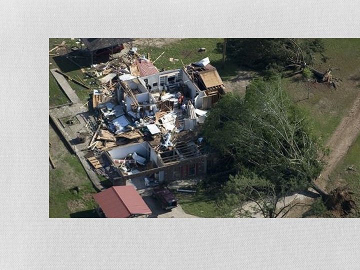
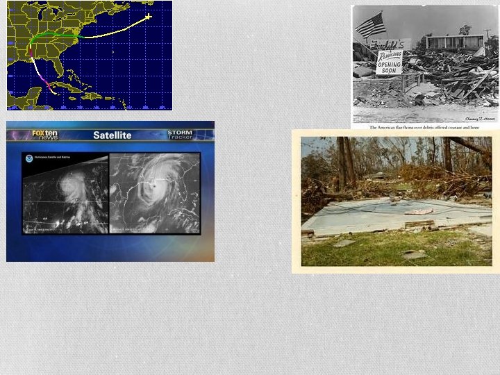
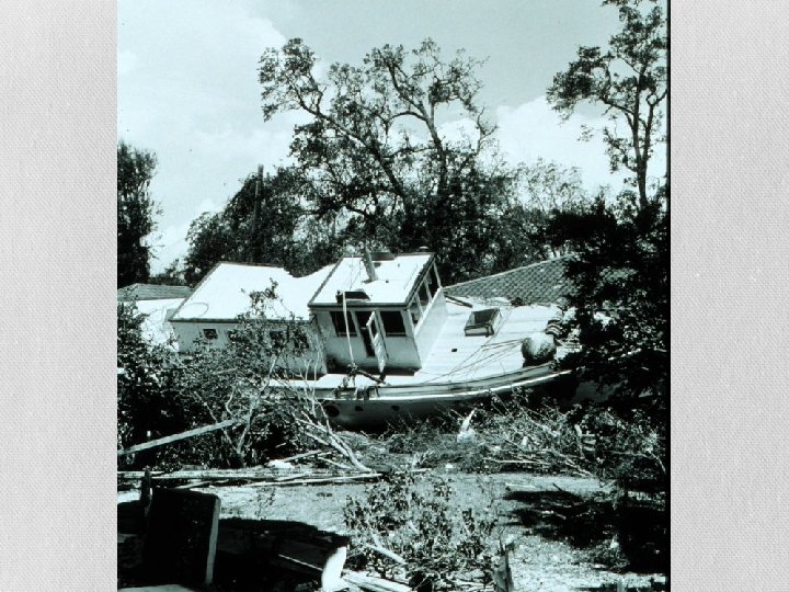
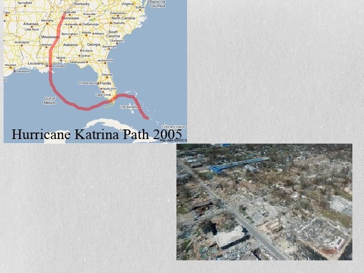
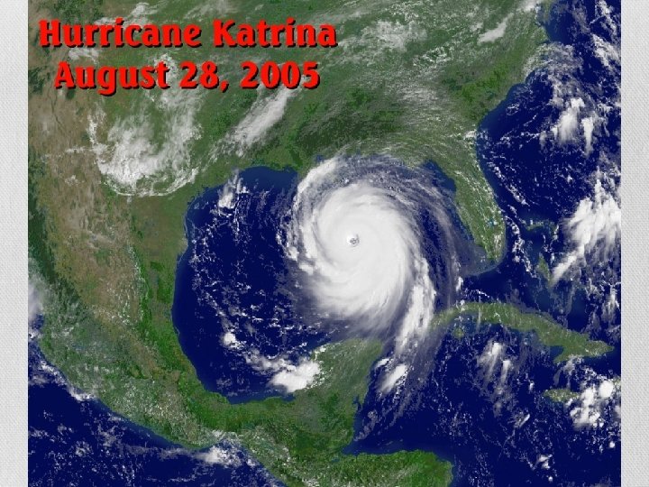
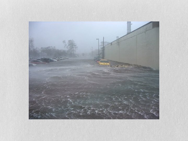
Storms • Hurricanes • Storms that form in the Atlantic Ocean with winds of at least 74 mph – 155 mph + • They are measured on the Saffir-Simpson scale using numbers 1 -5 • Usually called category • There have been two major hurricanes in Mississippi • Camille 1969 • Katrina 2005
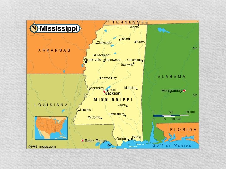
REGIONS Of Mississippi
Six Major Regions
1. Delta • A flat, alluvial plain that runs along the banks of the MS River from Memphis to Vicksburg • The soil allows for the growth of large cotton crops • Farming in the 1800 s was based on Sharecropping
2. Loess Hills • Their economy is based on cattle, light manufacturing, and industry
3. Red Clay Hills • This area is ideal for crops especially cotton because there are few trees • Economy: trade, commerce, and industry
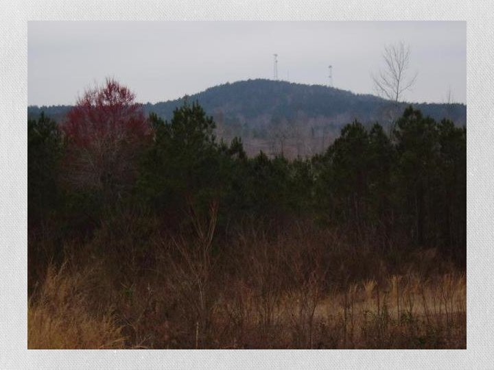
4. Northeast Highlands • Woodall Mountain is the highest point in the state
5. Piney Woods • This area was the center of the lumber and railroad industry at one time • As a result boom towns were created to provide for lumber and railroad companies • Hattiesburg and Laurel are two boom towns that are still successful today
6. Gulf Coast • MS has five barrier islands off the coast • 1. Horn Island • The largest • Used for biological weapons testing • 2. Cat Island • It got its name from the French who thought raccoons were cats • Used in WWII to train dogs for military service • Hurricane Katrina washed part of the island away • 3. Deer Island • Closest to the coast • It got its name because deer escaped to the island • 4. Ship Island • Hurricane Camille split the Island into two pieces • It is the only deep water harbor between the MS River and Mobile Bay
6. Gulf Coast Continued • 5. Petit Bois • French for Little Woods • The Mississippi Sound is the area of water between the barrier islands and the coast • The Gulf Coast was the first area to be explored and settled • Their main economic activities are fishing and tourism