MINISTRY OF ENVIRONMENT AND NATURAL RESOURCES PROTECTION OF
- Slides: 23
MINISTRY OF ENVIRONMENT AND NATURAL RESOURCES PROTECTION OF GEORGIA NATIONAL ENVIRONMENTAL AGENCY PILOT DATA SHARING – WATER QUALITY IN RIVERS AND LAKES BASED ON WISE So. E (GEORGIA) Regional Workshop, 13 May 2014, Geneva 1
OUTLINE 1. 2. 3. 4. National coordination for surface water quality data Procedure for river/lakes quality data flow Preparation of data for reporting (WISE So. E methodologies) National system vs WISE methodologies Regional Workshop, 13 May 2014, Geneva 2
1. NATIONAL COORDINATION FOR SURFACE WATER QUALITY DATA ØLeading coordinating – Ministry of Environment and Natural Resources Protection of Georgia ØData provided by the National Environmental Agency Regional Workshop, 13 May 2014, Geneva 3
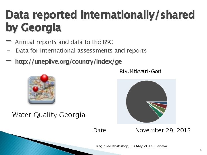
Data reported internationally/shared by Georgia - Annual reports and data to the BSC - Data for international assessments and reports - http: //uneplive. org/country/index/ge Riv. Mtkvari-Gori Water Quality Georgia Date November 29, 2013 Regional Workshop, 13 May 2014, Geneva 4
2. PROCEDURES FOR RIVERS/LAKES DATA FLOW Sphere of Competence of Environmental Pollution Monitoring Department of the National Environmental Agency Ø Ø Identification of different levels of pollution caused by anthropogenic factors, regular monitoring of background pollution, atmospheric air pollution, water pollution, atmospheric precipitation’s pollution, chemical pollution of the soil and radiation pollution through observation points and field expeditions; Preparation of yearbooks, bulletins, reviews, notes and other materials consisting of actual information on environment pollution Regional Workshop, 13 May 2014, Geneva 5
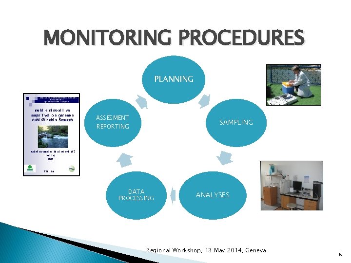
MONITORING PROCEDURES PLANNING ASSESMENT SAMPLING REPORTING DATA PROCESSING ANALYSES Regional Workshop, 13 May 2014, Geneva 6
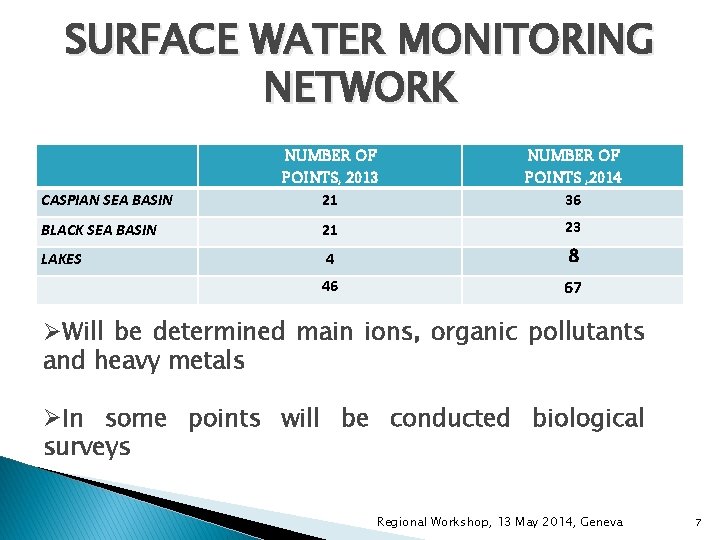
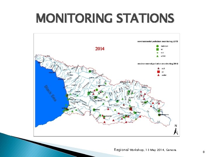
SURFACE WATER MONITORING NETWORK NUMBER OF POINTS, 2013 21 NUMBER OF POINTS , 2014 36 BLACK SEA BASIN 21 23 LAKES 4 8 46 67 CASPIAN SEA BASIN ØWill be determined main ions, organic pollutants and heavy metals ØIn some points will be conducted biological surveys Regional Workshop, 13 May 2014, Geneva 7
MONITORING STATIONS Regional Workshop, 13 May 2014, Geneva 8
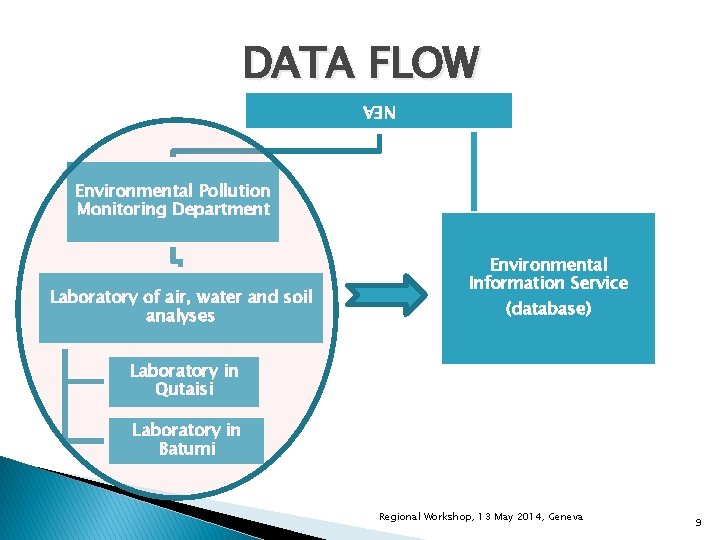
DATA FLOW NEA Environmental Pollution Monitoring Department Laboratory of air, water and soil analyses Environmental Information Service (database) Laboratory in Qutaisi Laboratory in Batumi Regional Workshop, 13 May 2014, Geneva 9
Information Dissemination www. meteo. gov. ge Monthly informative bulletin “State of Environment of Georgia” http: //moe. gov. ge Time series data on the indicators for 1990 -2012, Table C-10. Biochemical oxygen demand (BOD 5) and concentration of ammonium in rivers Time series data on the indicators for 1990 -2012, Table C-11 a Nutrients in freshwater - rivers Regional Workshop, 13 May 2014, Geneva 10
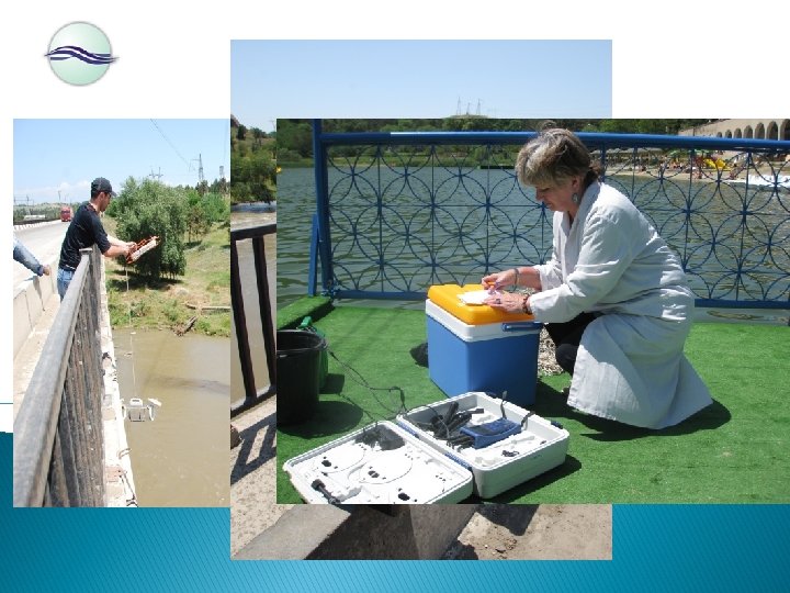
SAMPLING
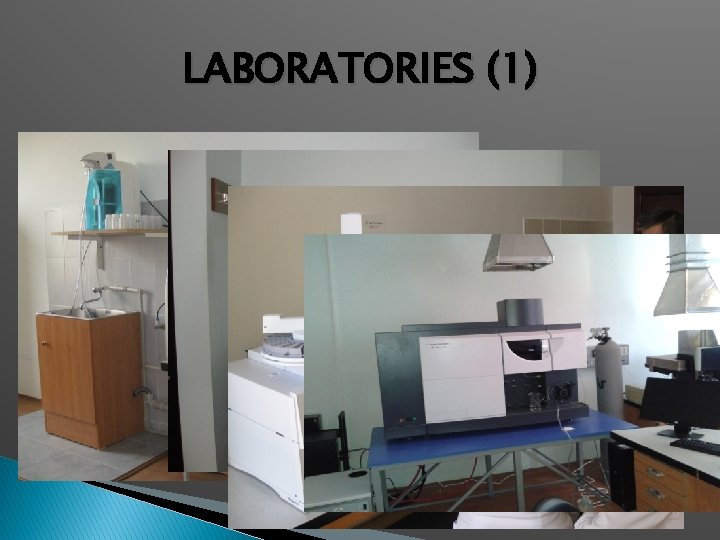
LABORATORIES (1)
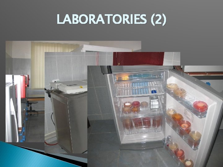
LABORATORIES (2) 13
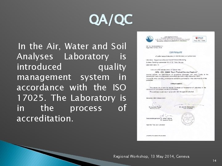
QA/QC In the Air, Water and Soil Analyses Laboratory is introduced quality management system in accordance with the ISO 17025. The Laboratory is in the process of accreditation. Regional Workshop, 13 May 2014, Geneva 14
3. Preparation of data for reporting (WISE So. E methodologies) RIVERS/LAKES SELECTED FOR PILOT DATA SHARING Ø Ø River Kura Basin – 7 points Borjomi, Gori Tbilisi – Zahesi, Tbilisi -Vakhushti Bridge, Tbilisi - Metekhi Bridge, Gachiani, Rustavi River Rioni Basin – 6 points Qutaisi – Upper, Qutaisi, Photi – north, Photi – south, Chaladidi, Oni Chorokhi-Adjaristskali Basin – 2 points Qeda, Batumi Lake Paliastomi Regional Workshop, 13 May 2014, Geneva 15
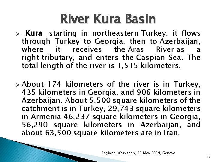
River Kura Basin Ø Ø Kura starting in northeastern Turkey, it flows through Turkey to Georgia, then to Azerbaijan, where it receives the Aras River as a right tributary, and enters the Caspian Sea. The total length of the river is 1, 515 kilometers. About 174 kilometers of the river is in Turkey, 435 kilometers in Georgia, and 906 kilometers in Azerbaijan. About 5, 500 square kilometers of the catchment is in Turkey, 29, 743 square kilometers in Armenia 46, 237 square kilometers in Georgia, 56, 290 square kilometers in Azerbaijan, and about 63, 500 square kilometers are in Iran. Regional Workshop, 13 May 2014, Geneva 16
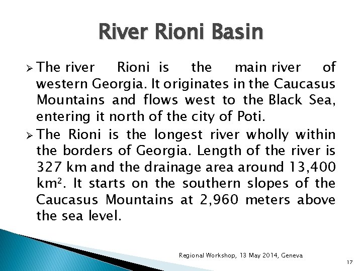
River Rioni Basin Ø The river Rioni is the main river of western Georgia. It originates in the Caucasus Mountains and flows west to the Black Sea, entering it north of the city of Poti. Ø The Rioni is the longest river wholly within the borders of Georgia. Length of the river is 327 km and the drainage area around 13, 400 km². It starts on the southern slopes of the Caucasus Mountains at 2, 960 meters above the sea level. Regional Workshop, 13 May 2014, Geneva 17
Chorokhi-Adjaristskali Basin ENPI-EPIRB project “Environmental Protection of International River Basins” works on preparation of River Basin Management Plan. The Chorokhi-Adjaristskali pilot basin is located in the Adjarian Autonomous Republic and covers significant part of its territory. Regional Workshop, 13 May 2014, Geneva 18
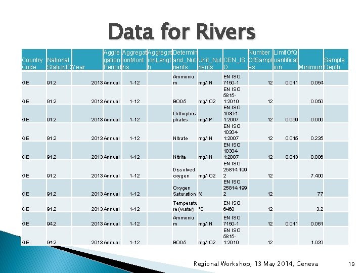
Data for Rivers Country National Code Station. IDYear Aggregat Determin Number Limit. Of. Q Sample gation ion. Mont ion. Lengt and_Nut Unit_Nut CEN_IS Of. Sampl uantificat Period hs h rients O es ion Minimum Depth GE 91. 2 2013 Annual 1 -12 Ammoniu m mg/l N GE 91. 2 2013 Annual 1 -12 BOD 5 GE 91. 2 2013 Annual 1 -12 Orthophos phates mg/l P GE 91. 2 2013 Annual 1 -12 Nitrate mg/l N GE 91. 2 2013 Annual 1 -12 Nitrite mg/l N GE 91. 2 2013 Annual 1 -12 Dissolved oxygen mg/l O 2 GE 91. 2 2013 Annual 1 -12 Oxygen Saturation % EN ISO 7150 -1 EN ISO 58151: 2010 EN ISO 103041: 2007 EN ISO 25814: 199 2 GE 91. 2 2013 Annual 1 -12 Temperatu re (water) °C EN ISO 6468 GE 94. 2 2013 Annual 1 -12 Ammoniu m mg/l N GE 94. 2 2013 Annual 1 -12 BOD 5 EN ISO 7150 -1 EN ISO 58151: 2010 mg/l O 2 12 0. 011 12 0. 054 0. 050 12 0. 069 0. 000 12 0. 015 0. 235 12 0. 013 0. 006 12 7. 400 12 77 12 3. 2 12 12 0. 011 0. 061 1. 020 Regional Workshop, 13 May 2014, Geneva 19
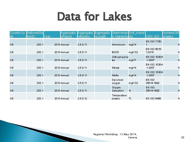
Data for Lakes Country. Co National. Sta de tion. ID Year Aggregatio Determinan Unit_Nutrie n. Period n. Months n. Length d_Nutrients CEN_ISO Number. Of. S amples GE 203. 1 2013 Annual 2. 5. 8. 11 Ammonium mg/l N EN ISO 71501 4 GE 203. 1 2013 Annual 2. 5. 8. 11 BOD 5 mg/l O 2 EN ISO 58151: 2010 4 GE 203. 1 2013 Annual 2. 5. 8. 11 Orthophospha tes mg/l P EN ISO 10304 -1: 2007 4 GE 203. 1 2013 Annual 2. 5. 8. 11 Nitrate mg/l N EN ISO 10304 -1: 2007 4 GE 203. 1 2013 Annual 2. 5. 8. 11 Nitrite mg/l N EN ISO 10304 -1: 2007 4 GE 203. 1 2013 Annual 2. 5. 8. 11 Dissolved oxygen mg/l O 2 EN ISO 25814: 1992 4 GE 203. 1 2013 Annual 2. 5. 8. 11 Oxygen Saturation % EN ISO 25814: 1992 4 GE 203. 1 2013 Annual 2. 5. 8. 12 Temperature (water) °C EN ISO 6468 4 Regional Workshop, 13 May 2014, Geneva 20
Challenges Generally the structure of the national database is comparable with WISE So. E. For each monitoring station it provides the following information: name of station, national code, distance from source and distance from populated area, sampling date, sampling depth, determinand names, units, single measurements, Min, Max and Mean. But there is no any other required data as defined in “data dictionaries” (e. g. pressures, catchment area, information on analytical methods etc. ). Regional Workshop, 13 May 2014, Geneva 21
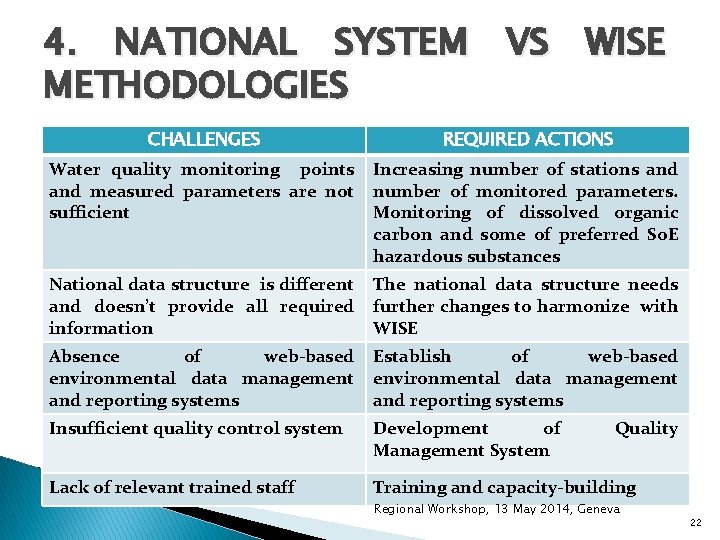
4. NATIONAL SYSTEM VS WISE METHODOLOGIES CHALLENGES REQUIRED ACTIONS Water quality monitoring points and measured parameters are not sufficient Increasing number of stations and number of monitored parameters. Monitoring of dissolved organic carbon and some of preferred So. E hazardous substances National data structure is different and doesn’t provide all required information The national data structure needs further changes to harmonize with WISE Absence of web-based environmental data management and reporting systems Establish of web-based environmental data management and reporting systems Insufficient quality control system Development of Management System Lack of relevant trained staff Training and capacity-building Quality Regional Workshop, 13 May 2014, Geneva 22
THANK YOU FOR ATTENTION! Marine Arabidze Environmental Pollution Monitoring Department marabidze@environment. ge