Miller Diagrams A Brief Introduction Outline Origins n
Miller Diagrams A Brief Introduction

Outline Origins n Overview n Fields to Analyze n Pattern Types n Final Points n
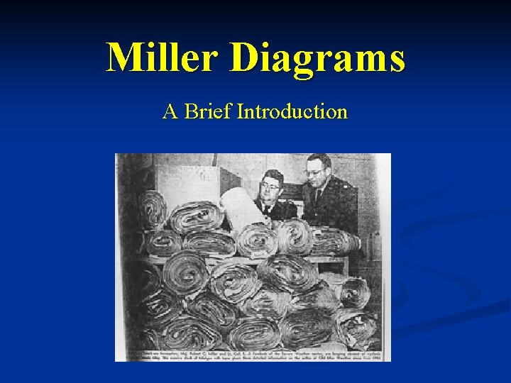
Origins Developed in 1948 by Robert Miller and Ernest Fawbush. n A tornado struck Tinker AFB on 20 March, and Fawbush and Miller were directed to investigate the forecastability of tornadoproducing thunderstorms. n So, they pored over all the available data (for the Tinker tornado as well as several other previous tornado outbreaks). n
Origins Fawbush and Miller noticed similarities in the synoptic patterns associated with the tornado outbreaks. n On the morning of 25 March, they noticed that the synoptic pattern was similar to what was observed on 20 March. n When a squall line was detected on radar at 2 pm, they decided (very nervously) to issue a tornado forecast. n
Origins n n n Fawbush and Miller waited expectantly over the next three hours to see if the squall line would generate severe weather, let alone a tornado. At 5 pm, Will Rogers airport (7 miles southwest of Tinker) reported only a light thunderstorm, wind gusts to 26 mph and pea-sized hail. The forecast was apparently a bust, and Miller left the base and drove home, certain he and Fawbush would be harshly reprimanded the next day.
Origins But, lo and behold, the system intensified and – believe it or not – Tinker AFB was hit by another tornado, only 5 days after the first! n Fawbush and Miller became legends, and Miller Diagrams became a standard prognostic tool of weather forecasters in the plains (and elsewhere). n
Miller Diagram Overview Provides an efficient means of analyzing the relevant synoptic features important in severe weather outbreaks n Cartoon-style analysis is performed for the surface, 850 mb, 700 mb and 500 mb (occasionally 250 or 300 mb) and the results are plotted on a single chart. n
Surface Fields Fronts n Dryline(s) n
850 mb Fields Dryline(s) n General Flow n Low-Level Jet(s) n Thermal Ridge n Moisture Tongues, Moisture Axes n Confluent Zones n
700 mb Fields Dry Tongue(s) n General Flow n Wind Max Axis/Axes n Moisture n Confluent Zones n Diffluent Zones n
500 mb Fields Isotherms n Thermal Trough n Jet Flow n Diffluent Zone(s) n Horizontal Speed Shear Zones n
Jet-Level Fields Jet Flow n Jet Max n Speed Shear Zones n Diffluent Zones n

Synoptic Type A Pattern Well-defined southwesterly jet (500 mb) n Well-defined dry tongue at 700 mb, moving from SW to NE n Influx of low-level moisture from the south n Streamline convergence at 850 to 700 mb, at the boundary between the moist and dry air n
Synoptic Type A Pattern Usually occurs around 3 -4 pm to 10 pm n Max in late afternoon/early evening n Thunderstorms form in clusters, not squall line n
Synoptic Type B Pattern Similar to Type A, but with a major upper trough (500 mb) and eastward-moving surface cold front to the west of the threat area n Initial development occurs along the front (often as a squall line) and then becomes severe / tornadic as the storms move farther east into more unstable area n F 2 -F 5 tornadoes possible n Very diurnally persistent n

Synoptic Type C Pattern Well-defined westerly jet (500 mb) n Quasistationary surface frontal boundary n Dry air most pronounced at 700 mb, moving from SW to NE n Initial development occurs in the vicinity of the surface front, south of the jet, and rapidly becomes severe when the dry air at mid levels arrives from the SW n
Synoptic Type C Pattern Not much diurnal variation (max 6 hours after surface heating) n Smaller scale than other types n Produces singular tornadoes n If surface air behind front is below 50 degrees, chances for severe weather go down n
Synoptic Type D Pattern A southerly jet and closed low at 500 mb n Deepening surface low n Destabilization occurs when warm, moist air at surface undercuts cold air aloft n Moist flow from SE, dry air at mid levels from SW n Typically not as favorable for tornadoes as patterns A, B or C n More favorable for hail n

Synoptic Type E Pattern Westerly Jet at 500 mb n Similar to pattern C, but with major cyclogenesis at surface n Squall line formation likely n Diurnally persistent (max at 3 -6 hours after max surface heating) n
Final Points to Consider Sometimes, patterns may be difficult to classify (hybrids) or transition from one type to another. n Typically, the transitions follow: n Pattern A becomes Pattern B (as a cold front sweeps through) n Pattern C becomes Pattern E (as cyclogenesis occurs along surface front) n
One Last Point n No matter what the pattern, the area of violent weather is located by the position of the convergence zone in low / mid levels, the position of the jet, and the leading edge of the dry air advancing from the SW.
- Slides: 21