METEOROLOGY GEL1370 Chapter Four Humidity Condensation Clouds Goal

- Slides: 52

METEOROLOGY GEL-1370

Chapter Four Humidity, Condensation & Clouds

Goal for this Chapter We are going to learn answers to the following questions: • Why eyeglasses often fog up after coming indoors on a cold day? • On a cold winter, why do you feel your skin to be very dry, lips crack, and have itching sensation on the skin? • You often itchy throat during winter than summer? • Why you have different types, colors and shapes of cloud during various days and times of the year? • Learn various terms (relative humidity, vapor pressure, dew, frost, haze, fog, cirrus clouds, cumulus clouds, stratocumulus clouds, etc. ) used by Meteorologists

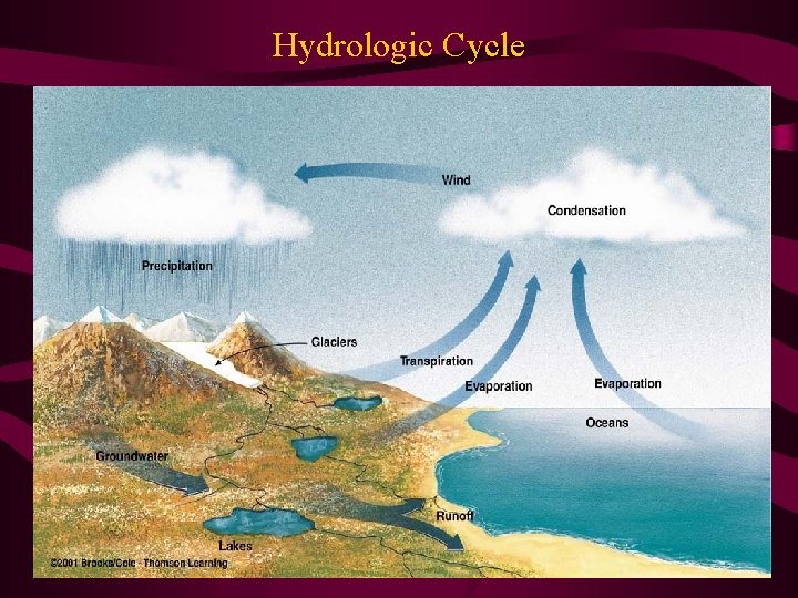
Water Circulation in the Atmosphere • Evaporation: Conversion of liquid water into vapor • Condensation: Conversion of water vapor into liquid • Precipitation: Stuff that falls to the surface from the growth of cloud particles (rain, snow or hail) • Transpiration: Release of moisture from plants/trees • Hydrologic Cycle: Cycling of water molecules from liquid to vapor and back to liquid- ocean – atmosphere – land – ocean • Some Facts: 1. 5 billion gallons of water vapor evaporate into the atmosphere in a year; 85% from ocean (70% of the earth’s surface area) & 15% from evaporation and transpiration • Total Mass of Water Vapor ~ 7 days of precipitation for the globe (Residence time ~ 7 days)

Hydrologic Cycle

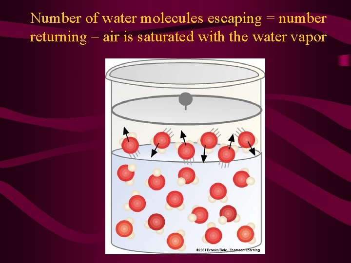
Saturation & Condensation • Saturation: When number of molecules escaping a parcel of air = number of returning molecules • Wind can push away the molecules from a water body and hence will enhance evaporation • Warm temperature will aid the molecules to move faster leading to evaporation – warmer the water, greater the rate by evaporation • Condensation Nuclei: Microscopic particles such as dust, smoke, salt from ocean spray, etc – serve as surfaces on which water vapor can condense • Condensation occurs when air is cooled – speed of the vapor molecules decrease leading to more condensation

Saturation & Humidity • Saturation is more likely to occur in cool air than warm air – Warm air can hold more water vapor molecules before getting saturated than cold air – Warm air has greater capacity to hold water vapor • Absolute Humidity or Water vapor density in a parcel of air = Weight of water vapor (g) / volume of air (m 3) • Specific Humidity in a parcel of air = Weight of water vapor (g) / Total weight of all the air (kg) • Mixing Ratio in a parcel of air = Weight of water vapor (g) / Weight of the dry air (kg) • Relative Humidity = Amount of water vapor in the air / Maximum amount of water required for saturation at that temperature

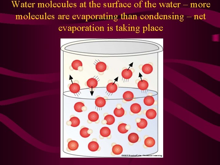
Water molecules at the surface of the water – more molecules are evaporating than condensing – net evaporation is taking place

Number of water molecules escaping = number returning – air is saturated with the water vapor

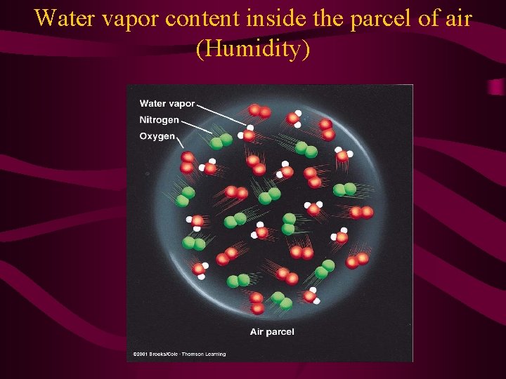
Water vapor content inside the parcel of air (Humidity)

Humidity contd. • Relative Humidity (RH) tells us how close the air is to being saturated • RH = (vapor pressure / saturation vapor pressure) x 100 • Air RH >100%, is said to be supersaturated • Vapor Pressure: Total pressure inside a parcel of air = Sum of the pressures of individual gases • Total pressure (1000 mb) = Partial pressure (PP) exerted by N 2 (78% or 780 mb) + PP exerted by O 2 (21% or 210 mb) + PP exerted by water vapor (1% or 10 mb) • The partial pressure of water vapor (Actual vapor pressure) ~ 10 mb – only a small fraction of the total air pressure

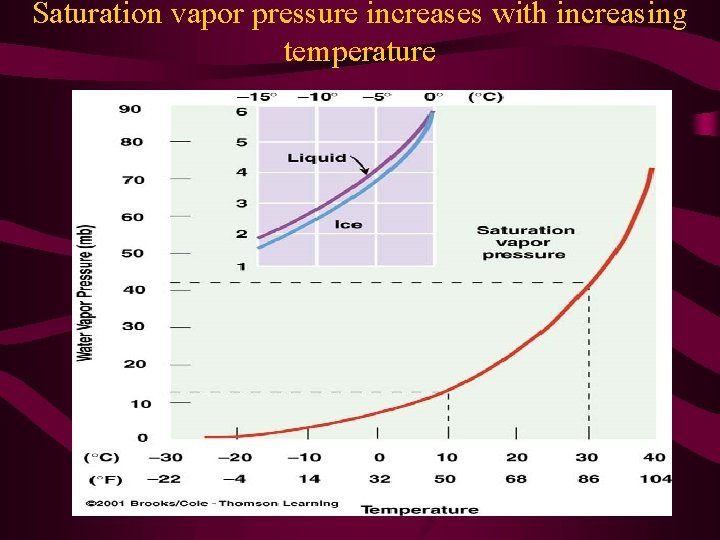
Vapor Pressure • High actual vapor pressure indicates large numbers of water vapor molecules • Saturation Vapor Pressure: Pressure that the water vapor molecules would exert if the air were saturated with vapor at a given temperature • At higher air temperatures, it takes more water vapor to saturate the air (increase in temp leads to increased in the velocity – number of molecules escaping per second increases)

Saturation vapor pressure increases with increasing temperature

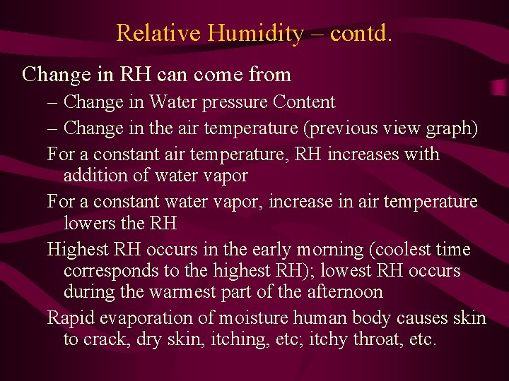
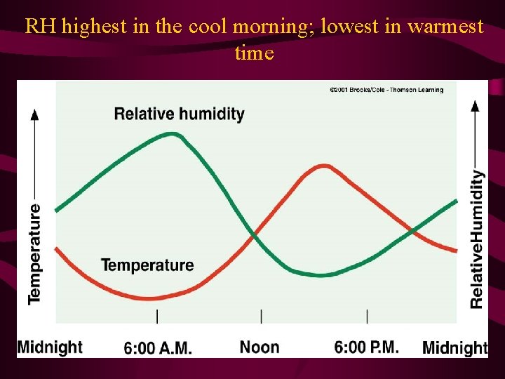
Relative Humidity – contd. Change in RH can come from – Change in Water pressure Content – Change in the air temperature (previous view graph) For a constant air temperature, RH increases with addition of water vapor For a constant water vapor, increase in air temperature lowers the RH Highest RH occurs in the early morning (coolest time corresponds to the highest RH); lowest RH occurs during the warmest part of the afternoon Rapid evaporation of moisture human body causes skin to crack, dry skin, itching, etc; itchy throat, etc.

RH highest in the cool morning; lowest in warmest time

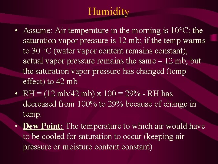
Humidity • Assume: Air temperature in the morning is 10°C; the saturation vapor pressure is 12 mb; if the temp warms to 30 °C (water vapor content remains constant), actual vapor pressure remains the same – 12 mb, but the saturation vapor pressure has changed (temp effect) to 42 mb • RH = (12 mb/42 mb) x 100 = 29% - RH has decreased from 100% to 29% because of change in temp. • Dew Point: The temperature to which air would have to be cooled for saturation to occur (keeping air pressure or moisture content constant)

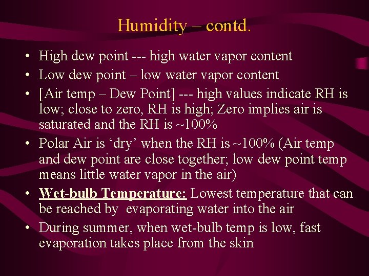
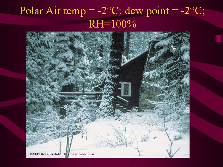
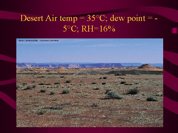
Humidity – contd. • High dew point --- high water vapor content • Low dew point – low water vapor content • [Air temp – Dew Point] --- high values indicate RH is low; close to zero, RH is high; Zero implies air is saturated and the RH is ~100% • Polar Air is ‘dry’ when the RH is ~100% (Air temp and dew point are close together; low dew point temp means little water vapor in the air) • Wet-bulb Temperature: Lowest temperature that can be reached by evaporating water into the air • During summer, when wet-bulb temp is low, fast evaporation takes place from the skin

Polar Air temp = -2°C; dew point = -2°C; RH=100%

Desert Air temp = 35°C; dew point = 5°C; RH=16%

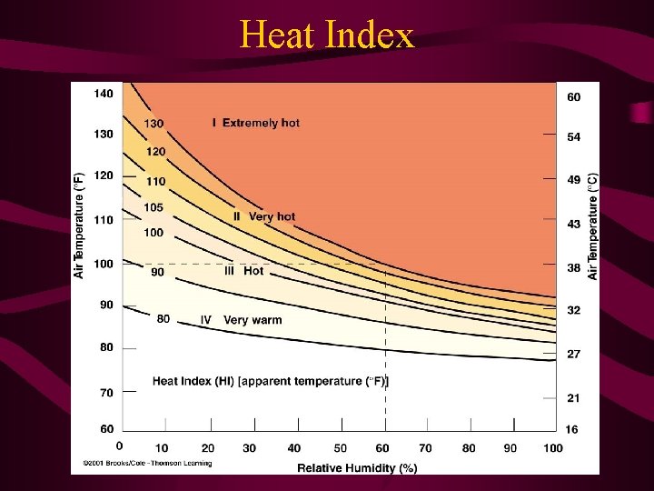
Human body adjustment When the human body temp rises, the hypothalamus gland (gland in the brain that regulates body temp) activates the body’s heat regulating mechanism, and evaporation increases – we feel thirsty to keep up the fluid level in the body Heat Index: It is the apparent temperature of what the temperature ‘feels like’ – It takes air temp and RH into account (air temp of 100°F & RH ~60% - Heat index ~130 °F) Measurement of dew point and RH is done using Psychrometer

Heat Index

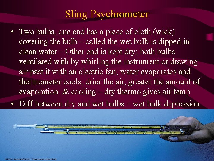
Sling Psychrometer • Two bulbs, one end has a piece of cloth (wick) covering the bulb – called the wet bulb is dipped in clean water – Other end is kept dry; both bulbs ventilated with by whirling the instrument or drawing air past it with an electric fan; water evaporates and thermometer cools; drier the air, greater the amount of evaporation & cooling – dry thermo gives air temp • Diff between dry and wet bulbs = wet bulk depression

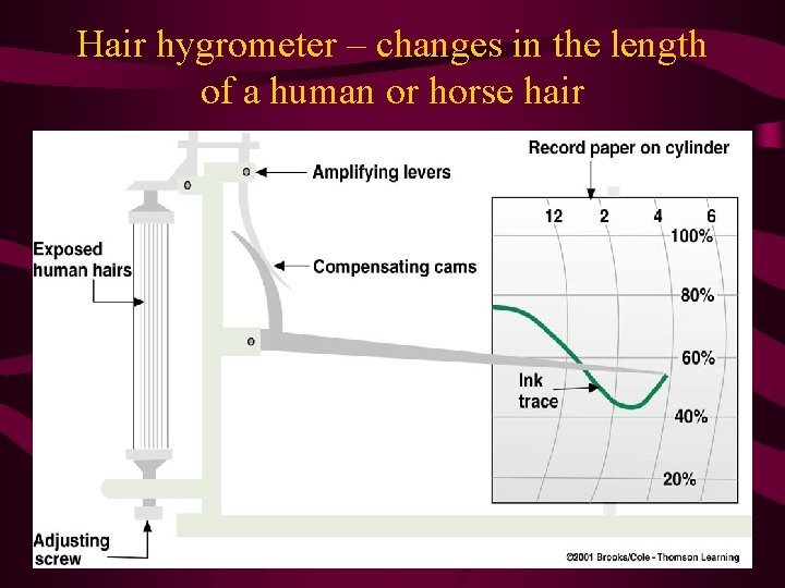
Humidity measurements • Large depression --- more water can evaporate into the air – RH is very low • Small depression --- little evaporation of water vapor is possible • Humidity are commonly called Hygrometers – Human humidity increases, the length of hair increases and the RH decreases, so does the hair length • Electrical Hygrometer: Plate coated with a film of carbon; electrical current sent across the plate; water vapor absorbed changes the electrical resistance of the carbon coating

Hair hygrometer – changes in the length of a human or horse hair

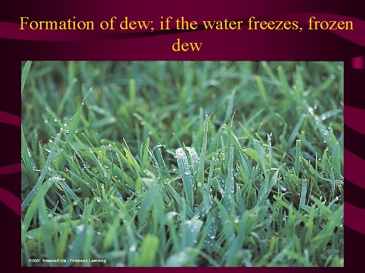
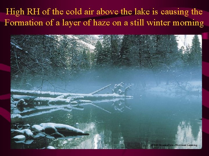
Dew, Frost, Fog • When air cools below the dew point, water vapor begins to condense upon surfaces forming tiny visible specks of water called ‘dew’ • If the air temp falls below freezing, the dew will freeze, becoming tiny beads of ice called frozen dew • When dew is seen, it will not rain; if grass is dry, rain may come • When air temp is much below freezing, water vapor can directly become ice – Deposition (opposite is sublimation) – White crystal is called frost • When RH >75%, some of the water vapor may condense onto condensation nuclei – size increases and can scatter light --- becoming haze

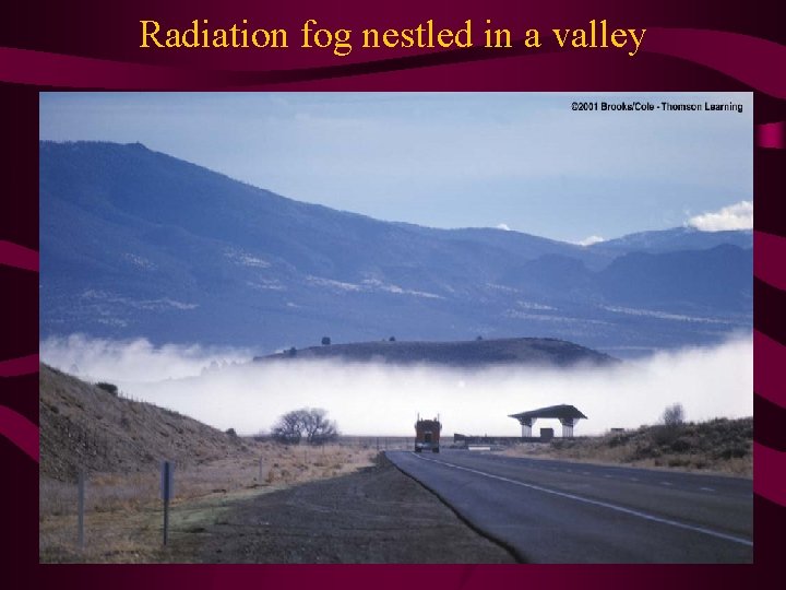
Haze, Fog • Fog: Visibility < 1 km; air is wet with millions of tiny liquid droplets (or ice crystals), the haze becomes cloud with earth’s surface as the base • Radiation Fog or Ground Fog: Produced by the earth’s radiational cooling; most common over land in late fall & winter; ground cools so does the air directly above it, and a surface inversion forms --- moist lower layer quickly becomes saturated, and fog forms • Valley Fog: Radiation fog in a valley; heavy air drains downhill and collects in valley bottoms • How fog disappears when sun rises: Sunlight penetrates and warms the ground; temp of air increases; warm rises and mixes w/foggy air above; droplets evaporate

Formation of dew; if the water freezes, frozen dew

High RH of the cold air above the lake is causing the Formation of a layer of haze on a still winter morning

Radiation fog nestled in a valley

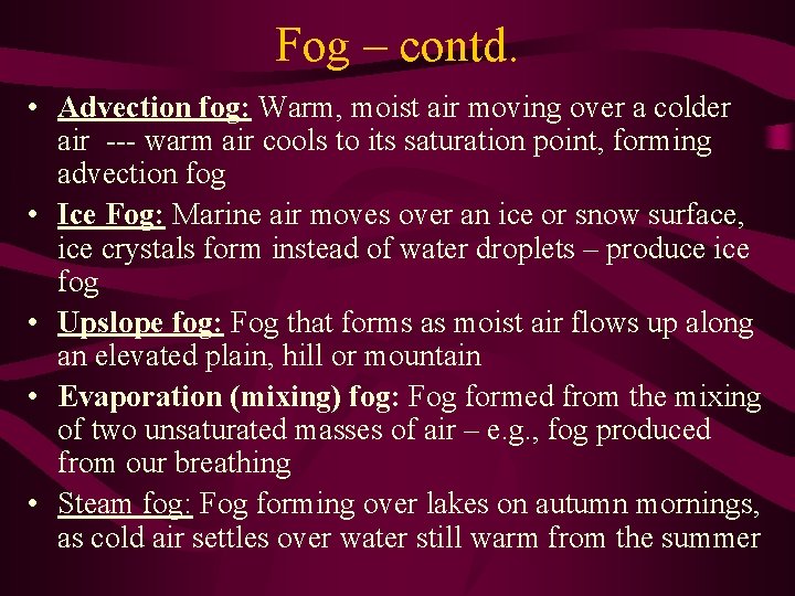
Fog – contd. • Advection fog: Warm, moist air moving over a colder air --- warm air cools to its saturation point, forming advection fog • Ice Fog: Marine air moves over an ice or snow surface, ice crystals form instead of water droplets – produce ice fog • Upslope fog: Fog that forms as moist air flows up along an elevated plain, hill or mountain • Evaporation (mixing) fog: Fog formed from the mixing of two unsaturated masses of air – e. g. , fog produced from our breathing • Steam fog: Fog forming over lakes on autumn mornings, as cold air settles over water still warm from the summer

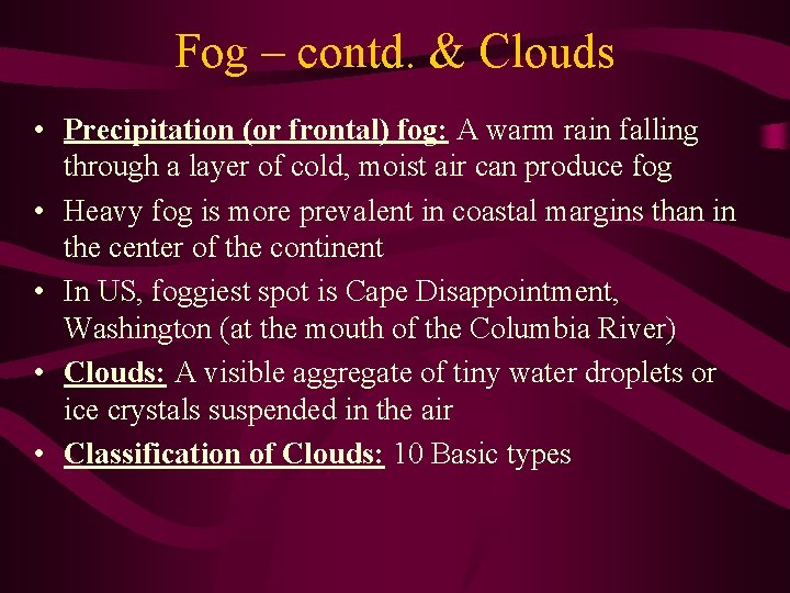
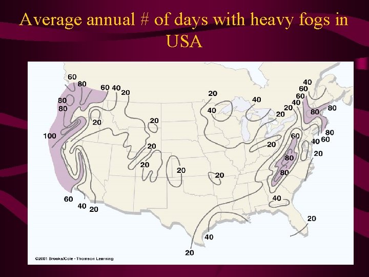
Fog – contd. & Clouds • Precipitation (or frontal) fog: A warm rain falling through a layer of cold, moist air can produce fog • Heavy fog is more prevalent in coastal margins than in the center of the continent • In US, foggiest spot is Cape Disappointment, Washington (at the mouth of the Columbia River) • Clouds: A visible aggregate of tiny water droplets or ice crystals suspended in the air • Classification of Clouds: 10 Basic types

Average annual # of days with heavy fogs in USA

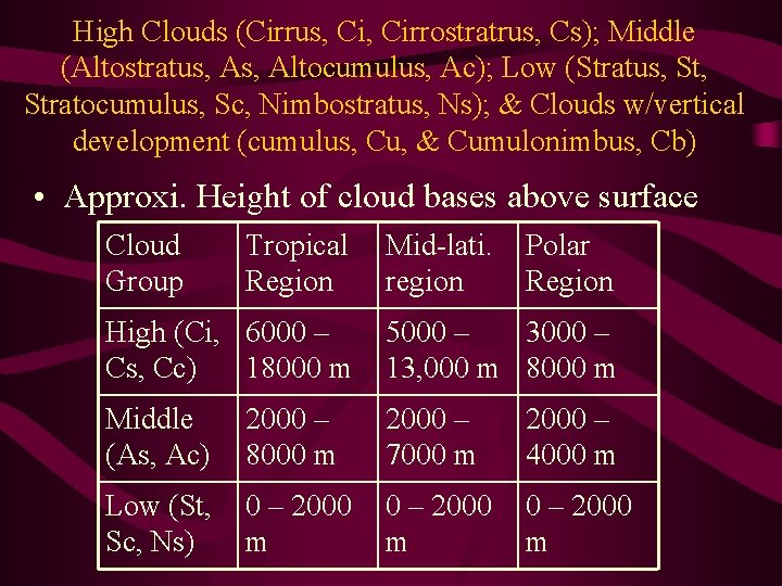
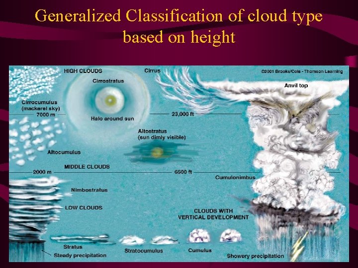
High Clouds (Cirrus, Cirrostratrus, Cs); Middle (Altostratus, Altocumulus, Ac); Low (Stratus, Stratocumulus, Sc, Nimbostratus, Ns); & Clouds w/vertical development (cumulus, Cu, & Cumulonimbus, Cb) • Approxi. Height of cloud bases above surface Cloud Group Tropical Region Mid-lati. region Polar Region High (Ci, 6000 – Cs, Cc) 18000 m 5000 – 3000 – 13, 000 m 8000 m Middle (As, Ac) 2000 – 8000 m 2000 – 7000 m 2000 – 4000 m Low (St, Sc, Ns) 0 – 2000 m

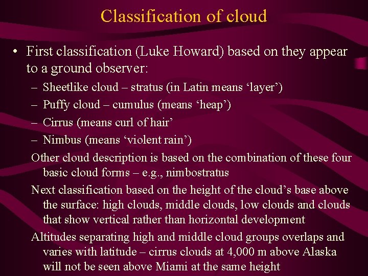
Classification of cloud • First classification (Luke Howard) based on they appear to a ground observer: – Sheetlike cloud – stratus (in Latin means ‘layer’) – Puffy cloud – cumulus (means ‘heap’) – Cirrus (means curl of hair’ – Nimbus (means ‘violent rain’) Other cloud description is based on the combination of these four basic cloud forms – e. g. , nimbostratus Next classification based on the height of the cloud’s base above the surface: high clouds, middle clouds, low clouds and clouds that show vertical rather than horizontal development Altitudes separating high and middle cloud groups overlaps and varies with latitude – cirrus clouds at 4, 000 m above Alaska will not be seen above Miami at the same height

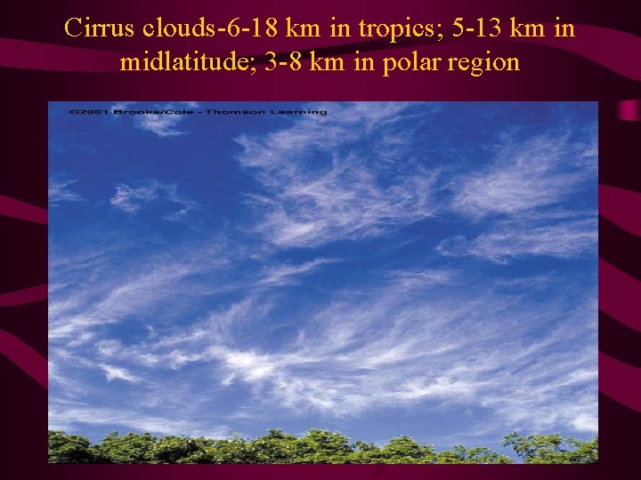
Cirrus clouds-6 -18 km in tropics; 5 -13 km in midlatitude; 3 -8 km in polar region

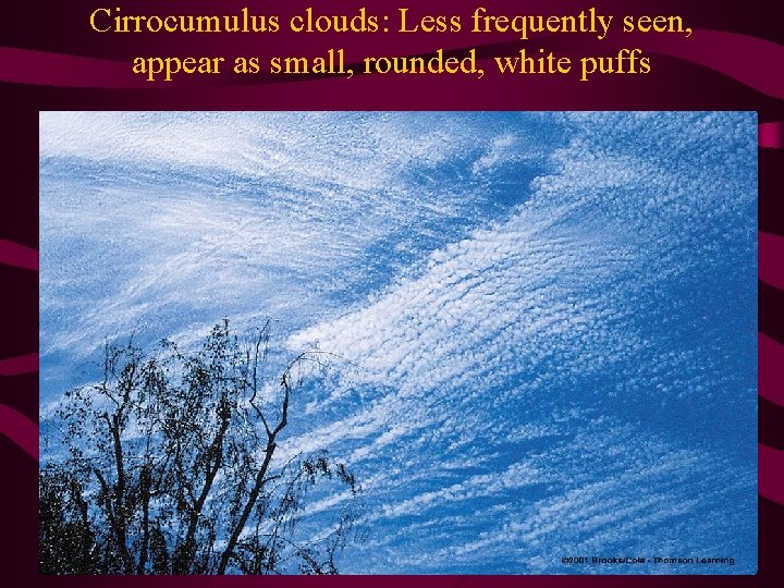
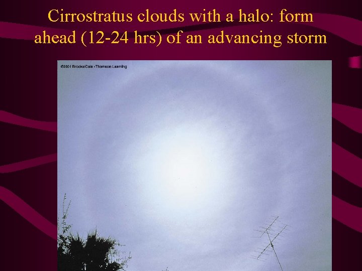
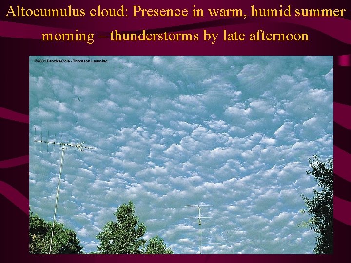
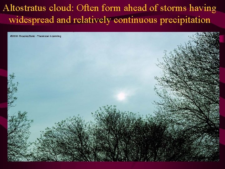
Cloud classification – contd. • High Clouds: Clouds composed of ice crystals and are thin; – Cirrus clouds usually move across the sky from west to east – cirrocumulus less seen frequently than cirrus – cirrostratus form ahead of an advancing storm; appearance of cirrostratus used to predict rain or snow within 12 -24 hrs • Middle Clouds: Have bases 2 -7 km; – Altocumulus: One part of the cloud is darker than the other – Altostratus: Gray or blue-gray cloud often covering entire sky or over an area that extends over many hundreds of square km; often forms ahead of storms having widespread and continuous precipitation; if precipitation takes place from this cloud, the base height lowers

Cirrocumulus clouds: Less frequently seen, appear as small, rounded, white puffs

Cirrostratus clouds with a halo: form ahead (12 -24 hrs) of an advancing storm

Altocumulus cloud: Presence in warm, humid summer morning – thunderstorms by late afternoon

Altostratus cloud: Often form ahead of storms having widespread and relatively continuous precipitation

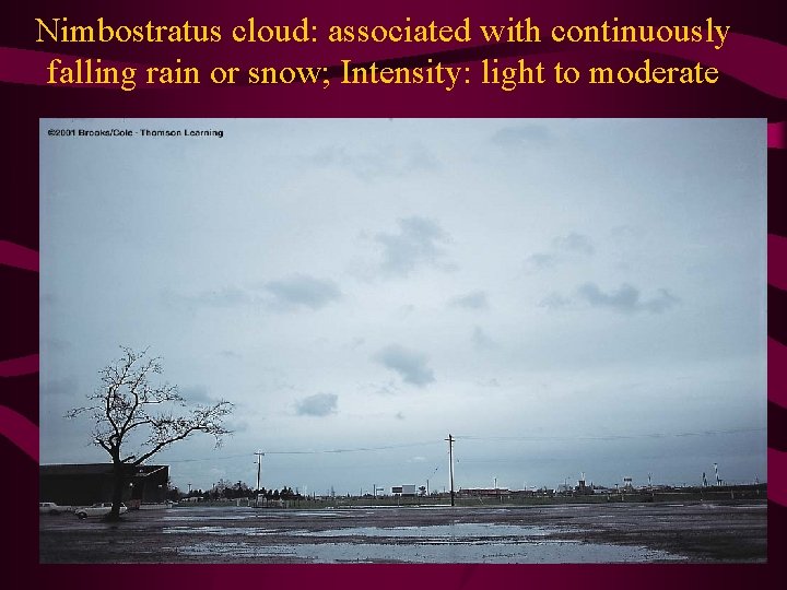
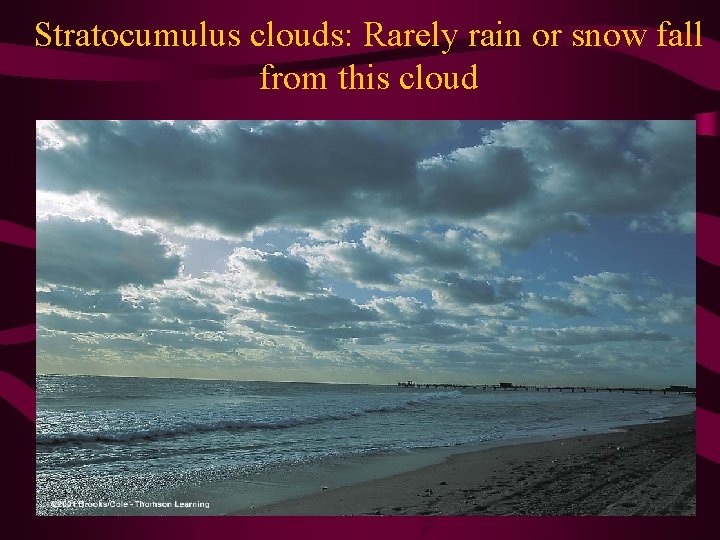
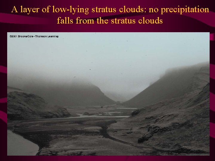
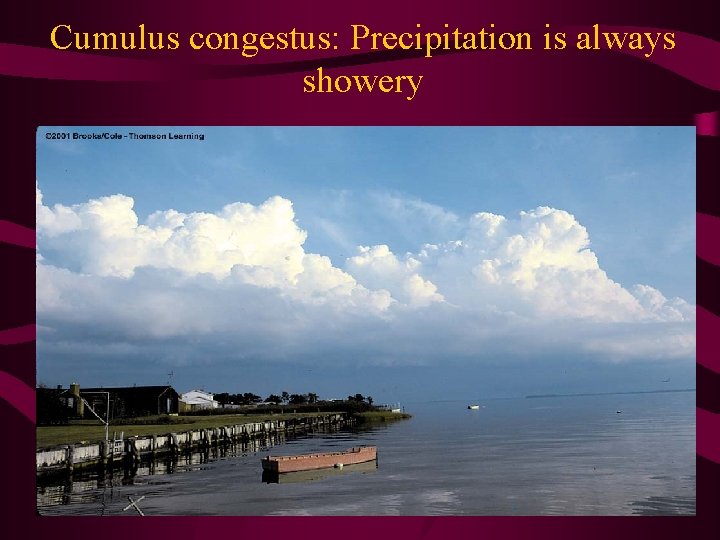
Cloud classification – contd. • Low Clouds: Bases lie below 2000 m; composed of water droplets (in cold weather may contain ice crystals and snow) – Nimbostratus: Dark gray, ‘wet’-looking cloud layer; associated with continuously falling rain or snow; intensity of rain is light or moderate; never heavy, showery variety – Stratocumulus: Rain or snow rarely fall from stratocumulus – Stratus: When a thick fog ‘lifts, ’ the resulting cloud is low stratus; generally no precipitation falls from the stratus Clouds with Vertical Development: Takes a variety of shapes, most often looks like a piece of floating cotton with sharp outlines and flat base; precipitation from cumulus congestus is always showery

Nimbostratus cloud: associated with continuously falling rain or snow; Intensity: light to moderate

Stratocumulus clouds: Rarely rain or snow fall from this cloud

A layer of low-lying stratus clouds: no precipitation falls from the stratus clouds

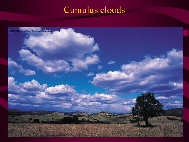
Cumulus clouds

Cumulus congestus: Precipitation is always showery

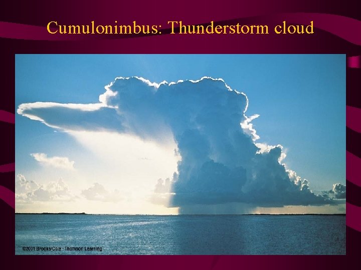
Cumulonimbus: Thunderstorm cloud

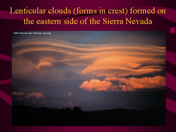
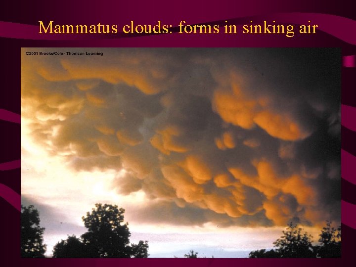
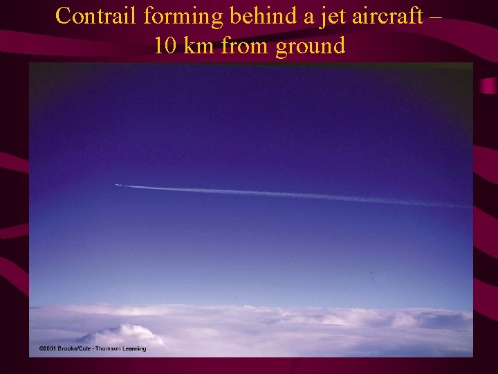
Clouds with vertical development • Cumulonimbus is a thunderstorm cloud; condensation of water vapor --- release of energy – violent up- and down-drafts – lightning, thunder, violent tornadoes associated with the cumulonimbus Other Clouds: Lenticular clouds: formed in the wave crest ; wave is formed by the moist air crossing a mountain barrier 0 rkednmoist air crossing Mammatus clouds: Formed in sinking air Condensation trail air (or contrail): Trail of Condensed vapor produced by a jet aircraft

Generalized Classification of cloud type based on height

Lenticular clouds (forms in crest) formed on the eastern side of the Sierra Nevada

Mammatus clouds: forms in sinking air

Contrail forming behind a jet aircraft – 10 km from ground