
Meteorology for the Soaring Pilot Joerg Stieber Canadian

Meteorology for the Soaring Pilot Joerg Stieber Canadian Advanced Soaring
Why do we need to know this? A profound understanding of the weather is the basis for reaching your goals as a XC Pilot. • Macro weather – Weather systems (Highs, Lows, fronts) – Rain or shine • Micro weather – Why are the cu here and not there? – Local effects like convergence, lake effect, etc. Canadian Advanced Soaring
The Atmosphere • Think of it as an ocean of air • All weather relevant to gliding occurs below 35, 000 ft (Troposphere) • Different airmasses and their properties – Temperature – Humidity • Warm air can hold more moisture than cold air • Percent of saturation (public weather) • Dew point: Temperature at which an airmass is saturated (aviation reports) Canadian Advanced Soaring
Fronts • Fronts are boundaries between different airmasses • They pass over us as airmasses move like currents in an ocean – Cold Front • Cold air displaces warm air – Temperature drop, gusty NW winds, likely rain, possibly thunder, quick passage – clear behind – Warm Front • Warm air displaces cold air – Thickening layers of clouds, steady rain, slow passage Canadian Advanced Soaring

Cold Front Good soaring conditions Ground 18 – 24 hrs Canadian Advanced Soaring Tephi
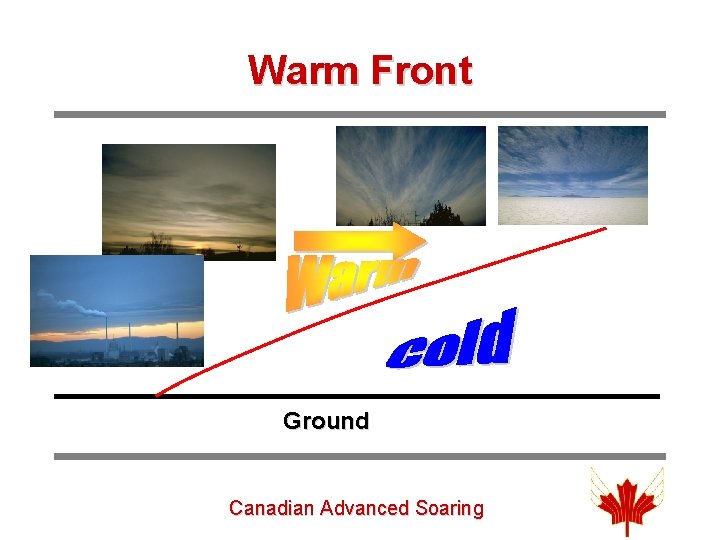
Warm Front Ground Canadian Advanced Soaring
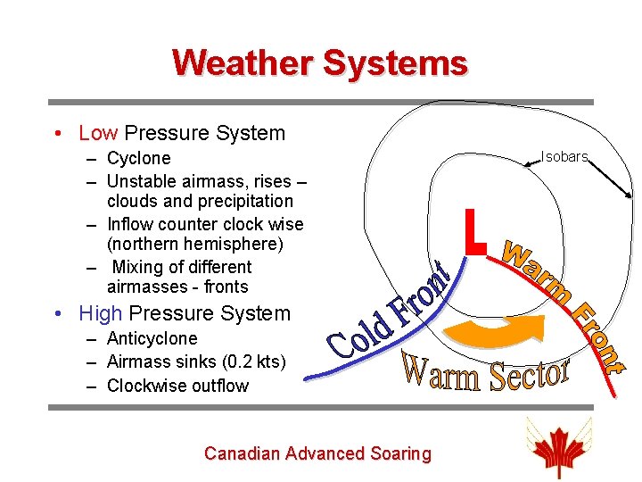
Weather Systems • Low Pressure System – Cyclone – Unstable airmass, rises – clouds and precipitation – Inflow counter clock wise (northern hemisphere) – Mixing of different airmasses - fronts • High Pressure System – Anticyclone – Airmass sinks (0. 2 kts) – Clockwise outflow Canadian Advanced Soaring Isobars
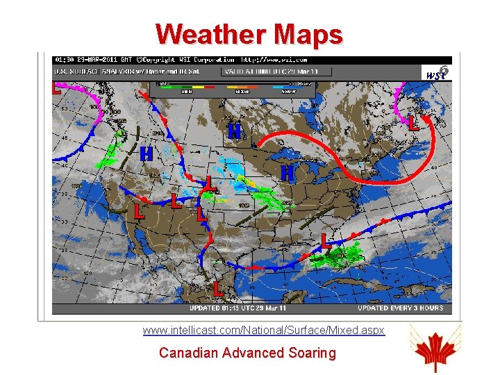
Weather Maps www. intellicast. com/National/Surface/Mixed. aspx Canadian Advanced Soaring
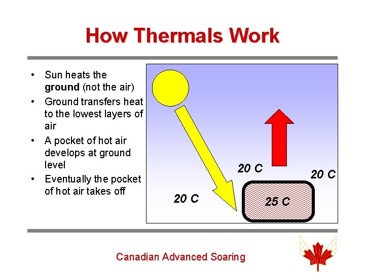
How Thermals Work • Sun heats the ground (not the air) • Ground transfers heat to the lowest layers of air • A pocket of hot air develops at ground level • Eventually the pocket of hot air takes off 20 C Canadian Advanced Soaring 20 C 25 C
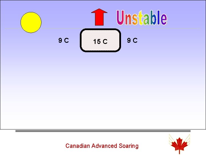
9 C 15 C 9 C • The parcel of air cools as a result of expanding as the pressure drops with height – adiabatic lapse rate – dry / wet • Environmental lapse rate ~ -2 C per 1000 ft Canadian Advanced Soaring
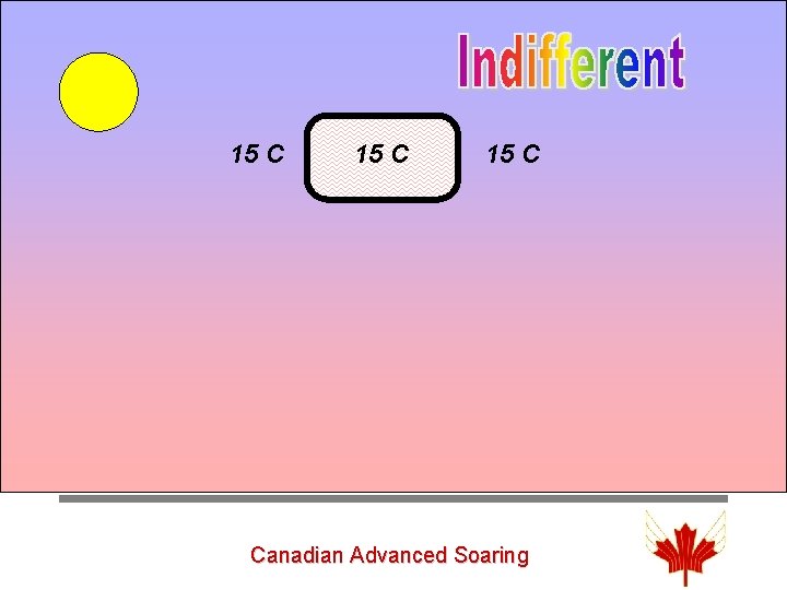
Unstable 15 C Canadian Advanced Soaring
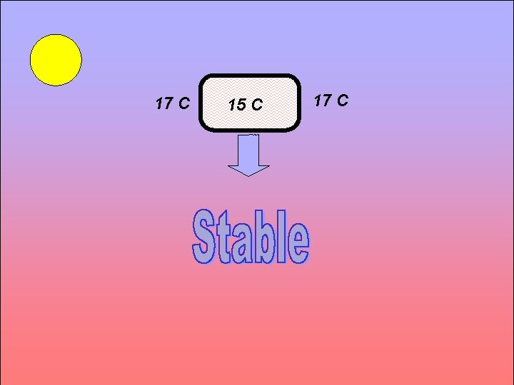
Unstable 17 C 15 C 17 C Canadian Advanced Soaring

Questions? ? Canadian Advanced Soaring
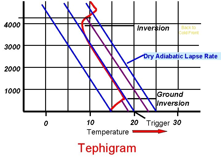
4000 Inversion Back to Cold Front 3000 Dry Adiabatic Lapse Rate 2000 1000 Ground Inversion 0 20 10 Temperature Tephigram Trigger 30
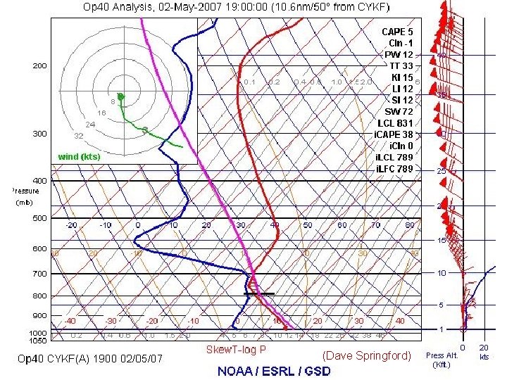
The Tephigram • Temperature and humidity over altitude • The tephigram shows if a particular airmass is stable or unstable and allows us to forecast – – – thermal strength depth (height) of convection trigger temperature Clouds Overdevelopment • The easiest to use is the NOAA Java based plot at: http: //rucsoundings. noaa. gov Canadian Advanced Soaring
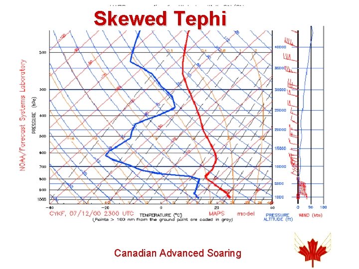
Skewed Tephi Canadian Advanced Soaring
4 Different Tephis (Dave Springford) • • Blue soaring day Good soaring day Over-development Cu spreading out Canadian Advanced Soaring
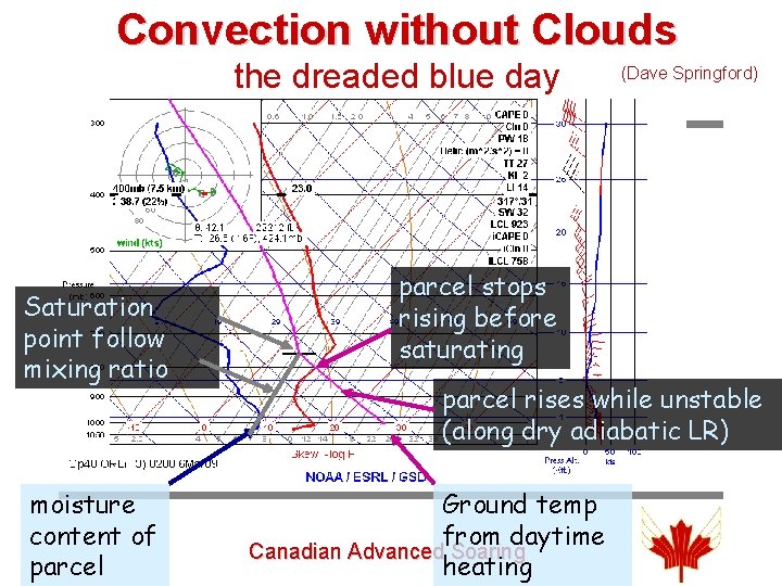
Convection without Clouds the dreaded blue day Saturation point follow mixing ratio moisture content of parcel (Dave Springford) parcel stops rising before saturating parcel rises while unstable (along dry adiabatic LR) Ground temp from daytime Canadian Advanced Soaring heating
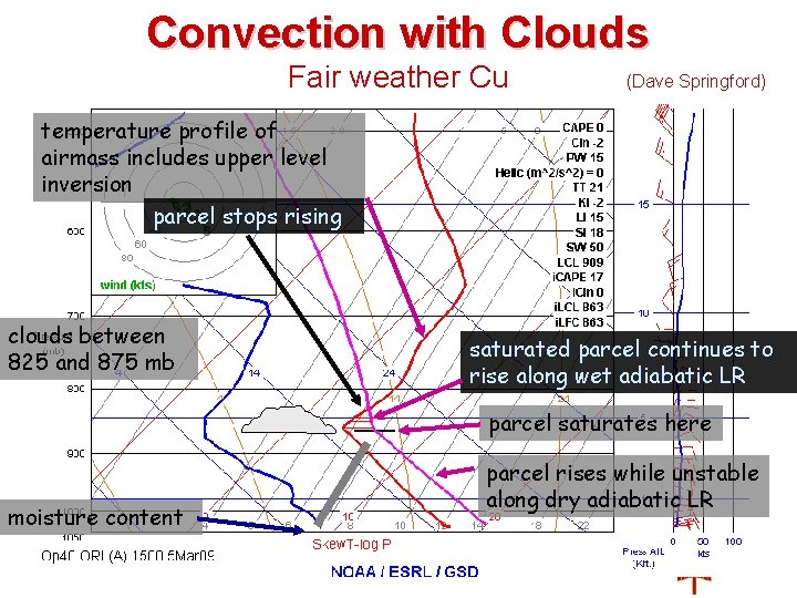
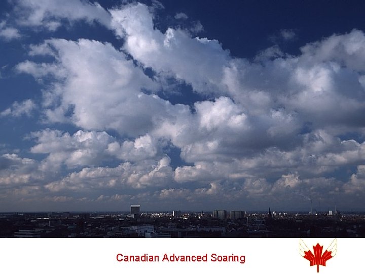
Convection with Clouds Fair weather Cu (Dave Springford) temperature profile of airmass includes upper level inversion parcel stops rising clouds between 825 and 875 mb saturated parcel continues to rise along wet adiabatic LR parcel saturates here moisture content parcel rises while unstable along dry adiabatic LR Canadian Advanced Soaring
Canadian Advanced Soaring
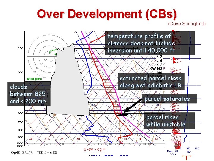
Over Development (CBs) (Dave Springford) temperature profile of airmass does not include inversion until 40, 000 ft clouds between 825 and < 200 mb saturated parcel rises along wet adiabatic LR parcel saturates parcel rises while unstable Canadian Advanced Soaring
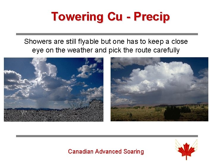
Towering Cu - Precip Showers are still flyable but one has to keep a close eye on the weather and pick the route carefully Canadian Advanced Soaring
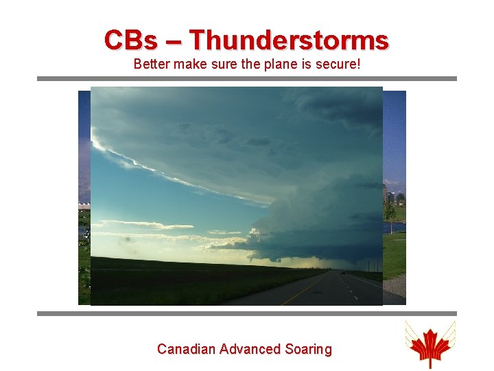
CBs – Thunderstorms Better make sure the plane is secure! Canadian Advanced Soaring
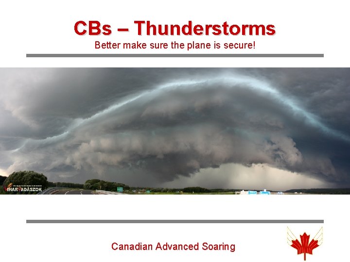
CBs – Thunderstorms Better make sure the plane is secure! Canadian Advanced Soaring
(Dave Springford) Canadian Advanced Soaring
Canadian Advanced Soaring

Questions? ? Canadian Advanced Soaring
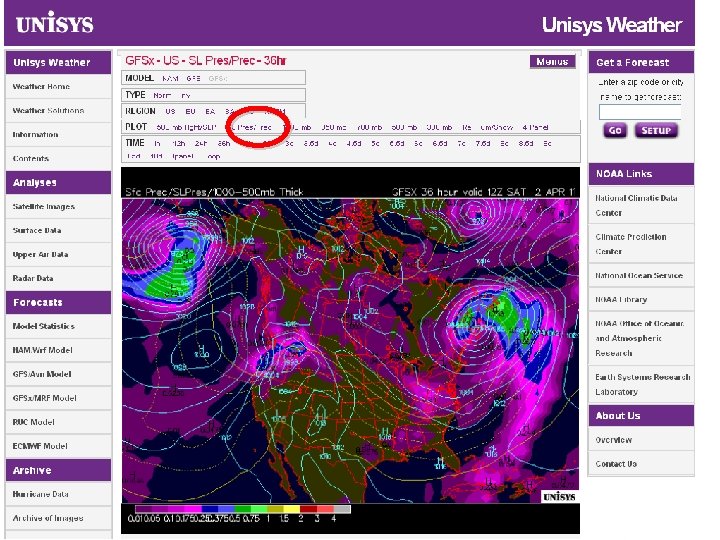
Looking a Week ahead Any good Days coming up? • Long-term forecast (5 – 7 days) – Public forecast: www. weatheroffice. gc. ca/ – www. theweathernetwork. com/fourteenday/caon 0356? ref=qlink_st_14 day – Unisys 10 day forecast: http: //weather. unisys. com/ • Forecast maps for days 2 -3 Unisys Map – Intellicast www. intellicast. com/National/Surface/Forecast 36. aspx • Dr. Jack/XC Skies for days 1 -2 -3 NAM & RUC – http: //www. drjack. info/BLIP/index. html Jump to Day Canadian Advanced Soaring Dr Jack
Canadian Advanced Soaring
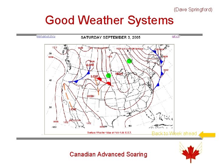
(Dave Springford) Good Weather Systems Back to Week ahead Canadian Advanced Soaring
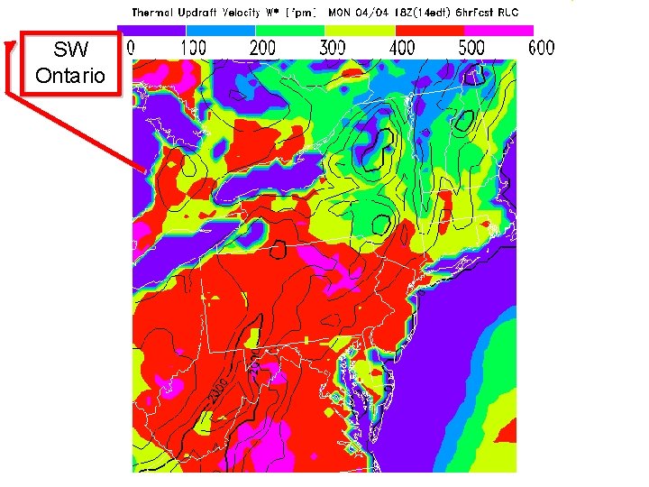
SW Ontario Canadian Advanced Soaring
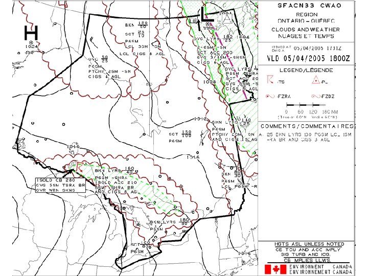
On the Day of the Flight • Look out the window – You should see clear blue sky or small low cu (after a recent cold front) – The air should feel fresh and cool • Public forecast – WX, max temperature, dew point, any change later? – Cloud base in ft AGL = 400*(Tmax – Tdewp) (if thermals go that high) • Tephi for Kitchener/London (16 z, 18 z, 21 z) – Airmass, height of inversion, cu? , winds aloft • Satellite Picture – clear? • Nav Canada – Prog Charts (18 z) – change in airmass expected? • Dr. Jack or XC-Skies – thermal strength, height, cu, boyancy/shear (18 z, 21 z) Canadian Advanced Soaring
Canadian Advanced Soaring
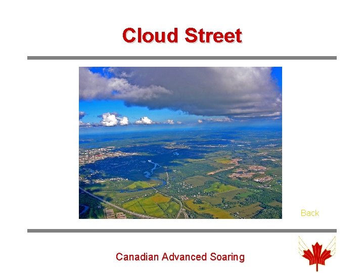
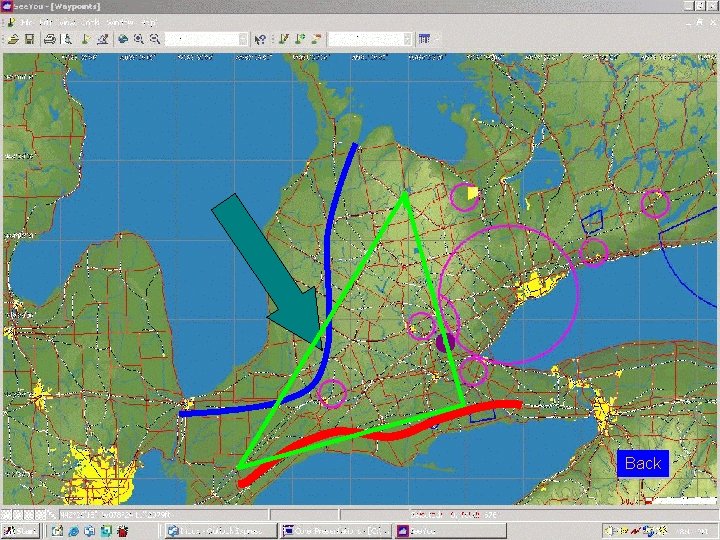
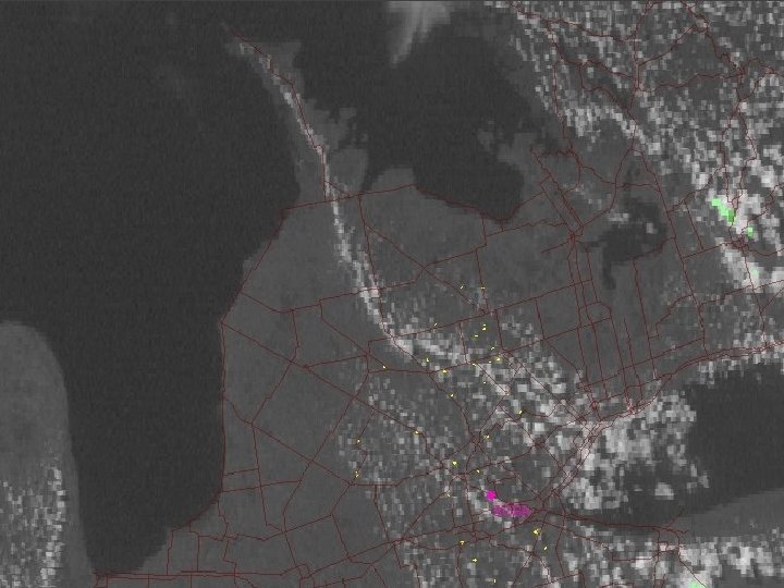
Special Situations • Cloud streets Cloud Street – On windy days – form upwind/downwind • Lake effect – Wind off the lakes • L. Ontario (E-wind), Erie (S-wind), Huron NW • Sea breeze Lake Effect – General wind direction 5 – 10 kts off-shore • Convergence Canadian Advanced Soaring Convergence
Cloud Street Back Canadian Advanced Soaring
Back Canadian Advanced Soaring
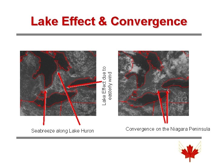
Lake Effect due to easterly wind Lake Effect & Convergence Seabreeze along Lake Huron Convergence on the Niagara Peninsula
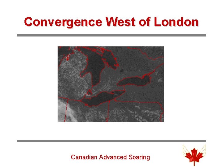
Convergence West of London Canadian Advanced Soaring
Canadian Advanced Soaring
Internet Sources (Dave Springford) • The first thing you need is a public forecast from Environment Canada to give a general weather picture – Sun or rain? – Max temp for the day? – Wind direction? For what Period? Dewpoint? • Next an overall picture of the frontal systems in NA is helpful – I use either Intellicast or Unisys • A satellite picture can also help – the GOES Satellite picture is good: http: //weather. unisys. com/satellite/ – Weatherundergound: (check the IR too) http: //www. wunderground. com/satellite/vis/1 k/US. html • A clouds and weather forecast from Nav. Canada is also helpful
- Slides: 40