Met Office GPCI simulations Adrian Lock UK Met


- Slides: 17

Met Office GPCI simulations Adrian Lock

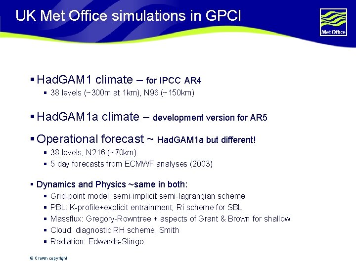
UK Met Office simulations in GPCI § Had. GAM 1 climate – for IPCC AR 4 § 38 levels (~300 m at 1 km), N 96 (~150 km) § Had. GAM 1 a climate – development version for AR 5 § Operational forecast ~ Had. GAM 1 a but different! § 38 levels, N 216 (~70 km) § 5 day forecasts from ECMWF analyses (2003) § Dynamics and Physics ~same in both: § § § Grid-point model: semi-implicit semi-lagrangian scheme PBL: K-profile+explicit entrainment; Ri scheme for SBL Massflux: Gregory-Rowntree + aspects of Grant & Brown for shallow Cloud: diagnostic RH scheme, Smith Radiation: Edwards-Slingo © Crown copyright

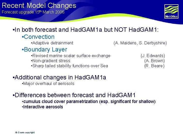
Recent Model Changes Forecast upgrade 15 th March 2006 • In both forecast and Had. GAM 1 a but NOT Had. GAM 1: • Convection • Adaptive detrainment (A. Maidens, S. Derbyshire) • Boundary Layer • Revised marine scalar surface exchange • Non-gradient stress • Sharp tailed stability functions over Sea (J. Edwards) (A. Brown) (R. Beare) • Additional changes in Had. GAM 1 a • Major overhaul of aerosols • Differences between forecast and Had. GAM 1 • cumulus cloud cover parametrization (esp. significant for shallow) • Interactive aerosols © Crown copyright

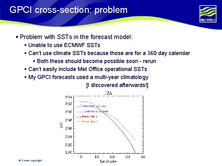
GPCI cross-section: problem § Problem with SSTs in the forecast model: § Unable to use ECMWF SSTs § Can’t use climate SSTs because those are for a 360 day calendar § Both these should become possible soon - rerun § Can’t easily include Met Office operational SSTs § My GPCI forecasts used a multi-year climatology [I discovered afterwards!] © Crown copyright

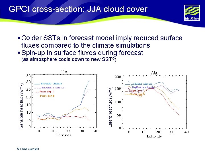
GPCI cross-section: JJA cloud cover § Colder SSTs in forecast model imply reduced surface fluxes compared to the climate simulations § Spin-up in surface fluxes during forecast © Crown copyright Latent heat flux (W/m 2) Sensible heat flux (W/m 2) (as atmosphere cools down to new SST? )

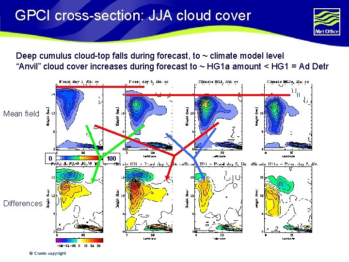
GPCI cross-section: JJA cloud cover Deep cumulus cloud-top falls during forecast, to ~ climate model level “Anvil” cloud cover increases during forecast to ~ HG 1 a amount < HG 1 = Ad Detr Mean field 0 Differences © Crown copyright 100

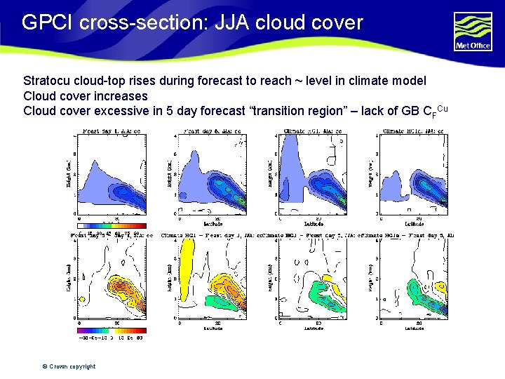
GPCI cross-section: JJA cloud cover Stratocu cloud-top rises during forecast to reach ~ level in climate model Cloud cover increases Cloud cover excessive in 5 day forecast “transition region” – lack of GB CFCu © Crown copyright

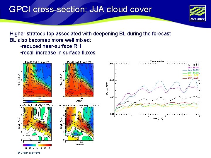
GPCI cross-section: JJA cloud cover Higher stratocu top associated with deepening BL during the forecast BL also becomes more well mixed: • reduced near-surface RH • recall increase in surface fluxes © Crown copyright

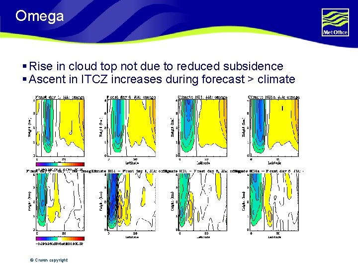
Omega § Rise in cloud top not due to reduced subsidence § Ascent in ITCZ increases during forecast > climate © Crown copyright

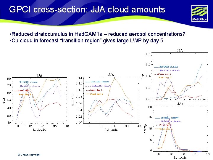
GPCI cross-section: JJA cloud amounts • Reduced stratocumulus in Had. GAM 1 a – reduced aerosol concentrations? • Cu cloud in forecast “transition region” gives large LWP by day 5 © Crown copyright

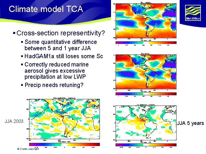
Climate model TCA § Cross-section representivity? § Some quantitative difference between 5 and 1 year JJA § Had. GAM 1 a still loses some Sc § Correctly reduced marine aerosol gives excessive precipitation at low LWP § Precip needs retuning? JJA 2003 © Crown copyright JJA 5 years

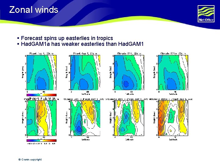
Zonal winds § Forecast spins up easterlies in tropics § Had. GAM 1 a has weaker easterlies than Had. GAM 1 © Crown copyright

Summary § Deep convection doesn’t penetrate high enough (as high as ECMWF analysis) § Stratocumulus thickens up and rises from EC analysis § Aerosol change between climate model versions highlights importance of drizzle § Persistent problems with Met Office models in Sc-Cu transition regions § GB shallow cu cloud fraction parametrization helps § Still tends to be too cloudy § Further work on interaction between cumulus and inversion © Crown copyright

Thanks! Questions?

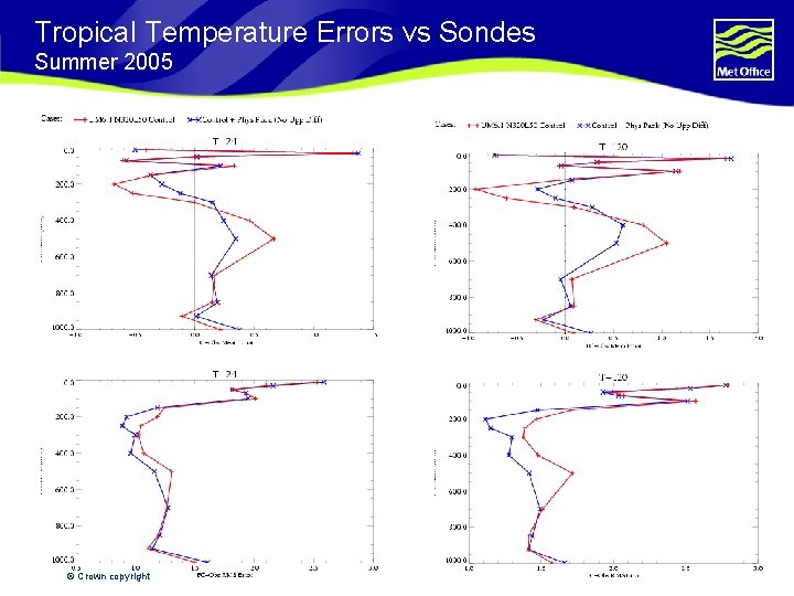
Tropical Temperature Errors vs Sondes Summer 2005 © Crown copyright

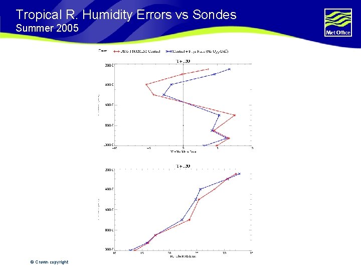
Tropical R. Humidity Errors vs Sondes Summer 2005 © Crown copyright

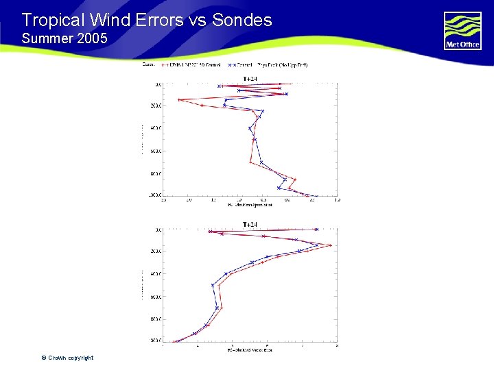
Tropical Wind Errors vs Sondes Summer 2005 © Crown copyright