Mesoscale Numerical Weather Prediction With the WRF Model
- Slides: 30

Mesoscale Numerical Weather Prediction With the WRF Model Ying-Hwa Kuo, Joseph Klemp, and John Michalakes Mesoscale and Microscale Meteorology Division National Center for Atmospheric Research Boulder, Colorado, U. S. A.

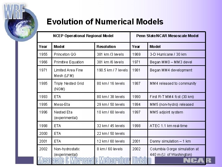
Evolution of Numerical Models NCEP Operational Regional Model Penn State/NCAR Mesoscale Model Year Model Resolution Year Model 1955 Princeton QG 381 km /3 levels 1969 3 -D Hurricane / 30 km 1966 Primitive Equation 381 km /6 levels 1971 Began MM 0 – MM 3 devel 1971 Limited Area Fine Mesh (LFM) 190. 5 km / 7 levels 1981 Began MM 4 development 1985 Triply Nested Grid (NGM) 80 km / 16 levels 1987 MM 4 released to community 1993 ETA 80 km / 38 levels 1990 First R-T MM 4 fcst (30 km) 1995 Meso-Eta 29 km / 50 levels 1994 MM 5 (non-hydro) released 1996 Nested Eta (experimental) 10 km / 60 levels 1997 MM 5 adjoint system 1998 ETA 32 km / 45 levels 1998 ATEC 1. 1 km real-time 2000 ETA 22 km / 50 levels 2001 ETA 12 km / 60 levels 2001 Danny simulation – 1 km 2002 Non-hydrostatic (experimental) 8 km / 60 levels 2002 Columbia Gorge simulation at 440 m (U. of Washington)

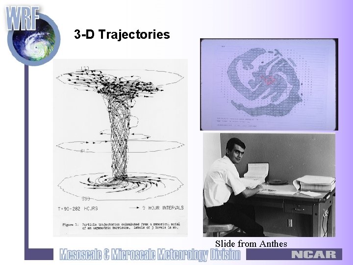
3 -D Trajectories Anthes’ hurricane simulation 30 x 3 mesh at 30 km. First 3 -D simulation with asymmetric hurricane structure. Slide from Anthes

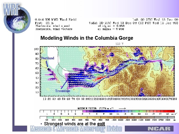
Modeling Winds in the Columbia Gorge Portland Cascade Locks Troutdale • Strongest winds are at the exit

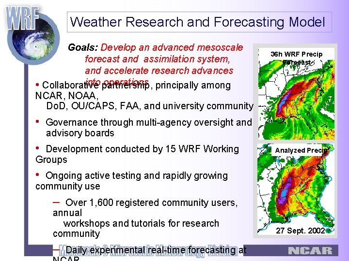
Weather Research and Forecasting Model Goals: Develop an advanced mesoscale forecast and assimilation system, and accelerate research advances into partnership, operations principally among • Collaborative NCAR, NOAA, Do. D, OU/CAPS, FAA, and university community • 36 h WRF Precip Forecast Governance through multi-agency oversight and advisory boards • Development conducted by 15 WRF Working Groups Analyzed Precip • Ongoing active testing and rapidly growing community use – Over 1, 600 registered community users, annual workshops and tutorials for research community – Daily experimental real-time forecasting at 27 Sept. 2002

WRF Model Characteristics • Highly modular, single source code with plug-compatible modules • State-of-the-art, transportable, and efficient in a massively parallel computing environment. • Design priority for high-resolution (nonhydrostatic) applications • Advanced data assimilation systems developed in tandem with the model itself. • Numerous physics options, tapping into the experience of the full modeling community. • Maintained and supported as a community mesoscale model to facilitate broad use in the research community. • Research advances will have a direct path to operations.

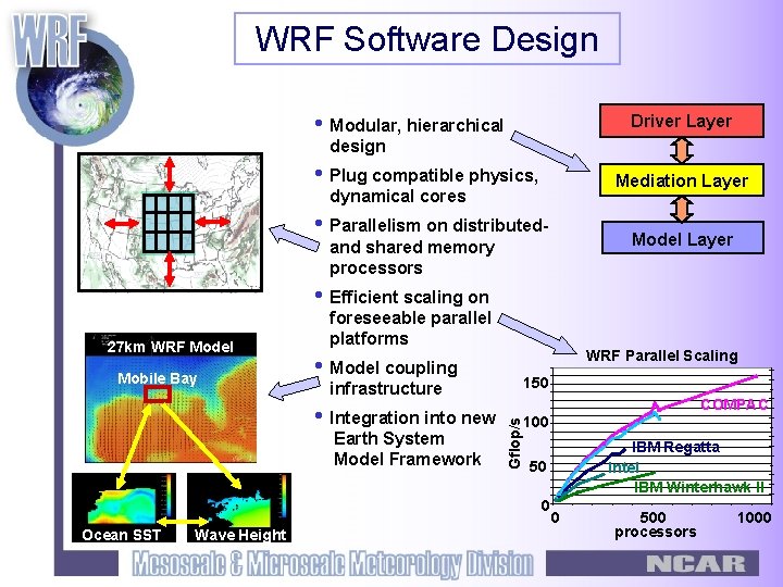
WRF Software Design • Modular, hierarchical Driver Layer design • Plug compatible physics, Mediation Layer dynamical cores • Parallelism on distributed- Model Layer and shared memory processors • Efficient scaling on Mobile Bay WRF Parallel Scaling • Model coupling 150 infrastructure • Integration into new Earth System Model Framework COMPAC Gflop/s 27 km WRF Model foreseeable parallel platforms 100 50 0 Ocean SST Wave Height IBM Regatta Intel IBM Winterhawk II 0 500 processors 1000

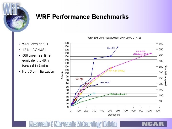
WRF Performance Benchmarks • WRF Version 1. 3 • 12 -km CONUS • 500 times real time equivalent to 48 h forecast in 6 mins. • No I/O or initialization

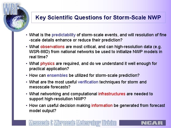
Key Scientific Questions for Storm-Scale NWP • What is the predictability of storm-scale events, and will resolution of fine -scale details enhance or reduce their prediction? • What observations are most critical, and can high-resolution data (e. g. WSR-88 D) from national networks be used to initialize NWP models in real time? • What physics are required, and do we understand it well enough for practical application? • How can ensembles be utilized for storm-scale prediction? • What are the most useful verification techniques for storm and mesoscale forecasts? • What networking and computational infrastructures are needed to support high-resolution NWP? • How can useful decision making information be generated from forecast model output?

Convection-Resolving NWP using WRF Motivating Questions § Is there any increased skill in convection-resolving forecasts, measured objectively or subjectively? § Is there increased value in these forecasts? § If the forecasts are more valuable, are they worth the cost?

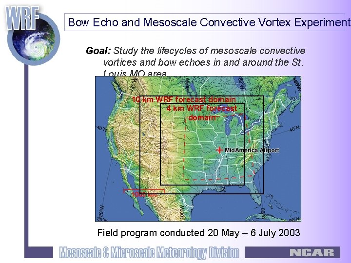
Bow Echo and Mesoscale Convective Vortex Experiment Goal: Study the lifecycles of mesoscale convective vortices and bow echoes in and around the St. Louis MO area 10 km WRF forecast domain 4 km WRF forecast domain Field program conducted 20 May – 6 July 2003

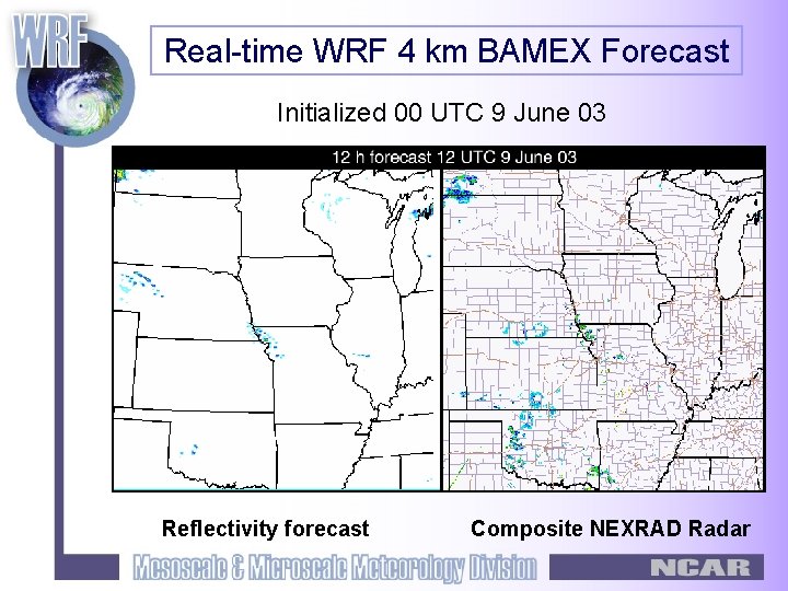
Real-time WRF 4 km BAMEX Forecast Initialized 00 UTC 9 June 03 Reflectivity forecast Composite NEXRAD Radar

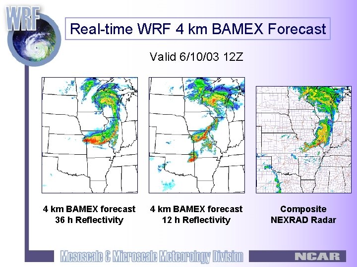
Real-time WRF 4 km BAMEX Forecast Valid 6/10/03 12 Z 4 km BAMEX forecast 36 h Reflectivity 4 km BAMEX forecast 12 h Reflectivity Composite NEXRAD Radar

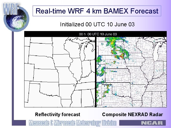
Real-time WRF 4 km BAMEX Forecast Initialized 00 UTC 10 June 03 Reflectivity forecast Composite NEXRAD Radar

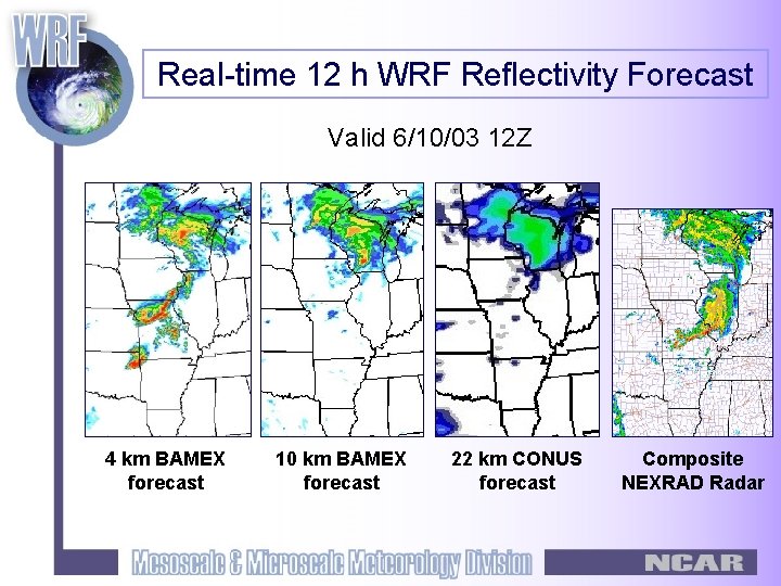
Real-time 12 h WRF Reflectivity Forecast Valid 6/10/03 12 Z 4 km BAMEX forecast 10 km BAMEX forecast 22 km CONUS forecast Composite NEXRAD Radar

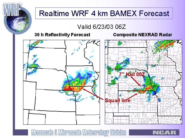
Realtime WRF 4 km BAMEX Forecast Valid 6/23/03 06 Z 30 h Reflectivity Forecast Composite NEXRAD Radar 7” hail 00 Z Squall line

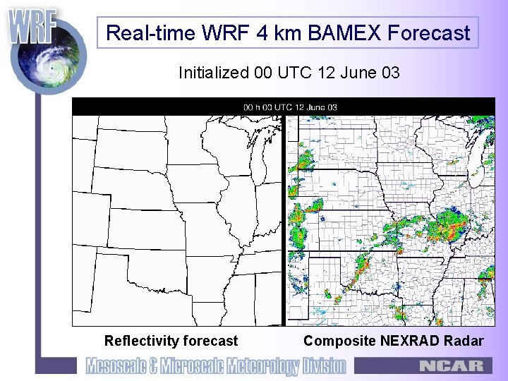
Real-time WRF 4 km BAMEX Forecast Initialized 00 UTC 12 June 03 Reflectivity forecast Composite NEXRAD Radar

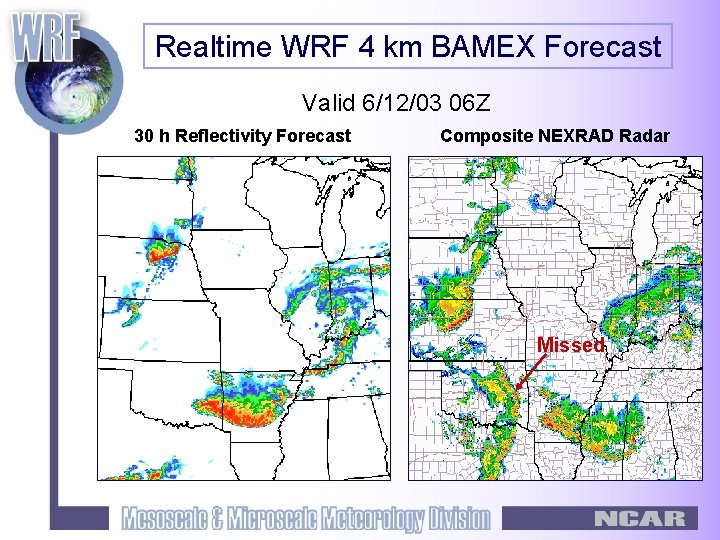
Realtime WRF 4 km BAMEX Forecast Valid 6/12/03 06 Z 30 h Reflectivity Forecast Composite NEXRAD Radar Missed

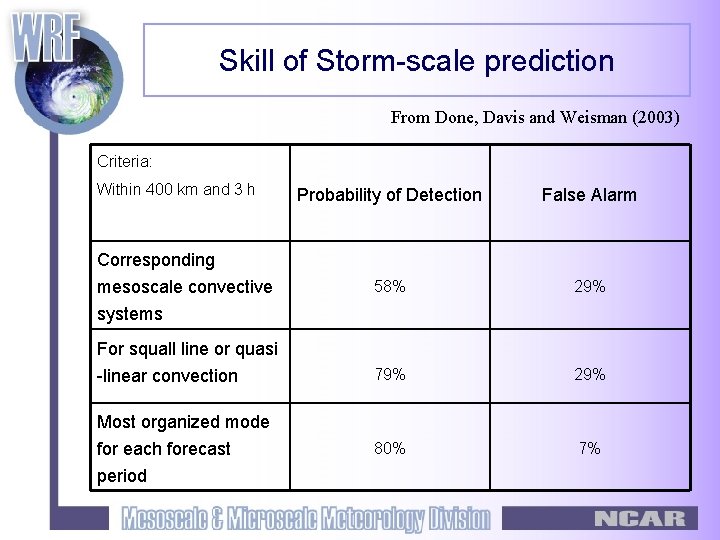
Skill of Storm-scale prediction From Done, Davis and Weisman (2003) Criteria: Within 400 km and 3 h Probability of Detection False Alarm 58% 29% 79% 29% 80% 7% Corresponding mesoscale convective systems For squall line or quasi -linear convection Most organized mode for each forecast period

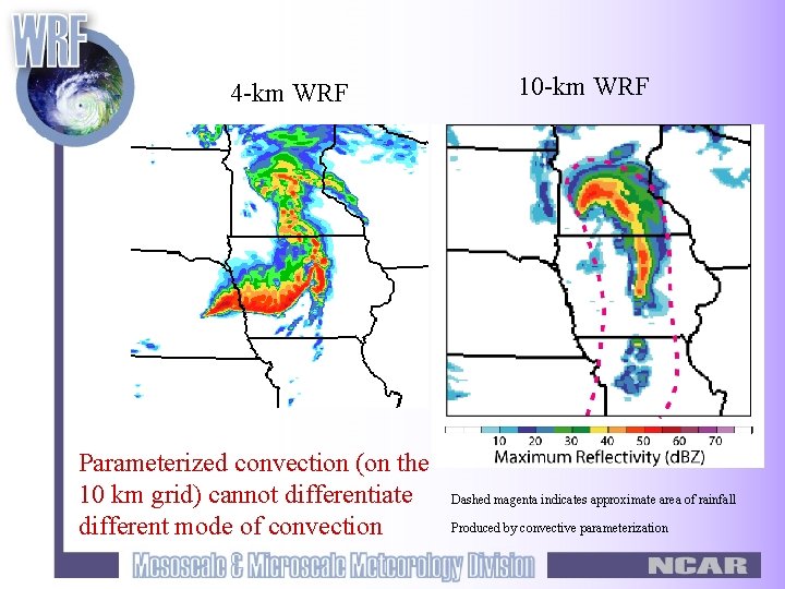
4 -km WRF Parameterized convection (on the 10 km grid) cannot differentiate different mode of convection 10 -km WRF Dashed magenta indicates approximate area of rainfall Produced by convective parameterization

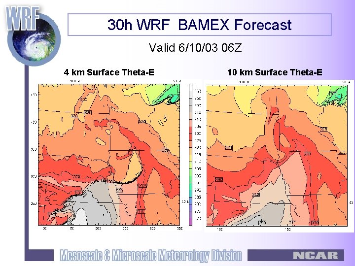
30 h WRF BAMEX Forecast Valid 6/10/03 06 Z 4 km Surface Theta-E 10 km Surface Theta-E

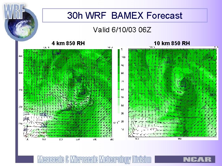
30 h WRF BAMEX Forecast Valid 6/10/03 06 Z 4 km 850 RH 10 km 850 RH

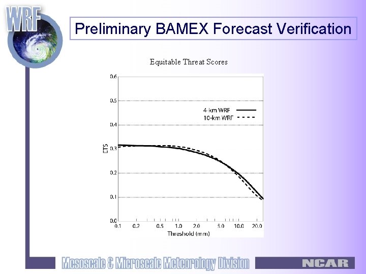
Preliminary BAMEX Forecast Verification Equitable Threat Scores

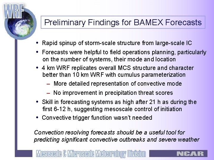
Preliminary Findings for BAMEX Forecasts • Rapid spinup of storm-scale structure from large-scale IC • Forecasts were helpful to field operations planning, particularly • on the number of systems, their mode and location 4 km WRF replicates overall MCS structure and character better than 10 km WRF with cumulus parameterization – More detailed representation of convective mode – No improvement in precipitation threat scores • Skill in forecasting systems as high after 21 h as during the • first 6 -12 h, suggesting mesoscale control of initiation Convective trigger function wasn’t needed Convection resolving forecasts should be a useful tool for predicting significant convective outbreaks and severe weather

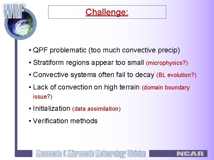
Challenge: • QPF problematic (too much convective precip) • Stratiform regions appear too small (microphysics? ) • Convective systems often fail to decay (BL evolution? ) • Lack of convection on high terrain (domain boundary issue? ) • Initialization (data assimilation) • Verification methods

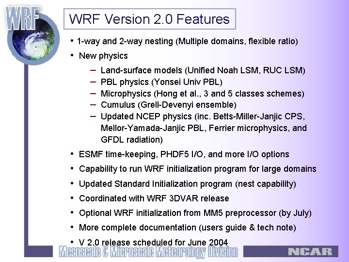
WRF Version 2. 0 Features • 1 -way and 2 -way nesting (Multiple domains, flexible ratio) • New physics – Land-surface models (Unified Noah LSM, RUC LSM) – PBL physics (Yonsei Univ PBL) – Microphysics (Hong et al. , 3 and 5 classes schemes) – Cumulus (Grell-Devenyi ensemble) – Updated NCEP physics (inc. Betts-Miller-Janjic CPS, Mellor-Yamada-Janjic PBL, Ferrier microphysics, and GFDL radiation) • • ESMF time-keeping, PHDF 5 I/O, and more I/O options Capability to run WRF initialization program for large domains Updated Standard Initialization program (nest capability) Coordinated with WRF 3 DVAR release Optional WRF initialization from MM 5 preprocessor (by July) More complete documentation (users guide & tech note) V 2. 0 release scheduled for June 2004

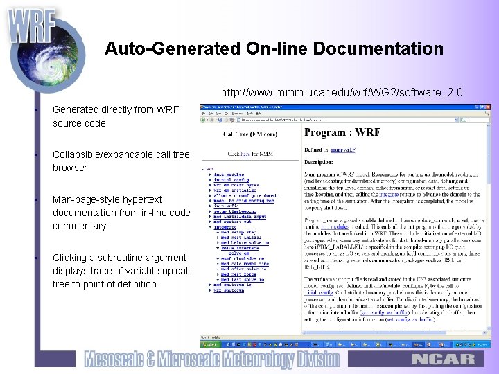
Auto-Generated On-line Documentation http: //www. mmm. ucar. edu/wrf/WG 2/software_2. 0 • Generated directly from WRF source code • Collapsible/expandable call tree browser • Man-page-style hypertext documentation from in-line code commentary • Clicking a subroutine argument displays trace of variable up call tree to point of definition

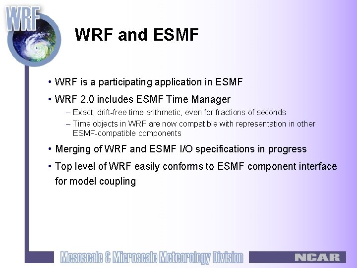
WRF and ESMF • WRF is a participating application in ESMF • WRF 2. 0 includes ESMF Time Manager – Exact, drift-free time arithmetic, even for fractions of seconds – Time objects in WRF are now compatible with representation in other ESMF-compatible components • Merging of WRF and ESMF I/O specifications in progress • Top level of WRF easily conforms to ESMF component interface for model coupling

• For details please refer to http: //www. wrf-model. org/ • Upcoming events – WRF workshop: 22 -25 June 2004 – WRF Tutorial: 28 June – 2 July 2004

Thank you!