Measuring Precipitation from Satellite Ralf Bennartz Cooperative Institute

Measuring Precipitation from Satellite Ralf Bennartz Cooperative Institute for Meteorological Satellite Studies University of Wisconsin – Madison

Outline • What is the impact of precipitation on radiation observed in the: • Solar spectral range… • Infrared spectral range… • Microwave spectral range… • Active versus passive • Build your own rain retrieval • Recap

Solar spectral range

Solar spectral range • Cloud thickness • Cloud top effective radius • Do we actually see the rain from satellite?
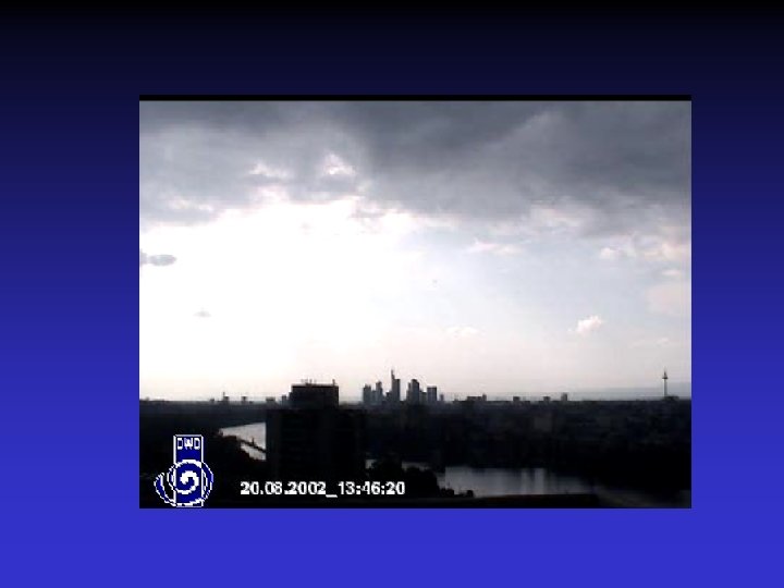

Solar spectral range • Cloud thickness • Cloud top effective radius • Do we actually see the rain from satellite? • Rain is very optically thin compared to clouds. • If it is underneath a cloud we cannot actually see it. • Thickness, particle size are correlated with precipitation

Infrared spectral range

Infrared spectral range

Infrared spectral range • We see the cloud top temperature • This information is correlated with precipitation (i. e. thick, cold clouds rain often). • However, we do not see the rain. (E. g. we cannot discriminate a thick anvil cloud from the core of a thunderstorm. )

NOAA 15 overpass 13 September 2000, 06: 43 UTC RGB AVHRR ch 3, 4, 5 PC product RGB: red: very light green: light/moderate blue: intense Radar composite different projection!

Cloud and water vapor absorption 19. 4 22. 2 37. 0 85. 5 Water Vapor Absorption Liquid Water Absorption

Let’s build our own rain retrieval! • Most directly linked to surface precipitation • Over cold (water) surfaces only • All types of surfaces • More indirect

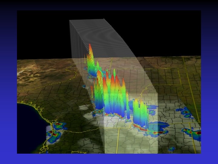
Radar • Active sensor • Sends out energy and measures how much is scattered back • Allows to slice the atmosphere

Weather radar tower

NEXRAD radar sites

Inexpensive vertically looking ground radar

Spaceborne precipitation radar


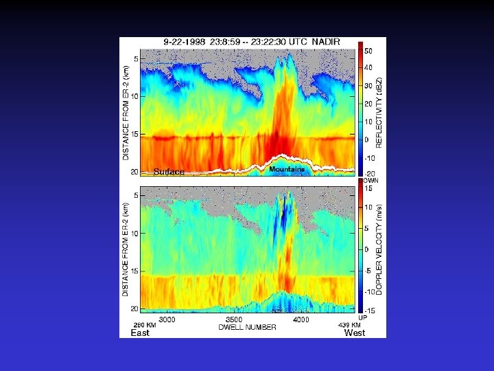
ER-2 EDOP Doppler Radar Frequency / Wavelength: Peak Transmit Power Pulse Repetition Frequency Pulse Widths/Range Resolution Antenna Beam Widths 9. 72 GHz / 3. 07 cm 20 k. W 2. 2 of 4. 4 k. Hz 0. 25, 1. 0 micro-sec / 37. 5, 150 m 2. 9 deg

: Z=200 R 1. 6 Sekhon-Srivastava (1970): Z=2000 R 2.")
Z-R conversion radar Marshall-Palmer (1948): Z=200 R 1. 6 Sekhon-Srivastava (1970): Z=2000 R 2. 0 (Figure from Battan, 1981)

Let’s build our own rain retrieval! • Most directly linked to surface precipitation • Over cold (water) surfaces only • All types of surfaces • More indirect
 surfaces only")
Precipitation • Most directly linked to surface precipitation • Over cold (water) surfaces only • All types of surfaces • More indirect

Rain retrieval

Rain retrieval

Rain retrieval
")
Rain retrieval Freezing Level (ZF)

Rain retrieval

Rain retrieval

Rain retrieval NOTES: • Real retrieval algorithms are a bit more complicated b/c they have to work everywhere • But, the basic principle is pretty much the same

Recap • Infrared sees cloud top. Solar sees cloud thickness, particle size. Both are correlated with rain but no direct signal. • Direct signal of precipitation only observed in the microwave. • Radars allow to derive much more information about precipitation (but much more expensive and have their own problems as well).

Precipitation processes

Precipitation processes Autoconversion

Precipitation processes Autoconversion Accretion

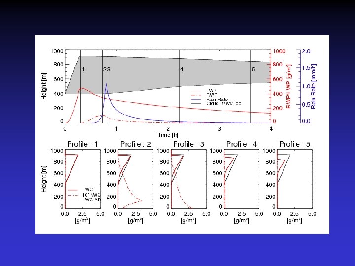
Warm rain

Warm rain From Lowenstein et al. , 2009, QJRMS

Comparison with observations

Nakajima-King retrieval

Adiabatic cloud

Simulated Sc cloud with rain
- Slides: 44