Measuring Earth Unit 2 Earths Spheres Information regarding


 was a Greek mathematician, poet, athlete, geographer, astronomer, music")


 of the land.")


 EARTH ROTATES")


- Slides: 71
Measuring Earth Unit 2
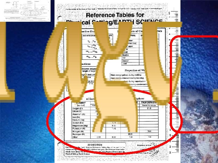
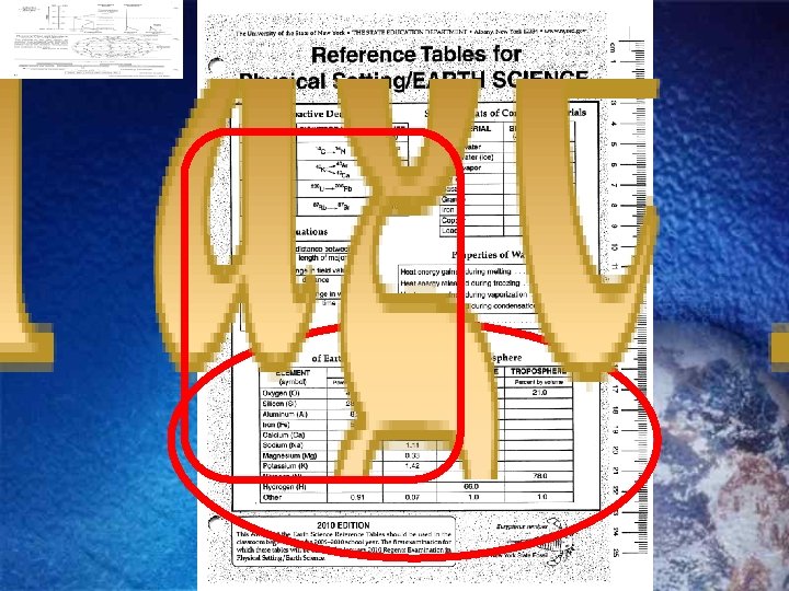
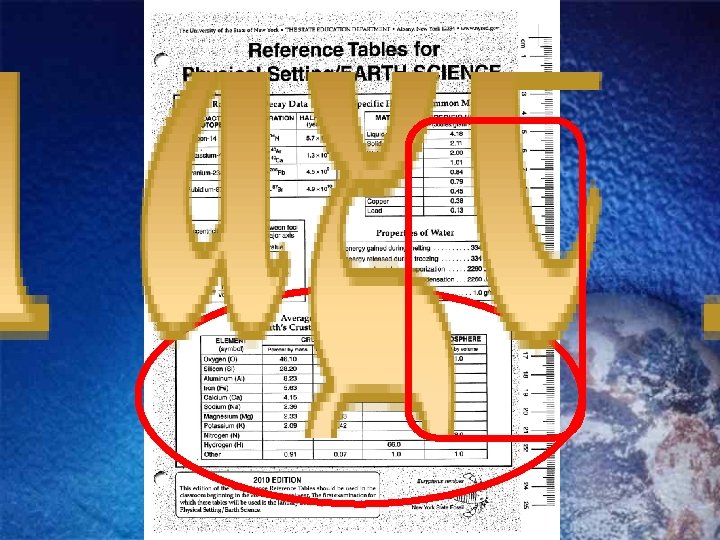
Earth’s Spheres Information regarding Earth’s atmosphere can be found on page 1 and 14 of the ESRTs
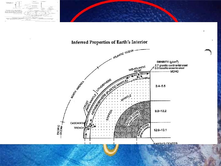
Earth’s Spheres Information regarding Earth’s interior can be found on page 1 & 10 of the ESRTs
Earth’s Spheres Information regarding Earth’s hydrosphere can be found on page of the ESRTs
3. Hydrogen, Oxygen
Shape of the Earth is an oblate spheroid. Earth is slightly flattened at the poles and bulges at the Equator.
Ships sail over the curve of the Earth.
During a lunar eclipse, the Earth’s shadow is curved.
Photos from space.
Although the Earth is oblate, it looks very, very, very ROUND.
Size of the Earth Eratosthenes first determined the size of the spherical Earth, 1500 years before Columbus.
(276 BC – 195 BC) was a Greek mathematician, poet, athlete, geographer, astronomer, music theorist and Mario Cart champion.
Mama Mia! Eratosthenes was the first person to This the is a not a calculate circumference of the good! spherical earth. o 7. 5 360 o ------ = -----800 km C ABOUT 3% ERROR Pretty good, don’t ya think? Over 1600 years before Columbus.
POLAR CIRCUMFERENCE 24, 845 MILES EQUATORIAL CIRCUMFERENCE 24, 887 MILES About 42 miles difference.
Measurements on earth. Satellite data. Gravimeter readings. Gravity readings show that you weigh more at the North Pole than at the Equator, because the poles are closer to the Earth’s center.
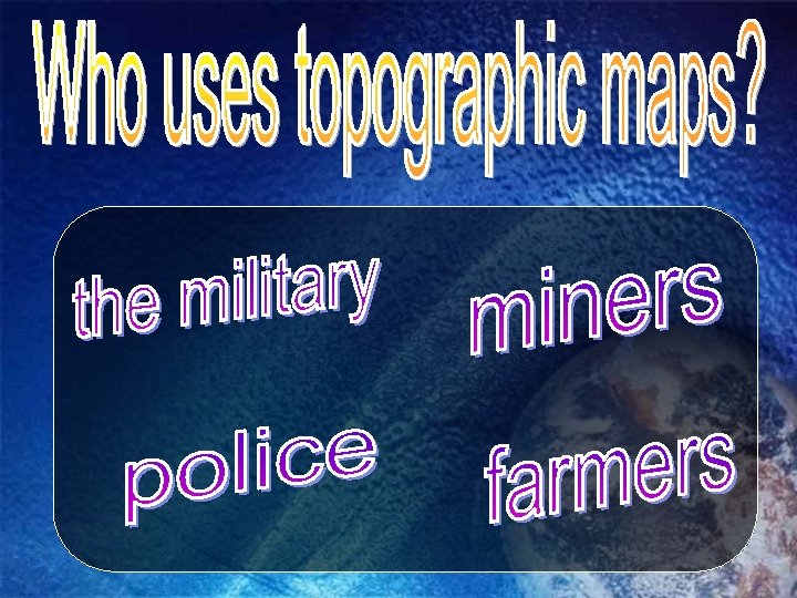
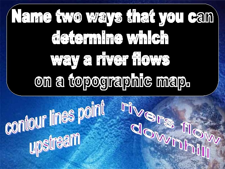
Topographic maps show the elevation (therefore the shape) of the land.
When might someone use a topographic map?
25
What do hachured lines show?
What are the rules concerning hachured lines?
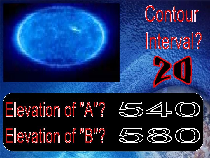
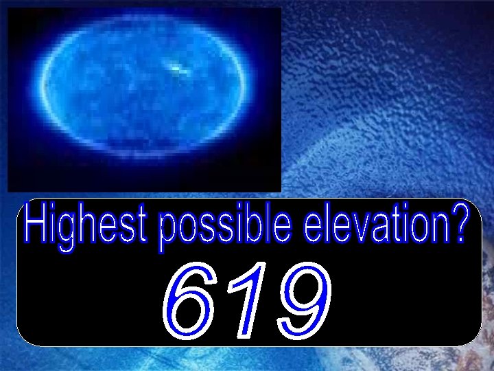
300 m 250 m
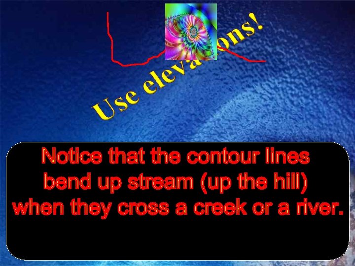
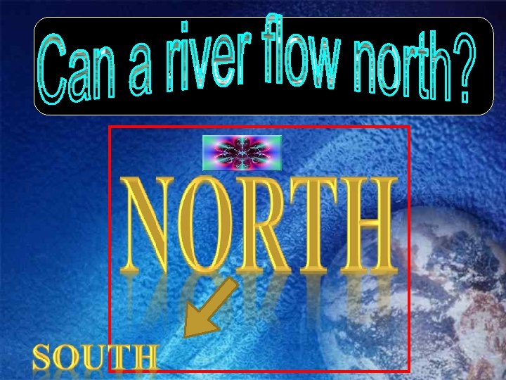
Oatka Creek flows NORTH V We’re here.
What are the steps to draw a topographic profile place a piece of paper between the points mark where every contour line touches the edge of the paper determine the elevation of each mark place the paper on the graph and mark the elevation of each contour line
Using the map and chart below, construct a topographic map profile.
Please match the contour map on the left with the profile on the right.
The elevation of Albany is 282 feet. The elevation at Binghamton is 1634 feet. Calculate the gradient to the nearest tenth of a ft/mi. Show all work. 115 miles gradient = change in elevation distance = 1634 -282 115 miles = 11. 8 ft/mile = 1352 ft 115 miles
The elevation of Watertown is 99 m. The elevation at Oswego is 144 m. Calculate the gradient to the nearest tenth of a m/km. Show all work. gradient = change in elevation distance = 144 - 99 = 45 m 75 km = 0. 6 m/km
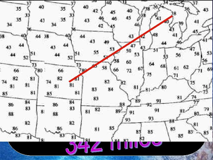
If the distance between the two circled cities is 425 km, calculate the temperature gradient to the nearest hundredth? Show all work. gradient = change in temperature distance = 82 -48 = 34 = 0. 08 °F/km 425
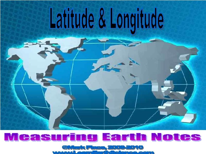
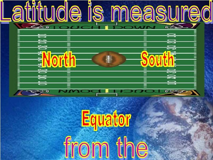
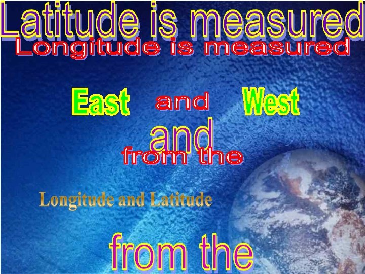
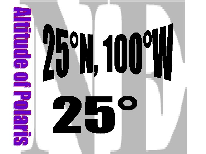
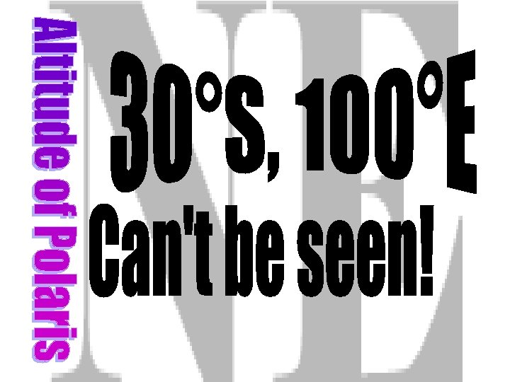
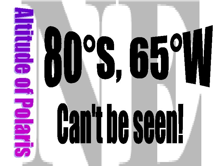
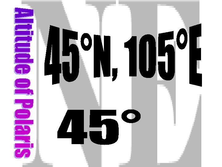
Let’s Look at This Question: How is latitude measured?
180 165 150 135 120 105 90 75 60 45 30 15 30 45 60 75 90 105 120 135 150 165 180 90 80 70 E 60 50 40 30 F 20 10 G 20 30 40 50 60 H 70 80 90
180 165 150 135 120 105 90 75 60 45 30 15 30 45 60 75 90 105 120 135 150 165 180 90 80 70 E 60 50 40 30 F 20 10 G 20 30 40 50 60 H 70 80 90
N W Lines run east and O D west but measure H C north and south; U O like on a football T field.
Let’s Look at This Question: How is longitude measured?
180 165 150 135 120 105 90 75 60 45 30 15 30 45 60 75 90 105 120 135 150 165 180 90 80 70 E 60 50 40 30 F 20 10 G 20 30 40 50 60 H 70 80 90
180 165 150 135 120 105 90 75 60 45 30 15 30 45 60 75 90 105 120 135 150 165 180 90 80 70 E 60 50 40 30 F 20 10 G 20 30 40 50 60 H 70 80 90
Let’s do some plotting.
On the coordinate system, plot the coordinates given in your notes: 180 165 150 135 120 105 90 75 60 45 30 15 30 45 60 75 90 105 120 135 150 165 180 90 80 70 E 60 50 40 30 F 20 10 G 20 30 40 50 60 H 70 80 90
State the coordinates for each of the letters in the figure above: 180 165 150 135 120 105 90 75 60 45 30 15 30 45 60 75 90 105 120 135 150 165 180 90 80 70 E 60 50 40 F 30 20 10 0 G 10 20 30 40 50 H 60 70 80 90
BASED ON THE ______ OF OF ________ Demo
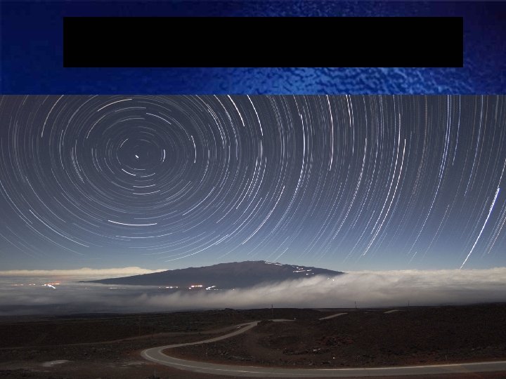
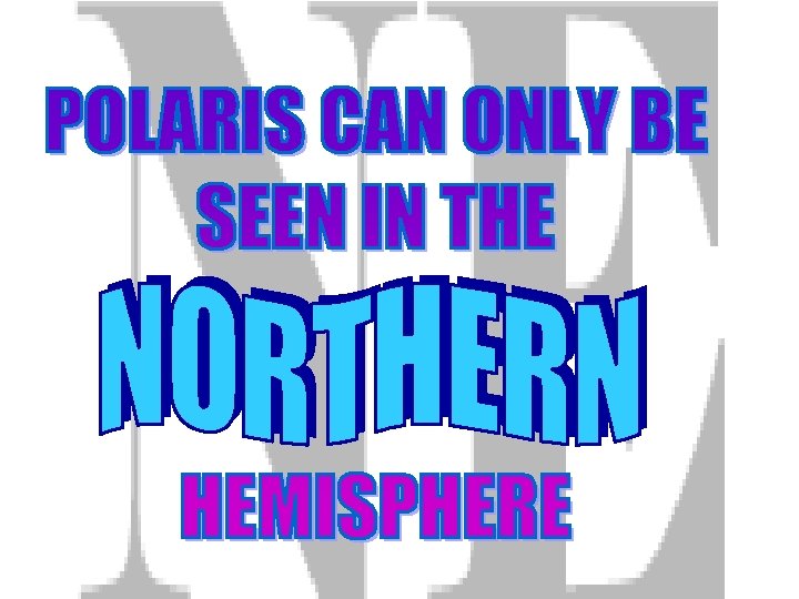
POLA RIS
BASED ON EARTH’S
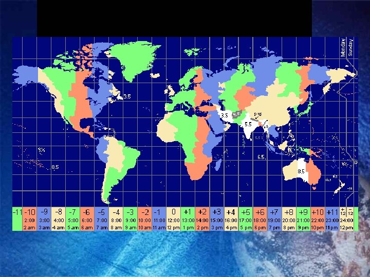
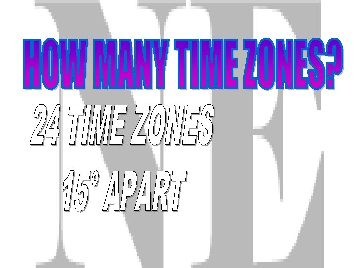
EACH HOUR, (360°/24 hrs) EARTH ROTATES
Example: Two students record a difference in local time of two hours. How many degrees of longitude apart are they?