Marine Navigation Software and Electronic Charts Introduction to


, • Integrated")


 (x 5, y 5)")
 Envisaged")


- Slides: 76
Marine Navigation Software and Electronic Charts • Introduction to navigation support technological systems • Electronic Charts • ECDIS • Open source Applications examples 1
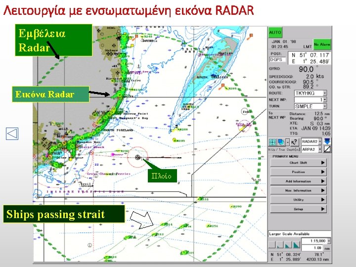
Eikona gefyras
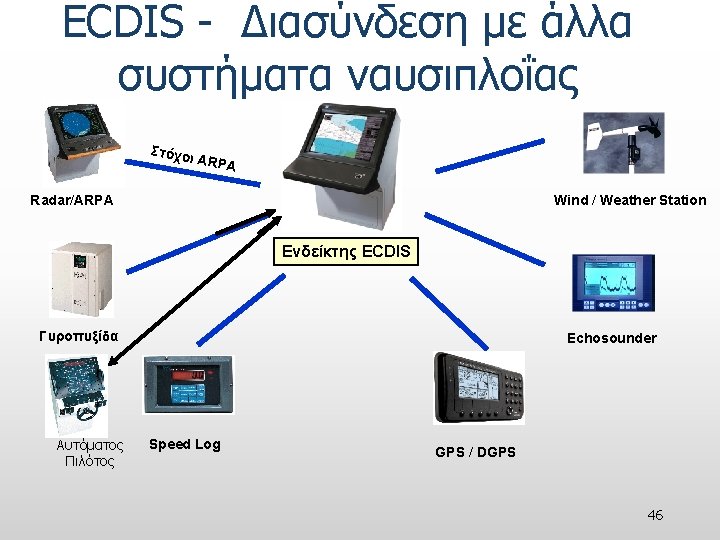
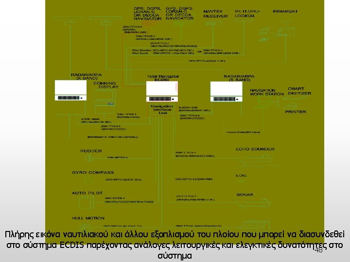
Navigation support technological systems • Electronic Chart Display and Information System (ECDIS), • Integrated Bridge Systems/Integrated Navigation Systems (IBS/INS), • Automatic Radar Plotting Aids (ARPA), • Automatic Identification System (AIS), • Long Range Identification and Tracking (LRIT) systems, • Vessel Traffic Services (VTS), • Vessel Traffic Monitoring & Information Systems (VTMIS) 3
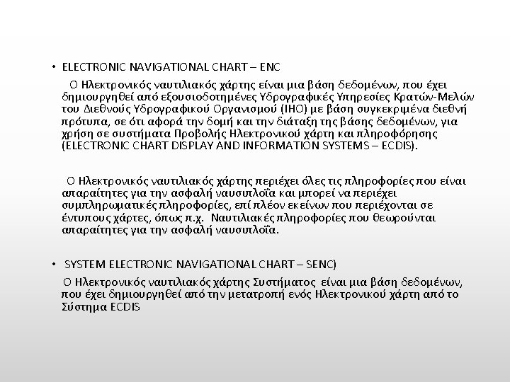
Κράτη-Μέλη IHO INTERNATIONAL HYDROGRAPHIC ORGANIZATION 9
Types of Data Vector Raster Deals with features: - Points, Lines, and Polygons (topographic data) Uses pixels or arrays of cells to represent features on the earth (satellite imagery, air photos, scanned images) 13
Image of Vector/Raster 14
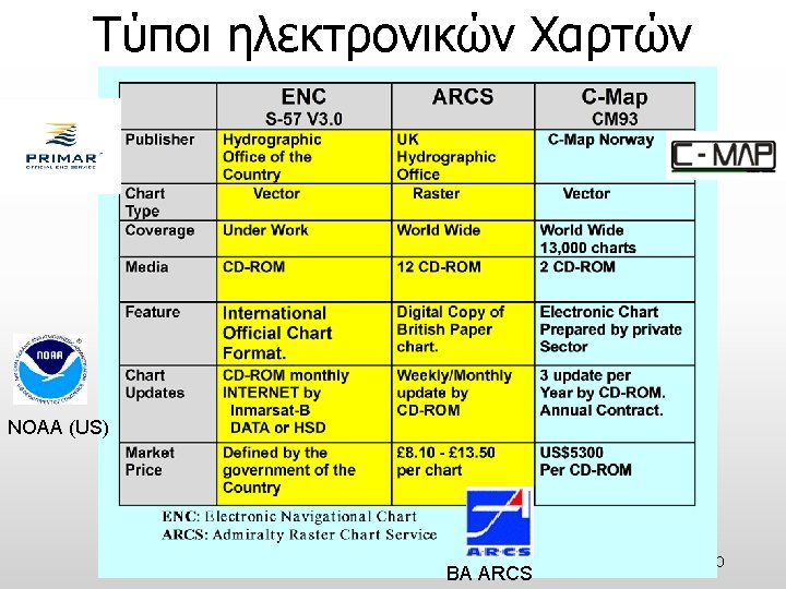
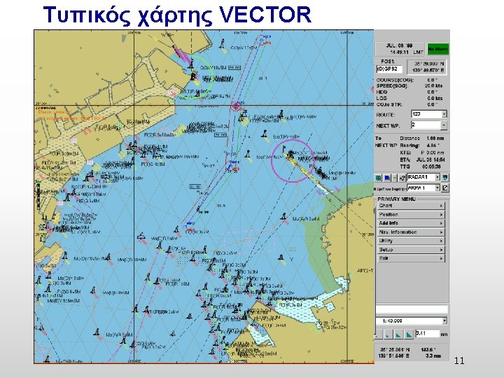
Σύγκριση χαρτών VECTOR και RASTER VECTOR (x 4, y 4) (x 5, y 5) RASTER (x 1, y 1) (x 0, y 0) (x 2, y 2) (x 3, y 3) 15
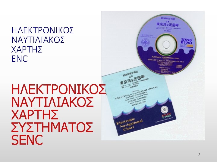
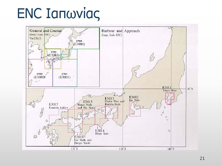
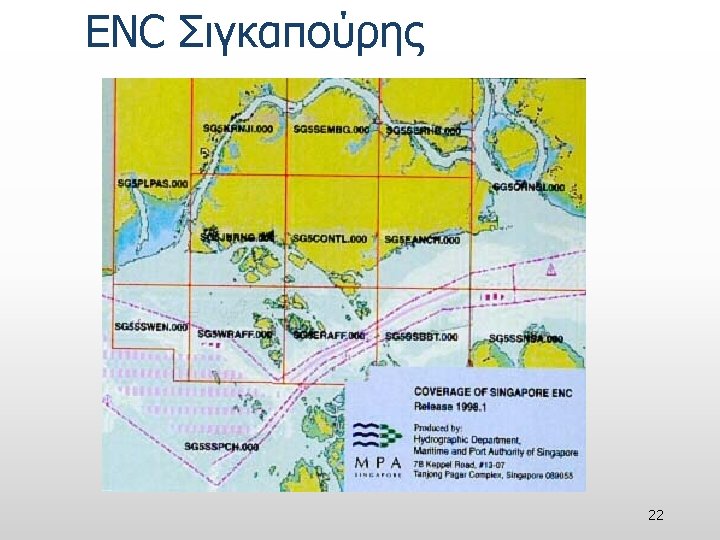
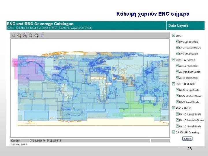
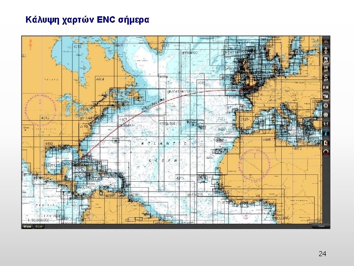
Κάλυψη χαρτών ENC Εικόνα Ιουνίου 1999 Edition 3 Version 2 (or National format) Envisaged 19
ENC Ευρώπης North European Dover Straight Red Sea 20
28
29
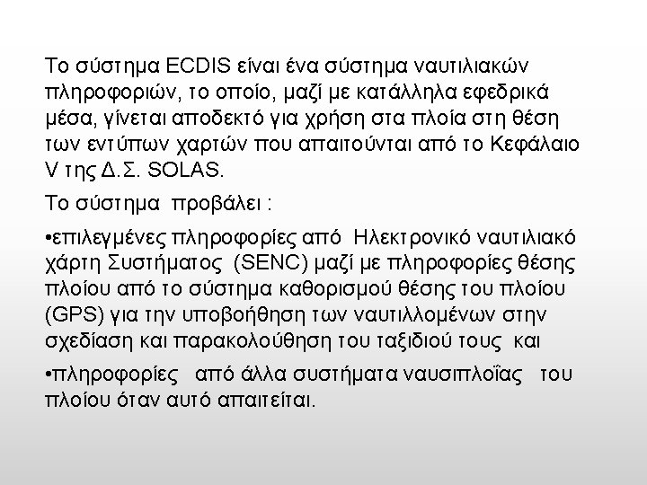
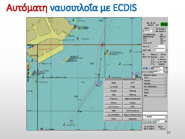
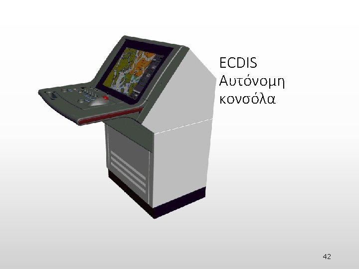
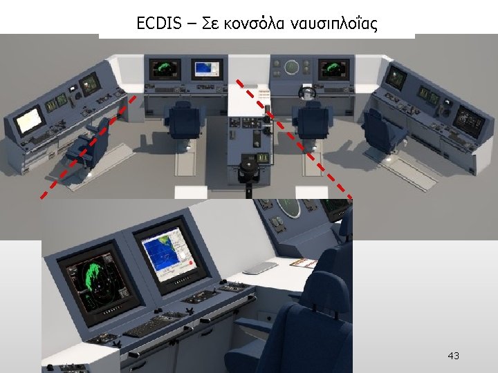
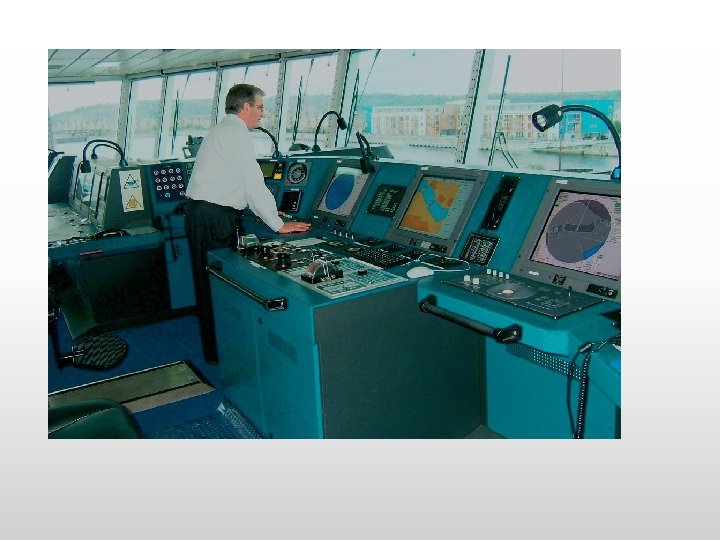
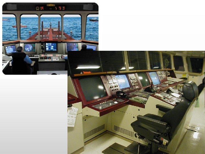
ECDIS Electronic Chart Display and Information System Τι είναι;
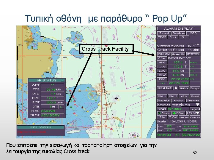
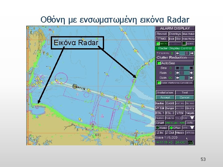
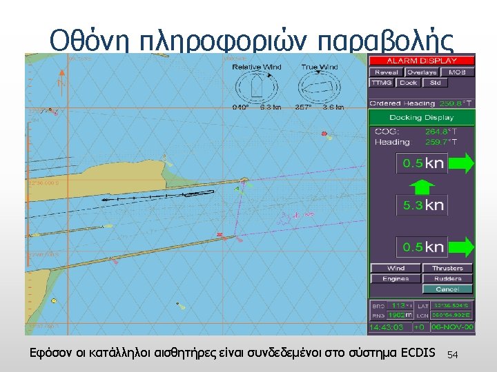
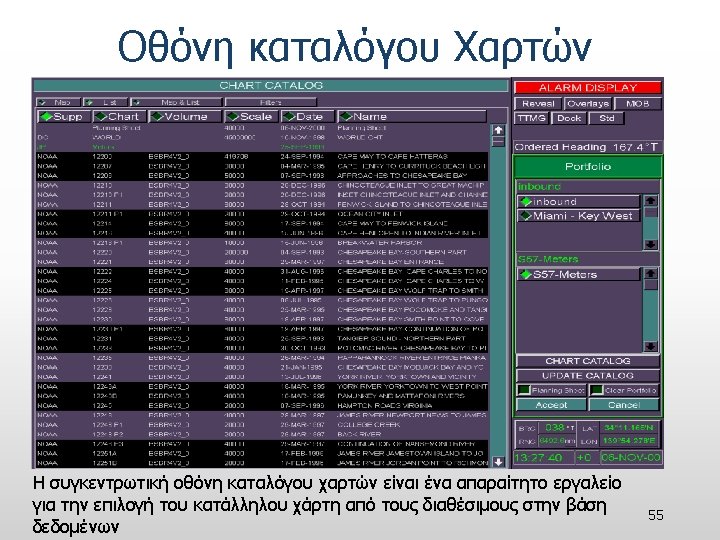
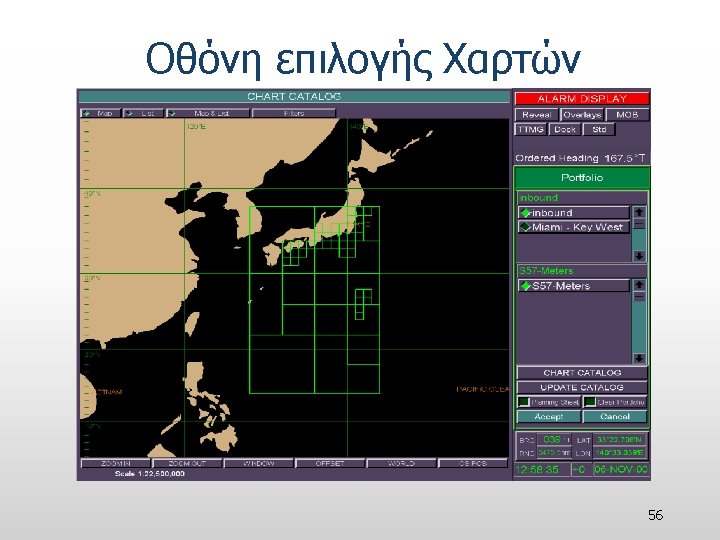
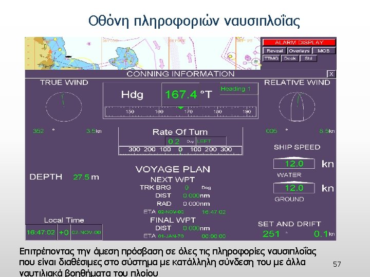
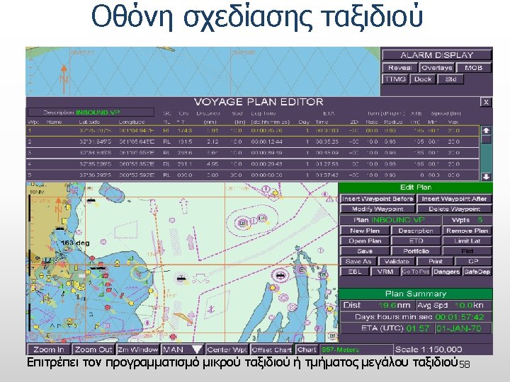
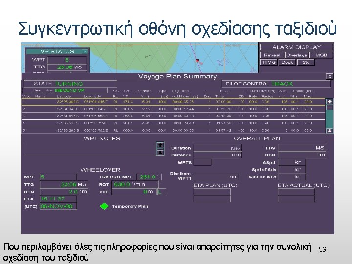
Τυπική οθόνη με χάρτη Vector Ownship Position Ownship Vector Voyage Plan ARPA Targets 51
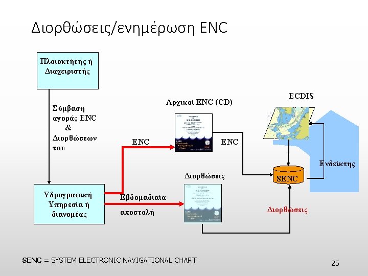
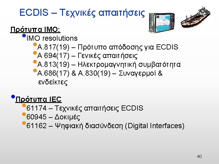
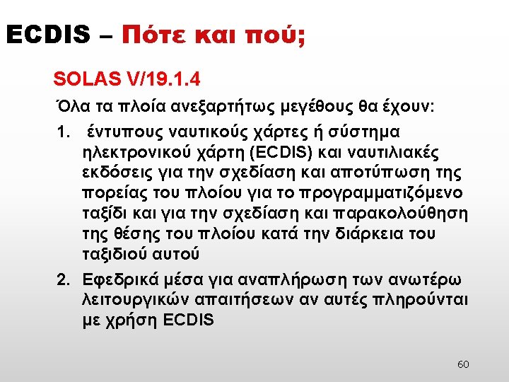
Resolutions and Obligations related to ENCs and ECDIS SOLAS V/2 – Nautical chart or nautical publication is a special-purpose map or book, or a specially compiled database from which such a map or book is derived, that is issued officially by or on the authority of a Government, authorized Hydrographic Office or other relevant government institution and is designed to meet the requirements of marine navigation*. SOLAS V/9 - provision of hydrographic services. . . collection and compilation of hydrographic data and the publication, dissemination and keeping up to date of all nautical information necessary for safe navigation Means: surveying and data collection publication of charts and nautical publications chart maintenance, updating providing Maritime Safety Information (MSI)
Resolutions and Obligations related to ENCs and ECDIS UN Resolution A/58/240 • “Invites the International Hydrographic Organization and the International Maritime Organization to continue their coordinated efforts, to jointly adopt measures with a view to encouraging greater international cooperation and coordination for the transition to electronic nautical charts and to increase coverage of hydrographic information on a global basis, especially in areas of international navigation and ports and where there are vulnerable or protected marine areas. ” IMO Resolution A. 958(23) • “Invites Governments, in addition to their existing obligations under SOLAS Regulation V/9, to promote through their national maritime administrations, the use of ECDIS together with the use and further production of official ENCs. ”
ECDIS Implementation Phases 63
Free Data Distribution • NOAA ENCs are “Free on the web” • Get the ENC data in the most hands, end users and developers
ENC Data • Integrating data from different sources – Inshore depth areas & obstructions – New channel information – Updated Aids to Navigation
High Accuracy Source • Digital Shoreline • NOAA Hydrographic Surveys • USACE Dredge Surveys
Application examples • Open. CPN • Open. Sea. Map • Sea. Clear II 67
Open. CPN http: // opencpn. org • Open. CPN is a free software (GPLv 2) project to create a concise chart plotter and navigation software, for use underway or as a planning tool. • Open. CPN is developed by a team of active sailors using real world conditions for program testing and refinement. 68
Open. CPN Features • BSBv 3 raster and S 57 ENC chart support. • AIS input with full target tracking and collision alerting. • CM 93 vector chart support, with per cell offset corrections. • AIS support for SART, DSC and GPSGate Buddies. • IHO S 52 compliant display of S 57 vector charts. • Anchor watch/alarm functions. • "BSB 4" and "nv-chart" support through plugins. • GRIB file input and display for weather forecasting. • Single-chart and Quilted display modes. • GPX Waypoint, Track and Route input and output file support. • North-up, Course-up and Chart-up display modes. • Tide and Current prediction and display by location. • Moving-map display mode. • Route planning with tidal support. • Route navigation with ship tracking functions. • Builtin great-circle routing. • Waypoint navigation. • Integrated weather routing through qt. Vlm. • Dashboard for configurable on-screen display of ship's NMEA • data. • • NMEA 0183 GPS interface at selectable baud rate. • • Open. GL support for enhanced performance on modern hardware. • • Advance NMEA message handling structure, with built in multiplexer. GPX Layers for annotation of charts. A selection of display themes. A growing number of plugins. Google Earth, World Magnetic Variation, Voyage Data Recorder, AIS -radar, SAR and a Log. Book. Multi-language support. 20+ languages supported. • Autopilot output support. 69
Open. Sea. Map - The free nautical chart 70
Open. Sea. Map Resources • Open. Street. Map database • Ports from the World Port Index, Open. Street. Map and Skipper. Guide. The water depths were rendered from GEBCO data. • Weather data were taken from the NOAA. • Lighthouses were found in the List of Lights and Open. Street. Map. • The links to Wikipedia are from Wikipedia and images from Wikimedia Commons. • The DE gauge data came from Wasser- und Schifffahrtsverwaltung (PEGELONLINE), • The CH ones from Bundesamt für Umwelt, Abteilung Hydrologie. The aerial photographs are from Bing. • AIS data were provided by Aegean University and ship tracking date by INTERMAR and Sat. Pro. • Inland waterway data in DE are provided by Wasser- und Schifffahrtsverwaltung des Bundes (WSV). • The height data (ASTA GDEM) is a product from METI and NASA provided by Open. Map. Surfer of Uni Heidelberg. • Depth data are collected by Crowdsourcing and computed, or are provided by third parties, e. g. from Bundesamt für Seeschifffahrt und Hydrographie (BSH). The data are stored on Linux servers in a Postgres/Post. GIS database and rendered with Mapnik or Osmarender and illustrated with Open. Layers. 71
Application examples: http: //map. openseamap. org/ 72
Sea. Map. Editor: JOSM and Plugin Login Editor Seamark Harbour Window Editing entry 'JOSM' is a powerful tool to edit all elements of the map with high precision. A 'plugin' helps you add nautical information to be rendered on the Open. Sea. Map overlay. Seamark objects are chosen from drop-down menus and specifications can be entered manually. Only choices relavent to objects will be shown. A validity check will be performed before saving. Installation 1. install JOSM The JOSM editor is installed from the Open. Street. Map 2. install Sea. Map. Editor plugin 3. install seamark images Login In order to edit the map, you must register a user account. 73
Open. Sea. Map Legal Notices Restrictions • The content on this site will be monitored with the greatest possible care, however the provider does not vouch for the accuracy and completeness of the content. Usage of the content of the website is at the users own risk. Named contributions do not reflect the views of the author or the provider. Official Charts • Good seamanship requires the use of official charts. Open. Sea. Map is for use with other charts and cannot replace official charts. Use is at your own risk. 74
Application examples: Sea. Clear II 75
Challenges Awareness • Next Generation products and it is necessary to improve the awareness in the maritime community. Training • Complex tools with many new options & capabilities. The mariners needs guidance on how to use them properly, what they provide and what not.
77