Marine and Tropical Services Update Wayne Weeks Marine

- Slides: 28

Marine and Tropical Services Update Wayne Weeks Marine and Coastal Weather Services Branch (OS 21 Office of Climate, Water, and Weather Services wayne. weeks@noaa. gov 301 -713 -1677, x 129 NWS Partners Meeting - August 2014

National Weather Service Mission: “To provide weather and flood warnings, public forecasts and advisories for all the United States, its territories, adjacent waters, and ocean areas, primarily for the protection of life and property. ”

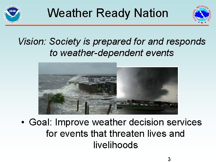
Weather Ready Nation Vision: Society is prepared for and responds to weather-dependent events • Goal: Improve weather decision services for events that threaten lives and livelihoods 3

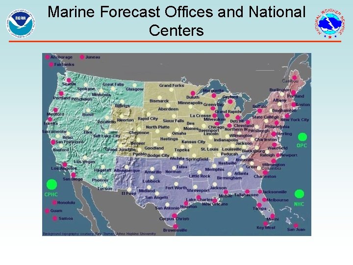
Marine Forecast Offices and National Centers

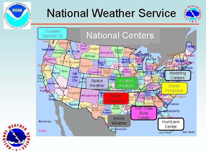
National Weather Service Tsunami Centers (2) National Centers Space Weather Modeling Centers Aviation Weather Ocean Prediction Storm Prediction NASA Weather Nat’l Data Buoy Center Hurricane Center

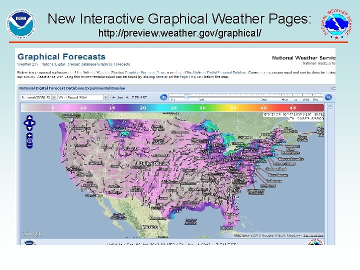
New Interactive Graphical Weather Pages: http: //preview. weather. gov/graphical/

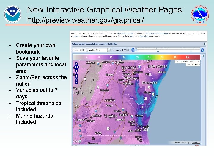
New Interactive Graphical Weather Pages: http: //preview. weather. gov/graphical/ - Create your own bookmark - Save your favorite parameters and local area - Zoom/Pan across the nation - Variables out to 7 days - Tropical thresholds included - Marine hazards included

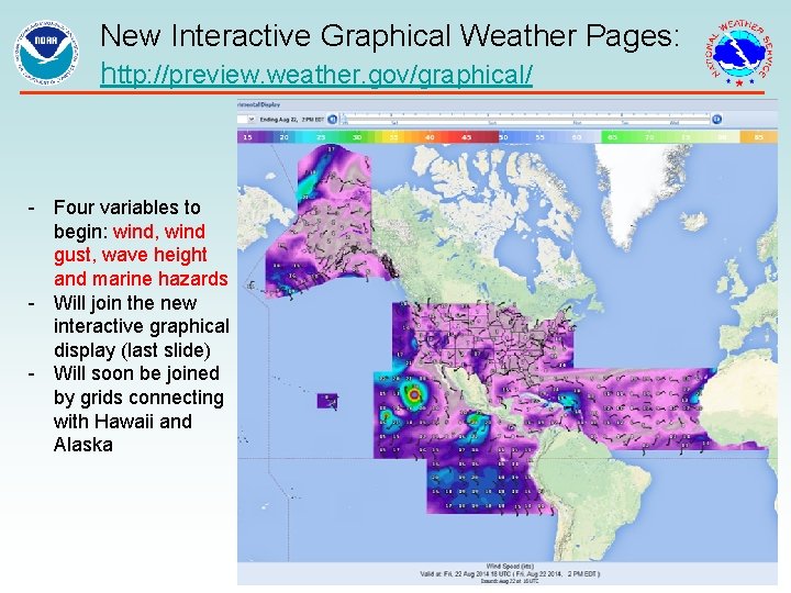
New Interactive Graphical Weather Pages: http: //preview. weather. gov/graphical/ - Four variables to begin: wind, wind gust, wave height and marine hazards - Will join the new interactive graphical display (last slide) - Will soon be joined by grids connecting with Hawaii and Alaska

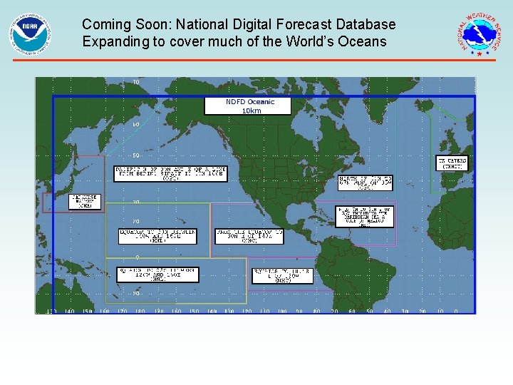
Coming Soon: National Digital Forecast Database Expanding to cover much of the World’s Oceans

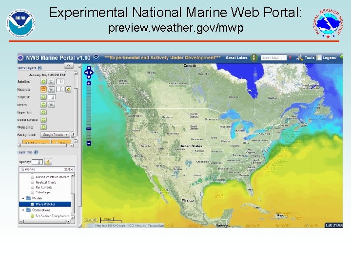
Experimental National Marine Web Portal: preview. weather. gov/mwp

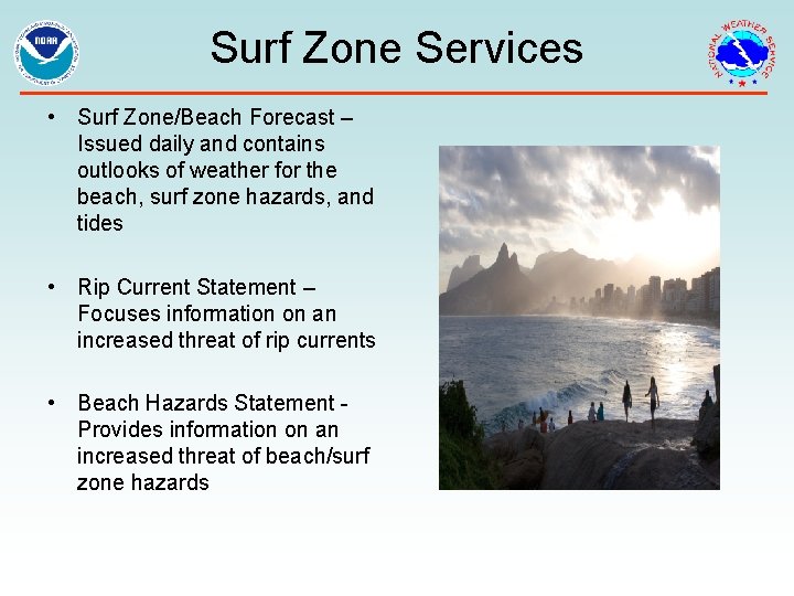
Surf Zone Services • Surf Zone/Beach Forecast – Issued daily and contains outlooks of weather for the beach, surf zone hazards, and tides • Rip Current Statement – Focuses information on an increased threat of rip currents • Beach Hazards Statement - Provides information on an increased threat of beach/surf zone hazards

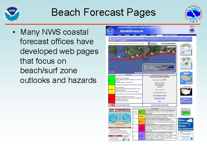
Beach Forecast Pages • Many NWS coastal forecast offices have developed web pages that focus on beach/surf zone outlooks and hazards

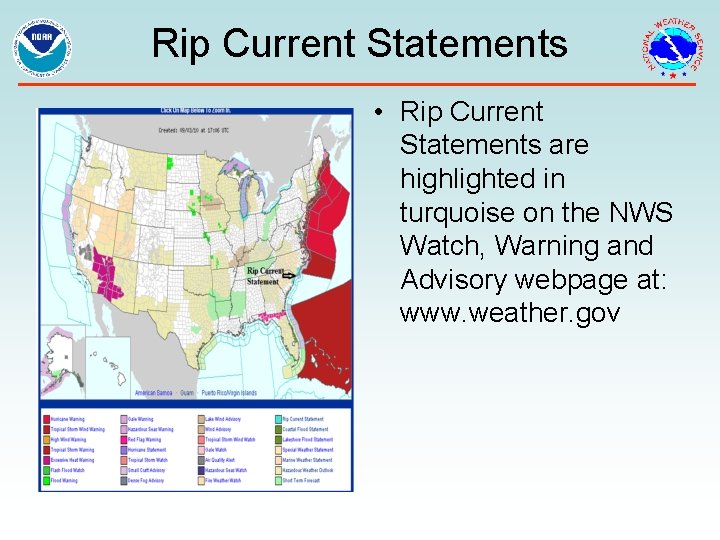
Rip Current Statements • Rip Current Statements are highlighted in turquoise on the NWS Watch, Warning and Advisory webpage at: www. weather. gov

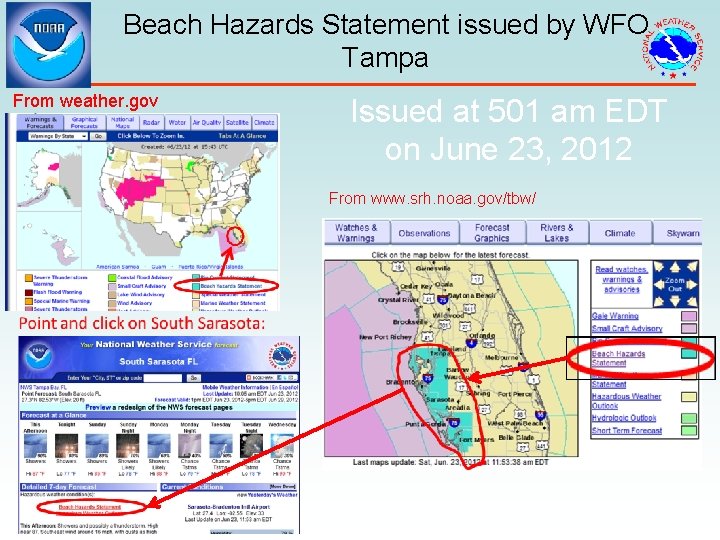
Beach Hazards Statement issued by WFO Tampa From weather. gov Issued at 501 am EDT on June 23, 2012 From www. srh. noaa. gov/tbw/

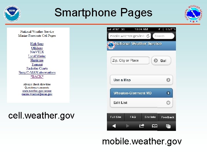
Smartphone Pages cell. weather. gov mobile. weather. gov

Smartphone Pages cell. weather. gov mobile. weather. gov

2014 Tropical Program Changes • • Experimental Potential Storm Surge Flooding Map Operational Implementation of P-Surge 2. 0 Experimental 5 -day Graphic Tropical Weather Outlook NHC and CPHC Products in Mixed Case NWS Partners Meeting - August 2014

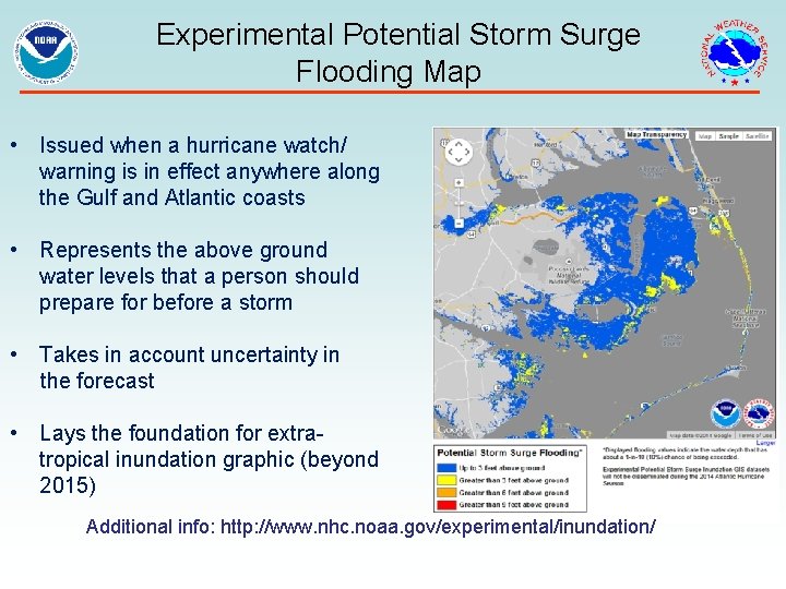
Experimental Potential Storm Surge Flooding Map • Issued when a hurricane watch/ warning is in effect anywhere along the Gulf and Atlantic coasts • Represents the above ground water levels that a person should prepare for before a storm • Takes in account uncertainty in the forecast • Lays the foundation for extratropical inundation graphic (beyond 2015) Additional info: http: //www. nhc. noaa. gov/experimental/inundation/ NWS Partners Meeting - August 2014

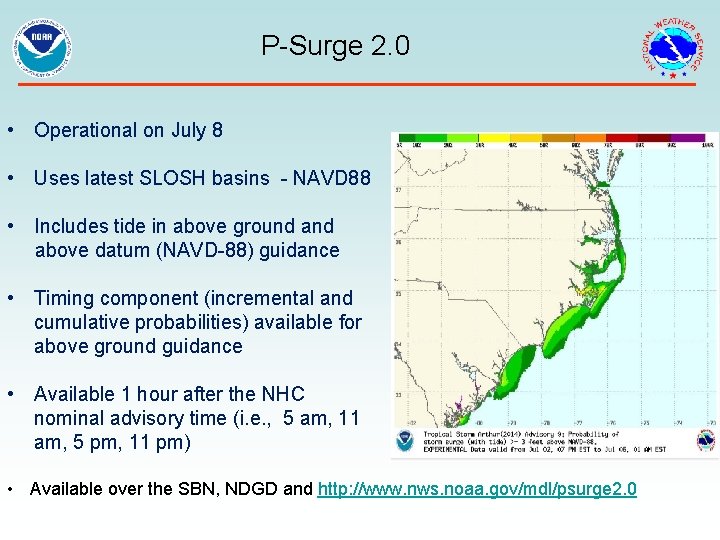
P-Surge 2. 0 • Operational on July 8 • Uses latest SLOSH basins - NAVD 88 • Includes tide in above ground above datum (NAVD-88) guidance • Timing component (incremental and cumulative probabilities) available for above ground guidance • Available 1 hour after the NHC nominal advisory time (i. e. , 5 am, 11 am, 5 pm, 11 pm) • Available over the SBN, NDGD and http: //www. nws. noaa. gov/mdl/psurge 2. 0 NWS Partners Meeting - August 2014

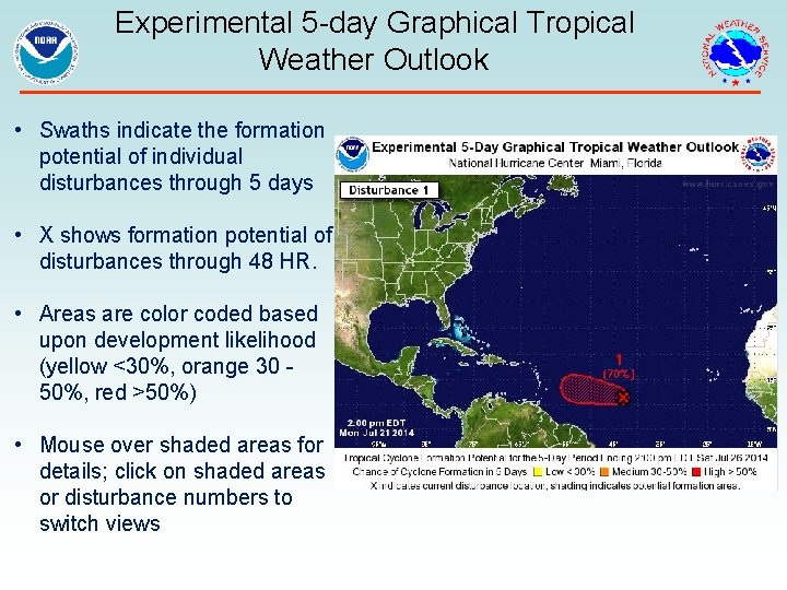
Experimental 5 -day Graphical Tropical Weather Outlook • Swaths indicate the formation potential of individual disturbances through 5 days • X shows formation potential of disturbances through 48 HR. • Areas are color coded based upon development likelihood (yellow <30%, orange 30 - 50%, red >50%) • Mouse over shaded areas for details; click on shaded areas or disturbance numbers to switch views NWS Partners Meeting - August 2014

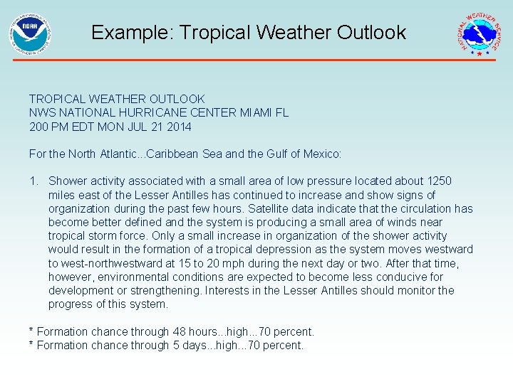
Mixed Case Text Products The following text products issued NHC and CPHC are in mixed case: Tropical Weather Outlook - discussion of significant areas of disturbed weather and their potential for development out to 5 days. Tropical Cyclone Discussion - explains the reasoning for the analysis and forecast of a tropical or subtropical cyclone. NWS Partners Meeting - August 2014

Example: Tropical Weather Outlook TROPICAL WEATHER OUTLOOK NWS NATIONAL HURRICANE CENTER MIAMI FL 200 PM EDT MON JUL 21 2014 For the North Atlantic. . . Caribbean Sea and the Gulf of Mexico: 1. Shower activity associated with a small area of low pressure located about 1250 miles east of the Lesser Antilles has continued to increase and show signs of organization during the past few hours. Satellite data indicate that the circulation has become better defined and the system is producing a small area of winds near tropical storm force. Only a small increase in organization of the shower activity would result in the formation of a tropical depression as the system moves westward to west-northwestward at 15 to 20 mph during the next day or two. After that time, however, environmental conditions are expected to become less conducive for development or strengthening. Interests in the Lesser Antilles should monitor the progress of this system. * Formation chance through 48 hours. . . high. . . 70 percent. * Formation chance through 5 days. . . high. . . 70 percent. NWS Partners Meeting - August 2014

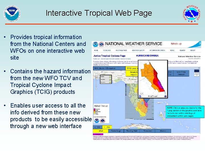
Tropical Program Changes for 2015 • • • Experimental Storm Surge Watch/Warning Process (HLS, TCV) New Interactive Tropical Web Page NWS Partners Meeting - August 2014

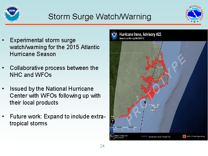
Storm Surge Watch/Warning • Experimental storm surge watch/warning for the 2015 Atlantic Hurricane Season • Collaborative process between the NHC and WFOs • Issued by the National Hurricane Center with WFOs following up with their local products • Future work: Expand to include extratropical storms 24

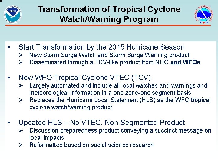
Transformation of Tropical Cyclone Watch/Warning Program • Start Transformation by the 2015 Hurricane Season Ø New Storm Surge Watch and Storm Surge Warning product Ø Disseminated through a TCV-like product from NHC and WFOs • New WFO Tropical Cyclone VTEC (TCV) Ø Largely automated and include all local watches and warnings and meteorological information in a one zone-one segment basis Ø Replaces the Hurricane Local Statement (HLS) as the WFO tropical cyclone watch/warning product • Updated HLS – No VTEC, Non-Segmented Product Ø Discussion preparedness product conveying a succinct message on local impacts Ø Reformatted based on social science research NWS Partners Meeting - August 2014

Interactive Tropical Web Page • Provides tropical information from the National Centers and WFOs on one interactive web site • Contains the hazard information from the new WFO TCV and Tropical Cyclone Impact Graphics (TCIG) products • Enables user access to all the info derived from these new products to be easily accessible through a new web interface NWS Partners Meeting - August 2014

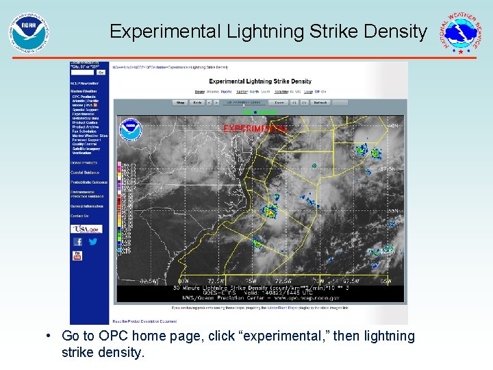
Experimental Lightning Strike Density • Go to OPC home page, click “experimental, ” then lightning NWS Partners Meeting - strike density. August 2014

We want to hear from you!!!! Questions? wayne. weeks@noaa. gov www. weather. gov