Maps Vocabulary part 2 Pangea It was a

Maps Vocabulary part 2

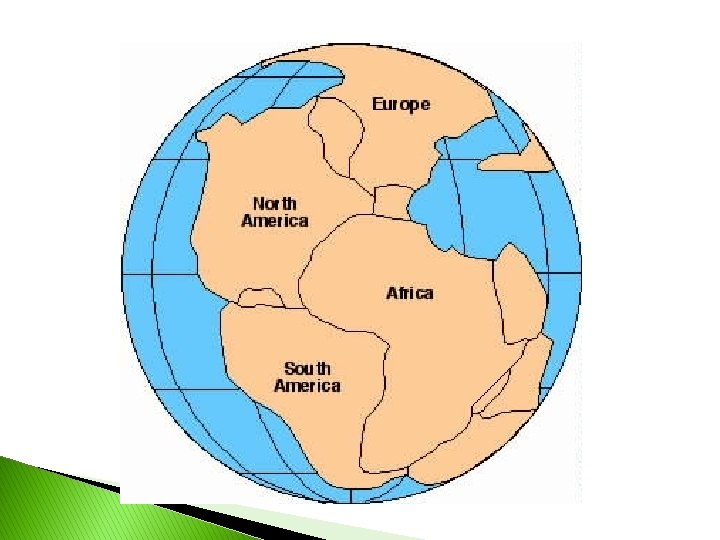
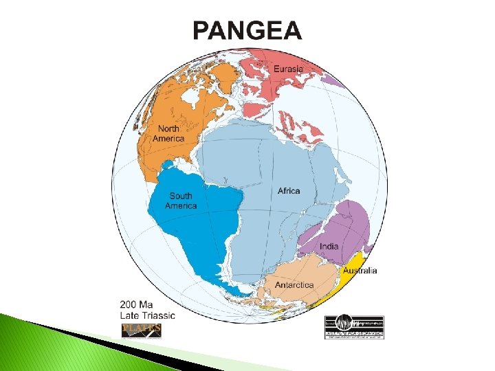
Pangea � It was a supercontinent from the Mesozoic and Paleozoic eras

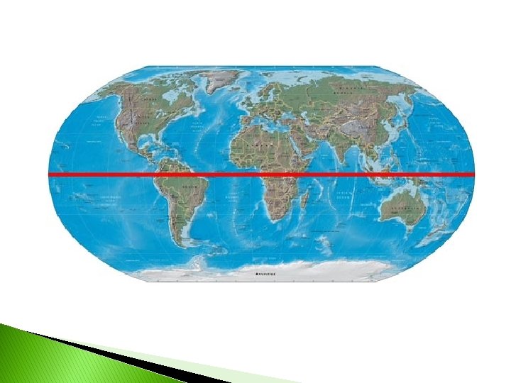
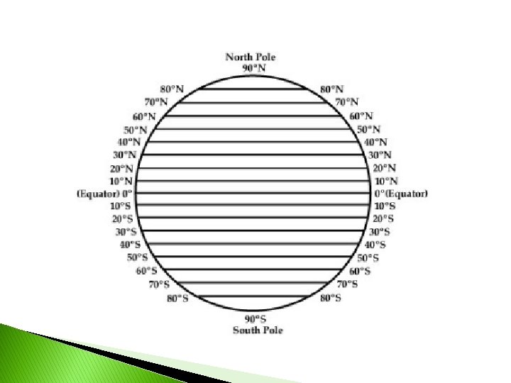
latitude � Line that run east to west, but measure north to south


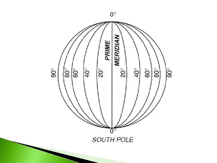
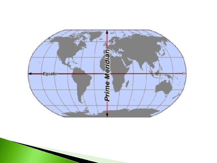
longitude � Lines that run north to south but measure east to west
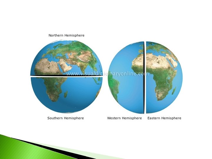
 latitude – divides the earth into northern and southern hemispheres �")
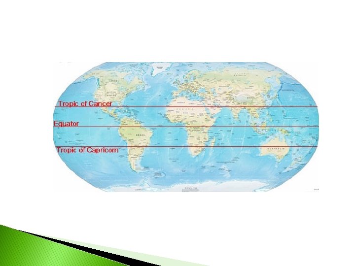
Equator degrees (0°) latitude – divides the earth into northern and southern hemispheres � Zero
 longitude - divides the earth into western and eastern hemispheres.")
Prime Meridian degrees (0°) longitude - divides the earth into western and eastern hemispheres. � Zero

hemisphere � Half of the earth

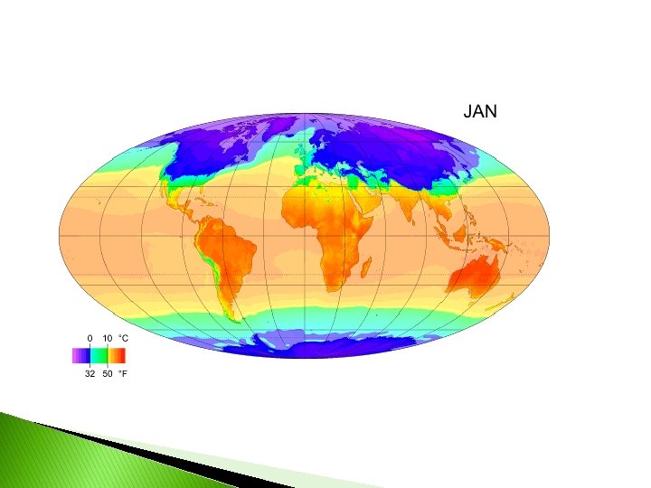
climate � Weather in a place over a long period of time

Tropic of Cancer ½ degrees N latitude – tropical zone north of equator � 23 ◦ (OPEN THE CAN ON TOP) ◦ most northerly circle of latitude on the Earth at which the Sun may appear directly overhead at its culmination
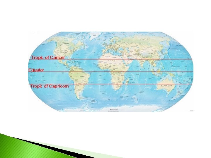

Tropic of Capricorn ½ degrees S latitude –tropical zone below the equator; southern border of the tropics � 23
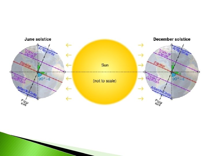

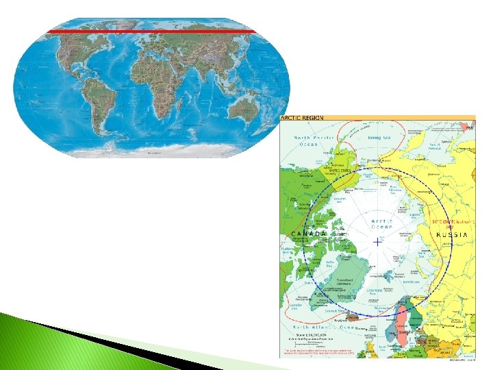
Arctic Circle line of latitude, approximately 66˚N; marks the beginning of North Polar region � Imaginary

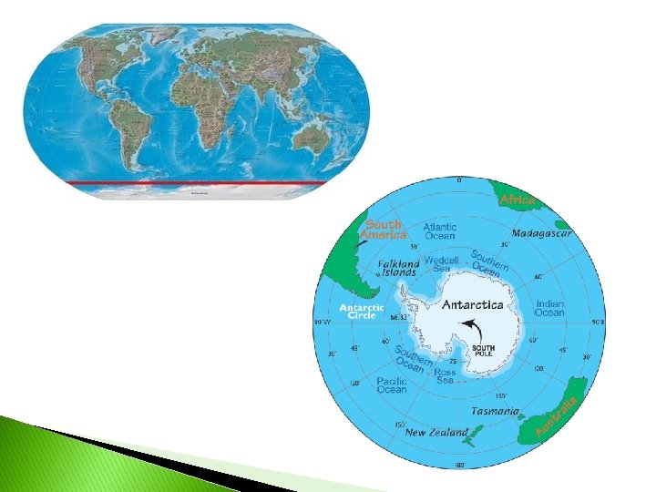
Antarctic Circle line of latitude, southern hemisphere; comparable to Arctic Circle. � Imaginary

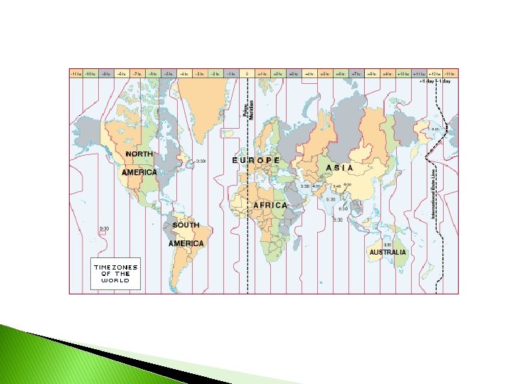
International Date Line � 180˚ line of longitude; where days begin ◦ Directly opposite of the Prime Meridian
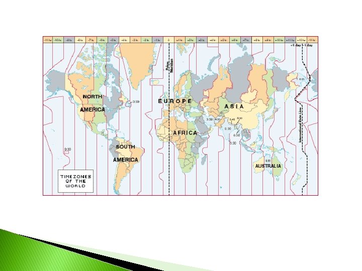

Time Zones � 24 time zones – 24 hours in a day; time zones are based on lines of longitude
")
parallels � Run east to west-called latitude lines ◦ Never going to touch (geometry)

meridians � Run north and south-called longitude lines ◦ Touch at the poles

- Slides: 33