Maps Projections AP Human Geography Mr Jones Functions


 n Global Positioning Systems (GPS) n")


- Slides: 31
+ Maps & Projections AP Human Geography Mr. Jones
+ Functions of a Map n. Two purposes n. Reference tool: to find locations, to find one’s way n. Communications tool: to show the distribution of human and physical features
+ Scale n Ratio/fraction – shows the ratio of distance on a map compared to the real earth measurement. n Bar/graphic – shows the ratio of the distance on the map to the distance on the earth n Written – describes relation between map and Earth in words n Small scale – shows a large area without a lot of detail n Large scale – shows a small area with a lot of detail.
+ Scale
+ Globe n 3 d representation of the earth n Advantage: provides a way to view the earth as it travels through space n Disadvantage: Can only see half of it at one time
+ Maps n 2 D representations of selected parts of the earths surface n Advantage: easily portable and can be drawn to any scale needed n Disadvantage: distortion occurs when as the is flattened to create a map earth’s surface
+ Types of Maps n General reference or topographic map: natural and man-made features on the earth n Thematic: emphasize n Navigational: help water or air. specific kind of information users plot a course through
+ Physical Maps n Show types of landforms and bodies of water in a specific area.
+ Political Maps n Show features on the earth’s surface that humans have created. n Cities, states, provinces, territories, and countries
+ Thematic Maps n Climate, vegetation, natural resources, population density and economic activities n Qualitative - use colors, symbols, dots or lines to see patterns n Cartograms – info about a country based on data other than land area n Flow-line – illustrate movement of people, goods, ideas, and animals
+ Spatial Distribution n The arrangement of items on the earth’s surface n Analyzed by the elements common to all spatial distributions n Density, Dispersion, and Pattern
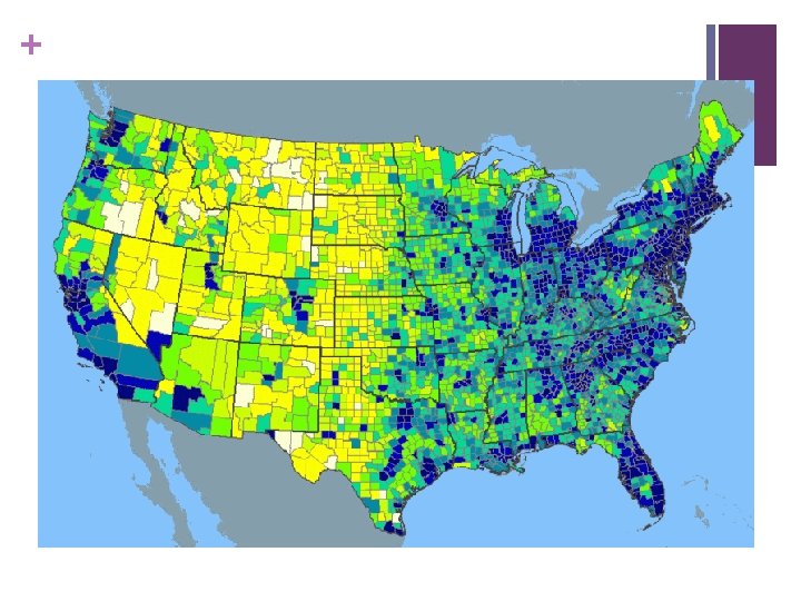
+ Density n The measure of the number or quantity of anything within a defined unit of area n Always number in relation to area n Normally used comparatively
+ Density n GA n Is pop. density = 141 per/sq mi that a high density? n Who knows… we must look comparatively n Ohio = 277, Michigan = 175, n New Jersey = 1134 n Therefore GA has a low Density n Wyoming =6
+ Dispersion n Spread of a phenomenon over an area n Not how many or how much but how far things are spread out n 1. Clustered/Agglomerated = spatially close together n 2. Dispersed/Scattered = spread out n Dispersion can change depending on scale
+ Pattern • The geometric arrangement of objects in space • Refers to distribution, but the reference emphasizes design rather than spacing • Types of Patterns: Linear, Centralized, and Random
+ Linear Patterns typically depict houses along a street or towns along a railroad
+ Centralized Patterns typically involve items concentrated around a single node Ex: Center City with surrounding suburbs
+ Random Pattern An unstructured irregular distribution
+ Land Ordinance of 1785 n Township and range system n Township = 6 sq. miles on each side n North–south lines = principal meridians n East–west lines = base lines n Range n Sections
+ Township & Range System
+ Contemporary Tools n Geographic Information Science (GIScience) n Global Positioning Systems (GPS) n Remote sensing n Geographic information systems (GIS)
+ Map Projections n A way of drawing the earth’s surface that reduces distortion caused by presenting a round earth on flat paper. n A cartographer will reduce some types of distortion by using different types of map projections n Distance, shape, direction, or area/size may be distorted.
+ Planar Projection n Projection on a flat surface. n Also called Azimuthal which shows the earth so a line that from the central point on the map gives the shortest distance between two points. n Size and shape are distorted.
+ Conical Projection n Projected onto a cone n Shows shape fairly accurate and used to show landmasses that cover large areas going east and west n Distorts landmasses at the edges
+ Cylindrical Projection n Projection onto a cylinder and shows the entire earth on one map. n Three types n Mercator n Homolosine n Robinson
+ Mercator n Shapes of continents are distorted at the poles and somewhat compressed near the equator
+ Homolsine n Oceans are divided n Shows accurate shapes and sizes of the landmasses but distances on the map are not correct.
+ Robinson n Shows entire earth almost true to sizes and shapes of continents and oceans. n Shapes of the landforms near the poles appear flat.
+ Map Projection Activity
+ Peter’s n http: //www. youtube. com/watch? playnext=1&index=0&feature= Play. List&v=n 8 z. BC 2 dv. ERM&list=PL 9 DF 42 BD 3 AD 0 FB 8 ED