Maps Chapter 1 A map is a representation


- Slides: 32
Maps Chapter 1
A map is a representation of the Earth’s surface Map of Charlotte, NC
Can you tell me? The EXACT location of the red star on the basketball below? How could we make it easier to do this?
Can you tell me? The EXACT location of the red star on the Earth below? How could we make it easier to do this?
The Global Grid It would be impossible to describe a position on Earth without some sort of grid system to give you an exact location. This grid system is called latitude and longitude.
Hemispheres Hemisphere = Half of the Earth
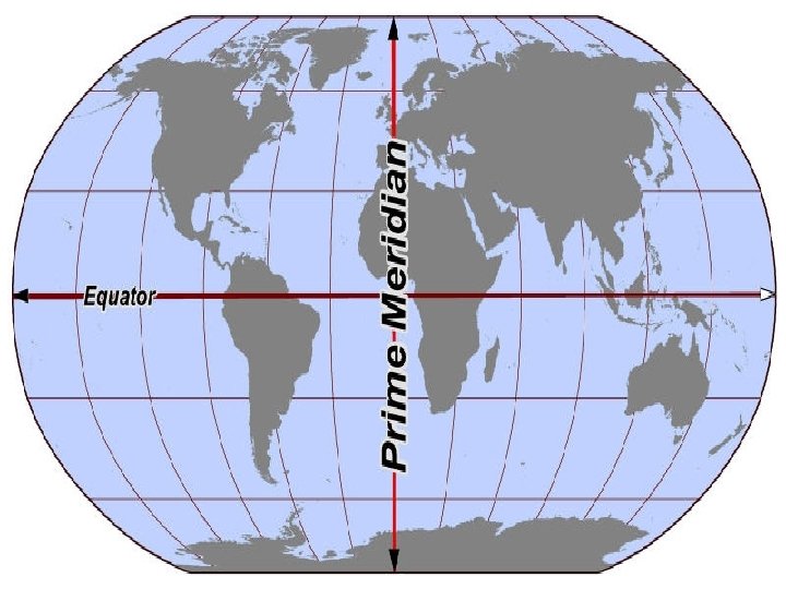
Equator The equator cuts the Earth into the NORTHERN and SOUTHERN hemispheres
Prime Meridian The prime meridian cuts the Earth into the EASTERN and WESTERN hemispheres
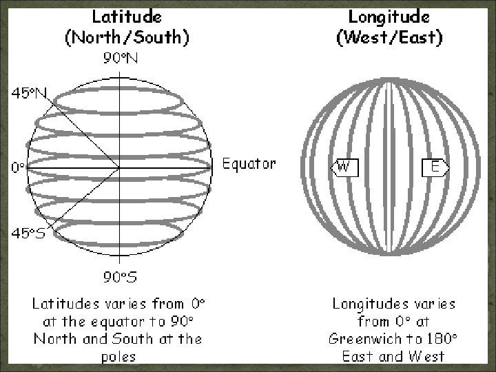
Latitude Lines of latitude measure the distance NORTH or SOUTH of the equator Measured from 0 -90 degrees, N & S of the Equator (0 degrees) There are 180 total degrees of Latitude.
Latitude = Ladder Think of latitude lines like steps on a ladder
O degrees
Latitude & Climate As your latitude INCREASES, your temperature DECREASES!! 90 0 90
The Climate Zones �Lines of latitude divide the globe into 3 distinct climate zones
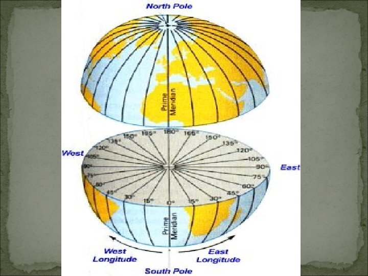
Longitude Lines of longitude measure the distance EAST or WEST of the prime meridian Measured 0 -180 degrees, E & W of the Prime Meridian (0 degrees)
Longitude = LONG hair Longitude lines are curved and meet at the poles.
Latitude vs. Longitude Latitude – HORIZONTAL lines Longitude – VERTICAL lines
Youtube Clip http: //www. youtube. com/watch? v=sw. KBi 6 h. HHMA
Practice Put on Your Thinking Cap
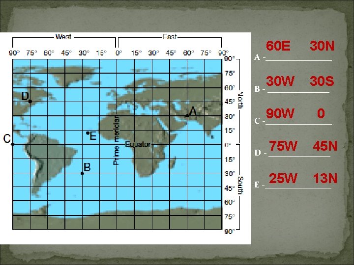
Practice Problems To find a location, you need BOTH the latitude and the longitude measurement!!
90 W 75 N A -________ 60 N B - 120 W _______ 60 E 60 N C -________ 15 N D -45 W _______ 150 W 0 E -________ 60 S F - 120 W _______ 0 30 S G -________ 75 E 15 S H - _______ 150 E 45 S I - ________ 180 E 30 N J - ________