Mapping the Earth Using Latitude and Longitude Eastern


- Slides: 32
Mapping the Earth Using Latitude and Longitude Eastern World Book Pages H 1 -H 11
Mapping the Earth Using Latitude and Longitude • A globe is a scale model of the Earth. – It is useful for showing the entire Earth or studying large areas of Earth’s surface. • Geographers use a pattern of imaginary lines that circles the globe in east-west and northsouth directions. It is called a grid. – Where these lines intersect helps us find places on Earth.
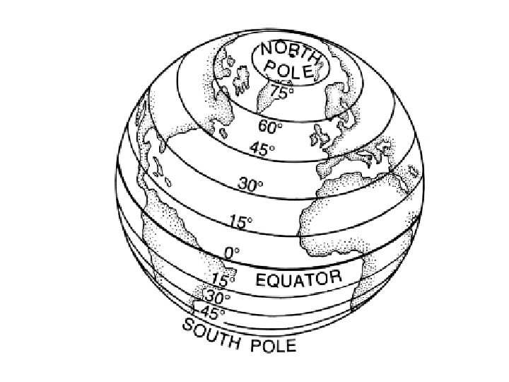
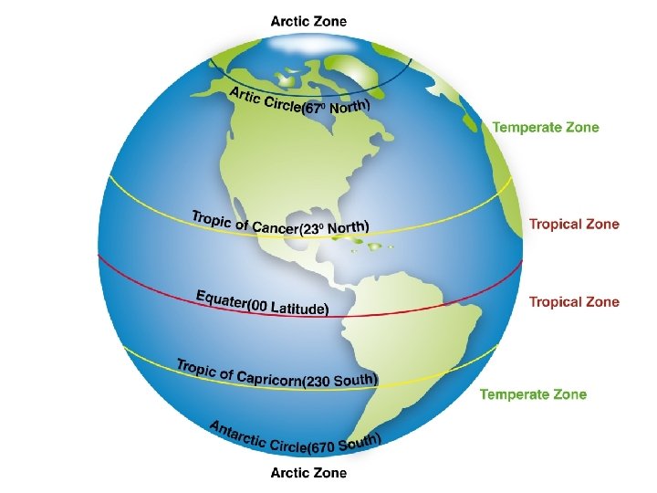
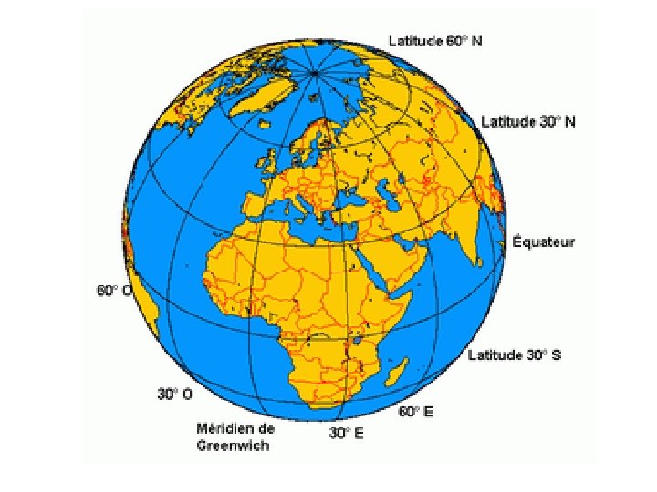
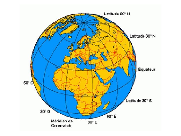
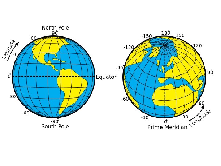
Mapping the Earth Using Latitude and Longitude • East-west lines in the grid are lines of latitude. • Lines of latitude are called parallels. • These lines measure distance north and south of the equator. • The equator is an imaginary line that circles the globe halfway between the North and South Poles.
Mapping the Earth Using Latitude and Longitude • Parallels measure the distance from the equator in degrees. • The symbol for degrees is. • Degrees are further divided into minutes. • The symbol for minutes is ‘. • There are 60 minutes in a degree.
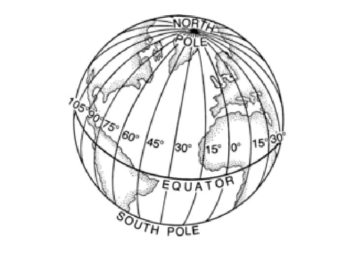
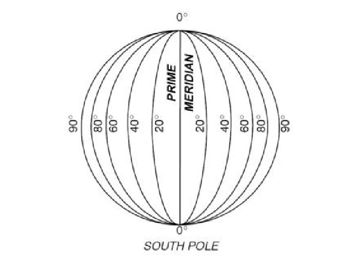
• • • Mapping the Earth Using Latitude and Longitude The north-south imaginary lines are lines of longitude. Lines of longitude are called meridians. These lines pass through the poles. They measure distance east and west of the prime meridian. The prime meridian represents 0 longitude. It runs through Greenwich, England.
• • Mapping the Earth Using Latitude and Longitude Lines of latitude range from 0, for locations on the equator, to 90 N or 90 S, for locations at the poles. Lines of longitude range from 0 on the prime meridian to 180 on a meridian in the mid. Pacific Ocean. Meridians west of the prime meridian to 180 are labeled with a W. Those east of the prime meridian to 180 are labeled with an E.
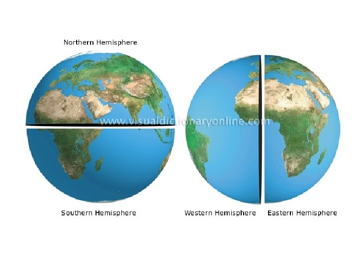
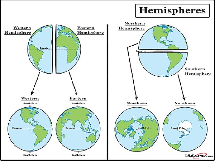
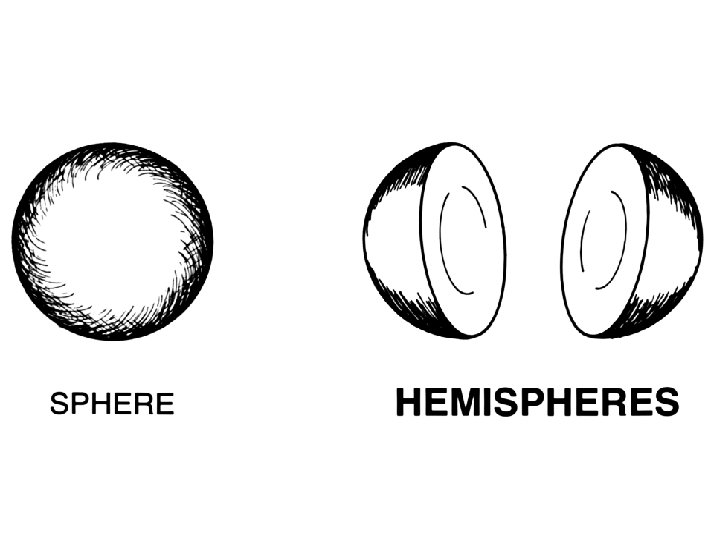
Mapping the Earth Using Latitude and Longitude • The equator divides the globe into two halves, called hemispheres. • The half north of the equator is the Northern Hemisphere. • The half south of the equator is the Southern Hemisphere. • The prime meridian divides the world into Eastern and Western Hemispheres.
Mapping the Earth Using Latitude and Longitude • Earth’s land surface is divided into seven large landmasses, called continents. • Landmasses smaller than continents and completely surrounded by water are called islands. • Geographers divide the world ocean into the Pacific, Atlantic, Arctic, Southern and Indian.
Mapmaking Understanding Map Projections • Mapmakers have created different ways of showing our round planet on flat maps. • These different ways are called map projections. • All flat maps are distorted in some way. • Many map projections are one of three kinds: cylindrical, conic or flat-plane.
Mapmaking Understanding Map Projections • Cylindrical projections are based on a cylinder wrapped around the globe. • Often used by navigators. – It shows true direction and shape.
Mapmaking Understanding Map Projections • Conic Projections are based on a cone place over the globe. • Most accurate along the lines of latitude where it touches the globe.
Mapmaking Understanding Map Projections • Flat-Plane Projections are based on a plane touching the globe a one point, such as the North Pole. • Shows true directions for planes and ship navigators.
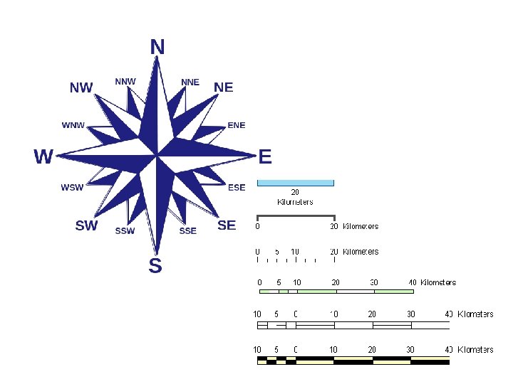
Map Essentials How to Read a Map • Most all maps have a title, compass rose, a scale, and a legend. • A map’s title shows what the subject of the map is. • The directional indicator shows which way north, south, east and west lie on a map. A compass rose has arrows that point to all four principal directions.
Map Essentials How to Read a Map • Mapmakers use scales to represent the distances between points on a map. • The legend, or key, explains what the symbols on the map represent. • A locator map shows where in the world the are on the map is located.
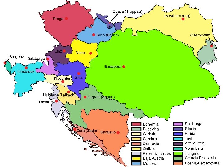
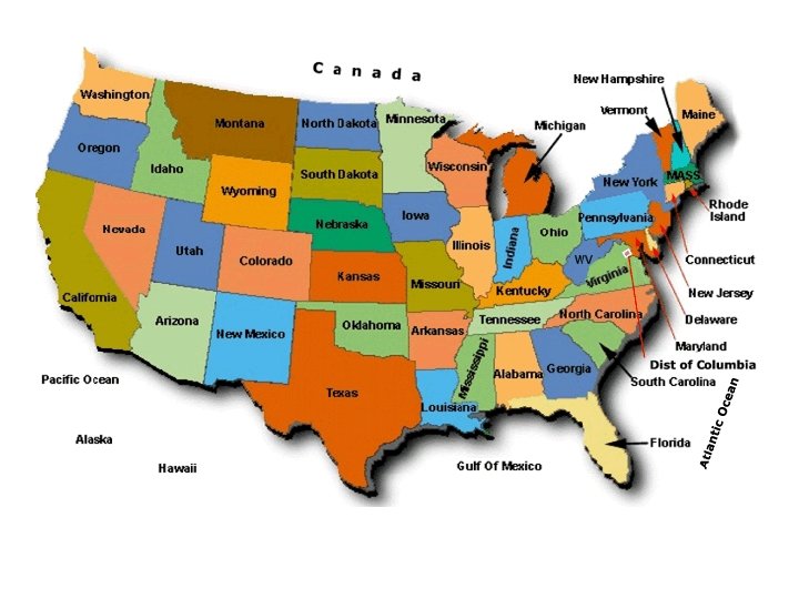
Working with Maps Using Different Kinds of Maps • Political maps show the major political features of a region. • These include: country borders, capital cities and other places. • Political maps use different colors to represent countries and capital cities are often show with a special star symbol.
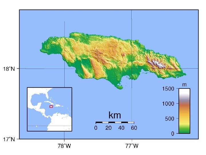
Working with Maps Using Different Kinds of Maps • Physical maps show the major physical features of a region. • These features may include mountain ranges, rivers, oceans, islands, deserts and plains. • These maps use different colors to represent different elevations of land.
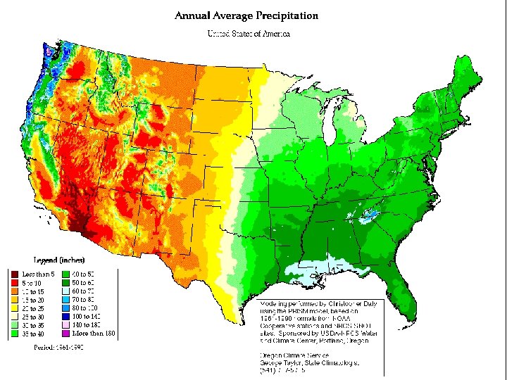
Working with Maps Using Different Kinds of Maps • Special-purpose maps focus on one special topic, such as climate, resources, or population. • Depending on the type of special-purpose map, the information may be shown with different colors, arrows, dots, or other symbols.