Mapping th 8 Grade General Science See also


")

")
 above and below sea")


- Slides: 32
Mapping th 8 Grade General Science See also KT Topography!!
Notes packet p. 22 – What is Latitude Do Now/HW p. 23 – What is Longitude Do Now/HW p. 24 – Plotting Latitude and Longitude
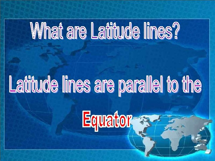
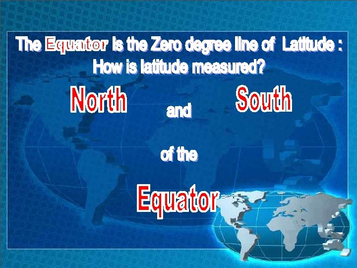
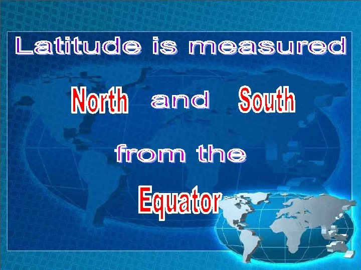
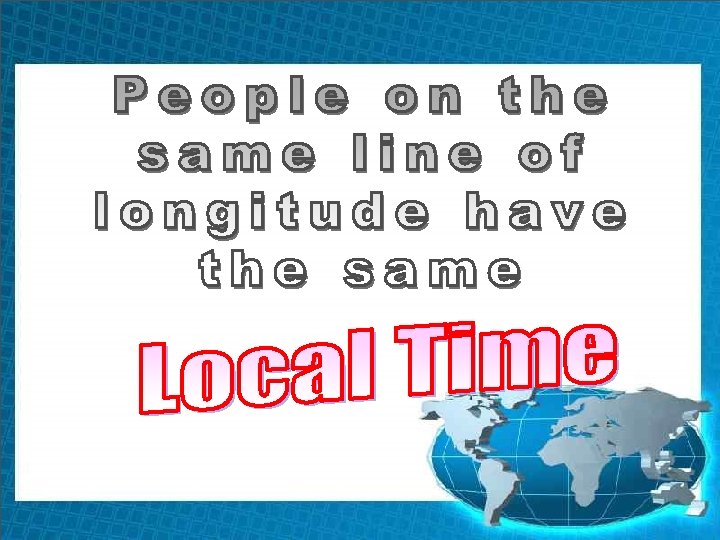
Latitude and Longitude is the coordinate system used to locate any point on Earth. (example: GPS) How is latitude measured?
180 165 150 135 120 105 90 75 60 45 30 15 30 45 60 75 90 105 120 135 150 165 180 90 80 70 E 60 50 40 30 F 20 10 G 20 30 40 50 60 H 70 80 90
What are Longitude Lines? Longitude lines connect the North Pole to the South Pole They are NOT Parallel to each other!
The Prime Meridian is the 0 degree line of longitude
180 165 150 135 120 105 90 75 60 45 30 15 30 45 60 75 90 105 120 135 150 165 180 90 80 70 E 60 50 40 30 F 20 10 G 20 30 40 50 60 H 70 80 90
180 165 150 135 120 105 90 75 60 45 30 15 30 45 60 75 90 105 120 135 150 165 180 90 80 70 E 60 50 40 30 F 20 10 G 20 30 40 50 60 H 70 80 90
Let’s do some plotting.
On the coordinate system, plot the coordinates given in your notes: 180 165 150 135 120 105 90 75 60 45 30 15 30 45 60 75 90 105 120 135 150 165 180 90 80 70 E 60 50 40 30 F 20 10 G 20 30 40 50 60 H 70 80 90
State the coordinates for each of the letters in the figure above: 180 165 150 135 120 105 90 75 60 45 30 15 30 45 60 75 90 105 120 135 150 165 180 90 80 70 E 60 50 40 F 30 20 10 0 G 10 20 30 40 50 H 60 70 80 90
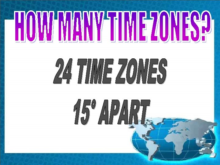
Notes page 20 BASED ON EARTH’S
EACH HOUR, EARTH ROTATES (360°/24 hrs)
Example: Two students record a difference in local time of two hours. How many degrees of longitude apart are they?
Elevation of the land (hills and valleys)
To show the Elevation of the land (hills and valleys) above and below sea level
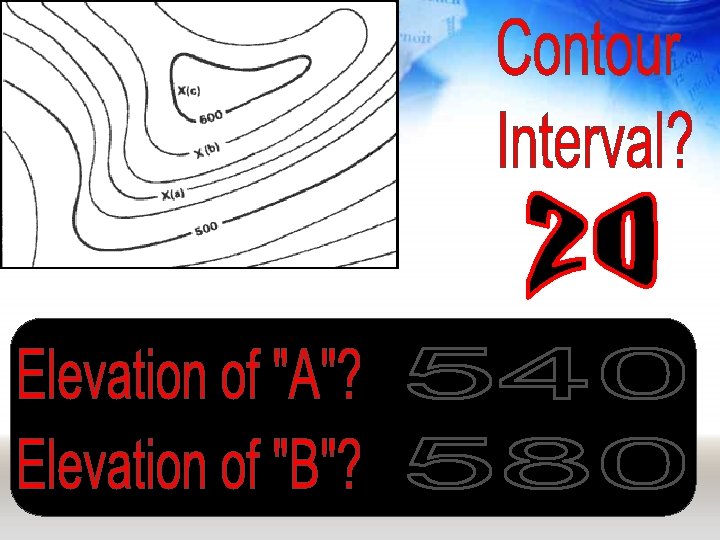
Map 1 Practice X
Lines close together = STEEP SLOPE Lines far apart = Gentle SLOPE
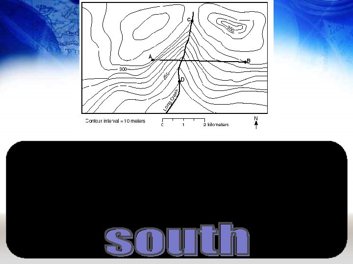
What do hachured lines show?
Please match the contour map on the left with the profile on the right.