MAPPING SKILLS FOR GEOGRAPHY Some important skills to


 divided by the Horizontal Scale (map scale)")


- Slides: 17
MAPPING SKILLS FOR GEOGRAPHY Some important skills to learn….
Here are some important books to use to improve your skills work…. some are quite old but that does not matter the key thing is a good book …. . n n n M. Stacey – Atlas Skills Workbook (2005) L. Scott & K. Laws – Mapping & Statistical Skills for Secondary Students (various editions) C. Bonnor & B. Ralph – Key Skills in Geography
Key or Legend n n SCALE – Linear - Representative Fraction - in words - Ratio
Working out scales…. . n Need to learn conversions 100 to get metres eg: 1: 100, 000 (cm) = 1 cm to 1, 000 m or 1 km 1: 50, 000 = 1 cm to 500 m or ½ km 1: 250, 000 = 1 cm to 2, 500 m or 2 ½ km 1: 30, 000 = 1 cm to 300 m 1: 10, 000 = 1 cm to 100 m
Contours join areas of equal height above sea level n n Steep slopes lines close Gentle slopes very spread out
Cross-sections
Drawing the cross-section - draw lines up from the base to make a dot at the correct height then a smooth line joining the dots…
Vertical Exaggeration n n Vertical Scale (graph) divided by the Horizontal Scale (map scale) Different Vertical Scales stretch or shrink the crosssection
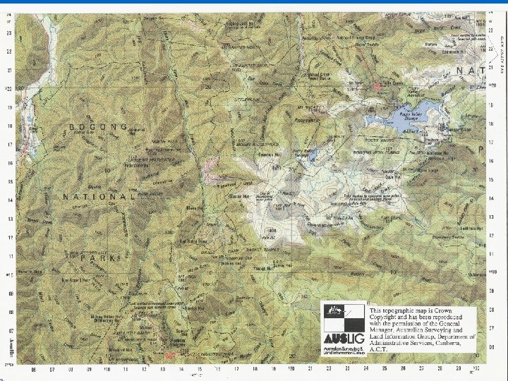
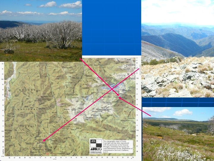
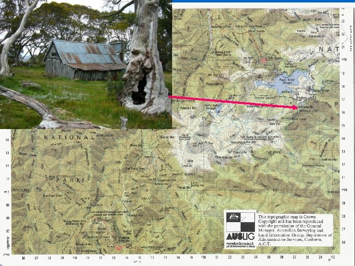
Working out the scale of an aerial photo when compared to a topographic map Find a familiar feature on both maps and calculate real distance on map compared to ruler distance on unknown n n Eg. Map scale 1: 25 000 at left
Precis or Sketch maps – Natural or Cultural features or both - must have TITLE, SCALE, NORTH SIGN, FRAME, LABELS, KEY.
n Difference in the Vertical Height between two points DIVIDED by the actual distance along the ground as measured on the scale of the map Gradient = 373 - 315 m 700 m = 58/700 = 1: 12
Intervisibility
DRAWING SEGMENTS: Pie Graphs n n Draw a circle any size Put centre of protractor on middle of circle To convert PERCENTAGES to DEGREES multiply by 3. 6 Draw segments from 12 o’clock moving clockwise moving from largest to smallest MEASURING SEGMENTS: • • Put protractor on Segment and measure DEGREES then DIVIDE by 3. 6 to get PERCENT Use this PERCENT to calculate from any raw numbers you are given eg. 50% of 278 = 50 x 278 = 1390 = 139 100 10
Time of Day from Photographs n n n Look at the shadows of buildings or structures Early Morning sun casts shadows to the west Late Afternoon sun casts shadows to the east Long shadows are early morning or late afternoon Direction of shadows indicates morning or afternoon No shadows indicate noon